President's Park

Last updated
President's Park
Aerial view of Lafayette Park.jpg
President's Park in Washington, D.C., including (left to right in center): The Ellipse, the White House, and Lafayette Square
Location map Washington, D.C. central.png
Red pog.svg
USA District of Columbia location map.svg
Red pog.svg
Usa edcp location map.svg
Red pog.svg
Location Washington, D.C., U.S.
Coordinates 38°53′46″N77°2′12″W / 38.89611°N 77.03667°W / 38.89611; -77.03667
Area77.48 acres (313,536 m²)
Built1791
ArchitectL'Enfant, Pierre C.; Downing, A.J.
Visitation714,224 (2022) [1]
Website President's Park (White House)
NRHP reference No. 80000347 [2]
Added to NRHPMay 6, 1980

President's Park, located in Downtown Washington, D.C., encompasses the White House and includes the Eisenhower Executive Office Building, the Treasury Building, and grounds; the White House Visitor Center; Lafayette Square; and The Ellipse. [3] President's Park was the original name of Lafayette Square.

Contents

President's Park is administered by the National Park Service. [4]

The park is officially referred to as President's Park or The White House and President's Park. [5]

White House and adjacent buildings

A map of President's Park in Washington, D.C. NPS white-house-map.pdf
A map of President's Park in Washington, D.C.

In 1790, under the Residence Act, Philadelphia was designated as the nation's temporary capital while the permanent capital was constructed in Washington, D.C. Contests were held to solicit designs for both the United States Capitol and what was then called the President's House. James Hoban's design was selected, and he supervised the construction.

The new national capital in Washington, D.C., was finalized and opened in 1800.

The White House was later expanded with the addition of the West Wing and East Wing, which now houses the office of the president and presidential staff. The White House grounds include the South Lawn, Rose Garden, Jacqueline Kennedy Garden, and North Lawn.

To the west of the White House, across from the West Wing is the Eisenhower Executive Office Building, formerly the Department of State, War, and Navy, and to the east is the Treasury Building.

Lafayette Square

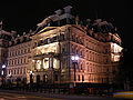
Lafayette Square is a 6.97 acre (28,191 m2) public park located directly north of the White House on H Street, bounded by Jackson Place on the west, Madison Place on the east, and Pennsylvania Avenue to the south. The square and the surrounding historic townhouse structures were designated a National Historic Landmark District in 1970. Planned as part of the pleasure grounds surrounding the Executive Mansion, this square was originally called "President's Park", which is now the name of the larger National Park Service unit. The park was separated from the White House grounds in 1804, when third President Thomas Jefferson had Pennsylvania Avenue cut through east–west. In 1824, the park was officially renamed in honor of the Marquis de Lafayette, the Frenchman and military officer who fought in the American Revolutionary War (1775–1783).

Lafayette Square has been used as a racetrack, a graveyard, a zoo, a slave market, an encampment for soldiers during the War of 1812, and many political protests and celebrations. Andrew Jackson Downing landscaped Lafayette Square in 1851 in the picturesque style.

The Ellipse

A May 2010 aerial view of The Ellipse and White House grounds Aerial view of White House and the Ellipse.jpg
A May 2010 aerial view of The Ellipse and White House grounds

President's Park South, commonly called The Ellipse, is a 52 acres (21 ha) park located just south of the White House fence. The entire park is open to the public, and features various monuments within walking distance, including the Washington Monument, the Lincoln Memorial, the Jefferson Memorial, and others.

The park was conceived in 1791, the first plan for the park was drawn up by Pierre (Peter) Charles L'Enfant. During the Civil War between 1861 and 1865, the grounds of the Ellipse and the not yet complete Washington Monument were used as corrals for horses, mules, and cattle, and as campsites for Union Army troops. The Army Corps of Engineers began landscaping work on the Ellipse in 1867 and worked on it through the late 1880s.

White House Visitor Center

The White House Visitor Center is located in the north end of the Herbert C. Hoover Building, which also houses the Department of Commerce, located off The Ellipse between 14th and 15th Streets on Pennsylvania Avenue NW,

Since the September 11 attacks, the visitor center no longer serves as a starting point for those going on a reserved tour of the White House. The various exhibits provide an alternative visitor experience for those not able to go on a tour. The themes of the six permanent exhibits are first families, symbols and images, White House architecture, White House interiors, the working White House, and ceremonies and celebrations. Other exhibits change throughout the year.

Related Research Articles

<span class="mw-page-title-main">United States Capitol</span> Meeting place of the United States Congress

The United States Capitol, often called the Capitol or the Capitol Building, is the seat of the United States Congress, the legislative branch of the federal government. It is located on Capitol Hill at the eastern end of the National Mall in Washington, D.C. Although no longer at the geographic center of the national capital, the U.S. Capitol forms the origin point for the street-numbering system of the district as well as its four quadrants.

<span class="mw-page-title-main">National Mall</span> Landscaped park in Washington, D.C.

The National Mall is a landscaped park near the downtown area of Washington, D.C., the capital city of the United States. It contains and borders a number of museums of the Smithsonian Institution, art galleries, cultural institutions, and various memorials, sculptures, and statues. It is administered by the National Park Service (NPS) of the United States Department of the Interior as part of the National Mall and Memorial Parks unit of the National Park System. The park receives approximately 24 million visitors each year.

<span class="mw-page-title-main">Outdoor sculpture in Washington, D.C.</span>

There are many outdoor sculptures in Washington, D.C. In addition to the capital's most famous monuments and memorials, many figures recognized as national heroes have been posthumously awarded with his or her own statue in a park or public square. Some figures appear on several statues: Abraham Lincoln, for example, has at least three likenesses, including those at the Lincoln Memorial, in Lincoln Park, and the old Superior Court of the District of Columbia. A number of international figures, such as Mohandas Gandhi, have also been immortalized with statues. The Statue of Freedom is a 19½-foot tall allegorical statue that rests atop the United States Capitol dome.

<span class="mw-page-title-main">Independence National Historical Park</span> National historic site in Philadelphia, Pennsylvania, United States

Independence National Historical Park is a federally protected historic district in Philadelphia, Pennsylvania that preserves several sites associated with the American Revolution and the nation's founding history. Administered by the National Park Service, the 55-acre (22 ha) park comprises many of Philadelphia's most-visited historic sites within the Old City and Society Hill neighborhoods. The park has been nicknamed "America's most historic square mile" because of its abundance of historic landmarks.

The National Capital Parks was a unit of the National Park System of the United States, now divided into multiple administrative units. It encompasses a variety of federally owned properties in and around the District of Columbia including memorials, monuments, parks, interiors of traffic circles and squares, triangles formed by irregular intersections, and other open spaces.

National Mall and Memorial Parks is an administrative unit of the National Park Service (NPS) encompassing many national memorials and other areas in Washington, D.C. Federally owned and administered parks in the capital area date back to 1790, some of the oldest in the United States. In 1933, they were transferred to the control of the National Park Service. These parks were known as the National Capital Parks from their inception until 1965. The NPS now operates multiple park groupings in the D.C. area, including National Capital Parks-East, Rock Creek Park, President's Park, and George Washington Memorial Parkway. National Mall and Memorial Parks also provides technical assistance for the United States Navy Memorial.

<span class="mw-page-title-main">The Ellipse</span> Park in Washington, D.C., U.S.

The Ellipse, sometimes referred to as President's Park South, is a 52-acre (21 ha) park south of the White House fence and north of Constitution Avenue and the National Mall in Washington, D.C., US. The Ellipse is also the name of the five-furlong (1.0 km) circumference street within the park. The entire park, which features monuments, is open to the public and is part of President's Park. The Ellipse is the location for many annual events.

<span class="mw-page-title-main">Jefferson Pier</span>

Jefferson Pier, Jefferson Stone, or the Jefferson Pier Stone, in Washington, D.C., marks the second prime meridian of the United States even though it was never officially recognized, either by presidential proclamation or by a resolution or act of Congress.

<span class="mw-page-title-main">McMillan Plan</span> 1902 planning report for Washington, D.C.

The McMillan Plan is a comprehensive planning document for the development of the monumental core and the park system of Washington, D.C., the capital of the United States. It was written in 1902 by the Senate Park Commission. The commission is popularly known as the McMillan Commission after its chairman, Senator James McMillan of Michigan.

<span class="mw-page-title-main">Downtown (Washington, D.C.)</span> United States historic place

Downtown is the central business district of Washington, D.C., located in Northwest D.C. It is the third largest central business district in the United States. The "Traditional Downtown" has been defined as an area roughly between Union Station in the east and 16th Street NW in the west, and between the National Mall on the south and Massachusetts Avenue on the north, including Penn Quarter. However, nowadays, Downtown D.C. usually refers to a larger area, as the DC Office of Planning states:

…most residents, workers, and visitors think of Downtown in a broader sense — including areas as far north as Dupont Circle, as far west as Foggy Bottom, and as far east as Capitol Hill. Only about half of the central city workforce is located within the city’s traditional Downtown.

<span class="mw-page-title-main">National Christmas Tree (United States)</span> Large Christmas tree near the White House in Washington, D.C.

The National Christmas Tree is a large evergreen tree located in the northeast quadrant of the Ellipse near the White House in Washington, D.C. Each year since 1923, the tree has been decorated as a Christmas tree. Every year, early in December, the tree is traditionally lit by the President and First Lady of the United States. Every president since Franklin D. Roosevelt has also made formal remarks during the tree lighting ceremony.

<span class="mw-page-title-main">Lafayette Square Historic District, Washington, D.C.</span> Historic district in Washington, D.C., United States

The Lafayette Square Historic District is a National Historic Landmark District in Washington, D.C., encompassing a portion of the original L'Enfant Plan for the city's core. It includes the 7-acre (2.8 ha) Lafayette Square portion of President's Park, all of the buildings facing it except the White House, and the buildings flanking the White House to the east and west. The district was designated a National Historic Landmark in 1970.

<span class="mw-page-title-main">First Division Monument</span> Military monument in Washington, D.C.

The First Division Monument is located in President's Park, south of State Place Northwest, between 17th Street Northwest and West Executive Avenue Northwest in Washington, DC, United States. The Monument commemorates those who died while serving in the 1st Infantry Division of the U.S. Army of World War I and subsequent wars.

<span class="mw-page-title-main">U.S. Capitol Gatehouses and Gateposts</span> United States historic place

The U.S. Capitol Gatehouses and Gateposts — designed circa 1827 by celebrated architect Charles Bulfinch — originally stood on the grounds of the United States Capitol in Washington, D.C. Two of the gatehouses are listed on the National Register of Historic Places in their new locations.

<span class="mw-page-title-main">Lafayette Square, Washington, D.C.</span> Urban park and square in Washington, D.C., U.S.

Lafayette Square is a seven-acre public park located within President's Park in Washington, D.C., directly north of the White House on H Street, bounded by Jackson Place on the west, Madison Place on the east and Pennsylvania Avenue on the south. It is named for the general, the Marquis de Lafayette, a French aristocrat, and hero of the American Revolutionary War (1775–1783) and includes several statues of revolutionary heroes from Europe, including Lafayette, while at its center is a famous statue of early 19th century U.S. president and general Andrew Jackson on horseback with both of the horse's front hooves raised.

<span class="mw-page-title-main">Equestrian statue of Andrew Jackson (Washington, D.C.)</span> Equestrian statue by Clark Mills in Washington, D.C., U.S.

Andrew Jackson is a bronze equestrian statue by Clark Mills mounted on a white marble base in the center of Lafayette Square within President's Park in Washington, D.C., just to the north of the White House. Jackson is depicted dressed in military uniform, raising his hat with his right hand, while controlling the reins with his left hand as his horse rises on its rear legs. 

<span class="mw-page-title-main">American Revolution Statuary</span> Statuary in Washington D.C., United States

American Revolution Statuary is a group of fourteen statues in Washington, D.C., which honor men whose actions assisted the Thirteen Colonies in their fight against the Kingdom of Great Britain in the American Revolutionary War. They are spread throughout the city, except for the four statues in Lafayette Square, across from the White House, that honor some of the foreign heroes from the war. Some of the statues are located in prominent places, while others are in small parks or stand alone in front of buildings. All of the statues are owned and maintained by the National Park Service, an agency of the United States Department of the Interior. The statuary was collectively listed on the National Register of Historic Places (NRHP) in 1978 and the District of Columbia Inventory of Historic Sites the following year. In addition, most are also contributing properties to historic districts listed on the NRHP.

<span class="mw-page-title-main">Architecture of Washington, D.C.</span>

Washington, D.C., the capital of the United States, has a unique and diverse architectural history. Encompassing government, monumental, commercial, and residential buildings, D.C. is home to some of the country's most famous and popular structures designed by some of the leading architects of their time. The popularity of the city's buildings is reflected in the findings of a 2007 poll of Americans by the American Institute of Architects, which found that six of the top 10 most popular U.S. structures were located in Washington, D.C. Overall, the poll found, 17 of the top 150 most popular structures were located in the capital.

<span class="mw-page-title-main">Freedman's Bank Building</span> United States historic place

The Freedman's Bank Building, previously known as the Treasury Annex, is a historic office building located on the corner of Madison Place and Pennsylvania Avenue NW in Washington, D.C. It sits on the east side of Lafayette Square, a public park on the north side of the White House, and across from the Treasury Building. The adjoining properties include the Howard T. Markey National Courts Building to the north and the former Riggs National Bank to the east.

References

  1. "NPS Annual Recreation Visits Report". National Park Service. Retrieved October 16, 2023.
  2. "National Register Information System". National Register of Historic Places . National Park Service. April 15, 2008.
  3. "Reservation List: The Parks of the National Park System, Washington, DC" (PDF). www.nps.gov. National Park Service; Land Resources Program Center; National Capital Region. Archived (PDF) from the original on 22 February 2017. Retrieved 25 November 2017.
  4. "President's Park (White House) – U.S. National Park Service". Nps.gov. Archived from the original on 2021-03-18. Retrieved 2010-01-26.
  5. "Foundation Document: The White House and President's Park" (PDF). National Park Service. Archived (PDF) from the original on 24 February 2017. Retrieved 30 November 2017.

Further reading