Sunset Beach, California

Last updated
Sunset Beach, California
Neighborhood of Huntington Beach
Sunset Beach -10.JPG
Lifeguard station #10 at Sunset Beach
USA California location map.svg
Red pog.svg
Sunset Beach, California
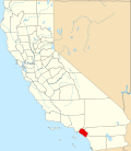
Position in California.
Coordinates: 33°43′04″N118°04′21″W / 33.71778°N 118.07250°W / 33.71778; -118.07250 Coordinates: 33°43′04″N118°04′21″W / 33.71778°N 118.07250°W / 33.71778; -118.07250
Country Flag of the United States.svg United States
State Flag of California.svg California
County Orange
CDP designationSeptember 8, 1904
Annexed into Huntington BeachAugust 2011
Area
[1]
  Total0.197 sq mi (0.511 km2)
  Land0.192 sq mi (0.498 km2)
  Water0.005 sq mi (0.013 km2)  2.49%
Elevation
5.3 ft (1.6 m)
Population
 (2010)
  Total971
  Density4,900/sq mi (1,900/km2)
ZIP code
90742
Area code 562
U.S. Geological Survey Geographic Names Information System: Sunset Beach, California

Sunset Beach is a Huntington Beach beachfront community in Orange County, California. It was established on September 8, 1904 [2] and developed as a result of the 1920 discovery of oil in the Huntington Beach Oil Field. The census-designated place of Sunset Beach, and its population of 971 as of the 2010 census, was annexed by Huntington Beach in 2011. [3] The elevation is 5.3 feet (1.6 m) above sea level and the community is stretched out along Pacific Coast Highway bracketed by the ocean and Huntington Harbour.

Contents

History

Sunset Beach was established in 1904 and developed as a result of the 1920 discovery of oil in the Huntington Beach Oil Field. [4] On August 2, 2010, the Huntington Beach city council, in a 5-2 vote, voted to annex Sunset Beach making the community a part of the much larger Huntington Beach. The annexation was to have officially begun in January 2011 but a group of residents filed suit on December 9, 2010, to stop the annexation due to new taxes that would be imposed on them once they become part of Huntington Beach. A hearing for a preliminary injunction was scheduled for January 19, 2011, in Orange County Superior Court. [5] Huntington Beach officially annexed Sunset Beach in August 2011. [6]

Geography

According to the United States Census Bureau, the CDP covered an area of 0.2 square miles (0.5 km2), 97.51% of it land, and 2.49% of it water.

Demographics

The 2010 United States Census [7] reported that Sunset Beach had a population of 971. The population density was 4,919.3 inhabitants per square mile (1,899.4/km2). The racial makeup of Sunset Beach was 863 (88.9%) White, 4 (0.4%) African American, 6 (0.6%) Native American, 42 (4.3%) Asian, 2 (0.2%) Pacific Islander, 18 (1.9%) from other races, and 36 (3.7%) from two or more races. Hispanic or Latino of any race were 79 persons (8.1%).

The 2010 Census reported that 971 people (100% of the population) lived in households, 0 (0%) lived in non-institutionalized group quarters, and 0 (0%) were institutionalized. [7]

There were 515 households, out of which 69 (13.4%) had children under the age of 18 living in them, 179 (34.8%) were opposite-sex married couples living together, 19 (3.7%) had a female householder with no husband present, 23 (4.5%) had a male householder with no wife present. There were 29 (5.6%) unmarried opposite-sex partnerships, and 5 (1.0%) same-sex married couples or partnerships. 224 households (43.5%) were made up of individuals, and 48 (9.3%) had someone living alone who was 65 years of age or older. The average household size was 1.89. There were 221 families (42.9% of all households); the average family size was 2.64.

The population was spread out, with 106 people (10.9%) under the age of 18, 72 people (7.4%) aged 18 to 24, 280 people (28.8%) aged 25 to 44, 365 people (37.6%) aged 45 to 64, and 148 people (15.2%) who were 65 years of age or older. The median age was 46.9 years. For every 100 females, there were 120.2 males. For every 100 females age 18 and over, there were 117.3 males.

There were 641 housing units at an average density of 3,247.5 per square mile (1,253.9/km2), of which 211 (41.0%) were owner-occupied, and 304 (59.0%) were occupied by renters. The homeowner vacancy rate was 4.4%; the rental vacancy rate was 8.9%. 455 people (46.9% of the population) lived in owner-occupied housing units and 516 people (53.1%) lived in rental housing units.

Economy

A surfer rides the break at Sunset Beach HardCore.JPG
A surfer rides the break at Sunset Beach

Sunset Beach has a number of restaurants and bars, including Captain Jack's, founded by noted surfer Jack Haley Sr., the father of basketball player Jack Haley. [8]

Arts and culture

The Sunset Beach Art Festival is held annually during Mothers Day weekend. It was created in 1948 by the local women's group as a way to promote education and social activities and was initially called the Beachcomber's Carnival. The festival generates $30,000 to $40,000, with all the proceeds going to charity. [9]

Parks and recreation

Sunset Beach features one of the widest beaches in southern California. Running parallel to the beach, from the north of town to the southern edge is the Green Belt, a bucolic 14 acre park on which residents walk their dogs and celebrate Mother's Day with the historic Sunset Beach Art Festival, sponsored by Las Damas. Southeast of Sunset Beach is Bolsa Chica State Beach. To the east is the bayfront community of Huntington Harbour (part of Huntington Beach), and roughly north is the Naval Weapons Station Seal Beach, and the Seal Beach National Wildlife Refuge. [10] The small gated community of Surfside located between Sunset Beach and the Weapons Station is part of Seal Beach, with the rest of Seal Beach on the other side of the Weapons Station. [10]

Infrastructure

Sunset Beach does not have residential mail delivery. Instead, residents pick up their mail at post office boxes in the centrally-located post office or at private post office boxes located on 22nd Street. The main Post Office features an award-winning wall mural designed and painted by local artist Katy Brack. [11] Sunset Beach is served by the Sunset Beach Sanitary District and emergency services are provided by the Huntington Beach Police Department and the Huntington Beach Fire Department. [12] Sunset Beach residents are civic minded and the town boasts three long term associations - The Sunset Beach Community Association SBCA, The Sunset Beach Woman's Club and Las Damas, a woman's philanthropic organization.

See also

Related Research Articles

<span class="mw-page-title-main">Orange County, California</span> County in California, United States

Orange County, often known by its initials O.C., is located in the Los Angeles metropolitan area in Southern California. As of the 2020 census, the population was 3,186,989, making it the third-most-populous county in California, the sixth-most-populous in the United States, and more populous than 19 American states and Washington, D.C. Although largely suburban, it is the second-most-densely-populated county in the state behind San Francisco County. The county's three most-populous cities are Anaheim, Santa Ana, and Irvine, each of which has a population exceeding 300,000. Santa Ana is also the county seat. Six cities in Orange County are on the Pacific coast: Seal Beach, Huntington Beach, Newport Beach, Laguna Beach, Dana Point, and San Clemente.

<span class="mw-page-title-main">Fountain Valley, California</span> City in California, United States

Fountain Valley is a suburban city in Orange County, California. The population was 57,047 at the 2020 census.

<span class="mw-page-title-main">Huntington Beach, California</span> City in California, United States

Huntington Beach is a seaside city in Orange County in Southern California, United States. The city is named after American businessman Henry E. Huntington. The population was 198,711 during the 2020 census, making it the fourth most populous city in Orange County, the most populous beach city in Orange County, and the seventh most populous city in the Los Angeles-Long Beach-Anaheim, CA Metropolitan Statistical Area. Located 35 miles (56 km) southeast of Downtown Los Angeles, it is bordered by Bolsa Chica Basin State Marine Conservation Area on the west, the Pacific Ocean on the southwest, by Seal Beach on the northwest, by Westminster on the north, by Fountain Valley on the northeast, by Costa Mesa on the east, and by Newport Beach on the southeast.

<span class="mw-page-title-main">Garden Grove, California</span> City in California, United States

Garden Grove is a city in northern Orange County, California, United States. The population was 171,949 at the 2020 census. State Route 22, also known as the Garden Grove Freeway, passes through the city in an east–west direction. The western portion of the city is known as West Garden Grove.

<span class="mw-page-title-main">Los Alamitos, California</span> City in California, United States

Los Alamitos is a city in Orange County, California. The city was incorporated in March 1960. The population was 11,780 at the 2020 census, up from 11,449 at the 2010 census. The adjacent unincorporated community of Rossmoor uses the same 90720 ZIP code in its mailing address, but is not part of the city. The Los Alamitos Race Course is named for the city, but lies in the neighboring city of Cypress.

<span class="mw-page-title-main">Seal Beach, California</span> City in California, United States

Seal Beach is a coastal city in Orange County, California, United States. As of the 2020 census, the population was 25,242, up from 24,168 at the 2010 census.

<span class="mw-page-title-main">Westminster, California</span> City in California, United States

Westminster is a city in northern Orange County, California, known for its many Vietnamese refugees who immigrated to the city during the 1980s. They settled largely in Little Saigon, and the city is known as the "capital" of overseas Vietnamese with 36,058 Vietnamese Americans and at 40.2% (2010), the highest municipal prevalence of Vietnamese Americans. The Little Saigon is a district of the town. Westminster was founded in 1870 by Rev. Lemuel Webber as a Presbyterian temperance colony and was incorporated in 1957.

<span class="mw-page-title-main">Solana Beach, California</span> City in California, United States

Solana Beach is a coastal city in San Diego County, California. Its population was at 12,941 at the 2020 U.S. Census, up from 12,867 at the 2010 Census.

<span class="mw-page-title-main">Beach City, Texas</span> City in Texas, United States

Beach City is a U.S. city in Chambers County, Texas. The population was 3,221 at the 2020 census. It can now be considered as a part of Greater Houston.

<span class="mw-page-title-main">Bolsa Chica State Beach</span> Beach in Orange County, California, USA

Bolsa Chica State Beach is a public ocean beach in Orange County, California, United States. It is located north of Huntington Beach and south of the community of Sunset Beach. The beach extends 3 miles (5 km) from Warner Avenue in Sunset Beach south to Seapoint Avenue, where the Huntington City Beach begins. The Bolsa Chica Ecological Reserve is located across the busy Pacific Coast Highway (PCH) from the beach and is a popular spot for birdwatching. The Bolsa Chica Bicycle Path runs along the length of the park through Huntington City Beach.

<span class="mw-page-title-main">Naval Weapons Station Seal Beach</span> US Navy installation in Seal Beach, California, US

Naval Weapons Station Seal Beach is a United States Navy weapons and munitions loading, storage and maintenance facility located in Seal Beach, California, with detachments in Fallbrook and Norco, both also in California. It also encloses the Seal Beach National Wildlife Refuge.

<span class="mw-page-title-main">Midway City, California</span> Census-designated place in California, United States

Midway City is a census-designated place in the United States that forms part of the county land controlled by Orange County, California. The only area in Orange County that incorporates its chamber of commerce and homeowners association to act in concert like a city council, the area mostly is surrounded by Westminster with Huntington Beach bordering it on the southwest. Midway City was so named because it is horizontally midway between Seal Beach, to the west, and Santa Ana, to the east. The 2010 census listed the population as 8,485.

<span class="mw-page-title-main">California's 47th congressional district</span> U.S. House district for California

California's 47th congressional district is a congressional district in the U.S. state of California.

<span class="mw-page-title-main">Bolsa Chica Ecological Reserve</span> Natural public land in Orange County, California, US

Bolsa Chica State Ecological Reserve is a natural reserve and public land in Orange County, governed by the state of California, and immediately adjacent to the city of Huntington Beach, California. The reserve is designated by the California Department of Fish and Wildlife (CDFW) to protect a coastal wetland and upland, with both migratory and resident threatened and endangered species of wildlife and wildflowers.

<span class="mw-page-title-main">Debbie Cook</span> American politician

Deborah Ann "Debbie" Cook is an American politician and lawyer from California. She is the former mayor of Huntington Beach, California, and was the Democratic candidate for California's 46th congressional district in 2008. Cook was elected to the Huntington Beach City Council in 2000 and re-elected in 2004. She is president of the board of directors of the Post Carbon Institute.

<span class="mw-page-title-main">Rancho La Bolsa Chica</span> Mexican land grant given in 1841

Rancho La Bolsa Chica was an 8,107-acre (32.81 km2) Mexican land grant in present day coastal northwestern Orange County, California given in 1841 by Governor Juan Alvarado to Joaquín Ruiz. The name means "little pocket", and refers to pockets of land amongst the marsh wetlands of the Santa Ana River estuary. The rancho lands include the present day city of Huntington Beach, the community of Sunset Beach, and the significant Bolsa Chica Ecological Reserve.

<span class="mw-page-title-main">Rossmoor, California</span> Census-designated place in California, United States

Rossmoor is a planned census-designated place located in Orange County, California. As of the 2020 census, the CDP had a total population of 10,625 up from the 2010 census population of 10,244. The gated Leisure World retirement community in the city of Seal Beach is to the south of Rossmoor, Los Alamitos is to the east and north, and Long Beach is to the west. The community of Rossmoor has two shopping centers within its boundaries, but only one—the Rossmoor Village Square, is now within the political boundaries of Rossmoor. A larger shopping center, the Rossmoor Business Center, was annexed, despite many protests, by the City of Seal Beach in 1967. The Center has been remodeled several times and was renamed the Shops at Rossmoor in the early 2000s.

Huntington Harbour is a community of about 3,500 people located in the northwestern section of Huntington Beach in Orange County, California. Huntington Harbour is a residential development of 680 acres (280 ha) which includes five man-made islands with waterways varying from 15 to 20 feet in depth used for boating. The five man-made islands in Huntington Harbour include: Admiralty, Davenport, Gilbert, Humboldt, and Trinidad.

Bolsa Chica Basin State Marine Conservation Area (SMCA) and Bolsa Bay State Marine Conservation Area (SMCA) are two adjoining marine protected areas located in Orange County on the southern coast of California, United States. The SMCAs cover 0.66 and 0.07 square miles, respectively. The SMCAs protect marine life by limiting the removal of marine wildlife from within their borders.

<span class="mw-page-title-main">Anaheim Bay</span>

Anaheim Bay is an extensive harbor and wetland complex in Orange County, California in the United States. The bay is located on the Pacific Ocean coast of northwestern Orange County next to Seal Beach and is split into several distinct but interconnected parts. The term "Anaheim Bay" generally refers to the deep-water Navy harbor at the bay entrance. Further southeast are the Huntington Harbor, which serves small private vessels, and the Bolsa Bay, a salt-water estuary. Bordering the bay are hundreds of acres of salt marshes, some of the largest remaining such habitats in Southern California.

References

  1. U.S. Census Archived 2012-07-02 at the Wayback Machine
  2. "Sunset Beach Specific Plan" (PDF). City of Huntington Beach. 2017. Retrieved 17 April 2018.
  3. U.S. Geological Survey Geographic Names Information System: Sunset Beach, California
  4. Caughman, Madge; Joanne S. Ginsberg (1987). California Coastal Resource Guide . California Coastal Commission, University of California Press. p.  317. ISBN   0-520-06186-1.
  5. Anton, Mike (January 3, 2011). "Lawsuit gives Sunset Beach a reprieve in annexation battle". Los Angeles Times . Retrieved 3 January 2011.
  6. Miller, Michael (August 25, 2011). "Sunset annexed; group plans appeal". Huntington Beach Independent . pp. A1, A10.
  7. 1 2 "2010 Census Interactive Population Search: CA - Sunset Beach CDP". U.S. Census Bureau. Archived from the original on July 15, 2014. Retrieved July 12, 2014.
  8. Christon, Lawrence (December 24, 2015). "Captain Jack's". The Orange County Register. Retrieved 27 December 2015.
  9. Mellen, Greg (May 11, 2017). "Local artists come to Sunset Beach to 50th annual show". Huntington Beach Wave. Orange County Register. pp. 1–2.
  10. 1 2 Marshutz, Scott (2008-06-08). "Friendly slice of beach in Orange County". Los Angeles Times. Retrieved 2008-06-10.
  11. Vittachi, Imran (May 3, 2012). "You can't miss it now". Huntington Beach Independent . p. B1. Retrieved May 5, 2012.
  12. Shadia, Mona (September 8, 2011). "H.B. police now patrol Sunset". Huntington Beach Independent . pp. A1, A14.