Copeland Tops State Conservation Area

Last updated

Copeland Tops State Conservation Area
New South Wales

Shatterwood & Birds Nest Ferns.JPG

Bird's nest ferns growing on shatterwood trees at Copeland Tops
Australia New South Wales relief location map.png
Red pog.svg
Copeland Tops State Conservation Area
Nearest town or city Gloucester
Coordinates 31°57′45″S151°48′05″E / 31.96250°S 151.80139°E / -31.96250; 151.80139 Coordinates: 31°57′45″S151°48′05″E / 31.96250°S 151.80139°E / -31.96250; 151.80139
Established 1 July 2003 (2003-07-01) [1]
Area 22.01 km2 (8.5 sq mi) [2]
Managing authorities NSW National Parks and Wildlife Service
Website Copeland Tops State Conservation Area

The Copeland Tops State Conservation Area is a protected conservation area located near the Barrington Tops in the Hunter Region of New South Wales, Australia. The 2,201-hectare (5,440-acre) is situated 12 km (7 mi) west of Gloucester.

State park protected area managed at the federated state level

State parks are parks or other protected areas managed at the sub-national level within those nations which use "state" as a political subdivision. State parks are typically established by a state to preserve a location on account of its natural beauty, historic interest, or recreational potential. There are state parks under the administration of the government of each U.S. state, some of the Mexican states, and in Brazil. The term is also used in the Australian state of Victoria. The equivalent term used in Canada, Argentina, South Africa and Belgium, is provincial park. Similar systems of local government maintained parks exist in other countries, but the terminology varies.

Habitat conservation

Habitat conservation is a management practice that seeks to conserve, protect and restore habitat areas for wild plants and animals, especially conservation reliant species, and prevent their extinction, fragmentation or reduction in range. It is a priority of many groups that cannot be easily characterized in terms of any one ideology.

Hunter Region Region in New South Wales, Australia

The Hunter Region, also commonly known as the Hunter Valley, is a region of New South Wales, Australia, extending from approximately 120 km (75 mi) to 310 km (193 mi) north of Sydney. It contains the Hunter River and its tributaries with highland areas to the north and south. Situated at the northern end of the Sydney Basin bioregion, the Hunter Valley is one of the largest river valleys on the NSW coast, and is most commonly known for its wineries and coal industry.

Contents

Features

Relics of the "Mountain Maid" gold mine may be visited with a tour guide. [2] Gold was discovered by timber collectors in 1875. By 1878, around one thousand people were living in the area. Most of the gold mining activity had ceased by 1890. [3] At the end of 1886, the Mountain Maid mine yielded 8,819 ounces (250,000 g) of gold. And the Hidden Treasure mine yielded 9,501 ounces (269,300 g). [4]

Australian gold rushes

During the Australian gold rushes, significant numbers of workers relocated to areas in which gold had been discovered. A number of gold finds occurred in Australia prior to 1851, but only the gold found from 1851 onwards created gold rushes. This is mainly because, prior to 1851, the colonial government of New South Wales had suppressed news of gold finds which it believed would reduce the workforce and destabilise the economy.

Flora include wet sclerophyll eucalyptus forest and a unique "dry" rainforest. Rainforest trees present include shatterwood, black booyong, Moreton Bay fig, and the white cedar. Some of the red cedar grow in excess of 40 metres (130 ft) tall. Of note is the large epiphytic ferns growing in the rainforest, such as birds nest ferns, staghorn fern, and elkhorn ferns.

Sclerophyll A type of vegetation that has hard leaves, short internodes and leaf orientation parallel or oblique to direct sunlight

Sclerophyll is a type of vegetation that has hard leaves, short internodes and leaf orientation parallel or oblique to direct sunlight. The word comes from the Greek sklēros (hard) and phyllon (leaf).

<i>Eucalyptus</i> genus of plants

Eucalyptus is a genus of over seven hundred species of flowering trees, shrubs or mallees in the myrtle family, Myrtaceae commonly known as eucalypts. Plants in the genus Eucalyptus have bark that is smooth, fibrous or stringy, leaves with oil glands, and sepals and petals that are fused to form a "cap" or operculum over the stamens. The fruit is a woody capsule commonly referred to as a "gumnut". Australia is covered by 92,000,000 hectares of eucalypt forest, comprising three quarters of the area covered by native forest.

<i>Ficus macrophylla</i> species of plant

Ficus macrophylla, commonly known as the Moreton Bay fig or Australian banyan, is a large evergreen banyan tree of the family Moraceae native to eastern Australia, from the Wide Bay–Burnett region in the north to the Illawarra in New South Wales, as well as Lord Howe Island. Its common name is derived from Moreton Bay in Queensland, Australia. It is best known for its imposing buttress roots. As Ficus macrophylla is a strangler fig, seed germination usually takes place in the canopy of a host tree and the seedling lives as an epiphyte until its roots establish contact with the ground. It then enlarges and strangles its host, eventually becoming a freestanding tree by itself. Individuals may reach 60 m (200 ft) in height. The large leathery, dark green leaves are 15–30 cm (6–12 in) long.

Koalas, eastern grey kangaroos, red-necked wallabies, wombats, and greater gliders are some of the many marsupial animals found here. Microbats rest in the gold mine shafts during the day.

Koala An arboreal herbivorous marsupial native to Australia.

The koala is an arboreal herbivorous marsupial native to Australia. It is the only extant representative of the family Phascolarctidae and its closest living relatives are the wombats, which comprise the family Vombatidae.. The koala is found in coastal areas of the mainland's eastern and southern regions, inhabiting Queensland, New South Wales, Victoria, and South Australia. It is easily recognisable by its stout, tailless body and large head with round, fluffy ears and large, spoon-shaped nose. The koala has a body length of 60–85 cm (24–33 in) and weighs 4–15 kg (9–33 lb). Pelage colour ranges from silver grey to chocolate brown. Koalas from the northern populations are typically smaller and lighter in colour than their counterparts further south. These populations possibly are separate subspecies, but this is disputed.

Eastern grey kangaroo species of mammal

The eastern grey kangaroo is a marsupial found in southern and eastern Australia, with a population of several million. It is also known as the great grey kangaroo and the forester kangaroo. Although a big eastern grey male typically masses around 66 kg and stands almost 2 m (6.6 ft.) tall, the scientific name, Macropus giganteus, is misleading: the red kangaroo of the semi-arid inland is larger, weighing up to 90 kg.

Wombat family of mammals

Wombats are short-legged, muscular quadrupedal marsupials that are native to Australia. They are about 1 m (40 in) in length with small, stubby tails. There are three extant species and they are all members of the family Vombatidae. They are adaptable and habitat tolerant, and are found in forested, mountainous, and heathland areas of south-eastern Australia, including Tasmania, as well as an isolated patch of about 300 ha in Epping Forest National Park in central Queensland.

See also

Related Research Articles

Barrington Tops National Park Protected area in New South Wales, Australia

The Barrington Tops National Park is a protected national park located in the Hunter Valley, approximately 200 kilometres (120 mi) north of Sydney in New South Wales, Australia. Gazetted in 1969, the 76,512-hectare (189,070-acre) park is situated between Scone, Singleton, Dungog, Gloucester and East Gresford.

Gardens of Stone National Park Protected area in New South Wales, Australia

The Gardens of Stone National Park is a protected national park that is located in the Central Tablelands region of New South Wales in eastern Australia. The 15,080-hectare (37,300-acre) national park is situated 125 kilometres (78 mi) northwest of Sydney, and 30 kilometres (19 mi) northwest of Lithgow. The national park draws its name from the natural stone pagodas within its boundaries.

Kanangra-Boyd National Park Protected area in New South Wales, Australia

The Kanangra-Boyd National Park is a protected national park that is located in the Central Tablelands region, west of the Southern Highlands and Macarthur regions, in New South Wales, in eastern Australia. The 68,660-hectare (169,700-acre) national park is situated approximately 180 kilometres (110 mi) south-west of Sydney and is contiguous with the Blue Mountains National Park and the Nattai National Park. The park was established in 1969.

Yengo National Park Protected area in New South Wales, Australia

The Yengo National Park is a protected national park that is located in the Lower Hunter region of New South Wales, in eastern Australia. The 154,328-hectare (381,350-acre) park is situated 85 kilometres (53 mi) northwest of the Sydney central business district, 40 kilometres (25 mi) south of Cessnock, 40 kilometres (25 mi) north of Wisemans Ferry, and 155 kilometres (96 mi) southwest of Newcastle.

Limpinwood Nature Reserve Protected area in New South Wales, Australia

The Limpinwood Nature Reserve is a protected nature reserve that is located on the Northern Rivers region of New South Wales, in eastern Australia. The reserve was gazetted in April 1963 with additions made in 1967, over former fauna and crown reserves, and further additions were made in 1988 to make the reserve to its current area of 2,646 hectares. The reserve is situated north-west of the rural locality of Limpinwood, and north of Tyalgum and defines part of the state border between New South Wales and Queensland.

Gondwana Rainforests area of subtropical rainforest in Australia

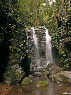
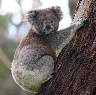
The Gondwana Rainforests of Australia, formerly known as the Central Eastern Rainforest Reserves, are the most extensive area of subtropical rainforest in the world. Collectively, the rainforests are a World Heritage Site with fifty separate reserves totalling 366,500 hectares from Newcastle to Brisbane.

Boorganna Nature Reserve Protected area in New South Wales, Australia

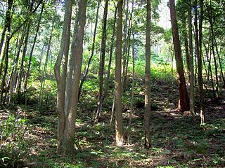
The Boorganna Nature Reserve is a protected nature reserve located northwest of Taree on the Comboyne Plateau in New South Wales, Australia. The 396-hectare (980-acre) reserve, managed by the NSW National Parks & Wildlife Service, was gazetted in 1904 and is the second oldest nature reserve in the state. The reserve features various forest types, including stands of sub tropical rainforest of which the large rosewood, yellow carabeen and small leaf fig are particularly noteworthy. The reserve is a remnant of the former extensive rainforest on the Comboyne Plateau. The plateau was cleared between 1900 and 1925. Australian red cedar was logged in the area in the nineteenth century. Originally proposed to be part of the world heritage rainforest group. The exploration, knowledge, uses and history of this area by Indigenous Australians is not well known in the present day.

Mount Hyland Nature Reserve Protected area in New South Wales, Australia

The Mount Hyland Nature Reserve is a protected nature reserve that is located in the New England region of New South Wales, in eastern Australia. The 2,519-hectare (6,220-acre) reserve is situated approximately 35 kilometres (22 mi) west of Dorrigo.

Yatteyattah Nature Reserve Protected area in New South Wales, Australia

The Yatteyattah Nature Reserve is a protected nature reserve in the south coast region of New South Wales, in eastern Australia. The 35-hectare (86-acre) reserve is situated near Milton.

Wilsons Peak Flora Reserve Protected area in New South Wales, Australia

The Wilsons Peak Flora Reserve is a protected nature reserve that is located in the Northern Rivers region in the state of New South Wales, in eastern Australia. The reserve is bounded to the north by the border between New South Wales and the state of Queensland. The nearest town is the Queensland settlement of Killarney.

Gumbaynggirr State Conservation Area Protected area in New South Wales, Australia

The Gumbayngirr State Conservation Area is a protected conservation area located in the Mid North Coast region of New South Wales, in eastern Australia. The 2,561-hectare (6,330-acre) conservation area is situated west of Nambucca Heads and contains a sub–tropical jungle, known as the League Scrub.

Susan Island Nature Reserve Protected area in New South Wales, Australia

The Susan Island Nature Reserve is a protected nature reserve containing Susan Island, a river island, that is located in the mouth of the Clarence River, in the Northern Rivers region of New South Wales in eastern Australia. The 23-hectare (57-acre) reserve is situated near Grafton. The island and reserve is a rare 16.5-hectare (41-acre) example of sub tropical lowland rainforest.

Wingham Brush Nature Reserve Protected area in New South Wales, Australia

The Wingham Brush Nature Reserve is a protected nature reserve that is located in the Mid North Coast region of New South Wales, in eastern Australia. The 8-hectare (20-acre) reserve is a rare example of sub tropical lowland rainforest and is situated on the Manning River.

Black Bulga State Conservation Area Protected area in New South Wales, Australia

The Black Bulga State Conservation Area is a protected conservation area located near the Barrington Tops, in the Hunter Region of New South Wales, Australia. The 1,554-hectare (3,840-acre) conservation area is situated 16 kilometres (9.9 mi) from Dungog, and used to be part of Trevor State Forest and Chichester State Forest.

Garawarra State Conservation Area Protected area in New South Wales, Australia

The Garawarra State Conservation Area is a protected conservation area that is located on the southern suburban fringe of Greater Sydney, in the state of New South Wales, in eastern Australia. The 949-hectare (2,350-acre) reserve abuts the Royal National Park and is situated 40 kilometres (25 mi) south of the Sydney central business district, near Helensburgh. Garawarra was gazetted as a park in 1987, and added, together with the Royal National Park, to the Australian National Heritage List on 15 September 2006.

Careys Peak mountain in Australia

Careys Peak is a peak in the Williams Range, part of the Mount Royal Range, located in the Upper Hunter region of New South Wales, Australia. At 1,544 metres (5,066 ft) above sea level, it is one of the higher points in Barrington Tops National Park, some 200 kilometres (120 mi) north of Sydney. The peak is at the edge of the Barrington Tops plateau, within the declared wilderness of the World Heritage Gondwana Rainforests of Australia.

Mount Royal (New South Wales) mountain at the southern end of the Mount Royal Range in eastern Australia

Mount Royal is situated at the southern end of the Mount Royal Range in the Barrington Tops region of eastern Australia. It is part of the World Heritage Gondwana Rainforests of Australia.

Bretti Nature Reserve Protected area in New South Wales, Australia

The Bretti Nature Reserve is a protected nature reserve located near the Barrington Tops in the Hunter Region of New South Wales, Australia. The 2,902-hectare (7,170-acre) reserve is situated approximately 30 kilometres (19 mi) north of Gloucester. Flora includes wet sclerophyll eucalyptus forest and rainforest. It is most often viewed on a drive along the Thunderbolts Way. The locally rare wompoo fruit dove may be heard in rainforest areas.

Sea Acres National Park Protected area in New South Wales, Australia

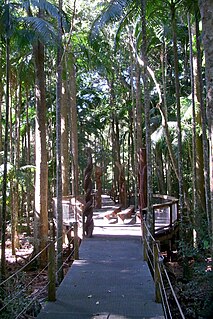
The Sea Acres National Park is a national park that is located in the Mid North Coast region of New South Wales, in eastern Australia. The 76-hectare (190-acre) park is situated near the town of Port Macquarie. The park is a popular tourist area with a 1.3-kilometre (0.81 mi) long boardwalk through a remnant of seaside rainforest. There is also an education centre and cafe. The park was initially declared as a nature reserve in 1987; and gazetted as a national park in October 2010.

Stotts Island Nature Reserve Protected area in New South Wales, Australia

The Stotts Island Nature Reserve is a protected nature reserve containing the Stotts Island, a river island, that is located in the Tweed River, in the Northern Rivers region of New South Wales in eastern Australia. The 141-hectare (350-acre) reserve is situated near Tweed Heads and 12 kilometres (7.5 mi) northeast of Murwillumbah.

References