Emma Burr Mountain

Last updated

Emma Burr Mountain
Emma Burr Mountain.jpg
Northeast aspect
Highest point
Elevation 13,544 ft (4,128 m) [1] [2]
Prominence 1,241 ft (378 m) [1]
Parent peak Mount Princeton (14,204 ft) [3]
Isolation 6.94 mi (11.17 km) [1]
Coordinates 38°44′01″N106°25′00″W / 38.7335434°N 106.4167273°W / 38.7335434; -106.4167273 [4]
Geography
USA Colorado relief location map.svg
Red triangle with thick white border.svg
Emma Burr Mountain
Location in Colorado
Usa edcp relief location map.png
Red triangle with thick white border.svg
Emma Burr Mountain
Emma Burr Mountain (the United States)
CountryUnited States
State Colorado
County Chaffee / Gunnison
Protected area San Isabel National Forest
Gunnison National Forest
Parent range Rocky Mountains
Sawatch Range
Collegiate Peaks [5]
Topo map USGS Cumberland Pass
Geology
Rock type Schist [6]
Climbing
Easiest route class 2 hiking [1]

Emma Burr Mountain is a 13,544-foot-elevation (4,128-meter) mountain summit on the common border shared by Chaffee and Gunnison counties in Colorado, United States. [4]

Contents

Description

Emma Burr Mountain is set on the Continental Divide in the Collegiate Peaks which are a subrange of the Sawatch Range. [5] The mountain ranks as the 12th-highest peak in Gunnison County and the 226th-highest in Colorado. [1] The peak is located 3.5 miles (5.6 km) southeast of the community of Tincup in the San Isabel National Forest and Gunnison National Forest. Precipitation runoff from the mountain's east slope drains into tributaries of Cottonwood Creek which in turn is a tributary of the Arkansas River, whereas the west slope drains to Willow Creek which is a tributary of the Taylor River. Topographic relief is significant as the summit rises nearly 2,600 feet (792 m) above Mirror Lake in less than one mile (1.6 km). The peak is the highest point along the Continental Divide for a 160-mile stretch from Carson Peak to an unnamed peak with elevation 13,570-ft. [7] [8]

History

In 1878, lode deposits were discovered in the vicinity, and the town of Virginia City was laid out in March 1879. By 1881 there were numerous mines, the principal ones being Gold Cup, Emma Burr, Anna Dedrika, Tin Cup, Mayflower, Cumberland, Jimmy Mack, King and Queen. [9] The name of the town was changed to Tincup, a nearby pass to the south was named Cumberland Pass, and mountains were named Emma Burr Mountain and Anna Mountain. The name "Emma Burr Mountain" appeared in publications in 1882. [10] [11] The mountain's toponym was officially adopted in 1963 by the United States Board on Geographic Names. [4]

Climate

According to the Köppen climate classification system, Emma Burr Mountain is located in an alpine subarctic climate zone with cold, snowy winters, and cool to warm summers. [12] Due to its altitude, it receives precipitation all year, as snow in winter and as thunderstorms in summer, with a dry period in late spring. Climbers can expect afternoon rain, hail, and lightning from the seasonal monsoon in late July and August.

See also

Related Research Articles

<span class="mw-page-title-main">Lead Mountain (Grand County, Colorado)</span> Mountain in Colorado, United States

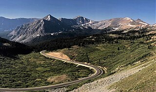
Lead Mountain is a summit in Grand County, Colorado, in the United States. With an elevation of 12,546 feet (3,824 m), Lead Mountain is the 970th-highest summit in the state of Colorado. Lead Mountain was named in 1879 on account of its lead deposits.

<span class="mw-page-title-main">Mount Emma</span> Mountain in the state of Colorado

Mount Emma is a 13,581-foot-elevation (4,139-meter) mountain summit located in San Miguel County of Colorado, United States. It is situated three miles north of the community of Telluride, on the south side of Yankee Boy Basin, in the Uncompahgre National Forest. It is part of the Sneffels Range which is a subset of the San Juan Mountains, which in turn is part of the Rocky Mountains. Mount Emma is situated west of the Continental Divide, two miles south of Mount Sneffels, and 0.8 mile south of Gilpin Peak, the nearest higher neighbor. Emma ranks as the 197th-highest peak in Colorado, and the 10th-highest in the Sneffels Range. Topographic relief is significant as the south aspect rises 4,830 feet above Telluride in approximately three miles. An ascent of Mt. Emma is a difficult climb with 2,180 feet of elevation gain covering three miles from Yankee Boy Basin, or 4,836 feet of elevation gain from Telluride. This mountain's name was officially adopted by the U.S. Board on Geographic Names.

<span class="mw-page-title-main">Coxcomb Peak (Colorado)</span> Mountain in the state of Colorado

Coxcomb Peak is a 13,656-foot-elevation (4,162-meter) mountain summit located on the common boundary of Hinsdale County and Ouray County, in Colorado, United States. It is situated nine miles northeast of the community of Ouray, in the Uncompahgre Wilderness, on land managed by Uncompahgre National Forest. It is part of the San Juan Mountains which are a subset of the Rocky Mountains, and is situated west of the Continental Divide. Coxcomb ranks as the 171st-highest peak in Colorado, and topographic relief is significant as the south aspect rises 2,000 feet above Wetterhorn Basin in approximately one mile, and 4,400 feet above Cow Creek in three miles. Neighbors include Precipice Peak 2.7 miles to the north, Redcliff one-half mile north, Matterhorn Peak 2.3 miles to the east-southeast, and nearest higher neighbor Wetterhorn Peak 1.8 mile to the southeast. The mountain's descriptive name, which has been officially adopted by the United States Board on Geographic Names, was in use since at least 1906 when Henry Gannett published it in the Gazetteer of Colorado.

<span class="mw-page-title-main">Stony Mountain (Colorado)</span> Mountain in the state of Colorado

Stony Mountain is a 12,698-foot-elevation (3,870-meter) mountain summit located in Ouray County of southwest Colorado, United States. It is situated five miles southwest of the community of Ouray, on land managed by Uncompahgre National Forest. It is part of the Sneffels Range which is a subset of the San Juan Mountains, which in turn is part of the Rocky Mountains. It is situated west of the Continental Divide, 1.3 miles southwest of Potosi Peak, and 1.15 miles northeast of parent Mount Emma. Yankee Boy Basin is surrounded by Stony Mountain, Gilpin Peak, Mount Sneffels, Cirque Mountain, and Teakettle Mountain. Topographic relief is significant as the east aspect rises 2,000 feet above Sneffels Creek in less than one mile. The mountain's name, which has been officially adopted by the United States Board on Geographic Names, was in use before 1899 when Henry Gannett published it in A Dictionary of Altitudes in the United States.

<span class="mw-page-title-main">Star Peak (Colorado)</span> Mountain in Colorado, United States

Star Peak is a 13,527-foot (4,123 m) summit on the shared border between Gunnison County and Pitkin County in Colorado, United States.

<span class="mw-page-title-main">North Star Mountain (Colorado)</span> Mountain in Colorado, United States

North Star Mountain is a 13,614-foot (4,150 m) mountain summit on the shared border of Park County and Summit County, in Colorado, United States.

<span class="mw-page-title-main">Afley Peak</span> Mountain in the state of Colorado

Afley Peak is a mountain summit in Gunnison County, Colorado, United States.

<span class="mw-page-title-main">Carson Peak (Colorado)</span> Mountain in the state of Colorado

Carson Peak is a 13,662-foot-elevation (4,164-meter) summit in Hinsdale County, Colorado, United States.

<span class="mw-page-title-main">Hunter Peak</span> Mountain in the state of Colorado

Hunter Peak is a 13,506-foot (4,117 m) mountain summit in Pitkin County, Colorado, United States.

<span class="mw-page-title-main">Keefe Peak</span> Mountain in the state of Colorado

Keefe Peak is a 13,532-foot (4,125 m) mountain summit in Pitkin County, Colorado, United States.

<span class="mw-page-title-main">Hayden Peak (Pitkin County, Colorado)</span> Mountain in the state of Colorado

Hayden Peak is a 13,570-foot (4,136 m) mountain summit in Pitkin County, Colorado, United States.

<span class="mw-page-title-main">Taylor Peak (Gunnison County, Colorado)</span> Mountain in the state of Colorado

Taylor Peak is a 13,435-foot (4,095 m) summit on the boundary shared by Gunnison County and Pitkin County in Colorado, United States.

<span class="mw-page-title-main">Crystal Peak (Gunnison County, Colorado)</span> Mountain in Gunnison County, Colorado, United States

Crystal Peak is a 12,777-foot (3,894 m) mountain summit in Gunnison County, Colorado, United States.

<span class="mw-page-title-main">Turner Peak</span> Mountain in the state of Colorado

Turner Peak is a 13,233-foot-elevation (4,033-meter) mountain summit in Chaffee County, Colorado, United States.

<span class="mw-page-title-main">Jones Mountain (Chaffee County, Colorado)</span> Mountain in the state of Colorado

Jones Mountain is a 13,218-foot-elevation (4,029-meter) mountain summit in Chaffee County, Colorado, United States.

<span class="mw-page-title-main">Grizzly Peak (Gunnison County, Colorado)</span> Mountain in the state of Colorado

Grizzly Peak is a 13,309-foot-elevation (4,057-meter) mountain summit in Gunnison County, Colorado, United States.

<span class="mw-page-title-main">Pearl Mountain</span> Mountain in the state of Colorado

Pearl Mountain is a 13,379-foot (4,078 m) summit on the shared border between Gunnison County and Pitkin County in Colorado, United States.

<span class="mw-page-title-main">Grizzly Peak (Dolores/San Juan Counties, Colorado)</span> Mountain in the state of Colorado

Grizzly Peak is a 13,738-foot-elevation (4,187-meter) mountain summit on the boundary shared by Dolores County and San Juan County, in Colorado, United States.

<span class="mw-page-title-main">Kendall Peak (Colorado)</span> Mountain in the state of Colorado

Kendall Peak is a 13,455-foot-elevation (4,101-meter) mountain summit in San Juan County, Colorado, United States.

<span class="mw-page-title-main">Wood Mountain (Colorado)</span> Mountain in the state of Colorado

Wood Mountain is a 13,682-foot-elevation (4,170 meter) summit located on the boundary shared by Hinsdale County with San Juan County, in Colorado, United States.

References

  1. 1 2 3 4 5 "Emma Burr Mountain - 13,544' CO". listsofjohn.com. Retrieved June 4, 2023.
  2. Robert M. Ormes (2000), Guide to the Colorado Mountains, Colorado Mountain Club Press, ISBN   9780967146607, p. 194.
  3. "Emma Burr Mountain, Peakvisor.com" . Retrieved June 4, 2023.
  4. 1 2 3 "Emma Burr Mountain". Geographic Names Information System . United States Geological Survey, United States Department of the Interior . Retrieved June 4, 2023.
  5. 1 2 "Emma Burr Mountain, Colorado". Peakbagger.com. Retrieved June 4, 2023.
  6. McClelland G. Dings (1957), Geology and Ore Deposits of the Garfield Quadrangle, Colorado, US Government Printing Office, p. 6.
  7. "13570 - 13,570' CO". listsofjohn.com. Retrieved June 4, 2023.
  8. The Continental Divide Trail Coalition (2016), The Best Hikes on the Continental Divide Trail: Colorado, ISBN   9781937052294
  9. Geo. A. Crofutt, Crofutt's Grip-Sack Guide of Colorado (1881), Overland Publishing, p. 149.
  10. Report of the Director of the Mint upon the Statistics of the Production of the Precious Metals in the United States (1882), Government Printing Office, p. 396.
  11. Report of the Director of the Mint upon the Production of the Precious Metals in the United States during the Calendar Year 1883 (1884), Government Printing Office, p. 318.
  12. Peel, M. C.; Finlayson, B. L.; McMahon, T. A. (2007). "Updated world map of the Köppen−Geiger climate classification". Hydrol. Earth Syst. Sci. 11 (5): 1633. Bibcode:2007HESS...11.1633P. doi: 10.5194/hess-11-1633-2007 . ISSN   1027-5606. S2CID   9654551.