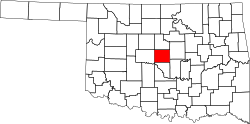
Jones, Oklahoma

Last updated

Jones, Oklahoma
Oklahoma County Oklahoma Incorporated and Unincorporated areas Jones highlighted.svg
Location in Oklahoma County and the state of Oklahoma.
Coordinates: 35°33′52″N97°17′22″W / 35.56444°N 97.28944°W / 35.56444; -97.28944
Country United States
State Oklahoma
County Oklahoma
Area
[1]
  Total13.67 sq mi (35.42 km2)
  Land13.67 sq mi (35.40 km2)
  Water0.01 sq mi (0.02 km2)
Elevation
[2]
1,116 ft (340 m)
Population
 (2020)
  Total2,885
  Density211.08/sq mi (81.50/km2)
Time zone UTC-6 (Central (CST))
  Summer (DST) UTC-5 (CDT)
ZIP code
73049
Area code 405
FIPS code 40-38350 [3]
GNIS feature ID2412809 [2]
Website Town of Jones City

Jones is a town in Oklahoma County, Oklahoma. It is named after Charles G. Jones, a three-time mayor of Oklahoma City. The population was 2,692 at the time of the 2010 census.

Contents

History

Early history

Jones was plotted as a townsite on April 22, 1898 by Luther F. Aldrich before the St. Louis and Oklahoma City Railroad constructed a line from Sapulpa to Oklahoma City. Aldrich named the town after his friend and business associate, Charles G. "Gristmill" Jones who was a three-time mayor of Oklahoma City. Jones later named his eldest son Luther. [4]

Jones is located just south of the place that Washington Irving described as "The Ringing of Horses" in the book A Tour on the Prairies (1835). [4]

Jones was incorporated as a city on January 4, 1909. The 1910 Census counted the population at 163. [4]

2007 ice storm and Jones High School fire

In December 2007, a devastating ice storm hit much of Oklahoma. It resulted in a fire at Jones High School, causing the school to burn to the ground. The new school was finished in 2010, after taking three years to build. The new school has a commons area and a theatre for drama club.

Earthquakes

On August 27, 2009, there were six earthquakes, the strongest of which registering a 3.7 magnitude on the Richter Scale, which occurred at 9:09 pm Central Standard Time.

On January 15, 2010, there were four earthquakes, the strongest of which registering a 4.0 magnitude on the Richter Scale, which occurred at 9:25 am Central Standard Time. [5]

On January 24, 2010, a magnitude 3.7 earthquake struck Jones at 1:15 am Central Standard Time. [6] [7]

On February 27, 2010, a magnitude 4.1 earthquake struck, east of Oklahoma City at 4:22 pm Central Standard Time, [8] preceded by a foreshock of magnitude 3.1 farther west on February 26 at 3:02 am local time. [9]

On October 13, 2010, a 4.7 magnitude earthquake hit, 10 miles (16 km) east of Norman at 9:06 a.m. [10]

Geography

According to the United States Census Bureau, the town has a total area of 13.7 square miles (35 km2), all land.

Jones is located in the Cross Timbers ecoregion and the Frontier Country tourism region. [11] [12]

Demographics

Historical population
CensusPop.Note
1910 163
1920 21431.3%
1930 28834.6%
1940 260−9.7%
1950 47683.1%
1960 79466.8%
1970 1,666109.8%
1980 2,27036.3%
1990 2,4246.8%
2000 2,5173.8%
2010 2,6927.0%
2020 2,8857.2%
U.S. Decennial Census [13]

As of the census [3] of 2000, there were 2,517 people, 914 households, and 673 families residing in the town. The population density was 184.2 inhabitants per square mile (71.1/km2). There were 986 housing units at an average density of 72.2 per square mile (27.9/km2). The racial makeup of the town was 88.16% White, 4.41% African American, 3.34% Native American, 0.16% Asian, 0.60% from other races, and 3.34% from two or more races. Hispanic or Latino of any race were 2.94% of the population.

There were 914 households, out of which 34.7% had children under the age of 18 living with them, 57.9% were married couples living together, 11.5% had a female householder with no husband present, and 26.3% were non-families. 22.4% of all households were made up of individuals, and 9.0% had someone living alone who was 65 years of age or older. The average household size was 2.61 and the average family size was 3.04.

In the town, the population was spread out, with 25.0% under the age of 18, 9.3% from 18 to 24, 27.5% from 25 to 44, 24.5% from 45 to 64, and 13.7% who were 65 years of age or older. The median age was 38 years. For every 100 females, there were 97.9 males. For every 100 females age 18 and over, there were 96.8 males.

The median income for a household in the town was $36,806, and the median income for a family was $41,495. Males had a median income of $31,406 versus $23,393 for females. The per capita income for the town was $16,388. About 9.5% of families and 13.6% of the population were below the poverty line, including 16.6% of those under age 18 and 13.4% of those age 65 or over.

Related Research Articles

<span class="mw-page-title-main">Pawnee County, Oklahoma</span> County in Oklahoma, United States

Pawnee County is a county located in the U.S. state of Oklahoma. As of the 2020 census, the population was 15,553. Its county seat is Pawnee. The county is named after the Pawnee Nation, whose reservation used to encompass the county prior to allotment in 1893.

<span class="mw-page-title-main">Beardsley, Minnesota</span> City in Minnesota, United States

Beardsley is a city in Big Stone County, Minnesota, United States. The population was 233 at the 2010 census.

<span class="mw-page-title-main">Sparta, North Carolina</span> Town in North Carolina, United States

Sparta is a town in Alleghany County, North Carolina, United States. At the last 2010 census, the population was 1,770 people. It is the county seat of Alleghany County.

<span class="mw-page-title-main">Armstrong, Oklahoma</span> Town in Oklahoma, United States

Armstrong is a town in Bryan County, Oklahoma, United States, along the Blue River. The population was 105 at the 2010 census, a 25.2 percent decrease from the figure of 141 recorded in 2000. The town was named for Frank C. Armstrong, a member of the Dawes Commission.

<span class="mw-page-title-main">Calumet, Oklahoma</span> Town in Oklahoma, United States

Calumet is a town in Canadian County, Oklahoma, United States. It is part of the Oklahoma City Metropolitan Area. The population was 507 at the 2010 census, a 5.23 percent decrease since 2000.

<span class="mw-page-title-main">Shattuck, Oklahoma</span> Town in Oklahoma, United States

Shattuck is a town in Ellis County, Oklahoma, United States. The population was 1,249 at the time of the 2020 census, a change from the 1,356 reported in the 2010 census.

<span class="mw-page-title-main">Covington, Oklahoma</span> Town in Oklahoma, United States

Covington is a town in Garfield County, Oklahoma, United States. The population was 477 at the 2020 census.

<span class="mw-page-title-main">Douglas, Oklahoma</span> Town in Oklahoma, United States

Douglas is a town in Garfield County, Oklahoma, United States. The population was 32 at the 2010 census.

<span class="mw-page-title-main">Ninnekah, Oklahoma</span> Town in Oklahoma, United States

Ninnekah is a town in Grady County, Oklahoma, United States. The population was 775 at the 2020 census, a 22.7% decrease from 2010.

<span class="mw-page-title-main">Snyder, Oklahoma</span> City in Oklahoma, United States

Snyder is a city in Kiowa County, Oklahoma, United States. The population was 1,394 at the 2010 census. This figure represented a decline of 7.6 percent from 1,509 persons in 2000.

<span class="mw-page-title-main">Fallis, Oklahoma</span> Town in Lincoln County, Oklahoma, United States

Fallis is a town in Lincoln County, Oklahoma, United States. The population was 27 at the 2010 census, a decline of 3.6 percent from the figure of 28 in 2000.

<span class="mw-page-title-main">Prague, Oklahoma</span> City in Oklahoma, United States

Prague is a city in Lincoln County, Oklahoma, United States. The population was 2,346 at the 2020 census, an 1.76 percent decrease from the figure of 2,388 in 2010. Czech immigrants founded the city, and named it after the capital of the present-day Czech Republic.

<span class="mw-page-title-main">Sparks, Oklahoma</span> Town in Oklahoma, United States

Sparks is a town in Lincoln County, Oklahoma, United States. The population was 169 at the 2010 census, a 23.4 percent gain from the figure of 137 in 2000. The center of population of Oklahoma is located in Sparks.

<span class="mw-page-title-main">Arcadia, Oklahoma</span> Town in Oklahoma County, Oklahoma

Arcadia is a town in Oklahoma County, Oklahoma, United States, and a part of the Oklahoma City metropolitan area. The population was 247 at the 2010 census, a decrease of 11.5 percent from the figure of 279 in 2000.

<span class="mw-page-title-main">Luther, Oklahoma</span> Town in Oklahoma, United States

Luther is a town in Oklahoma County, Oklahoma, United States, and a part of the Oklahoma City Metropolitan Area. The population was 1,221 at the 2010 census. Sperling Best Places lists the population of 4073 for the 73054 Luther zip code, which includes the town and immediate surrounding area of rural residents.

<span class="mw-page-title-main">Valley Brook, Oklahoma</span> Town in Oklahoma, United States

Valley Brook is a town in Oklahoma County, Oklahoma, United States, and is part of the Oklahoma City Metropolitan Area. The population was 765 at the 2010 census.

<span class="mw-page-title-main">Cleveland, Oklahoma</span> City in Oklahoma, United States

Cleveland is a city in Pawnee County, Oklahoma, United States. The 2010 census population was 3,251, a decrease of 0.9 percent from the figure of 3,282 recorded in 2000.

<span class="mw-page-title-main">Pawnee, Oklahoma</span> City in Oklahoma, United States

Pawnee is a city and county seat of Pawnee County, Oklahoma, United States. The town is northeast of Stillwater at the junction of U.S. Route 64 and State Highway 18.

<span class="mw-page-title-main">Optima, Oklahoma</span> Town in Oklahoma, United States

Optima is a town in Texas County, Oklahoma, United States. As of the 2020 census, the town’s population was 338.

<span class="mw-page-title-main">Searles Valley, California</span> Census-designated place in California, United States

Searles Valley is a census-designated place (CDP) in the Searles Valley of the Mojave Desert, in northwestern San Bernardino County, California.

References

  1. "ArcGIS REST Services Directory". United States Census Bureau. Retrieved September 20, 2022.
  2. 1 2 U.S. Geological Survey Geographic Names Information System: Jones, Oklahoma
  3. 1 2 "U.S. Census website". United States Census Bureau . Retrieved January 31, 2008.
  4. 1 2 3 Hedglen, Thomas L. "Jones," Encyclopedia of Oklahoma History and Culture, Oklahoma Historical Society. Accessed June 2, 2016.
  5. "M4.0 – Oklahoma". United States Geological Survey. Retrieved November 6, 2011.
  6. "Another small earthquake shakes eastern Oklahoma County". NewsOK. Retrieved November 6, 2011.
  7. "M3.7 – Oklahoma". United States Geological Survey. Retrieved November 6, 2011.
  8. "M4.1 – Oklahoma". United States Geological Survey. Retrieved November 6, 2011.
  9. "M3.1 – Oklahoma". United States Geological Survey. Retrieved November 6, 2011.
  10. Kimball, Michael. "Oklahoma earthquake: State survey lowers magnitude to 4.7". NewsOK. Retrieved November 19, 2010.
  11. "Ecoregions of Oklahoma" (PDF).
  12. "Cities & Regions". TravelOK.
  13. "Census of Population and Housing". Census.gov. Retrieved June 4, 2016.