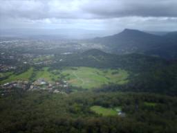
Wollongong is a city located in the Illawarra region of New South Wales, Australia. The name is believed to originate from the Dharawal language, meaning either 'five islands/clouds', 'ground near water' or 'sound of the sea'. Wollongong lies on the narrow coastal strip between the Illawarra Escarpment and the Pacific Ocean, 85 kilometres south of central Sydney. Wollongong had an estimated urban population of 302,739 at June 2018, making it the third-largest city in New South Wales after Sydney and Newcastle and the tenth-largest city in Australia by population. The city's current Lord Mayor is Gordon Bradbery AM who was elected in 2021.

Port Kembla is a suburb of Wollongong 10 km south of the CBD and part of the Illawarra region of New South Wales. The suburb comprises a seaport, industrial complex, a small harbour foreshore nature reserve, and a small commercial sector. It is situated on the tip of Red Point: its first European sighting was by Captain James Cook in 1770. The name "Kembla" is an Aboriginal word meaning "plenty [of] wild fowl".

Mount Kembla is a suburb and a mountain in the Illawarra region of New South Wales, Australia.
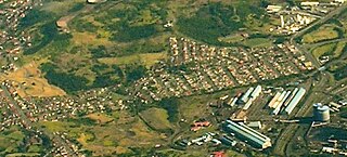
Unanderra is a suburb of Wollongong in New South Wales, Australia. It is located approximately 6 km south-west of the Wollongong CBD. It is bordered to the west by Farmborough, Cordeaux Heights and Farmborough Heights in the Mount Kembla foothills, the north by Figtree, the east by Berkeley and Flagstaff Hill, site of the Nan Tien Temple, and the south by Kembla Grange.

The South Coast Railway is a commuter and goods railway line from Sydney to Wollongong and Bomaderry in New South Wales, Australia. Beginning at the Illawarra Junction, the line services the Illawarra and South Coast regions of New South Wales.

The Division of Throsby was an Australian electoral division in the state of New South Wales. The division was named after Charles Throsby, a prominent pioneer and explorer in the early nineteenth century of the areas to the south of Sydney.

The South Coast Line (SCO) is an intercity rail service operated by NSW TrainLink that services the Illawarra region of New South Wales, Australia. The service runs from Central, and runs the entire length of the eponymous South Coast railway line to Bomaderry. The service also runs along the Eastern Suburbs railway line at peak hours and the Port Kembla railway line to Port Kembla. It is operated with NSW TrainLink H sets and Sydney Trains T sets, with Endeavour railcars operating the service on the non-electrified line between Kiama and Bomaderry.

Kembla Grange railway station is a single-platform intercity train station located in Kembla Grange, New South Wales, Australia, on the South Coast railway line. The station serves NSW TrainLink trains travelling south to Kiama and north to Wollongong and Sydney. The station ranked equal last for patronage on the metropolitan network in 2012, and was one of 23 on the metropolitan rail network to record an average of fewer than one passenger per day in 2014.

Unanderra railway station is located on the South Coast railway line in the Wollongong suburb of Unanderra, New South Wales, Australia.

Wollongong railway station is a heritage-listed railway station on the South Coast railway line in New South Wales, Australia. It serves the central business district of Wollongong. It was added to the New South Wales State Heritage Register on 2 April 1999.

Coniston railway station is located in Coniston, New South Wales, Australia, on the South Coast railway line. The station serves NSW TrainLink trains travelling south to Port Kembla or Kiama and north to Wollongong and Sydney.

Cringila railway station is located in Cringila, Australia, on the South Coast railway line's Port Kembla branch. The station serves NSW TrainLink trains travelling south to Port Kembla and north to Wollongong and Sydney.

Port Kembla railway station is a single-platform intercity train terminal located in Port Kembla, Australia, on the South Coast railway line's Port Kembla branch. The station serves NSW TrainLink trains traveling north to Wollongong and Sydney. The station also serves as a stabling location for South Coast line trains.
Wollongong is an electoral district of the Legislative Assembly in the Australian state of New South Wales. It is represented by Paul Scully of the Labor Party. Since a redistribution in 2013, it has covered an area of 79.25 square kilometres and includes the localities of Berkeley, Coachwood Park, Coniston, Cordeaux Heights, Corrimal, Cringila, Fairy Meadow, Farmborough Chase, Farmborough Heights, Figtree, Gwynneville, Kembla Grange, Kembla Heights, Kemblawarra, Lake Heights, Lindsay Heights, Mangerton, Mount Kembla, Mount Saint Thomas, North Wollongong, Port Kembla, Primbee, Spring Hill, Towradgi, Unanderra, Warrawong, West Wollongong, Windang, Wollongong.

Coniston, is a suburb of Wollongong in New South Wales, Australia. At the 2021 census, it had a population of 2,267.

Cringila is a southern suburb of the city of Wollongong, New South Wales, Australia. The suburb is bounded by Berkeley, Unanderra, Lake Heights and Warrawong.
The Unanderra–Moss Vale railway line is a cross country railway line in New South Wales, Australia. The line branches from the Illawarra line at Unanderra and winds west up the Illawarra escarpment to join the Main South line at Moss Vale. The line is one of the most scenic in New South Wales, and for the first 20 km (12 mi) after leaving Unanderra has an almost continuous grade 1 in 30 providing extensive views over the Illawarra coastline.

Summit Tank is a railway platform on the Unanderra–Moss Vale line in the Southern Highlands of New South Wales, Australia. The platform is located on the main line; there is an active passing loop and perway siding beside it.

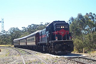
The 70 class were a class of diesel-hydraulic locomotives built by Commonwealth Engineering, Granville for the New South Wales Department of Railways in 1960–61. They were ordered to replace steam locomotives at Port Kembla.
The Kembla Grange Classic, registered as the Keith F Nolan Classic, is an Illawarra Turf Club Group 3 Thoroughbred horse race, for three-year-old fillies, at set weights with penalties, over a distance of 1600 metres, held annually at Kembla Grange Racecourse in New South Wales, Australia in March. Total prize money for the race is A$200,000 including trophies.


