Lake of the Woods County, Minnesota

Last updated

Lake of the Woods County
Zippel Bay State Park, Minnesota - Sunset on Lake of the Woods.jpg
Map of Minnesota highlighting Lake of the Woods County.svg
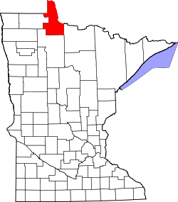
Location within the U.S. state of Minnesota
Minnesota in United States.svg
Minnesota's location within the U.S.
Coordinates: 48°46′N94°54′W / 48.77°N 94.9°W / 48.77; -94.9
CountryFlag of the United States.svg United States
StateFlag of Minnesota.svg Minnesota
FoundedNovember 28, 1922 (created by vote)
January 1, 1923 (organized)
Named after Lake of the Woods (lake)
Seat Baudette
Largest cityBaudette
Area
  Total
1,775 sq mi (4,600 km2)
  Land1,298 sq mi (3,360 km2)
  Water477 sq mi (1,240 km2)  27%
Population
 (2020)
  Total
3,763
  Estimate 
(2023)
3,778 Increase2.svg
  Density2.9/sq mi (1.1/km2)
Time zone UTC−6 (Central)
  Summer (DST) UTC−5 (CDT)
Congressional district 8th
Website co.lake-of-the-woods.mn.us

Lake of the Woods County is the northernmost county of the U.S. state of Minnesota. As of the 2020 census, the population was 3,763, [1] making it the state's second-least populous county. Its county seat is Baudette. [2]

Contents

The county contains the Northwest Angle, the northernmost point of the Lower 48 States, and the U.S. portion of Lake of the Woods, shared with Canada. The county also includes the exclave of Elm Point. Since Alaska has no counties, Lake of the Woods is the northernmost county in the United States. It is also the only county in the United States with four words in its name, although there is a parish in Louisiana called St. John the Baptist Parish, and the United States Census Bureau treats parishes as county equivalents for census purposes.

History

Lake of the Woods County was named for the lake that covers a large portion of it. Jacques de Noyon, a Frenchman who came from Trois Rivières, Quebec, explored the area in 1688 and was the first European to see the lake. He named it Lac aux Îles, "Lake of the Islands".

In 1885 the region got its first settler, Wilhelm Zippel, a German immigrant and fisherman. He settled on the lake's south shore in a place now called Zippel Bay. Shortly after, Alonzo Wheeler settled on the lake's southwest side at a place now called Wheeler's Point.

A wildfire, known as the Baudette fire of 1910, broke out in October of that year, burning 300,000 acres (1,200 km2) and destroying the towns of Spooner, Baudette, Graceton, Pitt, Williams, and Cedar Spur. [3] [4]

Lake of the Woods County's government was organized on January 1, 1923, with Baudette as the county seat. It is Minnesota's newest county; county voters approved separating the northern townships of Beltrami County into a separate unit on November 28, 1922. [5] [6]

Geography

Lake of the Woods County lies on Minnesota's border with Canada across the Rainy River, which flows northwest along the border to discharge into Lake of the Woods; its northwest border abuts Manitoba. The northern part of the county (the Northwest Angle) is separated from the rest of the county by the lake and thus has no land contact with the rest of the United States, making it an exclave. Land access to that part of the county is through Manitoba. Access by water or ice routes is possible. The Rapid River flows northeast through the southeastern part of the county to its discharge point into the Rainy River, near the county's northeast corner.

Lake of the Woods County's terrain consists of low rolling hills, partly wooded, devoted to agriculture. [7] The terrain slopes to the east and north. [8] Its highest point is a small protuberance one mile (1.6 km) west of Norris Camp, [7] at 1,316 ft (401 m) ASL. [9] The county has an area of 1,775 square miles (4,600 km2), of which 1,298 square miles (3,360 km2) is land and 477 square miles (1,240 km2) (27%) is water. [10]

Major highways

Adjacent counties and districts

Protected areas

Source: [7]

Lakes

Source: [7]

Demographics

Historical population
CensusPop.Note
1930 4,194
1940 5,97542.5%
1950 4,955−17.1%
1960 4,304−13.1%
1970 3,987−7.4%
1980 3,764−5.6%
1990 4,0768.3%
2000 4,52210.9%
2010 4,045−10.5%
2020 3,763−7.0%
2023 (est.)3,778 [11] 0.4%
U.S. Decennial Census [12]
1790-1960 [13] 1900-1990 [14]
1990-2000 [15] 2010-2020 [1]

2020 census

Lake of the Woods County Racial Composition [16]
RaceNum.Perc.
White (NH)3,49793%
Black or African American (NH)120.3%
Native American (NH)190.5%
Asian (NH)170.4%
Pacific Islander (NH)00%
Other/Mixed (NH)1624.3%
Hispanic or Latino 561.5%

As of the census of 2020, [17] there were 3,763 people and 1,522 households in the county. The racial makeup of the county was 93.3% White, 0.3% Black or African American, 0.5% Native American, 0.4% Asian, and 4.3% were two or more races. Hispanic or Latinos were 1.5% of the population. The most common ancestries were German (26.3%), Norwegian (18.2%), and Swedish (10.2%). 99.0% of residents were born in the United States, and 98.8% spoken only English at home.

2000 census

2022 US Census population pyramid for Lake of the Woods County, from ACS 5-year estimates LakeoftheWoodsCountyMn2022PopPyr.png
2022 US Census population pyramid for Lake of the Woods County, from ACS 5-year estimates

As of the census of 2000, there were 4,522 people, 1,903 households, and 1,267 families in the county. The population density was 3.48 per square mile (1.34/km2). There were 3,238 housing units at an average density of 2.49 per square mile (0.96/km2). The racial makeup of the county was 97.21% White/Caucasian, 0.29% Black/African American, 1.13% Native American, 0.24% Asian, 0.11% from other races, and 1.02% from two or more races. 0.64% of the population were Hispanic or Latino of any race. 26.2% were of Norwegian, 22.3% German, 8.9% Swedish, 5.8% American and 5.0% English ancestry.

There were 1,903 households, out of which 29.20% had children under the age of 18 living with them, 57.40% were married couples living together, 5.30% had a female householder with no husband present, and 33.40% were non-families. 29.70% of all households were made up of individuals, and 12.90% had someone living alone who was 65 years of age or older. The average household size was 2.35 and the average family size was 2.93.

The county population contained 24.70% under the age of 18, 5.70% from 18 to 24, 25.10% from 25 to 44, 27.20% from 45 to 64, and 17.20% who were 65 years of age or older. The median age was 42 years. For every 100 females there were 101.00 males. For every 100 females age 18 and over, there were 102.60 males.

The median income for a household in the county was $32,861, and the median income for a family was $38,936. Males had a median income of $30,469 versus $24,813 for females. The per capita income for the county was $16,976. About 6.70% of families and 9.80% of the population were below the poverty line, including 8.30% of those under age 18 and 10.60% of those age 65 or over.

Communities

Cities

Census-designated place

Unincorporated communities

Townships

Although all the townships are named, as of 2001, there are no township governments. All the townships are officially part of unorganized territory.[ citation needed ]

Government and politics

Lake of the Woods County favored Democrats in every election from 1932 to 1976, typically by large margins, with the exception of the 1972 landslide victory of Richard Nixon. Beginning in 1980, the county has voted Republican in every election except for 1992 and 1996, both wins by Bill Clinton, who won by less than 4% in the county and failed to obtain a majority of the vote both times thanks in part to the strong third-party performance of Ross Perot. With the exception of the landslide wins of Franklin D. Roosevelt in 1936 and Lyndon B. Johnson in 1964, no candidate of any party had won over 65% of the vote in Lake of the Woods County from its founding through 2012. That changed in 2016, when Donald Trump received over 68% of the county's vote, and he increased his vote share to over 70% in 2020 and earned nearly 73% of the vote in 2024, by far the three best performances by a Republican in the county's history. [18]

United States presidential election results for Lake of the Woods County, Minnesota [19]
Year Republican Democratic Third party(ies)
No.%No.%No.%
1924 70342.71%925.59%85151.70%
1928 78151.79%67144.50%563.71%
1932 36923.55%97262.03%22614.42%
1936 38518.76%1,56676.32%1014.92%
1940 85033.62%1,63864.79%401.58%
1944 64235.45%1,16864.49%10.06%
1948 58329.08%1,30264.94%1205.99%
1952 89844.30%1,11755.11%120.59%
1956 72340.69%1,04858.98%60.34%
1960 83543.86%1,05355.30%160.84%
1964 48927.71%1,26671.73%100.57%
1968 60738.96%87556.16%764.88%
1972 87755.44%67242.48%332.09%
1976 75738.52%1,10556.23%1035.24%
1980 1,05252.60%76338.15%1859.25%
1984 1,09456.39%82442.47%221.13%
1988 98454.24%79843.99%321.76%
1992 76234.67%79436.12%64229.21%
1996 81440.48%88844.16%30915.37%
2000 1,21655.60%84838.77%1235.62%
2004 1,42859.50%92138.38%512.13%
2008 1,27855.25%97141.98%642.77%
2012 1,30658.46%85938.45%693.09%
2016 1,54068.69%55324.67%1496.65%
2020 1,70470.76%67127.87%331.37%
2024 1,71072.86%60425.73%331.41%
County Board of Commissioners [20]
PositionNameDistrictNext Election
CommissionerJames "Buck" NordlofDistrict 12026
CommissionerCody HasbargenDistrict 22024
CommissionerJoe GrundDistrict 32026
Commissioner and ChairpersonJon WaibelDistrict 42024
CommissionerEdward ArnesenDistrict 52026
State Legislature (2023-2025)
PositionNameAffiliationDistrict
Senate Paul Utke [21] Republican District 2
House of Representatives Matt Grossell [22] Republican District 2A
House of Representatives Matt Bliss [23] Republican District 2B
U.S Congress (2023-2025)
PositionNameAffiliationDistrict
House of Representatives Pete Stauber [24] Republican 8th
Senate Amy Klobuchar [25] DFL N/A
Senate Tina Smith [26] DFL N/A

See also

References

  1. 1 2 "State & County QuickFacts". United States Census Bureau. Retrieved April 19, 2023.
  2. "Find a County". National Association of Counties. Retrieved June 7, 2011.
  3. "Cedar Spur". Minnesota HomeTownLocator (accessed May 1, 2019)
  4. "The Fire of 1910". Lake of the Woods County Historical Society. Archived from the original on July 13, 2011. Retrieved June 8, 2009.
  5. "Minnesota Place Names". Minnesota Historical Society. Archived from the original on October 27, 2014. Retrieved March 18, 2014.
  6. "History of Lake of the Woods County". Lake of the Woods County Historical Society. Archived from the original on August 27, 2014. Retrieved October 26, 2014.
  7. 1 2 3 4 5 6 7 8 Lake of the Woods County MN Google Maps (accessed May 1, 2019)
  8. ""Find an Altitude/Lake of the Woods County MN" Google Maps (accessed May 1, 2019)". Archived from the original on May 21, 2019. Retrieved May 1, 2019.
  9. Lake of the Woods County High Point, Minnesota. PeakBagger.com (accessed May 1, 2019)
  10. "2010 Census Gazetteer Files". United States Census Bureau. August 22, 2012. Archived from the original on September 21, 2013. Retrieved October 21, 2014.
  11. "Annual Estimates of the Resident Population for Counties: April 1, 2020 to July 1, 2023" . Retrieved March 18, 2024.
  12. "U.S. Decennial Census". United States Census Bureau. Archived from the original on May 7, 2015. Retrieved October 21, 2014.
  13. "Historical Census Browser". University of Virginia Library. Retrieved October 21, 2014.
  14. "Population of Counties by Decennial Census: 1900 to 1990". United States Census Bureau. Retrieved October 21, 2014.
  15. "Census 2000 PHC-T-4. Ranking Tables for Counties: 1990 and 2000" (PDF). United States Census Bureau. Archived (PDF) from the original on March 27, 2010. Retrieved October 21, 2014.
  16. "P2 HISPANIC OR LATINO, AND NOT HISPANIC OR LATINO BY RACE – 2020: DEC Redistricting Data (PL 94-171) – Lake of the Woods County, Minnesota".
  17. "Explore Census Data". Explore Census Data. United States Census Bureau. Retrieved November 30, 2022.
  18. Simon, Steve (November 21, 2024). "2024 State Canvassing Board Certificate". Minnesota Secretary of State . Archived from the original on April 22, 2025. Retrieved May 13, 2025.
  19. Leip, David. "Atlas of US Presidential Elections". uselectionatlas.org. Retrieved September 19, 2018.
  20. "County Board of Commissioners Page". www.co.lake-of-the-woods.mn.us. Retrieved May 7, 2024.
  21. "MN State Senate". www.senate.mn. Retrieved June 25, 2020.
  22. "Rep. Matt Grossell (02A) - Minnesota House of Representatives". www.house.leg.state.mn.us. Retrieved June 25, 2020.
  23. "Rep. Matt Bliss (02B) - Minnesota House of Representatives". www.house.leg.state.mn.us. Retrieved May 7, 2024.
  24. "Congressman Pete Stauber". www.stauber.house.gov/. Retrieved May 7, 2024.
  25. "U.S. Senator Amy Klobuchar". www.klobuchar.senate.gov. Retrieved June 24, 2020.
  26. "Home". Senator Tina Smith. Retrieved June 24, 2020.

48°46′N94°54′W / 48.77°N 94.90°W / 48.77; -94.90