Lakes by the Bay, Florida

Last updated
Lakes by the Bay, Florida
Miami-Dade County Florida Incorporated and Unincorporated areas Lakes by the Bay Highlighted.svg
Location in Miami-Dade County and the state of Florida
Lakes by the Bay.gif
U.S. Census Bureau map showing CDP boundaries
Coordinates: 25°34′18″N80°19′54″W / 25.57167°N 80.33167°W / 25.57167; -80.33167
Country Flag of the United States.svg  United States
State Flag of Florida.svg  Florida
County   Miami-Dade
Area
  Total5 sq mi (12.9 km2)
  Land4.9 sq mi (12.6 km2)
  Water0.1 sq mi (0.3 km2)
Elevation
3 ft (1 m)
Population
 (2000)
  Total9,055
  Density1,811/sq mi (701.9/km2)
Time zone UTC-5 (Eastern (EST))
  Summer (DST) UTC-4 (EDT)
FIPS code 12-38718 [1]
GNIS feature ID1867165 [2]

Lakes by the Bay is a neighborhood and former census-designated place (CDP) in Miami-Dade County, Florida, United States. [3] The population was 9,055 at the 2000 census. In 2005, the area of the CDP was included in the town of Cutler Bay.

Contents

Geography

Lakes by the Bay is located at 25°34′18″N80°19′54″W / 25.57167°N 80.33167°W / 25.57167; -80.33167 (25.571584, -80.331800). [4]

According to the United States Census Bureau, the CDP had a total area of 4.9 square miles (13 km2), of which, 4.8 square miles (12 km2) was land and 0.1 square miles (0.26 km2) of it (2.02%) water.

History

Damage from Hurricane Andrew in 1992 in Lakes by the Bay Destruction following hurricane andrew.jpg
Damage from Hurricane Andrew in 1992 in Lakes by the Bay

In August 1992, Lakes by the Bay and the surrounding South Miami-Dade area were severely damaged by Hurricane Andrew. Most of the homes and businesses in the neighborhood were destroyed. In the subsequent years, the area was slowly rebuilt. Unlike the destroyed homes which were made of wood frame construction, the new homes and construction were rebuilt with concrete walls. Although many areas of Miami were heavily affected by Hurricane Andrew, Lakes by the Bay was one of the worst affected and remains a reminder of the hurricane's extensive disaster in the city today. [5] [6]

Demographics

Historical population
CensusPop.Note
1990 5,615
2000 9,05561.3%
source: [7]

As of the census [1] of 2000, there were 9,055 people, 3,271 households, and 2,319 families residing in the CDP. The population density was 1,866.2 inhabitants per square mile (720.5/km2). There were 3,417 housing units at an average density of 704.2 per square mile (271.9/km2). The racial makeup of the CDP was 72.92% White (of which 36.7% were Non-Hispanic White,) [8] 15.36% African American, 0.18% Native American, 2.78% Asian, 0.10% Pacific Islander, 4.69% from other races, and 3.96% from two or more races. Hispanic or Latino of any race were 43.83% of the population.

There were 3,271 households, out of which 40.7% had children under the age of 18 living with them, 54.4% were married couples living together, 12.4% had a female householder with no husband present, and 29.1% were non-families. 23.1% of all households were made up of individuals, and 10.1% had someone living alone who was 65 years of age or older. The average household size was 2.77 and the average family size was 3.30.

In the CDP, the population was spread out, with 29.0% under the age of 18, 7.8% from 18 to 24, 35.7% from 25 to 44, 18.7% from 45 to 64, and 8.7% who were 65 years of age or older. The median age was 33 years. For every 100 females, there were 93.7 males. For every 100 females age 18 and over, there were 88.3 males.

The median income for a household in the CDP was $49,236, and the median income for a family was $53,616. Males had a median income of $37,129 versus $30,049 for females. The per capita income for the CDP was $20,708. About 7.8% of families and 10.1% of the population were below the poverty line, including 9.4% of those under age 18 and 26.2% of those age 65 or over.

As of 2000, speakers of English as a first language accounted for 52.57% of residents, while Spanish made up 44.50%, Arabic was at 1.90%, French was at 0.57%, and French Creole was 0.44% of the population. [9]

Related Research Articles

<span class="mw-page-title-main">Country Club, Florida</span> Census-designated place in Florida

Country Club is a census-designated place and a suburban unincorporated community located in northwest Miami-Dade County, Florida, United States. It is located in the Miami metropolitan area of South Florida. The CDP is named after the Country Club of Miami, which was established in 1961 in what was then an unpopulated and undeveloped section of the county. The population was 49,967 at the 2020 census, up from 3,408 in 1990.

<span class="mw-page-title-main">Country Walk, Florida</span> Census-designated place in Florida

Country Walk is a census-designated place (CDP) in Miami-Dade County, Florida, United States. It is part of the Miami metropolitan area of South Florida. The population was 16,951 at the 2020 census, up from 15,997 at the 2010 census.

<span class="mw-page-title-main">Kendall West, Florida</span> Census-designated place in Florida

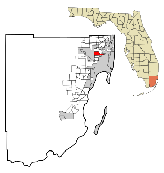
Kendall West is a census-designated place and unincorporated community in Miami-Dade County, Florida, west of the Florida Turnpike. It is located in the Miami metropolitan area of South Florida. The population was 36,536 at the 2020 census.

<span class="mw-page-title-main">Olympia Heights, Florida</span> Census-designated place in Florida

Olympia Heights is a census-designated place in Miami-Dade County, Florida, United States. It is located in the Miami metropolitan area of South Florida. The population was 12,873 at the 2020 census.

<span class="mw-page-title-main">Palm Springs North, Florida</span> Census-designated place in Florida

Palm Springs North is an unincorporated community and census-designated place (CDP) in Miami-Dade County, Florida, United States. It is part of the Miami metropolitan area of South Florida. The population was 5,030 at the 2020 census.

<span class="mw-page-title-main">Palmetto Estates, Florida</span> Census-designated place in Florida

Palmetto Estates is an unincorporated area and census-designated place (CDP) in Miami-Dade County, Florida, United States. It is part of the Miami metropolitan area of South Florida. The population was 13,498 at the 2020 census.

<span class="mw-page-title-main">Richmond Heights, Florida</span> Census-designated place in Florida

Richmond Heights is a census-designated place (CDP) in Miami-Dade County, Florida, United States. It is part of the Miami metropolitan area of South Florida. The population was 8,944 at the 2020 census.

<span class="mw-page-title-main">Richmond West, Florida</span> Census-designated place in Florida

Richmond West is a census-designated place (CDP) in Miami-Dade County, Florida, United States. It is part of the Miami metropolitan area of South Florida. The population was 35,884 at the 2020 census, up from 31,973 at the 2010 census.

<span class="mw-page-title-main">Sunset, Florida</span> Census-designated place in Florida

Sunset is a census-designated place (CDP) in Miami-Dade County, Florida, United States. It is part of the Miami metropolitan area of South Florida. The population was 15,912 at the 2020 census. The U.S. Postal Service uses the ZIP Codes of 33173 and 33183 for Sunset.

<span class="mw-page-title-main">The Crossings, Florida</span> CDP in Florida

The Crossings is a census-designated place (CDP) and suburb of Miami in Miami-Dade County, Florida, United States. It is part of the Miami metropolitan area of South Florida. The CDP includes the neighborhoods of The Crossings, Devon Aire, and Calusa. The population was 23,276 at the 2020 census.

<span class="mw-page-title-main">Three Lakes, Florida</span> Census-designated place in Florida

Three Lakes is a census-designated place (CDP) and planned community in Miami-Dade County, Florida, United States. It is part of the Miami metropolitan area of South Florida. The population was 16,540 at the 2020 census, up from 15,047 in 2010.

<span class="mw-page-title-main">West Little River, Florida</span> CDP in Miami-Dade County, Florida, US

West Little River is a census-designated place (CDP) in Miami-Dade County, Florida, United States. It is part of the Miami metropolitan area of South Florida. The population was 34,128 at the 2020 census.

<span class="mw-page-title-main">West Perrine, Florida</span> Census-designated place in Florida

West Perrine is a census-designated place (CDP) in Miami-Dade County, Florida, United States. It is part of the Miami metropolitan area of South Florida. The population was 10,602 at the 2020 census, up from 9,460 in 2010.

<span class="mw-page-title-main">Westwood Lakes, Florida</span> Census-designated place in Florida

Westwood Lakes is a census-designated place and unincorporated community of Miami-Dade County, Florida, United States. It is part of the Miami metropolitan area of South Florida. The population was 11,373 at the 2020 census.

<span class="mw-page-title-main">Lake Dalecarlia, Indiana</span> Census-designated place in Indiana, United States

Lake Dalecarlia is a census-designated place (CDP) in Lake County, Indiana, United States. The population was 1,355 at the 2010 census. The name comes from the English name of the Dalarna region of Sweden. The community is centered on the lake of the same name, which was completed in the 1920s.

<span class="mw-page-title-main">Finley Point, Montana</span> Census-designated place in Montana, United States

Finley Point is a census-designated place (CDP) in Lake County, Montana, United States. As of the 2010 census the population was 480.

<span class="mw-page-title-main">South Miami Heights, Florida</span> Census-designated place in Florida

South Miami Heights is a census-designated place (CDP), originally known as Eureka, in Miami-Dade County, Florida. It is part of the Miami metropolitan area of South Florida. The population was 36,770 as of the 2020 census.

<span class="mw-page-title-main">Conneaut Lakeshore, Pennsylvania</span> Census-designated place in Pennsylvania, United States

Conneaut Lakeshore is a census-designated place (CDP) in Crawford County, Pennsylvania, United States. The population was 2,395 at the 2010 census.

<span class="mw-page-title-main">Falmouth, Virginia</span> Census-designated place in Virginia, United States

Falmouth is a census-designated place (CDP) in Stafford County, Virginia, United States. Situated on the north bank of the Rappahannock River at the falls, the community is north of and opposite the city of Fredericksburg. Recognized by the U.S. Census Bureau as a census-designated place (CDP), Falmouth's population was 4,274 as of the 2010 census.

<span class="mw-page-title-main">Lake Morton-Berrydale, Washington</span> Census-designated place in Washington, United States

Lake Morton-Berrydale is a census-designated place (CDP) in King County, Washington, United States. The population was 10,474 at the 2020 census.

References

  1. 1 2 "U.S. Census website". United States Census Bureau . Retrieved 2008-01-31.
  2. "US Board on Geographic Names". United States Geological Survey. 2007-10-25. Retrieved 2008-01-31.
  3. U.S. Geological Survey Geographic Names Information System: Lakes by the Bay, Florida
  4. "US Gazetteer files: 2010, 2000, and 1990". United States Census Bureau. 2011-02-12. Retrieved 2011-04-23.
  5. "Destruction in the wake of Hurricane Andrew". Miami Herald . January 28, 2013. Archived from the original on January 28, 2013. Retrieved June 13, 2023.
  6. "Remembering the fury of Hurricane Andrew in South Florida". Miami Herald. Archived from the original on 2013-09-21.
  7. "CENSUS OF POPULATION AND HOUSING (1790-2000)". U.S. Census Bureau . Retrieved 2010-07-17.
  8. "Demographics of Lakes By The Bay, FL". MuniNetGuide.com. Archived from the original on 2008-07-24. Retrieved 2007-11-06.
  9. "MLA Data Center Results of Lakes By The Bay, FL". Modern Language Association . Retrieved 2007-11-06.