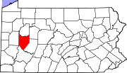
Marker title Image Date dedicated Location Marker type Topics Armstrong County October 15, 1982 Courthouse, north end Market Street, Kittanning 40°48′58″N 79°30′59″W / 40.81598°N 79.5164°W / 40.81598; -79.5164 (Armstrong County ) City French & Indian War, Government & Politics, Government & Politics 19th Century, Invention, Military, Native American Blanket Hill November 28, 1946 US 422, 6.5 miles southeast of Kittanning 40°45′54″N 79°25′00″W / 40.76488°N 79.41666°W / 40.76488; -79.41666 (Blanket Hill ) Roadside French & Indian War, Military, Native American Brady's Bend Works November 28, 1946 PA 68 Brady's Bend, at Allegheny River Bridge 40°59′57″N 79°37′32″W / 40.999167°N 79.625472°W / 40.999167; -79.625472 (Brady's Bend Works ) Roadside Business & Industry, Iron, Transportation Fort Armstrong November 28, 1946 PA 66, 1.8 miles south of Kittanning (MISSING) Roadside American Revolution, Forts, Military General John Armstrong - PLAQUE May 11, 1917 Mounted on Armstrong County Courthouse at entrance, north end of Market Street, Kittanning 40°48′58″N 79°30′59″W / 40.81612°N 79.5165°W / 40.81612; -79.5165 (General John Armstrong - PLAQUE ) Plaque American Revolution, Ethnic & Immigration, Military Kittanning November 28, 1946 Butler Road (Bus. Route 422) & Allegheny Avenue, at bridge, Applewold 40°48′42″N 79°31′27″W / 40.8116°N 79.52406°W / 40.8116; -79.52406 (Kittanning ) Roadside Early Settlement, French & Indian War, Military, Native American Kittanning November 28, 1946 At Highway garage on US 422 (South Water Street), Kittanning 40°48′30″N 79°30′57″W / 40.8084°N 79.51573°W / 40.8084; -79.51573 (Kittanning ) Roadside Early Settlement, Native American Kittanning or Attique Indian Town - PLAQUE September 1, 1926 At park on east bank of Allegheny River, adjacent to bridge, North Water & Market Streets, Kittanning 40°48′49″N 79°31′17″W / 40.81358°N 79.52127°W / 40.81358; -79.52127 (Kittanning or Attique Indian Town - PLAQUE ) Plaque Early Settlement, Native American Nellie Bly July 22, 1995 500 Terrace Avenue, Apollo 40°35′09″N 79°33′49″W / 40.585767°N 79.563700°W / 40.585767; -79.563700 (Nellie Bly ) City Professions & Vocations, Publishing, Women Pittsburgh Plate Glass Ford City Works November 12, 2003 Third Avenue at Ninth Street, Ford City 40°46′14″N 79°31′59″W / 40.77055°N 79.533°W / 40.77055; -79.533 (Pittsburgh Plate Glass Ford City Works ) City Business & Industry, Ethnic & Immigration, Glass, Labor St. Patrick's Church July 16, 1946 East Brady Road (PA 268), ~4 miles northwest of Cowansville 40°57′06″N 79°39′32″W / 40.95155°N 79.65895°W / 40.95155; -79.65895 (St. Patrick's Church ) Roadside Buildings, Religion 


