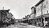
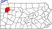
Marker title Image Date dedicated Location Marker type Topics Charles Lockhart (1818-1905) October 26, 2007 222 Center Street (PA 8), Oil City 41°26′04″N 79°42′26″W / 41.4344°N 79.7072°W / 41.4344; -79.7072 (Charles Lockhart ) City Business & Industry, Oil & Gas Crawford Family, The November 12, 2014 Emlenton Presbyterian Church, 508 Main Street, Emlenton 41°10′38″N 79°42′29″W / 41.17728°N 79.708057°W / 41.17728; -79.708057 (The Crawford Family ) Roadside Professions & Vocations, Business & Industry, Oil & Gas Densmore Tank Cars October 15, 2004 William Flinn Highway (PA 8), south of Titusville 41°34′10″N 79°41′31″W / 41.56935°N 79.69202°W / 41.56935; -79.69202 (Densmore Tank Cars ) Roadside Entrepreneurs, Invention, Oil & Gas, Railroads, Transportation Drake Well Park n/a At Drake Well Museum, southeast of Titusville 41°36′42″N 79°39′27″W / 41.61168°N 79.65747°W / 41.61168; -79.65747 (Drake Well Park ) Roadside Business & Industry, Oil & Gas Drake Well Park March 20, 1947 At Drake Well Museum, SE of Titusville Roadside Business & Industry, Oil & Gas First Oil Pipeline November 15, 1954 Rouseville Road (PA 227), 4 miles southwest of Pleasantville 41°32′29″N 79°36′39″W / 41.54152°N 79.61088°W / 41.54152; -79.61088 (First Oil Pipeline ) Roadside Business & Industry, Oil & Gas, Transportation Fort Franklin March 20, 1947 13th Street (US 322) & Franklin Avenue, Franklin 41°24′02″N 79°49′52″W / 41.40067°N 79.83112°W / 41.40067; -79.83112 (Fort Franklin ) Roadside American Revolution, Forts, Military Fort Machault April 8, 1969 Elk Street & 8th Street (US 322), Franklin 41°23′22″N 79°49′20″W / 41.38942°N 79.82225°W / 41.38942; -79.82225 (Fort Machault ) City Forts, French & Indian War, Military Fort Venango October 10, 1972 Elk Street and 8th Street (US 322), Franklin 41°23′22″N 79°49′20″W / 41.38932°N 79.82217°W / 41.38932; -79.82217 (Fort Venango ) City Forts, French & Indian War, Military, Native American Galena-Signal Oil Company August 7, 1999 Near County Courthouse, 1140 Liberty Street, Franklin 41°23′47″N 79°49′38″W / 41.39635°N 79.82718°W / 41.39635; -79.82718 (Galena-Signal Oil Company ) Roadside Business & Industry, Oil & Gas, Railroads George Bissell October 18, 2002 Near County Courthouse in South Park, corner of Liberty & South Park Streets Franklin 41°23′48″N 79°49′37″W / 41.3967°N 79.82705°W / 41.3967; -79.82705 (George Bissell ) Roadside Business & Industry, Oil & Gas, Professions & Vocations Henry R. Rouse December 11, 1996 PA 8 near south borough line of Rouseville 41°28′07″N 79°41′29″W / 41.46858°N 79.69145°W / 41.46858; -79.69145 (Henry R. Rouse ) Roadside Business & Industry, Oil & Gas, Professions & Vocations Humboldt Refinery August 3, 2001 Masonic Hall, Plumer Village along PA 227 outside Oil City 41°29′08″N 79°39′09″W / 41.48545°N 79.65248°W / 41.48545; -79.65248 (Humboldt Refinery ) Roadside Business & Industry, Invention, Oil & Gas Jacob J. Vandergrift August 3, 2001 Justus Park, Oil City 41°25′56″N 79°42′32″W / 41.432167°N 79.709000°W / 41.432167; -79.709000 (Jacob J. Vandergrift ) Roadside Business & Industry, Oil & Gas, Transportation Jesse L. Reno (1823-1862) June 20, 2014 US 62/PA 8 between 3rd & 4th Streets, Reno 41°24′35″N 79°45′09″W / 41.409817°N 79.752467°W / 41.409817; -79.752467 (Jesse L. Reno (1823-1862) ) Roadside Civil War, Military, Professions & Vocations John Dewey July 20, 1980 At Oil City Fire Department Headquarters, Central Avenue & West 4th Street, Oil City 41°25′30″N 79°42′37″W / 41.424950°N 79.710267°W / 41.424950; -79.710267 (John Dewey ) City Education John Franklin Carll (1826-1904) October 23, 2007 205 East State Street (PA 36), Pleasantville 41°35′26″N 79°34′38″W / 41.590633°N 79.577350°W / 41.590633; -79.577350 (John Franklin Carll ) Roadside Business & Industry, Medicine & Science, Oil & Gas, Professions & Vocations Johnny Appleseed September 26, 1982 13th Street (US 322) & Franklin Avenue, Franklin 41°24′03″N 79°49′52″W / 41.400800°N 79.831050°W / 41.400800; -79.831050 (Johnny Appleseed ) City Agriculture, Folklore, Professions & Vocations Joseph Reid Gas Engine Company October 10, 1997 Intersection of Main Street (PA 8), Halyday Street & Petroleum Street, Oil City 41°25′57″N 79°42′47″W / 41.432617°N 79.713033°W / 41.432617; -79.713033 (Joseph Reid Gas Engine Company ) City Business & Industry, Oil & Gas Oil Well Supply Company October 10, 1997 East Front Street (US 62) & East First Street, Oil City 41°25′45″N 79°42′33″W / 41.4291°N 79.70908°W / 41.4291; -79.70908 (Oil Well Supply Company ) City Business & Industry, Oil & Gas Old Garrison March 20, 1947 10th & Liberty Streets (US 322), Franklin 41°23′35″N 79°49′31″W / 41.393100°N 79.825217°W / 41.393100; -79.825217 (Old Garrison ) Roadside Military, Military Post-Civil War Oldest Oil Producing Well August 5, 1958 William Flinn Highway (PA 8) at McClintock, just S of Rouseville 41°27′32″N 79°41′24″W / 41.45902°N 79.69002°W / 41.45902; -79.69002 (Oldest Oil Producing Well ) Roadside Business & Industry, Oil & Gas Pithole December 1, 1973 Pithole Road (SR 1006) at site 41°31′30″N 79°34′55″W / 41.52487°N 79.5819°W / 41.52487; -79.5819 (Pithole ) Roadside Environment Pithole July 1, 1986 Rouseville Road (PA 227) & Pithole Road, ~5 miles from both Pleasantville and Rouseville 41°31′02″N 79°37′09″W / 41.51713°N 79.61913°W / 41.51713; -79.61913 (Pithole ) Roadside Business & Industry, Oil & Gas Pithole City July 26, 1966 At site on Pithole Road 41°31′28″N 79°34′54″W / 41.52442°N 79.58177°W / 41.52442; -79.58177 (Pithole City ) Roadside Business & Industry, Oil & Gas Samuel C. T. Dodd (1837-1907) November 7, 2008 1247 Liberty Street near Pennsylvania Alley, Franklin 41°23′51″N 79°49′47″W / 41.397617°N 79.829850°W / 41.397617; -79.829850 (Samuel C. T. Dodd ) City Government & Politics 20th Century, Oil & Gas, Professions & Vocations, Writers Speechley Gas Pool Well October 28, 1999 Fryburg Road (PA 157) & Sawtown Road, east of US 62 junction & southeast of Oil City 41°23′26″N 79°35′00″W / 41.390517°N 79.583333°W / 41.390517; -79.583333 (Speechley Gas Pool Well ) Roadside Business & Industry, Oil & Gas Venango County October 18, 1981 County Courthouse, 12th & Liberty Streets, Franklin 41°23′51″N 79°49′39″W / 41.39742°N 79.82758°W / 41.39742; -79.82758 (Venango County ) City Government & Politics, Government & Politics 19th Century Venango Path August 23, 1987 Old Route 8 (SR 3013) & Georgetown Road (SR 3003), just north of Wesley 41°13′56″N 79°57′23″W / 41.23233°N 79.95628°W / 41.23233; -79.95628 (Venango Path ) Roadside George Washington, Native American, Paths & Trails, Transportation