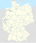
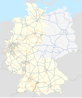
The German federal motorways are now numbered according to a clear system. Since the mid-1970s there has been a numbering system for motorways, which sets out which number is replaced by a new motorway. Motorways with a single-digit number (e.g. A 1) are of national or even cross-border significance. Highways with a two-digit number (e.g. A 20) are usually of overriding national importance. Highways with three digits (e.g. A 999) are generally of regional or urban significance; often these motorways are feeders or detours. If there is more than one digit, the first digit indicates the approximate location of the motorway (A 10 to A 19 for Berlin; A 20 in the north to A99 in the south, A 100 for Berlin; A 200 in the north to A 999 in the south). Usually highways with even numbers predominantly run east–west, and those with odd numbers run north–south. Exceptions include the A14 and the A15.
Highway shield | Expressway Name | Connects | Length (km) | Length (mi) | Status | Map |
---|---|---|---|---|---|---|
A 1 | Vogelfluglinie, Hansalinie, Ruhrtangente, Kölner Ring, Eifelautobahn | Heiligenhafen – Lübeck – Hamburg – Bremen – Osnabrück – Münster – Hamm – Dortmund – Hagen – Wuppertal – Remscheid – Leverkusen – Cologne – Blankenheim Kelberg – Trier – Saarbrücken | 748 | 465 | current under construction: Danish border – Puttgarden planned: Blankenheim – Kelberg | |
A 2 | "Warschauer Allee", "Schalkeschleichweg", Dortmunder Ring | Oberhausen – Bottrop – Gelsenkirchen – Recklinghausen – Dortmund – Hamm − Bielefeld – Hannover – Braunschweig – Magdeburg – AD Werder | 473 | 294 | current | |
A 3 | Hollandlinie, Rechtsrheinische Autobahn, Kölner Ring, Spessartautobahn, Donautalautobahn | (Arnhem A12 –) Emmerich – Oberhausen – Duisburg – Düsseldorf – Leverkusen – Cologne – Limburg an der Lahn – Wiesbaden – Frankfurt − Aschaffenburg – Würzburg – Nuremberg – Regensburg – Deggendorf – Passau (– A8 Linz) | 769 | 478 | current | |
A 4 | Hollandlinie, Kölner Ring, Oberbergische Straße | (Maastricht A76 –) Aachen – Cologne – Olpe – Krombach AD Kirchheim – Eisenach – Erfurt – Jena – Gera – Chemnitz – Dresden – Görlitz (– A4 Wrocław) | 583 | 362 | current | |
A 5 | HaFraBa, Bergstraßenautobahn, Rheintalautobahn, Rechtsrheinische Autobahn | AD Hattenbach – Frankfurt – Darmstadt – Heidelberg – Karlsruhe – Freiburg im Breisgau – Weil am Rhein (– Basel A2) (Mulhouse A36 –) AD Neuenburg | 440 | 270 | current | |
A 6 | Neckarlinie, Kraichgau-Autobahn, Via Carolina / Straße der Könige | (Paris A320 –) Saarbrücken – Kaiserslautern – Mannheim – Heilbronn – Nuremberg – Amberg – Waidhaus (– Prague D5) | 484 | 301 | current | |
A 7 | HaFraBa, Nord-Süd-Achse, Rhönautobahn / -linie | (Aarhus E45 –) Flensburg – Neumünster – Hamburg – Hannover – Göttingen – Kassel – AD Hattenbach – Fulda – Würzburg – Ulm – Memmingen – Füssen (– Reutte/Fernpass) | 962 | 598 | current | |
A 8 | Saar-Autobahn, Albauf- bzw. -abstieg, Salzburger/Wiener Autobahn | (Luxembourg A13 –) Perl – Saarlouis – Neunkirchen (Saar) – Pirmasens Karlsruhe – Stuttgart – Ulm – Augsburg – Munich Munich – Rosenheim − Bad Reichenhall/Piding (– Salzburg A1) | 505 | 314 | current | |
A 9 | MüLeiBerl, Berliner Autobahn, Nürnberger Autobahn | AD Potsdam – Dessau – Leipzig – Hof – Bayreuth – Nuremberg – Ingolstadt – Munich | 530 | 330 | current | |
Total Length | 5,494 | 3,414 |
Highway shield | Expressway Name | Connects | Length (km) | Length (mi) | Status | Map |
---|---|---|---|---|---|---|
A 10 | Berliner Ring | AD Barnim – AD Spreeau – AD Potsdam – AD Werder – AD Havelland – AD Kreuz Oranienburg – AD Barnim | 196 | 122 | current | |
A 11 | Berlinka | (A6 Szczecin–) Pomellen – Eberswalde – AD Barnim | 110 | 68 | current | |
A 12 | Autobahn der Freiheit | AD Spreeau – Frankfurt (Oder) (– A2 Poznań) | 58 | 36 | current | |
A 13 | AK Schönefeld – Lübbenau/Spreewald – Senftenberg – Dresden | 151 | 94 | current | ||
A 14 | Altmarkautobahn, Mitteldeutsche Schleife | Wismar – Schwerin – Ludwigslust – Karstädt Tangerhütte – Wolmirstedt | 318 | 198 | current under construction and planned: Karstädt – Stendal – Tangerhütte under construction: Wolmirstedt – Magdeburg | |
A 15 | Spreewaldautobahn | Lübbenau/Spreewald – Cottbus – Forst (– A18 Breslau) | 64 | 40 | current | |
A 16 | Leipzig-Lausitz-Achse | Leipzig – Torgau – Hoyerswerda – Weißwasser (– A18 Breslau) | Planning abandoned | |||
A 17 | Via Porta Bohemica / Prager Autobahn | Dresden – Heidenau (Sachsen) – Pirna – Bad Gottleuba (– D8 Prague) | 45 | 28 | current | |
Bautzen – Zittau (– D35 Liberec) | Planning abandoned; partially built as B 178 | |||||
A 18 | Lausitzautobahn (?) | Cottbus – Görlitz – Zittau | Planning abandoned; partially built as B 99 and B 115 | |||
A 19 | Rostock – AD Wittstock/Dosse | 123 | 76 | current | ||
Total Length | 1,065 | 662 |
Highway shield | Expressway Name | Connects | Length (km) | Length (mi) | Status | Map |
---|---|---|---|---|---|---|
A 20 | Küstenautobahn, Nordwestumfahrung Hamburg, Ostseeautobahn | Bad Segeberg – Lübeck – Wismar – Rostock – Greifswald – Neubrandenburg – AD Kreuz Uckermark | 345 | 214 | current planned: Westerstede – Bremerhaven – Glückstadt – Bad Segeberg | |
A 21 | Ostumfahrung Hamburg | Nettelsee – AK Bargteheide | 56 | 35 | current under construction and planned: Kiel – Nettelsee planned: Bargteheide – Geesthacht – AD Handorf | |
A 22 | Küstenautobahn | Westerstede – Jaderberg – Wesertunnel – Bremervörde – Stade | Planning abandoned; renamed to A 20 in 2010 | |||
A 23 | Westküstenautobahn | Heide – Itzehoe – Pinneberg – Hamburg | 96 | 60 | current | |
A 24 | Hamburg – AK Schwerin – AD Wittstock/Dosse – AD Havelland (Berlin) | 237 | 147 | current | ||
A 25 | Marschenlinie | Hamburg – Geesthacht | 18 | 11 | current planned: Geesthacht – Geesthacht-Nord | |
A 26 | Altes-Land-Autobahn, Hafenquerspange | Stade – Neu Wulmstorf | 24 | 15 | current planned: Drochtersen – Stade under construction: Neu Wulmstorf – AK Hamburg-Hafen planned: AK Hamburg-Hafen – AD Hamburg-Stillhorn | |
A 27 | Schellfischlinie, Blocklandlinie / -autobahn | Cuxhaven – Bremerhaven – Bremen – Walsrode | 162 | 101 | current | |
A 28 | Nordautobahn / "Ostfriesenhighway" | Leer – Westerstede – Oldenburg – Stuhr (– Bremen) | 97 | 60 | current | |
A 29 | Jadelinie | Wilhelmshaven – Oldenburg – AD Ahlhorner Heide | 95 | 59 | current | |
Total Length | 1,130 | 700 |
Highway shield | Expressway Name | Connects | Length (km) | Length (mi) | Status | Map |
---|---|---|---|---|---|---|
A 30 | (A1 Hengelo –) Rheine – Ibbenbüren – Osnabrück – Bad Oeynhausen | 136 | 85 | current | ||
A 31 | Emslandautobahn, (Ost-)Friesenspieß | Emden – Leer – Lingen – Schüttorf – Gronau – Gladbeck – Bottrop | 241 | 150 | current | |
A 32 | Schwarmstedt – Celle – Wolfsburg | Never built | ||||
A 33 | Teutoburger-Wald-Autobahn, Senne-Autobahn | Osnabrück – Halle – Bielefeld – Paderborn – AK Wünnenberg-Haaren | 104 | 65 | current planned: AD Wallenhorst – Osnabrück-Widukindland | |
A 35 | Nienburg – Hannover – Hameln – Bielefeld | Planning abandoned; partially built as B 6, B 61 and B 66 | ||||
A 36 | Vienenburg – Wernigerode – Quedlinburg – Aschersleben – Bernburg (Saale) Hameln – Alfeld – Goslar | planned; designation to replace B 6n | ||||
Nordharzautobahn | Braunschweig – Goslar – Wernigerode – Bernburg | 120 | 75 | current Former A 395 and former portion of B 6 | ||
A 37 | Messeschnellweg, Messestutzen | Burgdorf – Hannover-Misburg Hannover Messe – AD Hannover-Süd | 14 | 8.7 | current | |
A 38 | Südharzautobahn, Südumgehung Leipzig, Mitteldeutsche Schleife | AD Drammetal – Nordhausen – Halle (Saale) – Leipzig – AD Parthenaue | 219 | 136 | current | |
A 39 | Masch(e)ner Autobahn, Nordlandautobahn | Hamburg/Maschener Kreuz – Lüneburg Wolfsburg – Braunschweig – AD Salzgitter | 99 | 62 | current planned: Lüneburg – Wolfsburg | |
Total Length | 933 | 580 |
Highway shield | Expressway Name | Connects | Length (km) | Length (mi) | Status | Map |
---|---|---|---|---|---|---|
A 40 | Ruhrschnellweg / "Ruhrschleichweg" | (Antwerp – Venlo A67 –) Moers – Duisburg – Mülheim an der Ruhr – Essen – Bochum – Dortmund | 95 | 59 | current under construction and planned: Dortmund – AK Dortmund/Unna | |
Lipperandstraße / Lippeschnellweg | Kamp-Lintfort – Dinslaken – Marl – Lünen – Hamm – Beckum | Planning abandoned | ||||
A 41 | Nord-Süd-Autobahn Gelsenkirchen | Dorsten-Rhade – Gelsenkirchen – Sprockhövel | Planning abandoned; partially built as A 52 and L 608 | |||
A 42 | Südumgehung Kamp-Lintfort, Emscherschnellweg | Kamp-Lintfort B 509 – Duisburg – Oberhausen – Bottrop – Gelsenkirchen – Herne – Castrop-Rauxel – Dortmund | 58 | 36 | current | |
A 43 | Münster – Marl – Recklinghausen – Herne – Bochum – Witten – Wuppertal | 93 | 58 | current | ||
A 44 | Belgienlinie, DüBoDo, Nordumgehung Velbert Ruhrschnellweg / "Ruhrschleichweg", Hellweglinie | Belgien (Lüttich – Eupen) – Aachen – Mönchengladbach-Odenkirchen Mönchengladbach-Ost – Willich – Düsseldorf – Ratingen Heiligenhaus – Essen-Heisingen Helsa – Waldkappel | 282 | 175 | current under construction: Ratingen – Heiligenhaus under construction and planned: Kassel – Helsa under construction and planned: Waldkappel – Eisenach | |
A 45 | Dortmunder Ring, Sauerlandautobahn / -linie, Siegerlandautobahn, Wetteraulinie, Odenwaldautobahn, Neckar-Alb-Autobahn (NAAB) / Odenwald-Neckar-Alb-Autobahn (ONAA), Großer Nordostring Stuttgart (GrNORSt) / Nordosttangente Stuttgart | Dortmund – Siegen – Gießen – Hanau – Aschaffenburg | 257 | 160 | current | |
A 46 | Südlicher Zubringer, Wupperschnellweg Saarlandstraße, Hochsauerlandlinie, Ruhrtalautobahn | Heinsberg – Neuss – Düsseldorf – Wuppertal Arnsberg – Olsberg | 149 | 93 | current planned: Hemer – Menden | |
A 47 | Werretalautobahn, Ostwestfalendamm (OWD) | Kirchlengern – Bielefeld – Rheda-Wiedenbrück – Lippstadt – Erwitte | Planning abandoned; partially built as B 55, B 61, and B 239 | |||
A 48 | Eifelautobahn, HaFraBa (Hamburg-Frankfurt-Basel), Westerwaldautobahn | AD Vulkaneifel – Koblenz – AD Dernbach | 78 | 48 | current | |
A 49 | Lohfeldener Rüssel / Rüsselschwenk, Südtangente Kassel, Wetterau-Autobahn | Kassel – Neuental– Schwalmstadt | 57 | 35 | current under construction: Schwalmstadt – Stadtallendorf – Ohmtaldreieck | |
Total Length | 1,069 | 664 |
Highway shield | Expressway Name | Connects | Length (km) | Length (mi) | Status | Map |
---|---|---|---|---|---|---|
A 50 | Oberbergische Straße | Aachen – Olpe | Constructed as part of A 4 | |||
A 51 | Duisburg – Krefeld – Viersen – Hückelhoven – Aachen | Planning abandoned; partially constructed as B 509, B 57 and L 473n | ||||
A 52 | (Roermond N280–) Mönchengladbach – Neuss | 97 | 60 | current planned: Essen – Gelsenkirchen | ||
A 53 | (Lüttich A3–) Aachen – Düsseldorf | Planning abandoned; constructed as part of A 44 | ||||
A 54 | Viehbachtalstraße, Stadtautobahn Solingen | (Heerlen –) Jülich – Solingen – Lüdenscheid – Werdohl | Planning abandoned; partially constructed as A 542, B 55, B 477 and L 141n | |||
A 55 | Goch – Kempen – Krefeld – Grevenbroich – Hürth | Never built | ||||
A 56 | Ennertaufstieg | Selfkant – Jülich – Düren – Euskirchen – Bonn – Waldbröl | Planning abandoned; partially constructed as A 562 and B 56 | |||
A 57 | Niederrheinautobahn / Trans-Niederrhein-Magistrale, Linksrheinische Autobahn | (Nijmegen A77 –) Goch – Moers – Krefeld – Neuss – Köln | 119 | 74 | current | |
A 59 | Nord-Süd-Straße, Flughafenautobahn | Dinslaken – Duisburg | 69 | 43 | current | |
Total Length | 285 | 177 |
Highway shield | Expressway Name | Connects | Length (km) | Length (mi) | Status | Map |
---|---|---|---|---|---|---|
A 60 | Mainzer Ring (southern part) | (Lüttich A27–) Winterspelt – Wittlich Bingen – Mainz – Rüsselsheim | 113 | 70 | current | |
A 61 | Linksrheinische Autobahn | (Venlo A74 –) Kaldenkirchen – Mönchengladbach-Wanlo Jackerath – Bad Neuenahr-Ahrweiler – Koblenz – Bingen – Worms – Ludwigshafen – Hockenheim | 313 | 194 | current | |
A 62 | Nonnweiler – Pirmasens | 79 | 49 | current | ||
A 63 | Mainz – Kaiserslautern | 70 | 43 | current | ||
A 64 | Luxemburger Autobahn, Meulenwaldautobahn | (A1–) Grenzübergang Mesenich – Trier | 18 | 11 | current | |
A 65 | Pfälzer Autobahn | Ludwigshafen – Neustadt – Wörth | 59 | 37 | current | |
A 66 | Rheingau-Höhenstraße, Rhein-Main-Schnellweg, Kinzigtalautobahn, "Route 66", Mainzer Ring (northern part) | Wiesbaden – Frankfurt – Frankfurt-Miquelallee | 125 | 78 | current under construction: AD Erlenbruch – Frankfurt-Bergen-Enkheim | |
A 67 | Rechtsrheinische Autobahn | Rüsselsheim – Darmstadt – Viernheim | 58 | 36 | current | |
A 69 | Bienwaldautobahn | Schifferstadt – Germersheim – Wörth am Rhein (– Strasbourg A35) | Planning abandoned; partially constructed as B 9 | |||
Total Length | 835 | 519 |
Highway shield | Expressway Name | Connects | Length (km) | Length (mi) | Status | Map |
---|---|---|---|---|---|---|
A 70 | Maintalautobahn | Schweinfurt – Bamberg – Bayreuth | 120 | 75 | current | |
A 71 | Thüringer-Wald-Autobahn | Sangerhausen – Erfurt – Suhl – Schweinfurt | 220 | 140 | current | |
A 72 | Vogtlandautobahn | Hof – Zwickau – Chemnitz – Rötha | 162 | 101 | current under construction: Rötha – Leipzig | |
A 73 | Frankenschnellweg (northern part) Südwesttangente (eastern part) | Suhl – Coburg – Bamberg – Erlangen – Nürnberg/Fürth | 167 | 104 | current | |
A 75 | Mittelfrankenautobahn | Baiersdorf – Nürnberg – Hilpoltstein | Never built | |||
A 77 | Frankenschnellweg (southern part) | Nürnberg-Hafen – Weißenburg in Bayern – Donauwörth | Planning abandoned; partially constructed as B 2 and K 4 | |||
Total Length | 669 | 416 |
Highway shield | Expressway Name | Connects | Length (km) | Length (mi) | Status | Map |
---|---|---|---|---|---|---|
A 80 | Filstalautobahn | Germersheim – Bruchsal – Stuttgart – Göppingen – Ulm – Senden | Planning abandoned; partially constructed as B 10, B 28, and B 35 | |||
A 81 | Neckarlinie, Bodenseeautobahn / "Spätzle-Highway", Gipsstrecke | Würzburg – Heilbronn – Stuttgart – Sindelfingen – Villingen-Schwenningen – Singen (Hohentwiel) – Gottmadingen | 276 | 171 | current | |
A 82 | Karlsruhe – Pforzheim – Stuttgart | Never built; formerly a section of A 8 | ||||
Mannheim – Heilbronn – Bruchsal | Never built | |||||
Göttingen – Halle (Saale) | Redesignated as A 38 and A 143 | |||||
A 83 | Lauffen am Neckar – Stuttgart – Tübingen – Villingen-Schwenningen – Donaueschingen | Planning abandoned; partially constructed as B 27 | ||||
Chemnitz – Leipzig | Constructed as A 72 | |||||
A 84 | (Strasbourg A35 –) Freudenstadt – Tübingen – Reutlingen – Kirchheim unter Teck | Planning abandoned; partially constructed as B 28a | ||||
A 85 | Filderautobahn | Schwäbisch Hall – Stuttgart – Metzingen – Ravensburg | Planning abandoned; partially constructed as B 14 | |||
A 86 | Schwarzwaldautobahn | Breisach – Freiburg im Breisgau – Donaueschingen – Tuttlingen – Riedlingen – Ulm – Langenau | Planning abandoned; partially constructed as B 31, B 31a, and B 33 | |||
A 87 | Remstalautobahn | Stuttgart/Zuffenhausen Nord – Waiblingen – Schorndorf – Schwäbisch Gmünd – Aalen | Planning abandoned; constructed as B 29 | |||
A 88 | Riedlingen – Biberach – Memmingen | Planning abandoned; partially constructed as B 312 | ||||
A 89 | Ulm – Biberach – Ravensburg – Friedrichshafen | Planning abandoned; under construction as B 30 | ||||
Total Length | 276 | 171 |
Highway shield | Expressway Name | Connects | Length (km) | Length (mi) | Status | Map |
---|---|---|---|---|---|---|
A 90 | Paartalautobahn | Aichach – Pfaffenhofen an der Ilm – AK Holledau – Saalhaupt | Planning abandoned; partially constructed as A 93 and B 300 | |||
A 91 | Reichsstädtelinie, Ries-Autobahn, Lechfeldautobahn | Feuchtwangen – Donauwörth – Augsburg – Landsberg am Lech – Füssen | Planning abandoned; partially constructed as B 2, B 17, and B 25 | |||
A 92 | Isarlinie / Deggendorfer Autobahn / Bayerischer-Wald-Autobahn, Flughafenzubringer | AD Munich-Feldmoching – Munich Airport – Landshut – Deggendorf | 134 | 83 | current | |
A 93 | Ostbayernautobahn, Inntalautobahn, Brennerautobahn | Hof – Weiden – Regensburg – AD Holledau | 268 | 167 | current Planning abandoned: Regensburg – Rosenheim (became B 15n) | |
A 94 | Töginger Straße, Isentalautobahn | Munich – Burghausen | 103 | 64 | current planned: Burghausen – Malching under construction: Malching – AD Pocking | |
A 95 | Garmischer Autobahn, Olympiastraße (in Munich) | Munich – Garmisch-Partenkirchen | 69 | 43 | current | |
A 96 | Lindauer Autobahn / Bodenseeautobahn / Allgäuautobahn, Ammerseestraße | (Bregenz A14 –) Lindau – Memmingen – Landsberg – Munich | 173 | 107 | current | |
A 98 | Hochrheinautobahn, Bodenseeautobahn, Voralpenautobahn | Weil am Rhein – Rheinfelden-Ost Waldshut-Tiengen – Lauchringen | 47 | 29 | current planned: Rheinfelden-Ost – Murg planned: Hauenstein – Waldshut-Tiengen | |
A 99 | Autobahnring Munich | AD Munich-Süd-West – AK Munich-West – AK Munich-Nord – AK Munich-Ost – AK Munich-Süd | 54 | 34 | current | |
Eschenrieder Spange | AD Munich-Allach – AD Munich-Eschenried (unofficially designated as A 99a) | 4 | 2.5 | |||
Total Length | 852 | 529 |
Highway shield | Expressway Name | Connects | Length (km) | Length (mi) | Status |
---|---|---|---|---|---|
A 100 | Berlin Stadtring | Seestraße – AD Funkturm – AK Schöneberg – Grenzallee | 21 | 13 | current was A 10 from 1975-1990 under construction: Grenzallee – Am Treptower Park planned: Am Treptower Park – Storkower Straße |
A 102 | Zubringer Gradestraße | AK Tempelhof – Gradestraße | Became a branch of the A 100 in 2006 was A 12 from 1975–1990 | ||
A 103 | Abzweig Schöneberg | Sachsendamm – AK Schöneberg – Wolfensteindamm/Schloßstraße | 4 | 2.5 | current was A 13 from 1975–1990 |
A 104 | Autobahnzubringer Schmargendorf | Konstanzer Straße – AK Wilmersdorf – Schildhornstraße | Became a branch of the A 100 in 2006 was A 14 from 1975–1990 | ||
A 105 | Zubringer Kurt-Schumacher-Platz | AK Reinickendorf – Kurt-Schumacher-Platz | Became a branch of the A 111 in 2006 was A 11 from 1975–1990 | ||
A 106 | Berlin Südtangente | Berlin-Schöneberg – Berlin-Kreuzberg – Berlin-Treptow – Berlin-Köpenick | Never built was A 16 from 1975–1990 | ||
A 107 | Berlin Nordtangente | Berlin-Tiergarten – Berlin-Mitte – Berlin-Friedrichshain | Never built was A 17 from 1975–1990 | ||
A 111 | Autobahnzubringer Hamburg | AD Kreuz Oranienburg – AD Charlottenburg | 23 | 14 | current was A 11 from 1975–1990 |
A 113 | Zubringer Dresden | AD Neukölln – AK Schönefeld | 19 | 12 | current |
A 114 | Abzweig Berlin-Pankow | AD Pankow | 9 | 5.6 | current |
A 115 | AVUS | AD Funkturm – Potsdam – AD Nuthetal | 28 | 17 | current was A 15 from 1975–1990 |
A 117 | AD Treptow – AD Waltersdorf | 5 | 3.1 | current Former section of A 113 | |
A 140 | Leipzig Südtangente | AD Halle-Süd – Halle (Südumfahrung) – Leipzig (Südumfahrung) – AD Parthenaue | Planning abandoned; constructed as A 38 | ||
A 143 | Westumfahrung Halle, Mitteldeutsche Schleife | Halle-Neustadt – AD Halle-Süd | 9 | 5.6 | current under construction: AD Halle-Nord – Halle-Neustadt |
Total Length | 118 | 73 |
Highway shield | Expressway Name | Connects | Length (km) | Length (mi) | Status | Map |
---|---|---|---|---|---|---|
A 201 | Rügenzubringer | Grimmen – Stralsund – Rügen | Planning abandoned; partially constructed as B 96 | |||
A 205 | (Padborg E45–) Flensburg – Handewitt | Downgraded to B 200 in 1987 | ||||
A 210 | Mettenhofzubringer | Rendsburg – AK Kiel-West | 25 | 16 | current | |
A 215 | Kieler Abzweig | Kiel – AD Bordesholm | 23 | 14 | current | |
A 226 | AD Bad Schwartau – Lübeck-Siems | 5 | 3.1 | current | ||
A 227 | Lübeck-Zentrum – Lübeck-Travemünde | Planning abandoned; partially constructed as B 75 | ||||
A 241 | Schweriner Anschluss | Wismar – Schwerin | Became a portion of A 14 in 2006 | |||
A 250 | Maschener Autobahn | Maschener Kreuz – Lüneburg | Became a portion of A 39 in 2010 | |||
A 252 | Hafen(quer)spange | Hamburg-Wilmhelmsburg – AK Hamburg-Süd | Downgraded to B 75 in 2019 | |||
A 253 | Harburger Umgehung | Hamburg-Wilhelmsburg – Hamburg-Harburg | Downgraded to B 75 in 2019 | |||
A 255 | Abzweig Veddel | Hamburg-Veddel – AK Hamburg-Süd | 2 | 1.2 | current | |
A 261 | Eckverbindung Harburg | AD Hamburg-Südwest – Buchholzer Dreieck | 9 | 5.6 | current | |
A 263 | Schwarzenbek – Lüneburg | Planning abandoned; constructed as B 404 Under planning as a portion of A 21 | ||||
A 270 | Lesumer Schnellweg / Nordumgehung Bremen / Stadtautobahn Bremen-Nord | Bremen-Blumenthal – Ritterhude | 11 | 6.8 | current | |
A 280 | (Groningen A7 –) AD Bunde | 5 | 3.1 | current | ||
A 281 | Eckverbindung Bremen | AD Bremen-Industriehäfen – Burg-Grambke Bremen-Seehausen – Bremen Airport | 11 | 6.8 | current under construction: Burg-Grambke – Seehausen under construction and planned: Bremen Airport – Arsten | |
A 282 | Delmenhorst – Bremen | Planning abandoned; partially constructed as B 75 | ||||
A 290 | Wilhelmshaven – Wittmund | Planning abandoned; partially constructed as B 210 | ||||
A 293 | Westumgehung Oldenburg, Stadtautobahn Oldenburg | AK Oldenburg-Nord – AD Oldenburg-West | 9 | 5.6 | current | |
Total Length | 98 | 61 |
Highway shield | Expressway Name | Connects | Length (km) | Length (mi) | Status | Map |
---|---|---|---|---|---|---|
A 314 | (Enschede N35–) Gronau – Münster | Planning abandoned; partially constructed as B 54 | ||||
A 339 | Nordumgehung Bad Oeynhausen | Dehme – AK Bad Oeynhausen | Planning abandoned; partially constructed as A 30 | |||
A 352 | Eckverbindung Hannover | AD Hannover-Nord – AD Hannover-West | 17 | 11 | current | |
A 369 | Braunschweig – Wolfenbüttel – Vienenburg | Planning abandoned; constructed as A 395 | ||||
A 369 | Zubringer Bad Harzburg, Harz-Highway | Bad Harzburg – Harlingerode – Vienenburg | 4 | 2.5 | current Former portion of B 6 | |
A 376 | Messestutzen, Messeschnellweg | Hannover-Messegelände – AD Hannover-Süd | Planning abandoned; constructed as the southern extension of A 37 | |||
A 388 | Nordumgehung Göttingen | AD Göttingen-Nord – Göttingen-Weende | Downgraded to B 27 in 2003 | |||
A 391 | Westtangente Braunschweig | Braunschweig-Wenden – AD Braunschweig-Südwest | 12 | 7.5 | current | |
A 392 | Nordtangente Braunschweig | Watenbüttel – Siegfriedviertel | 4 | 2.5 | current | |
A 395 | Harz-Highway | Braunschweig – Wolfenbüttel – Goslar | AD Vienenburg – Bad Harzburg: Downgraded to B 6 and B 4 in 2001 Remainder renumbered to A 36 and A 369 in 2019 | |||
Total Length | 37 | 23 |
Highway shield | Expressway Name | Connects | Length (km) | Length (mi) | Status |
---|---|---|---|---|---|
A 430 | Ruhrschnellweg / "Ruhrschleichweg" | Duisburg – Mülheim an der Ruhr – Essen – Bochum – Dortmund | Became the eastern extension of A 40 in 1992 | ||
A 432 | Herne – Bochum | Never realized | |||
A 441 | Lünen – Dortmund – Schwerte | Planning abandoned; constructed as B 236 | |||
A 443 | Querspange Unna | Unna – Unna-Süd | Downgraded to B 233 and L 679 in 2006 | ||
A 445 | Werl-Nord – Arnsberg-Neheim | 14 | 8.7 | current planned: Hamm – Werl-Nord | |
A 448 | Bochumer Außenring, Opelquerspange | AD Bochum-West – AK Dortmund/Witten | 18 | 11 | current |
A 451 | Remscheid – Gummersbach – Waldbröl | Planning abandoned; partially constructed as B 256 | |||
A 480 | Gießener Ring | Aßlar – AK Wetzlar Wettenberg – AK Gießen-Nord – AD Reiskirchen | 19 | 12 | current |
A 480 | Gießener Ring | Wetzlar – Gießen | Downgraded to B 49 | ||
A 485 | Osttangente Gießen, Gießener Ring | AK Gießener-Nord – Langgöns | 19 | 12 | current |
Total Length | 52 | 32 |
Highway shield | Expressway Name | Connects | Length (km) | Length (mi) | Status | Map |
---|---|---|---|---|---|---|
A 516 | Zubringer Oberhausen | AK Oberhausen – Oberhausen-Eisenheim | 5 | 3.1 | current | |
A 524 | AD Breitscheid – Brühl | 8 | 5.0 | current under construction and planned: Krefeld – Duisburg-Huckingen | ||
A 533 | "Phantasialand-Autobahn" | AK Bliesheim – Brühl | Redesignated as A 553 | |||
A 535 | Velbert – Wuppertal | 13 | 8.1 | current | ||
A 540 | Zubringer Grevenbroich | Jüchen – Grevenbroich | Downgraded to B 59 in 2020 | |||
A 542 | Monheim – Langenfeld | 6 | 3.7 | current | ||
A 544 | Aachener Zubringer | Aachen-Europaplatz – AK Aachen | 5 | 3.1 | current | |
A 545 | Aachen – Bad Münstereifel | Never built | ||||
A 552 | Köln-Roggendorf/Thenhoven – Niehl | Planning abandoned; partially constructed as a Stadtstraße | ||||
A 553 | "Phantasialand-Autobahn" / -highway", Rheinsprange 553 | AK Bliesheim – Brühl | 13 | 8.1 | current planned: Brühl – A 555 – A 59 | |
A 555 | Köln-Bonner Autobahn, "Diplomatenrennbahn" | Cologne – Bonn | 20 | 12 | current | |
A 558 | Frechen – Rodenkirchen | Never built | ||||
A 559 | AK Köln-Gremberg – AD Porz | 7 | 4.3 | current | ||
A 560 | Siegtal-Autobahn | Sankt Augustin – Hennef | 13 | 8.1 | current | |
A 562 | Südumfahrung Bonn / Abzweig Bonn-Süd | Bonn-Friesdorf – AK Bonn-Ost | 4 | 2.5 | current | |
A 565 | Bonner Stadtautobahn | AD Bonn-Nordost – Meckenheim | 27 | 17 | current | |
A 571 | Abzweig Sinzig | Ehlingen – AD Sinzig | 3 | 1.9 | current | |
A 573 | Abzweig Bad Neuenahr–Ahrweiler | Grafschaft – Bad Neuenahr | 3 | 1.9 | current | |
A 580 | Aachener Zubringer / Abzweig Aachen | Aachen-Europaplatz – AK Aachen | Redesignated as A 544 | |||
Total Length | 127 | 79 |
Highway shield | Expressway Name | Connects | Length (km) | Length (mi) | Status |
---|---|---|---|---|---|
A 602 | Trierer Zubringer / Abzweig Trier / Moseltalautobahn | Trier – AD Moseltal | 10 | 6.2 | current |
A 610 | Idar-Oberstein – Bad Kreuznach | Planning abandoned; partially constructed as B 41 | |||
A 620 | Saarautobahn, Stadtautobahn Saarbrücken | Saarlouis – Saarbrücken | 32 | 20 | current |
A 621 | Saarlouis – Überherrn | Planning abandoned; constructed as B 269 | |||
A 623 | Grühlingsstraße | Friedrichsthal – Saarbrücken | 10 | 6.2 | current |
A 643 | Mainzer Ring (western part) | Wiesbaden – Mainz | 8 | 5.0 | current |
A 647 | Taunusautobahn | Frankfurt-Höchst – Königstein im Taunus | Planning abandoned; partially constructed as B 8 | ||
A 648 | Wiesbadener Straße | AD Eschborn – Messe Frankfurt | 5 | 3.1 | current |
A 650 | Bad Dürkheim – Ludwigshafen | 14 | 8.7 | current | |
A 652 | Kandel – Wörth am Rhein | Planning abandoned; partially constructed as A 65 and B 10 | |||
A 653 | Ludwigshafen – Speyer | Planning abandoned; constructed as B 44 and B 9 | |||
A 654 | Wörth am Rhein – Malsch | Never built | |||
A 655 | Worms – Ludwigshafen – Schwetzingen | Planning abandoned; partially constructed as B 9, B 36, and B 535 | |||
A 656 | Mannheim – Heidelberg | 12 | 7.5 | current | |
A 659 | Weinheim – Viernheim | 7 | 4.3 | current | |
A 661 | Osttangente Frankfurt, Taunusschnellweg | Oberursel (Taunus) – Frankfurt – Offenbach am Main – Egelsbach | 37 | 23 | current |
A 671 | Mainzer Ring (eastern part) | Wiesbaden – AD Mainspitz | 12 | 7.5 | current |
A 672 | Querspange Darmstadt | Griesheim – Darmstadt | 2 | 1.2 | current |
A 680 | Darmstadt – Dieburg | Downgraded to B 26 in the 1980s | |||
A 683 | Rodgauautobahn | Dieburg – Hanau | Downgraded to B 45 in the 1980s | ||
A 687 | Stockstadt am Main – Obernburg am Main | Planning abandoned; constructed as B 469 | |||
Total Length | 149 | 93 |
Highway shield | Expressway Name | Connects | Length (km) | Length (mi) | Status |
---|---|---|---|---|---|
A 713 | Estenfeld – Würzburg-Heidingsfeld | Planning abandoned; constructed as B 19 | |||
A 720 | Leipzig | Planning abandoned; constructed as A 72 | |||
A 722 | AD Bayrisches Vogtland – AD Hochfranken | Ran across the East German border; now part of A 72 | |||
A 731 | Bamberg – Pommersfelden | Planning abandoned; constructed as B 505 | |||
A 751 | Frankenschnellweg (southern part) | Nürnberg – Schwabach | Planning abandoned; initially planned as part of A 77 or B 2a; now a portion of N 4 | ||
A 752 | Südwesttangente (western part) | Diespeck – Nürnberg | Planning abandoned; constructed as B 8 | ||
A 753 | Frankenschnellweg (northern part) | Erlangen – Nürnberg | Planning abandoned; constructed as A 73 |
Highway shield | Expressway Name | Connects | Length (km) | Length (mi) | Status |
---|---|---|---|---|---|
A 828 | Baden-Baden – Geroldsau | Planning abandoned; partially constructed as B 500 | |||
A 831 | Stuttgart-Vaihingen – AK Stuttgart | 2 | 1.2 | current | |
A 833 | Sindelfingen – Böblingen | Downgraded to B 464 in 2002 | |||
A 834 | Stuttgart-Vaihingen – Stuttgart-Möhringen | Never built | |||
A 840 | Kehl – Appenweier | Planning abandoned; constructed as B 28 | |||
A 860 | Stadtautobahn Freiburg | Umkirch – Freiburg – Kirchzarten | Planned The section between B 31 and B 31a will be upgraded following the completion of the Freiburg City Tunnel | ||
A 861 | Querspange Rheinfelden | Karsau – Rheinfelden (–A3 Zurich) | 4 | 2.5 | current |
A 862 | (Mulhouse A 36 –) AD Neuenburg | Integrated as an entrance ramp to the A 5 in 2005 | |||
A 863 | Baden-Baden – Iffezheim (– Beinheim, Frankreich) | Planning abandoned; partially constructed as B 500 | |||
A 863 | Denzlingen – Freiburg im Breisgau | Planning abandoned; partially constructed as B 3 and B 294 | |||
A 864 | Donaueschingen – AD Bad Dürrheim | 6 | 3.7 | current originally planned as part of A 86 | |
A 881 | Junction Hegau – Konstanz | Planning abandoned; partially built as B 33 | |||
A 895 | Ulm-Grimmelfingen – Ulm-Wiblingen | Planning abandoned; constructed as K 9915 | |||
Total Length | 12 | 7.5 |
Highway shield | Expressway Name | Connects | Length (km) | Length (mi) | Status |
---|---|---|---|---|---|
A 921 | Munich Airport – Munich | Planning abandoned | |||
A 922 | Flughafenzubringer | Munich Airport – AD Munich-Feldmoching | Planning abandoned; constructed as A 92 | ||
A 942 | Mühldorf – Simbach | Planning abandoned; constructed as A 94 | |||
A 944 | Munich – Ebersberg – Wasserburg am Inn | Planning abandoned; partially constructed as B 304 | |||
A 952 | Abzweig Starnberg | AD Starnberg – Percha | 5 | 3.1 | current |
A 980 | Abzweig Waltenhofen, Südumfahrung Kempten | AD Allgäu – Waltenhofen | 5 | 3.1 | current Formerly a portion of A 98 |
A 985 | Kempten – Oberstdorf | Planning abandoned; partially constructed as B 19 | |||
A 990 | Fröttmaning – Schwabing | Planning abandoned; constructed as A 9 | |||
A 991 | AD Munich-Feldmoching – Olympiapark | Planning abandoned; partially constructed as B 304 | |||
A 992 | Munich-Steinhausen – AK Munich-Ost | Planning abandoned; constructed as A 94 | |||
A 993 | Perlach – Putzbrunn | Planning abandoned; partially constructed as S 2078 | |||
A 994 | Ramersdorfer Autobahn | Munich-Ramersdorf – AK Munich-Süd | Planning abandoned; constructed as A 8 | ||
A 995 | Südzubringer Munich, Giesinger Autobahn | Munich-Giesing – Sauerlach – AK Munich-Süd | 11 | 6.8 | current |
A 996 | Munich-Sendling – Forstenrieder Park | Planning abandoned; constructed as A 95 | |||
A 997 | Ammerseestraße | AD Munich-Südwest – Munich-Sendling | Planning abandoned; constructed as A 96 | ||
A 998 | AK Munich-West – Munich-Obermenzing | Planning abandoned; constructed as A 8 | |||
A 999 | Middle ring road around Munich | Planning abandoned; constructed as B 2 R | |||
Total Length | 21 | 13 |
As a densely populated country in a central location in Europe and with a developed economy, Germany has a dense transport infrastructure.
Speed limits on road traffic, as used in most countries, set the legal maximum speed at which vehicles may travel on a given stretch of road. Speed limits are generally indicated on a traffic sign reflecting the maximum permitted speed, expressed as kilometres per hour (km/h) or miles per hour (mph) or both. Speed limits are commonly set by the legislative bodies of national or provincial governments and enforced by national or regional police and judicial authorities. Speed limits may also be variable, or in some places nonexistent, such as on most of the Autobahnen in Germany.
A routenumber, designation or abbreviation is an identifying numeric designation assigned by a highway authority to a particular stretch of roadway to distinguish it from other routes and, in many cases, also to indicate its classification, general geographical location and/or orientation. The numbers chosen may be used solely for internal administrative purposes; however, in most cases they are also displayed on roadside signage and indicated on maps.
The Autobahn is the federal controlled-access highway system in Germany. The official German term is Bundesautobahn, which translates as 'federal motorway'. The literal meaning of the word Bundesautobahn is 'Federal Auto(mobile) Track'.
Bundesautobahn 2 is an autobahn in Germany that connects the Ruhr area in the west to Berlin in the east. The A 2 starts at the junction with the A3 near the western city of Oberhausen, passes through the north of the Ruhr valley, through the Münsterland and into Ostwestfalen, crossing the former inner German border and continuing through the Magdeburger Börde to merge into the Berliner Ring shortly before reaching Berlin. Major cities such as Magdeburg, Braunschweig, Hannover and Dortmund are situated very close to the A 2. The A 2 is one of the most important autobahns, connecting several large industrial areas with each other.
Bundesautobahn 3 is an autobahn in Germany running from the Germany-Netherlands border near Wesel in the northwest to the Germany-Austria border near Passau.
A controlled-access highway is a type of highway that has been designed for high-speed vehicular traffic, with all traffic flow—ingress and egress—regulated. Common English terms are freeway, motorway and expressway. Other similar terms include throughway and parkway. Some of these may be limited-access highways, although this term can also refer to a class of highways with somewhat less isolation from other traffic.
The ADAC, officially the Allgemeiner Deutscher Automobil-Club, is Europe's largest automobile association. The ADAC is the largest verein (club) in Germany, with around 21 million members. Its headquarters is located in Munich. Its original and most well-known service is roadside assistance.
Bundesautobahn 30 is a highway in northwestern Germany. It runs from west to east, starting at the Dutch border. On the border it connects with the Dutch A1 motorway, hence, the A 30 is part of the important European connection Berlin – Amsterdam. It is an important connection from Hannover and Minden to Osnabrück, Münster and the Netherlands, and part of European Route E 30.
Bundesautobahn 999 was the designated number for the Mittlerer Ring in Munich, Germany, a projected second ring road around the inner city districts to accompany the Münchner Ring (Bundesautobahn 99). The project to construct the Mittlerer Ring as an autobahn was not carried out, instead the Bundesstraße 2R now covers most of the planned A 999 trajectory.
Bundesstraße, abbreviated B, is the denotation for German and Austrian national highways.
The Austrian autobahns are controlled-access highways in Austria. They are officially called Bundesstraßen A (Bundesautobahnen) under the authority of the Federal Government according to the Austrian Federal Road Act (Bundesstraßengesetz), not to be confused with the former Bundesstraßen highways maintained by the Austrian states since 2002.
Switzerland has a two-class highway system: motorways with separated roads for oncoming traffic and a standard maximal speed limit of 120 kilometres per hour (75 mph), and expressways often with oncoming traffic and a standard maximal speed limit of 100 kilometres per hour (62 mph).
This article describes the highway systems available in selected countries.
Speed limits in Germany are set by the federal government. All limits are multiples of 10 km/h. There are two default speed limits: 50 km/h (31 mph) inside built-up areas and 100 km/h (62 mph) outside built-up areas. While parts of the autobahns and many other freeway-style highways have posted limits up to 130 km/h (81 mph) based on accident experience, congestion and other factors, many rural sections have no general speed limit. The Road Traffic Regulations (StVO) section on speed begins with the requirement which may be rendered in English:
Any person driving a vehicle may only drive so fast that the car is under control. Speeds must be adapted to the road, traffic, visibility and weather conditions as well as the personal skills and characteristics of the vehicle and load.
The Verein zur Vorbereitung der Autostraße Hansestädte–Frankfurt–Basel, commonly referred to as HaFraBa, was an organization dedicated to developing one of the first large Autobahn projects in Germany.
A tourist sign, often referred to as a brown sign, is a traffic sign whose purpose is to direct visitors to tourist destinations, such as historic buildings, tourist regions, caravan or camp sites, picnic areas, sporting facilities or museums. By international convention brown signs with white lettering and white pictograms are often used for this purpose.
The Reichsautobahn system was the beginning of the German autobahns under Nazi Germany. There had been previous plans for controlled-access highways in Germany under the Weimar Republic, and two had been constructed, but work had yet to start on long-distance highways. After previously opposing plans for a highway network, the Nazis embraced them after coming to power and presented the project as Hitler's own idea. They were termed "Adolf Hitler's roads" and presented as a major contribution to the reduction of unemployment. Other reasons for the project included enabling Germans to explore and appreciate their country, and there was a strong aesthetic element to the execution of the project under the Third Reich; military applications, although to a lesser extent than has often been thought; a permanent monument to the Third Reich, often compared to the pyramids {subjective *need quotation}; and general promotion of motoring as a modernization that in itself had military applications.
The Wiener Außenring Autobahn A 21 is a motorway in Austria and part of the European route E60. It connects the West Autobahn at the Steinhäusl interchange with the Süd Autobahn at the Vösendorf interchange, where it continues as the Wiener Außenring Schnellstraße.