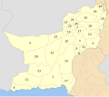
List
| City | Tehsil | Pop. | Pop. | Pop. | Pop. (1981) | Pop. (1972) | Pop. (1961) | Pop. (1951) | Image |
|---|---|---|---|---|---|---|---|---|---|
| Quetta | Chiltan Tehsil | 1,565,546 | 1,001,205 [4] | 565,137 | 286,000 | 158,000 | 107,000 | 84,000 | 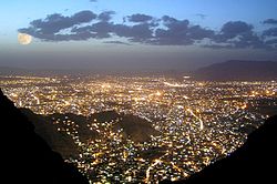 |
| Turbat | Turbat Tehsil | 268,625 | 213,557 [5] | 68,603 | 52,337 | 27,671 | 4,578 | 3,549 |  |
| Khuzdar | Khuzdar Tehsil | 218,112 | 182,927 [6] | 91,057 | 30,887 | 3,362 | ... | ... |  |
| Hub | Hub Tehsil | 195,661 | 175,376 [7] | 62,763 | 4,249 | ... | ... | ... |  |
| Panjgur | Panjgur Tehsil | 157,693 | 80,411 | 21,297 | 9,495 | 9,879 | 5,670 | 754 | |
| Chaman | Chaman Tehsil | 130,139 | 123,191 [8] | 56,792 | 29,793 | 20,702 | 12,208 | 6,980 | 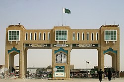 |
| Loralai | Bori Tehsil | 117,145 | 89,098 [9] | 29,450 | 15,482 | 11,157 | 8,519 | 4,437 | 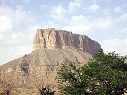 |
| Pishin | Pishin Tehsil | 107,646 | 35,577 [10] | 22,955 | 14,715 | 10,068 | 2,906 | 3,106 | |
| Dera Murad Jamali | Dera Murad Jamali Tehsil | 106,952 | 96,591 [11] | 38,341 | 9,133 | ... | ... | ... | |
| Dera Allah Yar | Jaffarabad Tehsil | 98,761 | 80,908 [12] | 38,371 | 6730 | 2332 | 1497 | ... | |
| Kharan | Kharan Tehsil | 80,806 | 51,388 [13] | 27,806 | 10,472 | 6,093 | 2,692 | 2,589 | |
| Sui | Sui Tehsil | 79,567 | 72,740 [14] | ... | ... | ... | ... | ... | |
| Zehri | Zehri Tehsil | 70,910 | 37,854 [6] | 13,143 | ... | ... | ... | ... | |
| Gwadar | Gwadar Tehsil | 70,852 | 90,762 [15] | 45,021 | 17,000 | 15,794 | ... | ... |  |
| Sibi | Sibi Tehsil | 69,300 | 64,427 [16] | 48,467 | 23,043 | 19,989 | 13,327 | 11,836 | |
| Buleda | Bulaida Tehsil | 68,752 | 39,813 [5] | ... | ... | ... | ... | ... | |
| Tasp | Panjgur Tehsil | 66,030 | 35,890 [17] | ... | ... | ... | ... | ... | |
| Usta Mohammad | Usta Muhammad Tehsil | 64,632 | 77,097 [12] | 38,946 | 12,016 | 6,605 | 3,341 | 2,089 | |
| Tump | Tump Tehsil | 49,269 | 48,766 [5] | ... | ... | ... | ... | ... |  |
| Nushki | Nushki Tehsil | 48,572 | 46,386 [18] | 23,948 | 11,300 | 5,329 | 3,153 | 2,142 | |
| Nal | Nal Tehsil | 48,481 | 33,299 [6] | ... | ... | ... | ... | ... | |
| Chitkan | Panjgur Tehsil | 47,034 | 44,434 [17] | 21,297 | 9,495 | 9,879 | 5,670 | 754 | |
| Khanozai | Karezat Tehsil | 46,682 | 40,238 [10] | ... | ... | ... | ... | ... | |
| Saranan | Saranan Tehsil | 46,512 | 37,927 [10] | ... | ... | ... | ... | ... | |
| Sanjawi | Sinjawi Tehsil | 45,539 | ... | ... | ... | ... | ... | ... | |
| Washbood | Panjgur Tehsil | 44,629 | ... | ... | ... | ... | ... | ... | |
| Machh | Machh Tehsil | 44,542 | 19,152 [19] | 14,488 | 8,419 | 7,273 | 4,921 | 3,211 | |
| Qalat | Kalat Tehsil | 44,440 | 36,864 [20] | 22,646 | 11,037 | 6,481 | 5,321 | 2,009 | |
| Zhob | Zhob Tehsil | 44,251 | 39,914 [21] | 37,791 | 31,931 | 17,291 | 8,058 | 5,932 | |
| Pasni | Pasni Tehsil | 43,494 | 34,524 [15] | 29,538 | 17,988 | 15,737 | 7,483 | 6,168 | |
| Huramzai | Hurramzai Tehsil | 42,945 | 29,400 [10] | ... | ... | ... | ... | ... | |
| Washuk | Washuk Tehsil | 41,107 | 21,872 [22] | ... | ... | ... | ... | ... | |
| Mastung | Mastung Tehsil | 40,374 | 34,997 [23] | 24,131 | 16,450 | 10,397 | 5,962 | 2,792 | |
| Uthal | Uthal Tehsil | 37,071 | 29,414 [7] | 13,319 | 9,404 | 2,296 | ... | ... | |
| Surab | Surab Tehsil | 36,468 | 35,594 [20] | 11,148 | ... | ... | ... | ... | |
| Qilla Abdullah | Killa Abdullah Tehsil | 35,384 | 26,151 [8] | ... | ... | ... | ... | ... | |
| Winder | Sonmiani Tehsil | 35,245 | 29,598 [7] | 11,569 | ... | ... | ... | ... | |
| Qilla Saifullah | Killa Saifullah Tehsil | 35,043 | 34,865 [24] | 8,129 | 835 | 555 | ... | ||
| Bela | Bela Tehsil | 29,380 | 24,603 [7] | 16,705 | 11,172 | 6,728 | 3,139 | 3,063 | |
| Muslim Bagh | Muslim Bagh Tehsil | 29,132 | 28,066 [24] | 17,170 | ... | 2,694 | 2,217 | ... | |
| Dera Bugti | Dera Bugti Tehsil | 28,880 | 27,625 | ||||||
| Awaran | Awaran Tehsil | 28,780 | 21,761 | ||||||
| Wadh | Wadh Tehsil | 26,875 | 22,209 | ||||||
| Jiwani | Jiwani Tehsil | 25,332 | 18,268 | ||||||
| Gandava | Gandava Tehsil | 24,130 | 7,815 | ||||||
| Dalbandin | Dalbandin Tehsil | 20,054 | 16,265 | ||||||
| Shahrig | Shahrig Tehsil | 19,156 | 11,259 | ||||||
| Kohlu | Kohlu Tehsil | 18,978 | 17,443 | ||||||
| Bhag | Bhag Tehsil | 18,634 | 16,600 | ||||||
| Mashkai | Mashkai Tehsil | 18,056 | 12,476 | ||||||
| Gaddani | Gaddani Tehsil | 17,540 | 7,679 | ||||||
| Dhadar | Dhadar Tehsil | 17,276 | 15,240 | ||||||
| Ormara | Ormara Tehsil | 16,573 | 15,631 | ||||||
| Musakhel | Musakhel Tehsil | 15,805 | 14,135 | ||||||
| Dureji | Dureji Tehsil | 15,688 | 12,855 | ||||||
| Sohbatpur | Sohbatpur Tehsil | 14,728 | 12,867 | ||||||
| Barkhan | Barkhan Tehsil | 14,425 | 12,201 | ||||||
| Harnai | Harnai Tehsil | 14,277 | 13,303 | ||||||
| Duki | Duki Tehsil | 9,783 | 10,042 | ||||||
| Ziarat | Ziarat Tehsil | 3,863 | 3,392 | 636 | 201 | 533 | ... | ... |