| Lulu Mountain | |
|---|---|
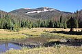
 Northwest aspect | |
| Highest point | |
| Elevation | 12,217 ft (3,724 m) [1] |
| Prominence | 887 ft (270 m) [1] |
| Parent peak | Mount Richthofen (12,945 ft) [1] |
| Isolation | 1.63 mi (2.62 km) [1] |
| Coordinates | 40°28′48″N105°51′45″W / 40.4801235°N 105.8625004°W [2] |
| Geography | |
 Lulu Mountain Location in Colorado  Lulu Mountain Lulu Mountain (the United States) | |
| Country | United States |
| State | Colorado |
| County | Grand County / Jackson County |
| Protected area | Rocky Mountain National Park |
| Parent range | Rocky Mountains Never Summer Mountains |
| Topo map | USGS Fall River Pass |
| Geology | |
| Rock age | Oligocene [3] |
| Rock type | Andesite breccia [3] |
| Climbing | |
| Easiest route | class 2 via Thunder Pass [4] |
Lulu Mountain is a 12,217-foot-elevation (3,724-meter) summit in Colorado, United States.