Lwajjali River

Last updated
Lwajjali
Rivers of North Uganda OSM.png
The rivers of northern Uganda with the Lwajjali River (bottom center)
Location
Country Uganda
Physical characteristics
SourceKisweera Swamp, Mukono District
  locationKisweera, Central Region, Uganda
  coordinates 00°24′50″N32°45′03″E / 0.41389°N 32.75083°E / 0.41389; 32.75083
  elevation1,200 m (3,900 ft)
Mouth Sezibwa River, Kayunga District
  location
Kiziba Swamp, Central Region, Uganda
  coordinates
00°51′27″N32°47′28.50″E / 0.85750°N 32.7912500°E / 0.85750; 32.7912500 Coordinates: 00°51′27″N32°47′28.50″E / 0.85750°N 32.7912500°E / 0.85750; 32.7912500
  elevation
1,150 m (3,770 ft)
Length65 km (40 mi)

River Lwajjali is a river in Uganda, in East Africa.

Contents

Location

The Lwajjali River is located in Central Uganda. It starts from the swamp, west of the village of Kisweera, in Mukono District, the Central Region of Uganda. It flows in a northwestern direction at first, then turns north and then northeast to empty into River Sezibwa in Kayunga District at its border with Luweero District, east of the village of Kiziba. The source of River Lwajjali is located in Kisweera, with coordinates:0°24'50.0"N, 32°45'03.0"E (Latitude:0.413889; Longitude:32.750833). [1] River Lwajjali empties into River Sezibwa in the swamps north of Kayunga, in Kayunga District, with coordinates:0°51'27.0"N, 32°47'29.0"E (Latitude:0.857500; Longitude:32.791389). [2]

Course

Out of its source, the river flows northwest and crosses the Gayaza-Kayunga Road at Nakasajja, where it forms the border between Wakiso District to the west and Mukono District to the east. The river then makes a gradual turn to flow in a northward direction. It continues to curve clockwise, now forming the boundary between Kayunga District to the east and Luweero District to the west. [3] In the swamps north of Kayunga, approximately 25 kilometres (16 mi), north of the town, Lwajjali empties into Sezibwa River, which continues northwards to empty into Lake Kyoga.

At its source, the altitude is approximately 1,200 metres (3,900 ft). At its point of entry into River Sezibwa, the altitude is approximately 1,150 metres (3,770 ft). The length of River Lwajjali, is approximately 65 kilometres (40 mi) from source to end. [4]

See also

Related Research Articles

Luweero District District in Central Region of Uganda, Uganda

Luweero District is a district in the Central Region of Uganda. Luweero is the site of the district headquarters.

Mukono District District in Central Region of Uganda, Uganda

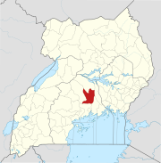
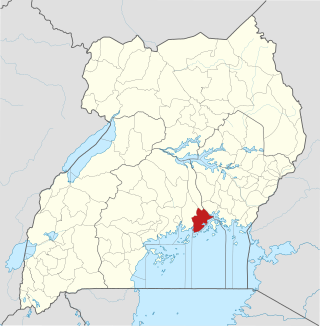
Mukono is one of the districts in the Central Region of Uganda. The town of Mukono home to the district's main commercial center and district headquarters.

Nkusi River

The Nkusi River is in the Bunyoro sub-region, in the Western Region of Uganda.

Mayanja River

River Mayanja is a river in Uganda, East Africa.

Kalagi is a town in Mukono District in the Central Region of Uganda.

The Kampala–Jinja Highway is a road in Uganda, connecting the cities of Kampala and Jinja. Sometimes referred to as Kampala–Jinja Road, it is a busy road, with several towns, trading centers and other points of interest along the way. As of October 2016, a new, wider, four-lane dual carriageway expressway, the Kampala–Jinja Expressway, is proposed to be constructed south of the present highway to relieve traffic and complement existing transport infrastructure between Kampala and Jinja.

Sezibwa River

The Sezibwa River is a river in Central Uganda, in East Africa. The name is derived from the Luganda phrase "sizibwa kkubo", which translates into "my path cannot be blocked".

Ziroobwe is a town in Luweero District in the Central Region of Uganda. The correct phonetic spelling in the native Luganda language is "Ziroobwe".

Gayaza is a town in Wakiso District in the Buganda Region of Uganda.

Nsasa is a neighborhood in Kira Municipality, Kyaddondo County, Wakiso District, in the Central Region of Uganda.

Nakifuma is a town in the Central Region of Uganda.

Naggalama Hospital, whose full name is St. Francis Hospital, Naggalama, is a hospital in Naggalama, Mukono District, in the Central Region of Uganda. It is a private, non-profit, faith-based community hospital, owned by the Roman Catholic Diocese of Lugazi.

Namanve Place in Wakiso District, Uganda

Namanve is an area in the Central Region of Uganda. The larger portion of Namanve lies in Kira Municipality, in Wakiso District with portions located in Mukono Municipality, in Mukono District.

Galilaya is a town in the Kayunga District of the Central Region of Uganda. The town is also known by its correct phonetic spelling, as Galiraya.

River Muzizi

River Muzizi is a river in Uganda, in East Africa. It separates the Two Banyakitara Kingdoms of Bunyoro-Kitara and Tooro

River Kafu

River Kafu is a river in Uganda, in East Africa. On some older maps, the river is labelled as River Kabi.

Kayunga–Galiraya Road is a road in the Central Region of Uganda connecting the town of Kayunga to the towns of Bbaale and Galilaya (Galiraya) on the shores of Lake Kyoga.

Kayunga Hospital, is a public hospital in Uganda.

Kijabijo is a neighborhood in Kira Town, in Wakiso District in the Buganda Region of Uganda.

Nagojje is a town in the Buganda Region of Uganda. It is a municipality in Mukono District.

References

  1. "Location of the Source of River Lwajjali At Google Maps". Google Maps . Retrieved 24 January 2015.
  2. "Location of the Mouth of River Lwajjali At Google Maps". Google Maps . Retrieved 24 January 2015.
  3. Muzaale, Fred (25 May 2010). "Uganda: Floods Cut Off Districts". Daily Monitor (Kampala) via AllAfrica.com . Retrieved 24 January 2015.
  4. "Interactive Map Showing Source And Mouth of River Lwajjali With Marker". Globefeed.com. Retrieved 24 January 2015.