| Miyazaki 宮崎市 | |||
|---|---|---|---|
| Core city | |||
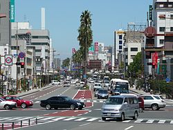 Tachibana Street in Miyazaki | |||
| |||
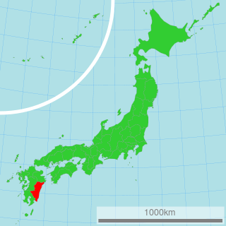
 Location of Miyazaki in Miyazaki Prefecture | |||
 Miyazaki Location in Japan | |||
| Coordinates: 31°55′N131°25′E / 31.917°N 131.417°E Coordinates: 31°55′N131°25′E / 31.917°N 131.417°E | |||
| Country | Japan | ||
| Region | Kyushu | ||
| Prefecture | Miyazaki Prefecture | ||
| Government | |||
| • Mayor | Tadashi Tojiki | ||
| Area | |||
| • Total | 286.96 km2 (110.80 sq mi) | ||
| Population (2010) | |||
| • Total | 399,834 | ||
| Symbols | |||
| • Tree | Cinnamomum camphora | ||
| • Flower | Iris ensata, Camellia | ||
| Time zone | Japan Standard Time (UTC+9) | ||
| City hall address | 1-1-1 Tachibana-dōri Nishi, Miyazaki-shi, Miyazaki-ken 880-8505 | ||
| Website | www | ||


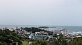
Miyazaki(宮崎市Miyazaki-shi, Japanese: [mijaꜜzaki] ) is the capital city of Miyazaki Prefecture on the island of Kyushu in Japan. Located on the coast and crossed by several rivers, Miyazaki City enjoys scenic views of both ocean and nearby, verdant mountains. A popular resort destination for Japanese tourists, the city offers many attractions, including the SeaGaia event center (though the indoor ocean facility is no longer operational), the Phoenix Zoo, and many large hotels and onsens (public baths). The city is the primary shopping destination for eastern Kyushu residents in smaller towns around the prefecture. The city was founded on April 1, 1924. [1]

A city is a local administrative unit in Japan. Cities are ranked on the same level as towns and villages, with the difference that they are not a component of districts. Like other contemporary administrative units, they are defined by the Local Autonomy Law of 1947.
Miyazaki Prefecture is a prefecture of Japan on the island of Kyushu. The capital is the city of Miyazaki.

Kyushu is the third largest island of Japan and most southwesterly of its four main islands. Its alternative ancient names include Kyūkoku(九国, "Nine Countries"), Chinzei(鎮西, "West of the Pacified Area"), and Tsukushi-no-shima(筑紫島, "Island of Tsukushi"). The historical regional name Saikaidō referred to Kyushu and its surrounding islands.
Contents
- History
- Economy
- Points of interest
- Transportation
- Twin towns – sister cities
- National
- International
- Notable people
- Education
- Climate
- References
- External links
As of this merger (but with 2003 population estimates), the city has an estimated population of 365,311 and a population density of 612 persons per km². The total area is 596.68 km². As of December 2010, the current population is 399,834.
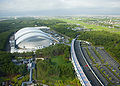
Miyazaki Airport and Miyazaki seaport serve [2] the city.

Miyazaki Airport is an airport located 3.2 km (2.0 mi) south southeast of Miyazaki, a city in the Miyazaki Prefecture of Japan.