This article needs additional citations for verification . (August 2012) (Learn how and when to remove this template message) |
Atsugi 厚木市 | |||
---|---|---|---|
Special city | |||
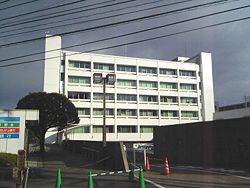
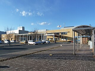
Atsugi City Hall | |||
| |||
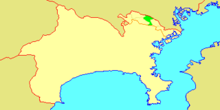
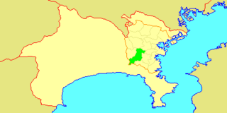
Location of Atsugi in Kanagawa Prefecture | |||
Coordinates: 35°26′00″N139°22′00″E / 35.43333°N 139.36667°E Coordinates: 35°26′00″N139°22′00″E / 35.43333°N 139.36667°E | |||
Country | Japan | ||
Region | Kantō | ||
Prefecture | Kanagawa Prefecture | ||
District | Aikō (formerly) | ||
Area | |||
• Total | 93.83 km2 (36.23 sq mi) | ||
Population (June 1, 2012) | |||
• Total | 224,462 | ||
• Density | 2,390/km2 (6,200/sq mi) | ||
Time zone | Japan Standard Time (UTC+9) | ||
- Tree | Maple | ||
- Flower | Rhododendron indicum | ||
Phone number | 046-223-1511 | ||
Address | 3-17-17 Nakacho, Atsugi-shi, Kanagawa-ken 243-8511 | ||
Website | www.city.atsugi.kanagawa.jp |
Atsugi(厚木市 Atsugi-shi) is a city located in Kanagawa Prefecture, Japan.
A city is a local administrative unit in Japan. Cities are ranked on the same level as towns and villages, with the difference that they are not a component of districts. Like other contemporary administrative units, they are defined by the Local Autonomy Law of 1947.
Kanagawa Prefecture is a prefecture located in Kantō region of Japan. The capital of the prefecture is Yokohama. Kanagawa is part of the Greater Tokyo Area. Kanagawa Prefecture is home to Kamakura and Hakone, two popular side trip destinations from Tokyo.
Japan is an island country in East Asia. Located in the Pacific Ocean, it lies off the eastern coast of the Asian continent and stretches from the Sea of Okhotsk in the north to the East China Sea and the Philippine Sea in the south.
As of June 2012, the city has an estimated population of 224,462, and a population density of 2,390 persons per km². The total area is 93.83 km².
In biology, a population is the number of all the organisms of the same group or species, which live in a particular geographical area, and have the capability of interbreeding. The area of a sexual population is the area where inter-breeding is potentially possible between any pair within the area, and where the probability of interbreeding is greater than the probability of cross-breeding with individuals from other areas.
Population density is a measurement of population per unit area or unit volume; it is a quantity of type number density. It is frequently applied to living organisms, and most of the time to humans. It is a key geographical term. In simple terms population density refers to the number of people living in an area per kilometer square.
While the name "Atsugi" is often associated with the United States Navy base named Naval Air Facility Atsugi, the base is actually not in Atsugi, but straddles the border between the nearby cities of Ayase and Yamato.
The United States Navy (USN) is the naval warfare service branch of the United States Armed Forces and one of the seven uniformed services of the United States. It is the largest and most capable navy in the world and it has been estimated that in terms of tonnage of its active battle fleet alone, it is larger than the next 13 navies combined, which includes 11 U.S. allies or partner nations. with the highest combined battle fleet tonnage and the world's largest aircraft carrier fleet, with eleven in service, and two new carriers under construction. With 319,421 personnel on active duty and 99,616 in the Ready Reserve, the Navy is the third largest of the service branches. It has 282 deployable combat vessels and more than 3,700 operational aircraft as of March 2018, making it the second largest and second most powerful air force in the world.
Naval Air Facility Atsugi is a naval air base located in the cities of Yamato and Ayase in Kanagawa Prefecture, Japan. It is the largest United States Navy (USN) air base in the Pacific Ocean and houses the squadrons of Carrier Air Wing Five (CVW-5), which deploys with the aircraft carrier USS Ronald Reagan.
Ayase is a city located in Kanagawa Prefecture, Japan. It is on the east bank of the Sagami River, and is bordered by Yamato, Fujisawa and Ebina cities. It should not be confused with a neighborhood of the same name in the special ward of Adachi, Tokyo.
Atsugi is located in the hilly center of Kanagawa Prefecture. Parts of the western portion of the city are within the Tanzawa-Ōyama Quasi-National Park and include Mount Ōyama
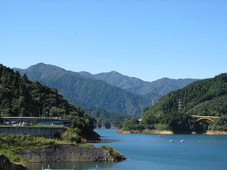
Tanzawa-Ōyama Quasi-National Park is a quasi-national park in the Kantō region of Honshū in Japan. It is rated a protected landscape according to the IUCN. The park includes the Tanzawa Mountains, Miyagase Dam and its surrounding forests, Hayato Great Falls, and the religious sites of Mount Ōyama in the mountains of western Kanagawa Prefecture.
Mount Ōyama, also Mount Afuri or Mount Kunimi (Kunimi-yama), is a 1,252-metre-high (4,108 ft) mountain situated on the border of Isehara, Hadano and Atsugi in Kanagawa Prefecture, Japan. Together with Mount Tanzawa and other mountains in the Tanzawa Mountains it forms the Tanzawa-Ōyama Quasi-National Park. Mount Ōyama is a popular sightseeing spot in Kanagawa Prefecture.
Isehara is a city located in Kanagawa Prefecture, Japan.
Ebina is a city located in Kanagawa Prefecture, Japan.
Zama is a city located in Kanagawa Prefecture, Japan. The city is also home to the United States' Camp Zama Army base.
The area around present-day Atsugi city has been inhabited for thousands of years. Archaeologists have found ceramic shards from the Jōmon period at numerous locations in the area. By the Kamakura period, this area part of the Mōri shōen , part of the holdings of Ōe no Hiromoto. His descendants, the Mōri clan later ruled Chōshū domain. During the Kamakura period, the area was also known for its foundry industry for the production of bells for Buddhist temples. The area came under the control of the Ashikaga clan in the early Muromachi period and was later part of the territories of the Later Hōjō clan from Odawara. With the start of the Edo period, the area was tenryō territory controlled directly by the Tokugawa shogunate, but administered through various hatamoto , as well as exclaves under the control of Odawara Domain, Sakura Domain, Mutsuura Domain, Ogino-Yamanaka Domain and Karasuyama Domain. After the Meiji Restoration, the area was consolidated into Aikō District of Kanagawa Prefecture by 1876. Atsugi town was created on April 1, 1889 through merger of several small hamlets. Atsugi was elevated to city status on February 1, 1955 through merger with neighboring Mutsuai Village, Koaiyu Village, Tamagawa Village and Minamimori Village. The city expanded on July 8, 1958 through merger with neighboring Echi Village, and with Aikawa Village from Naka District. On September 30, 1956, Ogino Village joined with Atsugi. In April 2000, Atsugi exceeded 200,000 in population and was proclaimed a special city with increased autonomy from the central government.
The Jōmon period is the time in Japanese prehistory, traditionally dated between c. 14,000–300 BCE, recently refined to about 1000 BCE, during which Japan was inhabited by a hunter-gatherer culture, which reached a considerable degree of sedentism and cultural complexity. The name "cord-marked" was first applied by the American scholar Edward S. Morse, who discovered sherds of pottery in 1877 and subsequently translated it into Japanese as jōmon. The pottery style characteristic of the first phases of Jōmon culture was decorated by impressing cords into the surface of wet clay and is generally accepted to be among the oldest in East Asia and the world.
The Kamakura period is a period of Japanese history that marks the governance by the Kamakura shogunate, officially established in 1192 in Kamakura by the first shōgun, Minamoto no Yoritomo. The period is known for the emergence of the samurai, the warrior caste, and for the establishment of feudalism in Japan.
A shōen was a field or manor in Japan. The Japanese term comes from the Tang dynasty Chinese term "莊園".
Atsugi is mainly known as a bedroom community for the Tokyo-Yokohama metropolitan area. Nissan has operated a design center in Atsugi, Japan, since 1982. [1] Sony operates the Atsugi Technology Center and the Atsugi Technology Center No. 2 in Atsugi. [2] Anritsu is headquartered in Atsugi, as well as some of the NTT Research and Development labs.
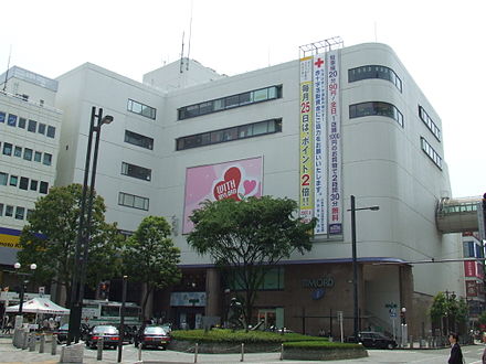
Atsugi is served by the Odakyu Odawara Line with connections to Shinjuku and Odawara. The main station is Hon-Atsugi Station, while Atsugi Station (on the Shinjuku side of the Sagami river) is located in nearby Ebina.
Hiratsuka is a city located in Kanagawa Prefecture, Japan.
Fujisawa is a city in Kanagawa Prefecture, Japan.
Sagami Province was a province of Japan located in what is today the central and western Kanagawa Prefecture. Sagami bordered on Izu, Musashi, Suruga Provinces; and had access to the Pacific Ocean through Sagami Bay. However, most of the present-day cities of Yokohama and Kawasaki, now part of Kanagawa Prefecture, were not in Sagami, but rather, in Musashi Province. Its abbreviated form name was Sōshū (相州).
Yamato is a city located in central Kanagawa Prefecture, Japan.
Hadano is a city in Kanagawa Prefecture, Japan.
Sagamihara is a city in Kanagawa Prefecture, Japan. It is the third most populous city in the prefecture, after Yokohama and Kawasaki, and the fifth most populous suburb of the Greater Tokyo Area. Its northern neighbor is Machida, with which a cross-prefectural merger has been proposed.
Ninomiya is a town located in Kanagawa Prefecture, Japan. As of June 2012, the town had an estimated population of 29,350, and a density of 3,230 persons per km2. The total area is 9.08 km2.
Aikawa is a town located in Kanagawa Prefecture, Japan. As of June 1, 2012, the town had an estimated population of 41,576, and a population density of 1,210 persons per km2. The total area is 34.29 km2.
Aikō District is a district located in central Kanagawa Prefecture, Japan. It currently consists of only one town, Aikawa, and one village, Kiyokawa. The city of Atsugi was formerly part of Aikō District.
Takatsu-ku (高津区) is one of the 7 wards of the city of Kawasaki in Kanagawa Prefecture, Japan. As of 2010, the ward had an estimated population of 215,158 and a density of 13,150 persons per km². The total area is 16.38 km².
Tama-ku (多摩区) is one of the eight wards of the city of Kawasaki in Kanagawa Prefecture, Japan. As of 2010, the ward has an estimated population of 211,221 and a population density of 10,310 persons per km². The total area is 20.49 km².
Totsuka-ku is one of the 18 wards of the city of Yokohama in Kanagawa Prefecture, Japan. As of 2010, the ward had an estimated population of 273,418 and a density of 7,640 persons per km². The total area was 35.70 km².
Uenohara is a city located in Yamanashi Prefecture, Japan.
The Kanagawa Prefectural Board of Education (神奈川県教育委員会) is the board of education for Kanagawa Prefecture in Japan. The board consists of six members; one of them is elected as the chair, and one of them is appointed by the board as the superintendent. The board administers municipal education and directly operates all of the prefectural schools.
Odawara is a city in Kanagawa Prefecture, Japan.
Odawara Domain was a Japanese domain of the Edo period, located primarily in western Sagami Province. It was centered on Odawara Castle in what is now the city of Odawara.
National Route 129 is a national highway of Japan connecting Hiratsuka, Kanagawa and Sagamihara, Kanagawa in Japan, with a total length of 31.7 km (19.7 mi). It junctions with the following routes: Japan National Route 16 in Sagamihara, Route 412 (Japan) and Japan National Route 246 in Atsugi, Kanagawa, and Japan National Route 1 and Japan National Route 134 in Hiratsuka, Kanagawa. The route runs in a north to south direction and spans along some major expressways. These include but not limited to Harataima, Kenoatsugi and Ebina, Kanagawa IC in Keno Expressway, Atsugi, Kanagawa IC in Tōmei Expressway, Atsuginishi in Odawara-Atsugi Road road and Samukawaminami in Shin-Shōnan Bypass.
Wikivoyage has a travel guide for Atsugi . |
Wikimedia Commons has media related to Atsugi, Kanagawa . |