Tokushima, Tokushima

Last updated
Tokushima
徳島市
City
Tokushima City
Bizan Tokushima05s5.jpg
Flag of Tokushima, Tokushima.svg
Flag
Emblem of Tokushima, Tokushima.svg
Emblem
Tokushima in Tokushima Prefecture Ja.svg
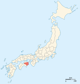
Location of Tokushima in Tokushima Prefecture
Japan location map with side map of the Ryukyu Islands.svg
Red pog.svg
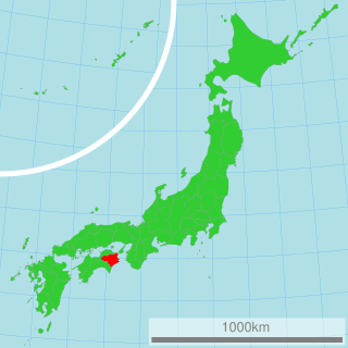
Tokushima
Location in Japan
Coordinates: 34°4′N134°33′E / 34.067°N 134.550°E / 34.067; 134.550 Coordinates: 34°4′N134°33′E / 34.067°N 134.550°E / 34.067; 134.550
Country Japan
Region Shikoku
Prefecture Tokushima Prefecture
Government
  Mayor Akiyoshi Endo (since April 2016)
Area
  Total 191.23 km2 (73.83 sq mi)
Population (july 1, 2018)
  Total 321,654
  Density 1,700/km2 (4,400/sq mi)
Symbols
  Tree Elaeocarpus
  Flower Cherry blossom
Time zone Japan Standard Time (UTC+9)
City hall address 2-5 Saiwai, Tokushima-shi, Tokushima-ken
770-8571
Website www.city.tokushima.tokushima.jp

Tokushima(徳島市,Tokushima-shi, Japanese:  [tokɯꜜɕima] ) is the capital city of Tokushima Prefecture on Shikoku island in Japan.

Cities of Japan administrative division of Japan

A city is a local administrative unit in Japan. Cities are ranked on the same level as towns and villages, with the difference that they are not a component of districts. Like other contemporary administrative units, they are defined by the Local Autonomy Law of 1947.

Tokushima Prefecture Prefecture of Japan

Tokushima Prefecture is a prefecture of Japan located on Shikoku Island. The capital is the city of Tokushima.

Japan Constitutional monarchy in East Asia

Japan is an island country in East Asia. Located in the Pacific Ocean, it lies off the eastern coast of the Asian continent and stretches from the Sea of Okhotsk in the north to the East China Sea and the Philippine Sea in the south.

Contents

As of October 1, 2016, the city had an estimated population of 258,237 and a population density of 1,400 persons per km². Its total area is 191.23 km². The city is situated in the north-eastern part of Tokushima Prefecture at the mouth of the Yoshino River. In terms of layout and organization, Tokushima displays the typical characteristics of a Japanese castle town. Tokushima was developed under the Hachisuka clan. Its prosperity was built on a strong indigo dye industry.

Population All the organisms of a given species that live in the specified region

In biology, a population is the number of all the organisms of the same group or species, which live in a particular geographical area, and have the capability of interbreeding. The area of a sexual population is the area where inter-breeding is potentially possible between any pair within the area, and where the probability of interbreeding is greater than the probability of cross-breeding with individuals from other areas.

Population density A measurement of population numbers per unit area or volume

Population density is a measurement of population per unit area or unit volume; it is a quantity of type number density. It is frequently applied to living organisms, and most of the time to humans. It is a key geographical term. In simple terms population density refers to the number of people living in an area per kilometer square.

Yoshino River river in Kochi and Tokushima prefectures, Japan

The Yoshino River is a river on the island of Shikoku, Japan. It is 194 km (121 mi) long and has a watershed of 3,750 km2 (1,450 sq mi). It is the second longest river in Shikoku, and is the only river whose watershed spreads over the four prefectures of the island.

The modern city of Tokushima was founded on October 1, 1889. At the time, it was the 10th largest city in Japan. The city is served by Tokushima Airport (recently renamed to Awa Odori Airport), in nearby Matsushige.

Tokushima Airport airport

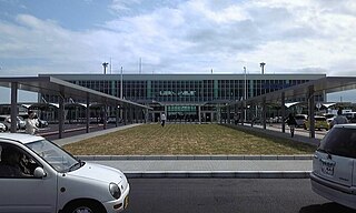
Tokushima Awaodori Airport is a joint civil-military public airport in Matsushige, Tokushima, Japan, near the city of Tokushima.

Matsushige, Tokushima Town in Shikoku, Japan

Matsushige is a town located in Itano District, Tokushima Prefecture, Japan.

History

World War II air raid

Tokushima was selected as a target by the United States' XXI Bomber Command during World War II because of the city's role as an agricultural center for the region. On July 3, 1945 at 5:45 PM (JST) 137 aircraft took off to bomb Tokushima. 1,050 tons of incendiary bombs were dropped on Tokushima, destroying 74% of the built up areas of the city. [1]

XXI Bomber Command

The XXI Bomber Command was a unit of the Twentieth Air Force in the Mariana Islands for strategic bombing during World War II.

World War II 1939–1945 global war

World War II, also known as the Second World War, was a global war that lasted from 1939 to 1945. The vast majority of the world's countries—including all the great powers—eventually formed two opposing military alliances: the Allies and the Axis. A state of total war emerged, directly involving more than 100 million people from over 30 countries. The major participants threw their entire economic, industrial, and scientific capabilities behind the war effort, blurring the distinction between civilian and military resources. World War II was the deadliest conflict in human history, marked by 50 to 85 million fatalities, most of whom were civilians in the Soviet Union and China. It included massacres, the genocide of the Holocaust, strategic bombing, premeditated death from starvation and disease, and the only use of nuclear weapons in war.

Culture

Every August, during the Obon Festival, Tokushima holds a cultural dance festival, the Awa Odori. Awa Odori literally translates as "Awa Dance" (Awa being Tokushima Prefecture's ancient name). During the festival, residents ranging from young children to professional dance troupes perform a distinctive style of Japanese traditional dance in regional costumes, accompanied by strings, drums, and singing (usually by the dancers themselves).

Awa Dance Festival

The Awa Dance Festival is held from 12 to 15 August as part of the Obon festival in Tokushima Prefecture on Shikoku in Japan. Awa Odori is the largest dance festival in Japan, attracting over 1.3 million tourists every year.

Awa Province (Tokushima) province of Japan, now Tokushima Prefecture

Awa Province was an old province of Japan in the area that is today a part of Tokushima Prefecture on Shikoku. Awa was bordered by Tosa, Sanuki, and Iyo Provinces. It was sometimes called Ashū (阿州).

Climate

Tokushima has a humid subtropical climate (Köppen climate classification Cfa) with hot summers and cool winters. Precipitation is high, but there is a pronounced difference between the wetter summers and drier winters.

Humid subtropical climate category in the Köppen climate classification system

A humid subtropical climate is a zone of climate characterized by hot and humid summers, and mild winters. These climates normally lie on the southeast side of all continents, generally between latitudes 25° and 40° and are located poleward from adjacent tropical climates. While many subtropical climates tend to be located at or near coastal locations, in some cases they extend inland, most notably in China and the United States, where they exhibit more pronounced seasonal variations and sharper contrasts between summer and winter, as part of a gradient between the more tropical climates of the southern coasts of these countries and the more continental climates of China and the United States’ northern and central regions.

Köppen climate classification widely used climate classification system

The Köppen climate classification is one of the most widely used climate classification systems. It was first published by the Russian climatologist Wladimir Köppen (1846–1940) in 1884, with several later modifications by Köppen, notably in 1918 and 1936. Later, the climatologist Rudolf Geiger introduced some changes to the classification system, which is thus sometimes called the Köppen–Geiger climate classification system.

Climate data for Tokushima, Tokushima
MonthJanFebMarAprMayJunJulAugSepOctNovDecYear
Average high °C (°F)9.3
(48.7)
9.7
(49.5)
13.0
(55.4)
18.7
(65.7)
23.0
(73.4)
25.8
(78.4)
29.7
(85.5)
31.1
(88)
27.4
(81.3)
22.2
(72)
17.0
(62.6)
12.0
(53.6)
19.9
(67.8)
Daily mean °C (°F)5.4
(41.7)
5.7
(42.3)
8.7
(47.7)
14.3
(57.7)
18.6
(65.5)
22.1
(71.8)
26.1
(79)
27.2
(81)
23.7
(74.7)
18.1
(64.6)
12.9
(55.2)
7.9
(46.2)
15.9
(60.6)
Average low °C (°F)1.9
(35.4)
2.1
(35.8)
4.6
(40.3)
10.0
(50)
14.5
(58.1)
18.9
(66)
23.2
(73.8)
24.0
(75.2)
20.6
(69.1)
14.6
(58.3)
9.1
(48.4)
4.1
(39.4)
12.3
(54.2)
Average precipitation mm (inches)46.2
(1.819)
56.3
(2.217)
83.1
(3.272)
130.9
(5.154)
136.6
(5.378)
229.6
(9.039)
168.6
(6.638)
178.4
(7.024)
307.8
(12.118)
141.7
(5.579)
96.9
(3.815)
37.9
(1.492)
1,614
(63.545)
Average snowfall cm (inches)3
(1.2)
3
(1.2)
0
(0)
0
(0)
0
(0)
0
(0)
0
(0)
0
(0)
0
(0)
0
(0)
0
(0)
0
(0)
6
(2.4)
Average relative humidity (%)62626367707679767469676369
Mean monthly sunshine hours 156.3143.0169.2173.3191.6147.8190.2213.3150.9158.2145.9154.11,993.8
Source: NOAA (1961-1990) [2]

Education

Geography

Mountains

NameHeightNotes
Bizan
(眉山)
277 m
Shiroyama
(城山)
62 m
Nakatsu Mineyama
(中津峰山)
773 mThe highest mountain in the Tokushima City district.
Nishi Ryuo-san
(西竜王山)
495 m
Higashi Ryuo-san
(東龍王山)
408m
Kinobeyama
(気延山)
212 m
Bentenzan
(弁天山)
6.1 mClaimed to be the smallest natural mountain in Japan.

Rivers

Sister cities

Related Research Articles

Shikoku smallest of the four main islands of Japan

Shikoku is the smallest and least populous of the four main islands of Japan, located south of Honshu and east of the island of Kyushu. Shikoku comprises 3.1 percent of the entire population of Japan. Its ancient names include Iyo-no-futana-shima (伊予之二名島), Iyo-shima (伊予島), and Futana-shima (二名島). The current name refers to the four former provinces that made up the island: Awa, Tosa, Sanuki, and Iyo.

Awaji Province province of Japan

Awaji Province was an old province of Japan covering Awaji Island, between Honshū and Shikoku. Today it is part of Hyōgo Prefecture. It is sometimes called Tanshu (淡州). Awaji is divided into three municipal sections: Awaji is the northernmost section, Sumoto is the most urban and central section, and four southern towns make up the city of Minamiawaji.

Bon Festival Japanese Buddhist custom

Obon (お盆) or just Bon (盆) is a Japanese Buddhist custom to honor the spirits of one's ancestors. This Buddhist-Confucian custom has evolved into a family reunion holiday during which people return to ancestral family places and visit and clean their ancestors' graves, and when the spirits of ancestors are supposed to revisit the household altars. It has been celebrated in Japan for more than 500 years and traditionally includes a dance, known as Bon-Odori.

Aizumi, Tokushima Town in Shikoku, Japan

Aizumi is a town located in Itano District, in northeastern Tokushima Prefecture, Japan.

Yoshino was a town located in Itano District, Tokushima Prefecture, Japan.

Itano District, Tokushima district of Japan

Itano is a district located in Tokushima Prefecture, Japan.

Awa, Tokushima City in Shikoku, Japan

Awa is a city located in Tokushima Prefecture, Japan.

Mima, Tokushima City in Shikoku, Japan

Mima is a city located in Tokushima Prefecture, Japan.

Yoshinogawa, Tokushima City in Shikoku, Japan

Yoshinogawa is a city located in Tokushima Prefecture, Japan.

Fujimino, Saitama City in Kantō, Japan

Fujimino is a city located in Saitama Prefecture, Japan. As of 1 February 2016, the city had an estimated population of 111,218, and a population density of 7600 persons per km². Its total area is 14.64 square kilometres (5.65 sq mi).

Tsurugi, Tokushima Town in Shikoku, Japan

Tsurugi is a town in Mima District, Tokushima Prefecture, on the island of Shikoku in Japan.

Takamatsu, Kagawa Core city in Shikoku, Japan

Takamatsu is a city located in central Kagawa Prefecture on the island of Shikoku in Japan, and is the capital city of the prefectural government. It is designated a core city by the Japanese Government. It is a port city located on the Seto Inland Sea, and is the closest port to Honshu from Shikoku island. For this reason it flourished under the daimyōs as a castle town in the fiefdom of Takamatsu, during the Edo period. Takamatsu is a city with a large concentration of nationwide companies' branch offices, which play a large role in its economy, and it contains most of the national government's branch offices for Shikoku. The castle tower formerly used as the symbol of the city was destroyed during the Meiji period. In 2004, construction of the Symbol Tower, the new symbol of Takamatsu, was completed. The Symbol Tower is located in the Sunport area of the city. The Symbol Tower is the tallest building in Takamatsu, and is right next to another tall building The JR Clement Hotel, which is also part of the Sunport complex.

Tokushima Line railway line in Tokushima prefecture, Japan

The Tokushima Line is a railway line in Tokushima Prefecture, Japan, owned and operated by Shikoku Railway Company. The Tokushima Line connects Sako Station in Tokushima and Tsukuda Station in Miyoshi from west to east in central Tokushima Prefecture. As the line parallels the Yoshino River, it is officially nicknamed the "Yoshino River Blue Line" (よしの川ブルーライン). In addition to linking Tokushima and Kōchi prefectures, the line's eastern half serves the city of Tokushima as a commuter line.

Mount Bizan mountain in Japan

Mount Bizan is a mountain in Tokushima. Its name is formed of the kanji for eyebrow, and it is said to have earned this name because the mountain looks like an eyebrow from all views. Known as a symbol of Tokushima City, the name Mount Bizan appears in many school songs in the city district, such as the Tokushima Prefectural Jonan High School, Tokushima Municipal High School and many more. In 2007 Mount Bizan became widely known as the setting for a national movie of the same name, based on a book by Sada Masashi.

Aibahama Park

Aibahama Park (藍場浜公園) is a park in Aiba-cho in Tokushima City in Tokushima Prefecture.

Kōenji Awa Odori

Kōenji Awa-Odori (高円寺阿波おどり) is one of Tokyo’s largest summer street festivals with up to 12,000 dance team participants and over 1.2 million visitors over the two day event.

Kōchi, Kōchi Core city in Shikoku, Japan

Kōchi is the capital city of Kōchi Prefecture located on the island of Shikoku in Japan.

References