Troutdale, Virginia

Last updated • 3 min readFrom Wikipedia, The Free Encyclopedia

Troutdale, Virginia
Troutdale post office 24378, and bank.jpg
Post office and bank
VAMap-doton-Troutdale.PNG
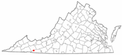
Location of Troutdale, Virginia
Coordinates: 36°42′3″N81°26′41″W / 36.70083°N 81.44472°W / 36.70083; -81.44472
Country United States
State Virginia
County Grayson
Area
[1]
  Total3.13 sq mi (8.10 km2)
  Land3.12 sq mi (8.09 km2)
  Water0.00 sq mi (0.00 km2)
Elevation
3,127 ft (953 m)
Population
 (2020) [2]
  Total140 Decrease2.svg
  Estimate 
(2021) [2]
140
  Density53.14/sq mi (20.52/km2)
Time zone UTC-5 (Eastern (EST))
  Summer (DST) UTC-4 (EDT)
ZIP code
24378
Area code 276
FIPS code 51-79456 [3]
GNIS feature ID2391451 [4]

Troutdale is a town in Grayson County, Virginia, United States. [4] The population was 140 at the 2020 census. [2]

Contents

Geography

Troutdale is located at 36°42′3″N81°26′41″W / 36.70083°N 81.44472°W / 36.70083; -81.44472 (36.700963, -81.444823). [5]

According to the United States Census Bureau, the town has a total area of 3.1 square miles (8.1 km2), all land.

Climate

The climate in this area has mild differences between highs and lows, and there is adequate rainfall year-round. According to the Köppen Climate Classification system, Troutdale has a marine west coast climate, abbreviated "Cfb" on climate maps. [6]

History

Troutdale was chartered as a town by the Virginia Legislature in 1906 and remains an incorporated town with a council and mayor. The Troutdale town limit is a circle of 1 mile radius. In 1930, Carrie Wright was elected as mayor, possibly the first female mayor in Virginia.

Demographics

Historical population
CensusPop.Note
1910 431
1920 63647.6%
1930 357−43.9%
1940 334−6.4%
1950 250−25.1%
1960 2739.2%
1970 209−23.4%
1980 24818.7%
1990 196−21.0%
2000 1,230527.6%
2010 178−85.5%
2020 140−21.3%
2021 (est.)140 [2] 0.0%
U.S. Decennial Census [7]

The original 2000 census listed Troutdale with a population of 1,230, a very sharp increase from 192 in 1990. This, and the similarly anomalous figure of 30.89% black American population, was the result of a tabulation error in which much of the population of Wise County's correctional facilities were counted as Troutdale residents. census revision

As of the census [3] of 2000, there were 1,230 people, 79 households, and 56 families living in the town. The population density was 395.5 inhabitants per square mile (152.7/km2). There were 111 housing units at an average density of 35.7 per square mile (13.8/km2). The racial makeup of the town was 67.80% White, 30.89% African American, 0.41% Asian, 0.81% from other races, and 0.08% from two or more races. Hispanic or Latino of any race were 0.89% of the population.

There were 79 households, out of which 21.5% had children under the age of 18 living with them, 54.4% were married couples living together, 11.4% had a female householder with no husband present, and 29.1% were non-families. 22.8% of all households were made up of individuals, and 7.6% had someone living alone who was 65 years of age or older. The average household size was 2.46 and the average family size was 2.93.

The median income for a household in the town was $38,438, and the median income for a family was $45,833. Males had a median income of $24,258 versus $16,250 for females. The per capita income for the town was $18,139. About 3.2% of families and 3.6% of the population were below the poverty line, including 5.6% of those under age 18 and 2.9% of those age 65 or over.

Event

The Troutdale Fire Department sponsors "Troutdale Days" on the second Saturday of August each year, including a parade, contests, entertainment, and food.

Notable people

Further reading

Related Research Articles

<span class="mw-page-title-main">Grayson County, Virginia</span> County in Virginia, United States

Grayson County is a county located in the southwestern part of the Commonwealth of Virginia. As of the 2020 census, the population was 15,333. Its county seat is Independence. Mount Rogers, the state's highest peak at 5,729 feet (1,746 m), is in Grayson County.

<span class="mw-page-title-main">Troutdale, Oregon</span> City in Oregon, United States

Troutdale is a city in Multnomah County, Oregon, United States, immediately north of Gresham and east of Wood Village. As of the 2020 census, the city population was 16,300. The city serves as the western gateway to the Historic Columbia River Highway, the Mount Hood Scenic Byway, and the Columbia River Gorge. It is approximately 12 miles (19 km) east of Portland and is part of the Portland, Oregon metropolitan area.

<span class="mw-page-title-main">Onley, Virginia</span> Town in Virginia, United States

Onley is a town in Accomack County, Virginia, United States. The population was 516 at the 2010 census.

<span class="mw-page-title-main">Fancy Gap, Virginia</span> CDP in Virginia, United States

Fancy Gap is a census-designated place (CDP) in Carroll County, Virginia. The population was 237 at the 2010 census.

<span class="mw-page-title-main">Middletown, Virginia</span> Town in Virginia, United States

Middletown is a town in Frederick County, Virginia, United States, in the northern Shenandoah Valley. The population was 1,265 at the 2010 census, up from 1,015 at the 2000 census.

<span class="mw-page-title-main">Glen Lyn, Virginia</span> Town in Virginia, United States

Glen Lyn is a town in Giles County, Virginia, United States, at the confluence of the East and New rivers. The population was 115 at the 2010 census, down from 151 at the 2000 census. It is part of the Blacksburg–Christiansburg Metropolitan Statistical Area.

<span class="mw-page-title-main">Boydton, Virginia</span> Town in Virginia, United States

Boydton is a town in Mecklenburg County, Virginia, United States. The population was 302 at the 2020 census. It is the county seat of Mecklenburg County, and it is near Kerr Lake.

<span class="mw-page-title-main">Branchville, Virginia</span> Town in Virginia, United States

Branchville is a town in Southampton County, Virginia, United States. The population was 123 at the 2000 census.

<span class="mw-page-title-main">Grantsville, West Virginia</span> Town in West Virginia, United States

Grantsville is a town in Calhoun County, West Virginia, United States. The population was 482 at the 2020 census. It is the county seat of Calhoun County. The town was established along the Little Kanawha River in 1865 and named for Ulysses S. Grant. Grantsville is home to Wayne Underwood Park, which includes a .25-mile-long (0.40 km) walking trail, and to the annual West Virginia Wood Festival.

<span class="mw-page-title-main">McMechen, West Virginia</span> City in West Virginia

McMechen is a city in Marshall County, West Virginia, United States, situated along the Ohio River. It is part of the Wheeling, West Virginia Metropolitan Statistical Area. The population was 1,714 at the 2020 census.

<span class="mw-page-title-main">Henderson, West Virginia</span> Unincorporated Town in West Virginia, United States

Henderson is an unincorporated community and former town in Mason County, West Virginia, United States, at the confluence of the Ohio and Kanawha Rivers. The population was 231 at the 2020 census. It is part of the Point Pleasant, WV–OH Micropolitan Statistical Area. The town was incorporated in 1893 and named for Samuel Bruce Henderson, who owned the townsite at the time. The town was unincorporated following a public hearing on August 11, 2022.

<span class="mw-page-title-main">Iaeger, West Virginia</span> Town in West Virginia, United States

Iaeger is a town in McDowell County, West Virginia, United States. The population was 257 at the 2020 census.

<span class="mw-page-title-main">Matoaka, West Virginia</span> Census-designated place in West Virginia, United States

Matoaka is a census-designated place in Mercer County, West Virginia, United States. The population was 173 at the 2020 census. It is part of the Bluefield, WV-VA micropolitan area which has a population of 100,093. This town is named for Chief Powhatan's daughter Matoaka who was better known by her nickname "Pocahontas". Matoaka became an unincorporated town when it voted to dissolve its charter in May 2018.

<span class="mw-page-title-main">Granville, West Virginia</span> Town in West Virginia

Granville is a town in Monongalia County, West Virginia, United States. The population was 1,355 at the 2020 census. It is included in the Morgantown metropolitan area.

<span class="mw-page-title-main">Albright, West Virginia</span> Town in West Virginia, United States

Albright is a town in central Preston County, West Virginia, United States, along the Cheat River. The population was 260 at the 2020 census. A former coal town, it is part of the Morgantown metropolitan area.

<span class="mw-page-title-main">Eleanor, West Virginia</span> Town in West Virginia, United States

Eleanor is a town in Putnam County, West Virginia, United States, along the Kanawha River. Its population was 1,548 at the 2020 census. It is part of the Huntington–Ashland metropolitan area. The town, named for Eleanor Roosevelt, was established as a New Deal project in the 1930s like other Franklin D. Roosevelt towns around the nation.

<span class="mw-page-title-main">Cairo, West Virginia</span> Town in West Virginia, United States

Cairo is a town in Ritchie County, West Virginia, United States, along West Virginia Route 31, the North Fork of the Hughes River, and the North Bend Rail Trail. The population was 174 at the 2020 census.

<span class="mw-page-title-main">Ellenboro, West Virginia</span> Town in West Virginia, United States

Ellenboro is a town in Ritchie County, West Virginia, United States. The population was 222 at the 2020 census. The town is located at the junction of U.S. Route 50 and West Virginia Route 16; the North Bend Rail Trail also passes through the town. The town was named for Ellen Mariah Williamson, the eldest daughter of the family that granted a right of way for the Baltimore and Ohio Railroad to build their line through the town; an earlier name for the community was Shumley. Ellenboro was incorporated in 1903.

<span class="mw-page-title-main">Middlebourne, West Virginia</span> Town in West Virginia, United States

Middlebourne is a town and the county seat of Tyler County, West Virginia, United States. The population was 715 at the 2020 census.

<span class="mw-page-title-main">Elizabeth, West Virginia</span> Town in West Virginia, United States

Elizabeth is a town in and the county seat of Wirt County, West Virginia, United States, situated along the Little Kanawha River. The population was 724 as of the 2020 census.

References

  1. "2019 U.S. Gazetteer Files". United States Census Bureau. Retrieved August 7, 2020.
  2. 1 2 3 4 "City and Town Population Totals: 2020—2021". Census.gov. US Census Bureau. Retrieved October 7, 2022.
  3. 1 2 "U.S. Census website". United States Census Bureau . Retrieved January 31, 2008.
  4. 1 2 "Town of Troutdale". Geographic Names Information System . United States Geological Survey, United States Department of the Interior . Retrieved February 25, 2014.
  5. "US Gazetteer files: 2010, 2000, and 1990". United States Census Bureau. February 12, 2011. Retrieved April 23, 2011.
  6. Climate Summary for Troutdale, Virginia
  7. "Census of Population and Housing". Census.gov. Retrieved June 4, 2015.
  8. "Ripshin Farm". National Historic Landmark summary listing. National Park Service. Archived from the original on June 6, 2011. Retrieved April 16, 2008.