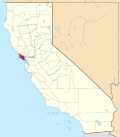
Woodacre | |
---|---|
Coordinates: 38°00′46″N122°38′43″W / 38.01278°N 122.64528°W | |
Country | United States |
State | California |
County | Marin |
Government | |
• County Board | District 4 Dennis Rodoni [1] |
• State Senate | Mike McGuire (D) |
• Assembly | Stephanie Nguyen (D) |
• U.S. Congress | Jared Huffman (D) [2] |
Area | |
• Total | 1.797 sq mi (4.653 km2) |
• Land | 1.797 sq mi (4.653 km2) |
• Water | 0 sq mi (0 km2) 0% |
Elevation | 364 ft (111 m) |
Population (2020) [5] | |
• Total | 1,410 |
• Density | 780/sq mi (300/km2) |
Time zone | UTC-8 (PST) |
• Summer (DST) | UTC-7 (PDT) |
ZIP code | 94973 |
Area codes | 415/628 |
FIPS code | 06-86216 |
GNIS feature ID | 1652657 |
Woodacre is an unincorporated town and census-designated place (CDP) in Marin County, California, United States. The population was 1,410 at the 2020 census. [5]
The community is located at 38°00′46″N122°38′43″W / 38.01278°N 122.64528°W [4] in the eastern half of the San Geronimo Valley of central Marin County. San Geronimo and Lagunitas-Forest Knolls are to its west. Woodacre is located 8 miles (13 km) south-southwest of Novato, [6] and 8 miles northwest of San Rafael; the nearest incorporated town is Fairfax, 4 miles (6 km) east-southeast. At 364 feet (111 m), Woodacre has the highest base elevation in Marin County. [4]
According to the United States Census Bureau, the CDP has a total area of 1.8 square miles (4.7 km2), all of it land. [3]
The community began when promoters subdivided the place in 1912. [6] The first post office opened in 1925. [6] In 1926 fire threatened the area and 35 of the 40 homes in Woodacre burned. [7]
The 2010 United States Census [8] reported that Woodacre had a population of 1,348. The population density was 750.3 inhabitants per square mile (289.7/km2). The racial makeup of Woodacre was 1,231 (91.3%) White, 3 (0.2%) African American, 4 (0.3%) Native American, 27 (2.0%) Asian, 4 (0.3%) Pacific Islander, 10 (0.7%) from other races, and 69 (5.1%) from two or more races. Hispanic or Latino of any race were 77 persons (5.7%).
The Census reported that 100% of the population lived in households.
There were 595 households, of which 144 (24.2%) had children under the age of 18 living in them, 279 (46.9%) were opposite-sex married couples living together, 54 (9.1%) had a female householder with no husband present, 25 (4.2%) had a male householder with no wife present. There were 49 (8.2%) unmarried opposite-sex partnerships, and 11 (1.8%) same-sex married couples or partnerships. 163 households (27.4%) were made up of individuals, and 44 (7.4%) had someone living alone who was 65 years of age or older. The average household size was 2.27. There were 358 families (60.2% of all households); the average family size was 2.72.
238 people (17.7%) were under the age of 18, 53 people (3.9%) aged 18 to 24, 262 people (19.4%) aged 25 to 44, 575 people (42.7%) aged 45 to 64, and 220 people (16.3%) who were 65 years of age or older. The median age was 50.5 years. For every 100 females there were 92.0 males. For every 100 females age 18 and over, there were 88.5 males.
There were 639 housing units at an average density of 355.7 per square mile (137.3/km2), of which 74.6% were owner-occupied and 25.4% were occupied by renters. The homeowner vacancy rate was 0.7%; the rental vacancy rate was 2.6%. 77.3% of the population lived in owner-occupied housing units and 22.7% lived in rental housing units.
At the 2000 census, [9] there were 1,393 people, 548 households and 381 families residing in the CDP. The population density was 763.6 inhabitants per square mile (294.8/km2). There were 570 housing units at an average density of 312.5 per square mile (120.7/km2). The racial makeup of the CDP inj 2010 was 88.0% non-Hispanic White, 0.2% non-Hispanic African American, 0.1% Native American, 2.0% Asian, 0.3% Pacific Islander, 0.3% from other races, and 3.3% from two or more races. Hispanic or Latino of any race were 5.7% of the population.
There were 548 households, of which 34.3% had children under the age of 18 living with them, 55.3% were married couples living together, 11.3% had a female householder with no husband present, and 30.3% were non-families. 19.5% of all households were made up of individuals, and 4.4% had someone living alone who was 65 years of age or older. The average household size was 2.54 and the average family size was 2.90.
23.0% of the population were under the age of 18, 3.7% from 18 to 24, 25.8% from 25 to 44, 38.8% from 45 to 64, and 8.7% who were 65 years of age or older. The median age was 44 years. For every 100 females there were 92.1 males. For every 100 females age 18 and over, there were 88.2 males.
The median household income was $62,917 and the median family income was $71,250. Males had a median income of $50,109 compared with $40,167 for females. The per capita income for the CDP was $31,996. About 3.9% of families and 6.6% of the population were below the poverty line, including 8.4% of those under age 18 and none of those age 65 or over.
Almost all of the community is in the Lagunitas Elementary School District while a small portion is in the Ross Valley Elementary School District. All of it is in the Tamalpais Union High School District. [10]
Bayview-Montalvin is a former census-designated place (CDP) in Contra Costa County, California, United States. The population was 5,004 at the 2000 census.
Dustin Acres is a census-designated place (CDP) in Kern County, California, United States. Dustin Acres is located 6.5 miles (10 km) north-northeast of Taft, at an elevation of 384 feet (117 m). The population was 652 at the 2010 census, up from 585 at the 2000 census.
Desert View Highlands is a census-designated place (CDP) in Los Angeles County, California, United States. The population was 2,360 at the 2010 census, up from 2,337 at the 2000 census. It is surrounded by the City of Palmdale.
East San Gabriel is a census-designated place (CDP) in Los Angeles County, California, United States. The population was 14,874 at the 2010 census, up from 14,512 at the 2000 census.
West Rancho Dominguez, formerly known as West Compton and also known as East Gardena, is an unincorporated census-designated place (CDP) located in southern Los Angeles County, California. Per the 2020 census, the population was 24,347. The community lies to the west of the city of Compton. The ZIP Codes encompassing the CDP area are 90220 & 90248.
Black Point-Green Point is a census-designated place (CDP) in Marin County, California, United States. It is unincorporated, sitting between the city of Novato to the southwest and the Petaluma River and San Pablo Bay to the northeast. The population was 1,431 at the 2020 census.
Kentfield is a census-designated place (CDP) in Marin County, California, United States, just north of San Francisco. Kentfield is located 2 miles (3 km) southwest of downtown San Rafael, at an elevation of 115 feet. The population was 6,808 at the 2020 census. The ZIP codes are 94904 for street addresses, and 94914 for PO boxes, and are shared with the neighboring community of Greenbrae.
Lagunitas-Forest Knolls is a census-designated place, composed of two unincorporated areas in the western half of the San Geronimo Valley in Marin County, California. It is located to the west of San Geronimo and Woodacre. The population was 1,924 at the 2020 census.
Lucas Valley-Marinwood is a census-designated place (CDP) in Marin County, California, United States. It includes the neighborhoods of Lucas Valley and Marinwood. As of the 2020 census, the population was 6,259.
Muir Beach is a census designated place (CDP), unincorporated community, and beach on the Pacific Ocean. The community is located 16.5 miles (26.6 km) northwest of San Francisco in western Marin County, California, United States. Unlike many other entities in the area, it is not named directly in honor of conservationist John Muir; instead, it was named after Muir Woods National Monument to capitalize on the latter's popularity. The population was 304 at the 2020 census. The community itself flanks the northwest side of the beach.
San Geronimo is a census-designated place (CDP) located in the San Geronimo Valley in Marin County, California in the United States. San Geronimo is bordered by Lagunitas-Forest Knolls to its west and Woodacre to its east. It is 8 miles (13 km) southwest of downtown Novato at an elevation of 292 feet (89 m). The population was 510 at the 2020 census.
Santa Venetia is a census-designated place (CDP) in Marin County, California, United States. It is located 1.5 miles (2.4 km) north of downtown San Rafael, at an elevation of 56 feet (17 m). The population was 4,289 at the 2020 census.
Strawberry is a census-designated place (CDP) and an unincorporated district of Marin County, California, United States. It shares a ZIP code (94941) with Mill Valley and falls within its school districts; however, it is considered within the sphere of influence of the town of Tiburon. It is largely separated from Mill Valley by U.S. Route 101. Its population was 5,447 at the 2020 census.
Tamalpais-Homestead Valley is a census-designated place (CDP) in Marin County, California, United States. The population was 11,492 at the 2020 census.
Tomales is a census-designated place (CDP) on State Route 1 in Marin County, California, United States. The population was 187 at the 2020 census.
North Auburn is a census-designated place (CDP) in Placer County, California, United States. It is part of the Sacramento–Arden-Arcade–Roseville Metropolitan Statistical Area. The population was 13,452 at the 2020 census.
El Cerrito is a census-designated place (CDP) in Riverside County, California, United States. It is an unincorporated area mostly surrounded by the city of Corona. The population was 5,100 at the 2010 census, up from 4,590 at the 2000 census.
Bluewater is a census-designated place (CDP) in San Bernardino County, California, United States. The population was 172 at the 2010 census, down from 265 at the 2000 census.
Bayport is an unincorporated community and census-designated place (CDP) in Hernando County, Florida, United States. The population was 43 at the 2010 census.
Drysdale is a census-designated place (CDP) in Yuma County, Arizona, United States. The population was 272 at the 2010 census.