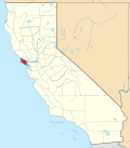
Alto | |
---|---|
Coordinates: 37°54′16″N122°31′32″W / 37.90444°N 122.52556°W | |
Country | United States |
State | California |
County | Marin County |
Metro | San Francisco Bay Area |
Area | |
• Total | 0.13 sq mi (0.33 km2) |
• Land | 0.13 sq mi (0.33 km2) |
• Water | 0.00 sq mi (0.00 km2) 0% |
Elevation | 26 ft (8 m) |
Population (2020) | |
• Total | 732 |
• Density | 5,809.52/sq mi (2,247.56/km2) |
Time zone | UTC-8 (Pacific (PST)) |
• Summer (DST) | UTC-7 (PDT) |
GNIS feature ID | 218191; 2582933 |
U.S. Geological Survey Geographic Names Information System: Alto, California; U.S. Geological Survey Geographic Names Information System: Alto, California |
Alto (Spanish for "Tall") is a census-designated place [3] adjacent to Mill Valley in Marin County, California. [2] It lies at an elevation of 26 feet (8 m). [2] The population was 732 at the 2020 census.
According to the United States Census Bureau, the CDP covered an area of 0.326 square kilometers (0.126 sq mi), all of it land.
Census | Pop. | Note | %± |
---|---|---|---|
2010 | 711 | — | |
2020 | 732 | 3.0% | |
U.S. Decennial Census [4] 1850–1870 [5] [6] 1880-1890 [7] 1900 [8] 1910 [9] 1920 [10] 1930 [11] 1940 [12] 1950 [13] 1960 [14] 1970 [15] 1980 [16] 1990 [17] 2000 [18] 2010 [19] |
At the 2010 census Alto had a population of 711. The population density was 5,654.1 inhabitants per square mile (2,183.1/km2). The racial makeup of Alto was 619 (87.1%) White, 8 (1.1%) African American, 2 (0.3%) Native American, 30 (4.2%) Asian, 1 (0.1%) Pacific Islander, 16 (2.3%) from other races, and 35 (4.9%) from two or more races. Hispanic or Latino of any race were 51 people (7.2%). [20]
The census reported that 100% of the population lived in households.
There were 297 households, 108 (36.4%) had children under the age of 18 living in them, 140 (47.1%) were opposite-sex married couples living together, 34 (11.4%) had a female householder with no husband present, 6 (2.0%) had a male householder with no wife present. There were 17 (5.7%) unmarried opposite-sex partnerships, and 0 (0%) same-sex married couples or partnerships. 33.7% of households were one person and 10.1% were one person aged 65 or older. The average household size was 2.39. There were 180 families (60.6% of households); the average family size was 3.05.
The age distribution was 177 people (24.9%) under the age of 18, 47 people (6.6%) aged 18 to 24, 188 people (26.4%) aged 25 to 44, 236 people (33.2%) aged 45 to 64, and 63 people (8.9%) who were 65 or older. The median age was 41.0 years. For every 100 females, there were 81.8 males. For every 100 females age 18 and over, there were 79.2 males.
There were 313 housing units at an average density of 2,489.1 per square mile, of the occupied units 157 (52.9%) were owner-occupied and 140 (47.1%) were rented. The homeowner vacancy rate was 0.6%; the rental vacancy rate was 4.1%. 60.3% of the population lived in owner-occupied housing units and 39.7% lived in rental housing units.
The community is in the Mill Valley Elementary School District and the Tamalpais Union High School District. [21]
Alpine Village is a census-designated place (CDP) in Alpine County, California, United States. The population was 114 at the 2010 census, down from 136 at the 2000 census.
Bowles is a census-designated place (CDP) in Fresno County, California, United States. The population was 166 at the 2010 census, down from 182 at the 2000 census. Bowles is located 11 miles (18 km) south of downtown Fresno, at an elevation of 279 feet.
Bodfish is a census-designated place (CDP) in the southern Kern River Valley of the Southern Sierra Nevada, in Kern County, California.
Bradley is an unincorporated community and census-designated place (CDP) in Monterey County, California, on the Salinas River 14 miles (23 km) south-southeast of San Ardo and 20 miles (32 km) north of Paso Robles. Bradley sits at an elevation of 548 feet (167 m). The population was 69 at the 2020 census, down from 93 at the 2010 census.
Big River is a census-designated place (CDP) in San Bernardino County, California, United States. The population was 1,084 at the 2020 census, down from 1,327 at the 2010 census.
Bluewater is a census-designated place (CDP) in San Bernardino County, California, United States. The population was 172 at the 2010 census, down from 265 at the 2000 census.
Camp Pendleton South is a census-designated place (CDP) in San Diego County, California, located at the southwest corner of the Marine Corps Base Camp Pendleton. The population was 10,616 at the 2010 census, up from 8,854 at the 2000 census. Much of the population are residents of Camp Pendleton barracks situated in the area, as well as housing communities for married Marine and Navy personnel and their families. It, along with Camp Pendleton Mainside CDP, is one of two CDPs on the base.
China Lake Acres is a census-designated place (CDP) in Kern County, California, United States. The population was 1,876 at the 2010 census, up from 1,761 at the 2000 census.
Carnelian Bay is an unincorporated community on the shore of Lake Tahoe in Placer County, California, United States. The Cornelian Bay post office operated from 1883 to 1887 and from 1891 to 1893. The Carnelian Bay post office opened in 1908.
Bloomfield is a census-designated place in Sonoma County, California, U.S. It is located in a rural area about 11 miles (18 km) southwest of Santa Rosa at the junction of Bloomfield Road and Valley Ford Road. Americano Creek flows westward along the south edge of the town.
Bayview is a census-designated place in Contra Costa County, California. Bayview sits at an elevation of 36 feet. The 2010 United States census reported Bayview's population was 1,754. Prior to 2010, Bayview was part of the Bayview-Montalvin CDP and then separated into the two individual communities of Bayview and Montalvin Manor for the census.
Bear Creek is a census-designated place in Merced County, California. It is located 3.5 miles (5.6 km) east of Merced, at an elevation of 190 feet. The population was 273 at the 2020 United States census, down from 290 at the 2010 census.
Aspen Springs is an unincorporated community and census-designated place (CDP) in Mono County, California, United States. It lies at an elevation of 7,109 feet (2,167 m). The population was 70 at the 2020 census.
Callender is a census-designated place in San Luis Obispo County, California, United States. Callender is located along California State Route 1 south of Arroyo Grande. The population was 1,262 at the 2010 census.
Allendale is a census-designated place (CDP) in Solano County, California, United States. Allendale is located along Interstate 505 6.5 miles (10.5 km) west of Dixon. The population was 1,506 at the 2010 census.
Butte Creek Canyon is an unincorporated community and census-designated place (CDP) in Butte County, California. Butte Creek Canyon sits at an elevation of 1024 feet in the Sierra Nevada foothills. The 2010 United States census reported Butte Creek Canyon's population was 1,086. In November 2018, the Camp Fire destroyed a large portion of the town.
Camino Tassajara is a census-designated place in Contra Costa County, California. Camino Tassajara sits at an elevation of 814 feet (248 m). The 2010 United States census reported Camino Tassajara's population was 2,197.
Carmet is a census-designated place (CDP) in Sonoma County, California. Carmet sits at an elevation of 180 feet (55 m). The 2010 United States census reported Carmet's population was 47.
Airport is a census-designated place (CDP) in Stanislaus County, California. Airport sits at an elevation of 92 feet (28 m). and is located near Modesto City–County Airport. The 2010 United States census reported Airport's population was 1,964.
Cedar Ridge is a census-designated place (CDP) in Tuolumne County, California. Cedar Ridge sits at an elevation of 3,760 feet (1,150 m). The 2010 United States census reported Cedar Ridge's population was 1,132.