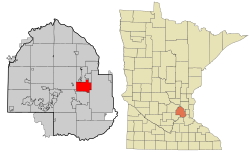
Golden Valley is a western first-ring suburb of Minneapolis in Hennepin County, Minnesota, United States. Its population was 22,552 at the 2020 census,[4] and was estimated to be 21,263 in 2024.[5] The city is mostly residential and is bordered by Interstate 394. Over 15% of it is parks or nature reserves.[7]Minnesota State Highway 55 runs through the city, providing a direct route to downtown Minneapolis.[8]
Golden Valley is the main corporate headquarters of General Mills, a major flour-milling and food-products company originally located in Minneapolis. It is the site of Pentair's U.S. headquarters and local NBC affiliate KARE. The city was also home to the former Minneapolis-Honeywell headquarters, which is now the Resideo Technologies corporate offices.[9]
History
Golden Valley is located on the ancestral lands of the Dakota people.[10]Ojibwe and Sioux tribes had encampments on nearby Medicine Lake. The first white settlers arrived in the early 1850s.[11] Golden Valley was incorporated on December 17, 1886. In the early 20th century, it was mostly a farming community.[12]
Geography
According to the United States Census Bureau, the city has a total area of 10.544 square miles (27.31km2), of which 0.340sqmi (0.88km2) (0.03% or 218 ac) is covered by water.[2] The 45th parallel north runs through Golden Valley, coinciding roughly with Duluth Street.
The chapel at Breck School, a private Episcopal school in Golden Valley
Most children who live in Golden Valley attend school in the Robbinsdale School District ISD #281 or the Hopkins School District ISD #270, as all of the city's territory belongs to one or the other. Some students attend public schools in other districts chosen by their families under Minnesota's open-enrollment statute.[13]
Golden Valley High School was founded in 1957, and the adjacent Golden Valley Middle School opened in 1964.[14] Both closed in the early 1980s after the Golden Valley School District merged with the Hopkins School District. Carl Sandburg Junior High School opened in 1959. In 1988, it became Sandburg Middle School.[15] In 1981, the Breck School, a private Episcopal school, purchased the former Golden Valley High School and Middle School property and moved from Minneapolis to the campus of the former Golden Valley schools.
King of Grace Lutheran School is a Christian preschool, elementary school, and middle school of the Evangelical Lutheran Synod in Golden Valley.[16]
Also, a private elementary Catholic School named Good Shepherd Catholic School changed its name in 2006 from Parkvalley Catholic.
Golden Valley's population is around 22,000, but more than 30,000 people work there,[26] because of the presence of large employers, including General Mills, Honeywell, and Pentair.
Top employers
According to the City's 2023 Annual Comprehensive Financial Report,[27] the largest employers in the city are:
As of the 2023 American Community Survey, an estimated 9,671 households were in Golden Valley, with an average of 2.22 persons per household. The city has a median household income of $114,435. About 8.1% of the city's population lived at or below the poverty line. Golden Valley had an estimated 66.5% employment rate, with 61.7% of the population holding a bachelor's degree or higher and 96.7% holding a high-school diploma.[29]
The top-five reported ancestries (people were allowed to report up to two ancestries, thus the figures generally add to more than 100%) were English (88.4%), Spanish (3.4%), Indo-European (6.1%), Asian and Pacific Islander (1.5%), and other (0.6%).[citation needed]
The median age in the city was 44.3 years.
Golden Valley, Minnesota – racial and ethnic composition Note: the US Census treats Hispanic/Latino as an ethnic category. This table excludes Latinos from the racial categories and assigns them to a separate category. Hispanics/Latinos may be of any race.
As of the 2020 census, 22,552 people, 9,957 households, and 5,829 families were residing in the city.[33] The population density was 2,211.6 inhabitants per square mile (853.9/km2). The 10,495 housing units had an average density of 1,028.5 per square mile (397.1/km2). The racial makeup of the city was 80.64% White, 6.78% African American, 0.36% Native American, 3.78% Asian, 1.55% from some other races, and 6.88% from two or more races. Hispanic or Latino people of any race were 3.80% of the population.[34]
2010 census
As of the 2010 census, 20,371 people, 8,816 households, and 5,417 families lived in the city. The population density was 1,998.2 inhabitants per square mile (771.5/km2). The 9,349 housing units had an average density of 917.47 per square mile (354.2/km2). The racial makeup of the city was 85.37% White, 7.07% African American, 0.42% Native American, 3.55% Asian, 0.88% from some other races and 2.71% from two or more races. Hispanic or Latino people of any race were 2.64% of the population.
Of the 8,816 households, 25.6% had children under 18 living with them, 50.3% were married couples living together, 8.1% had a female householder with no husband present, 3.1% had a male householder with no wife present, and 38.6% were not families. About 30.4% of all households were made up of individuals, and 14.5% had someone living alone who was 65 or older. The average household size was 2.26 and the average family size was 2.84.
The median age in the city was 45.7 years. The age distribution was 19.9% under 18, 5.1% from 18 to 24, 23.7% from 25 to 44, 30.9% from 45 to 64, and 20.3% were 65 or older. The gender makeup of the city was 48.6% male and 51.4% female.
2000 census
As of the 2000 census, 20,281 people, 8,449 households, and 5,508 families were living in the city. The population density was 1,982.3 inhabitants per square mile (765.4/km2). The 8,589 housing units had an average density of 839.5 per square mile (324.1/km2). The racial makeup of the city was 91.07% White, 3.59% African American, 0.29% Native American, 2.87% Asian, 0.58% from some other race, and 1.61% from two or more races. Hispanic or Latino people of any race were 1.76% of the population.
Od the 8,449 households, 26.5% had children under 18 living with them, 55.5% were married couples living together, 7.5% had a female householder with no husband present, and 34.8% were not families; 27.6% of all households were made up of individuals, and 12.1% had someone living alone who was 65 or older. The average household size was 2.31 and the average family size was 2.84.
In the city, the age distribution was 20.6% under 18, 5.0% from 18 to 24, 28.2% from 25 to 44, 26.5% from 45 to 64, and 19.6% who were 65 or older. The median age was 43 years. For every 100 females, there were 93.7 males. For every 100 females 18 and over, there were 89.9 males.
The median income for a household in the city was $62,063, and for a family was $75,899. Males had a median income of $49,890 versus $35,967 for females. The per capita income for the city was $34,094. About 0.8% of families and 3.0% of the population were below the poverty line, including 2.2% of those under 18 and 3.6% of those 65 or over.
Government
Golden Valley is a statutory city, where the mayor votes with the city council, and operates under the council–manager form of government. The city council sets the policy and overall direction for the city, and appoints a city manager to serve as administrator. The city manager directs city staff in carrying out council decisions and providing services.[1]
The mayor serves a four-year term. The four council members serve staggered four-year terms. Two council seats are up for election every two years, in odd-numbered years. The council members run citywide, with no wards. The current mayor is Roslyn Harmon. The current city council includes Sophia Ginis, Maurice Harris, Denise La Mere-Anderson, and Gillian Rosenquist.[1]
This page is based on this Wikipedia article Text is available under the CC BY-SA 4.0 license; additional terms may apply. Images, videos and audio are available under their respective licenses.