The Google Maps pin is the inverted-drop-shaped icon that marks locations in Google Maps. The pin is protected under a U.S. design patent as "teardrop-shaped marker icon including a shadow". [1] [2] Google has used the pin in various graphics, games, and promotional materials.
The pin, sometimes referred to as "the marker", [3] has been widely co-opted by other companies, organizations, and individuals for their own marketing efforts, artwork, and activism. In both digital and physical representations, the pin is often used to symbolize mapping software and the technology industry as a whole.
The Google Maps pin has been called "a product of pure function that has evolved into a cultural phenomenon" [4] and "a solution that would take on a life of its own, recognizable enough to stick up for itself in the art and design projects of others". [5] "Looking like a hot air balloon in flight, this marker has landed squarely in the middle of our visual culture". [6]
In 2014, the Museum of Modern Art acquired a physical representation of the Google Maps pin for its permanent collection. [7] [8] In 2020, the pin icon became the official logo of Google Maps. [9]
Jens Eilstrup Rasmussen designed the Google Maps pin prior to the launch of Google Maps in 2005. He wanted the pin to accurately mark a point on a map without obscuring the location. [4] The main body of the pin is circular at the top, but tapers into a point at the bottom, forming an inverted teardrop shape. A drop shadow extends from the point at the bottom, giving the pin a three-dimensional look.
In the original version of Google Maps, the pin was displayed with the letters "A" through "J" when there was more than one search result. [10] In later versions, the pin was shown with a black dot inside to mark a single location. [11] In 2011, Google released a minor redesign of the pin that changed the black outline of the pin to a dark red for a softer look. [12]
Google has used the pin in online and traditional print marketing campaigns for Google Maps. The pin is displayed as part of the icon for the Google Maps mobile application, on a stylized map along with an uppercase letter "G" for "Google."
The pin has been used on promotional objects like beer glasses, stickers, and coffee cup sleeves in various marketing campaigns. [13] Google has also designed and sold T-shirts that display a Google Maps pin along with the words "I am here". [14]
In 2009, Google launched the Favorite Places marketing campaign. 100,000 local businesses received a store-window decal portraying the Google Maps pin on a map, with the words "We're a Favorite Place on Google." [15] The stickers included a QR code which could be scanned by customers to bring up the business' Place Page in order to leave an online review. [16]
Celebrities including Yo-Yo Ma, [17] Diane von Furstenberg, Al Gore, and Tony Hawk, shared their favorite locations around the world, such as restaurants, bakeries, and design shops. [18] At 30 of these locations, Google erected an 800-pound pin, each personalized with unique designs based on input from the celebrity who chose that location. [19]
In 2013, Google commissioned New York-based graphic designer Matt Delbridge for the Hello World ad campaign. [20] Many of the illustrations incorporated the Google Maps pin along with images associated with specific locations around the world. [21]
In 2010, Google created online cards that used several pins to spell out "Happy Holidays". [22] In 2011, Google doubled the Google Maps pin to create a heart for a Map Your Valentine holiday feature. [23]
In 2011, Google partnered with Susan G. Komen for the Cure to create a campaign called Pink Pin in New York City. Businesses and consumers were asked to pin their locations on the Pink Pin website, share personal stories related to breast cancer awareness, and donate to the cause. [24]
In 2014, Google launched "Smarty Pins", a browser-based geographical trivia game that features the Google Maps pin. [25] Players receive clues about locations around the world, which they then identify by placing the Google Maps pin on a map. Players start the game with 1,000 points, and lose points equivalent to the number of miles they place their pins from the correct location. Bonus points can be gained by answering the trivia questions quickly. [26] [27]
The Google Maps API allows developers to create customized maps, for which they can create their own markers. [6] [28]
Although the Google Maps pin is protected under a U.S. design patent, other organizations have used it as a component of their own logos. [29] [30]
The Labour Party of Malta used an image closely resembling the Google Maps pin as their logo in the 2014 European Parliament election campaign. A Google spokesperson contacted by The Times of Malta would not comment on whether the logo was a breach of Google's intellectual property rights, though a copyright lawyer interviewed for the article explained that the similarity could result in legal repercussions. [31]
In 2010, Facebook filed a trademark application for a design including a marker similar to the Google Maps pin above a representation of a rectangular map, but later abandoned the application. [32]
When Metahaven, an Amsterdam-based studio for design and research, was charged with drafting concepts for WikiLeaks' new visual identity, they considered integrating the Google Maps pin, inverted. [5] This suggested a dripping leak, and the impossibility of pinpointing the source. [33]
In 2013, demonstrators in San Francisco carried signs shaped like the Google Maps pin, bearing the word "evicted" to protest tech-driven evictions in the city. [34] [35]
The Google Maps pin has evolved beyond its original intended use to become quasi-iconic in popular culture. Rob Walker cites the pin as an example of dedigitization, "something from the digital world crossing over to the physical". [5] The pin has been used in various mediums not just to pinpoint locations, but to represent abstracts like mapping technology or even the technology industry as a whole.
Berlin-based conceptual artist Aram Bartholl is known for creating works that examine the relationship between the digital and physical world, using popular imagery from software and games. [36] Beginning in 2006, Bartholl has created a public art installation called Map. [37] Bartholl installs a large physical representation of the Google Maps pin in the exact location that Google Maps identifies as the center of a city. [38] Locations thus far have included Taipei, Berlin, Arles, and Tallinn. Each sculpture remains in place for about three months, usually coinciding with a local art festival or exhibit. [39] The series was designed to raise viewers' awareness of the increasing overlap between the virtual and the physical, and to highlight mapping services' influence on perceptions of location. Bartholl's physical representations of the Google Maps pin urges viewers to reevaluate the information given by digitized maps, the meaning of the "center" of a city, the politicization of boundaries, and other issues related to maps and the digital versus the physical world. [40]
Before the Royal College of Art's 150th-anniversary exhibition in 2007, student Robert Sollis e-mailed Google requesting a temporary Google Maps marker be placed over the college's temporary site in Kensington Gardens. [41] Upon receiving only an auto-reply, Sollis created his own physical marker, which he hoped would appear in satellite images. [42] Sollis constructed the Google Carpet of individual carpet tiles, each 185mm2, which corresponds to one pixel of Google's satellite imagery. [43]
In July 2013, as part of a public art event in Horsens, Denmark, the Icelandic-Danish design duo ÖRNDUVALD installed a mural called Pin at 55°51′42″N9°50′47″E / 55.86167°N 9.84639°E . [44] The 9-square-meter piece, [45] "a giant and shimmering reinterpretation of the Google Maps pin", [46] was made from 10,078 circular discs mounted to plywood. [47] Amanda Kooser of cnet wrote, "if Liberace had been on the Google Maps design team, all the pins would look like this," [48] while Jamie Condliffe stated in Gizmodo, "The Google Maps pin is iconic: bold and simple, yet incredibly memorable. And emblazoned on the side of a Danish building in twinkling metallic form, it might just be the geekiest mural ever." [49]
In June 2012, Taiwanese designer Shu-Chun Hsiao created Project Google Birdhouse by hanging pin-shaped birdhouses around Taipei. [50] [51] He stated, "Google Map had created a remarkable landmark icon, showing the sites on its street views. To search for a landmark with online Google map, we can scroll to zoom from the satellite, soon we'll be able to wander on streets, virtually. Birds, have the most real experience of google map. Birds can fly through the city, through streets. A birdhouse becomes their destination as google map does. The iconic symbol will become a navigating landmark for the flying birds." [52] Jaime Derriger wrote, "The icon that we have all come to know and love which graces our Google maps to let us know where we are, or where we need to go, has become ubiquitous. Designer Shu-Chun Hsiao realized this and created the Google Birdhouse Project, an ongoing project to give birds destinations of their own, just like Google maps does for humans". [53]
Geocaching is an outdoor recreational activity, in which participants use a Global Positioning System (GPS) receiver or mobile device and other navigational techniques to hide and seek containers, called geocaches or caches, at specific locations marked by coordinates all over the world. The first geocache was placed in 2000, and by 2023 there were over 3 million active caches worldwide.
The Tube map is a schematic transport map of the lines, stations and services of the London Underground, known colloquially as "the Tube", hence the map's name. The first schematic Tube map was designed by Harry Beck in 1931. Since then, it has been expanded to include more of London's public transport systems, including the Docklands Light Railway, London Overground, the Elizabeth line, Tramlink, the London Cable Car and Thameslink.
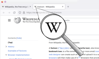
A favicon, also known as a shortcut icon, website icon, tab icon, URL icon, or bookmark icon, is a file containing one or more small icons associated with a particular website or web page. A web designer can create such an icon and upload it to a website by several means, and graphical web browsers will then make use of it. Browsers that provide favicon support typically display a page's favicon in the browser's address bar and next to the page's name in a list of bookmarks. Browsers that support a tabbed document interface typically show a page's favicon next to the page's title on the tab, and site-specific browsers use the favicon as a desktop icon.
Donatella Francesca Versace, sometimes simply referred to mononymously as Donatella, is an Italian fashion designer, Grand Ufficiale dell'Ordine al Merito della Repubblica Italiana and businesswoman, socialite, and model. She is the sister of Gianni Versace, founder of the luxury fashion company Versace, with whom she worked closely on the development of the brand and in particular its combining of Italian luxury with pop culture and celebrity.
Frank Shepard Fairey is an American contemporary artist, activist and founder of OBEY Clothing who emerged from the skateboarding scene. In 1989 he designed the "Andre the Giant Has a Posse" (...OBEY...) sticker campaign while attending the Rhode Island School of Design (RISD).
Smarties are color-varied, sugar-coated, dragée chocolate confectionery. They have been manufactured since 1937, originally by H.I. Rowntree & Company in the United Kingdom, and now by Nestlé.
Gianni Versace S.r.l., usually referred to as Versace, is an Italian luxury fashion company founded by Gianni Versace in 1978. The company produces Italian-made ready-to-wear and accessories, as well as haute couture under its Atelier Versace brand and licenses its name and branding to Luxottica for eyewear. Gianni Versace being a native of Calabria, in the ancient Magna Grecia, the company logo is inspired by Medusa, a figure from Greek mythology.
Google Maps is a web mapping platform and consumer application offered by Google. It offers satellite imagery, aerial photography, street maps, 360° interactive panoramic views of streets, real-time traffic conditions, and route planning for traveling by foot, car, bike, air and public transportation. As of 2020, Google Maps was being used by over one billion people every month around the world.
Andrew Reynolds is an American professional skateboarder known for co-founding Baker Skateboards in 2000 with artist Jay Strickland. He is now Baker Skateboard's sole owner. Reynolds established Bakerboys Distribution with Erik Ellington and Jim Greco in 2007. Bakerboys Distribution provides distribution for closely related in-house skateboard companies such as Deathwish Skateboards and Shake Junt. He is also the head of design at Altamont Apparel. Reynolds primarily skates street. He has been called one of the most influential skaters of all time.
Google Earth is a computer program that renders a 3D representation of Earth based primarily on satellite imagery. The program maps the Earth by superimposing satellite images, aerial photography, and GIS data onto a 3D globe, allowing users to see cities and landscapes from various angles. Users can explore the globe by entering addresses and coordinates, or by using a keyboard or mouse. The program can also be downloaded on a smartphone or tablet, using a touch screen or stylus to navigate. Users may use the program to add their own data using Keyhole Markup Language and upload them through various sources, such as forums or blogs. Google Earth is able to show various kinds of images overlaid on the surface of the Earth and is also a Web Map Service client. In 2019, Google revealed that Google Earth now covers more than 97 percent of the world, and has captured 10 million miles of Street View imagery.
Smarties Candy Company is a confectionery company well known for its namesake candy, Smarties. Edward "Eddie" Dee founded Ce De Candy in Bloomfield, New Jersey, in 1949. Dee emigrated from England to the United States.
Google Street View is a technology featured in Google Maps and Google Earth that provides interactive panoramas from positions along many streets in the world. It was launched in 2007 in several cities in the United States, and has since expanded to include all of the country's major and minor cities, as well as the cities and rural areas of many other countries worldwide. Streets with Street View imagery available are shown as clickable blue lines on Google Maps.
Aram Bartholl is a Berlin-based conceptual artist known for his examination of the relationship between the digital and physical world. His works often deal with anonymity and privacy. Aram Bartholl is currently Professor for art with digital media at HAW Hamburg.
Waze Mobile Ltd, doing business as Waze, formerly FreeMap Israel, is a subsidiary company of Google that provides satellite navigation software on smartphones and other computers that support the Global Positioning System (GPS). In addition to turn-by-turn navigation, it incorporates user-submitted travel times and route details while downloading location-dependent information over a cellular network. Waze describes its application as a community-driven initiative that is free to download and use.
The following is a timeline for Google Street View, a technology implemented in Google Maps and Google Earth that provides ground-level interactive panoramas of cities. The service was first introduced in the United States on May 25, 2007, and initially covered only five cities: San Francisco, Las Vegas, Denver, Miami, and New York City. By the end of 2008, Street View had full coverage available for all of the major and minor cities in the continental United States, and had started expanding its scope to include some of the country's national parks, as well as cities elsewhere in the world. For the first year and a half of its existence, Street View featured camera icon markers, each representing at least one major city or area. By its 10th anniversary, the Street View service had provided imagery for more than 10 million miles' worth of roads across 83 countries worldwide.
American entertainer Jennifer Lopez wore a green Versace silk chiffon dress to the 42nd Grammy Awards ceremony on February 23, 2000. The sheer fabric was printed with a tropical leaf and bamboo pattern, and cut with a very low neckline that extended well past Lopez's navel, while the waist of the dress was studded with citrines.
David Datuna was a Georgian-born American artist who lived in New York City. His Viewpoint of Millions series explores the sources and meaning of cultural identity from different points of view.
Kabalagala is a neighbourhood in Kampala, the capital and largest city in Uganda. It houses some of the leading partygoers in the city. It is located next to Nsambya where the American Embassy in Uganda is found.
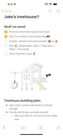
Notes is a notetaking app developed by Apple Inc. It is provided on the company's iOS, iPadOS, visionOS, and macOS operating systems, the latter starting with OS X Mountain Lion. It functions as a service for making short text notes, which can be synchronized between devices using Apple's iCloud service. The application uses a similar interface on iOS and macOS, with a non-textured paper background for notes and light yellow icons, suggesting pencil or crayon. Until 2013, both applications used a strongly skeuomorphic interface, with a lined, textured paper design; the Mountain Lion version placed this inside a leather folder. This design was replaced in OS X Mavericks and iOS 7.

Jens Eilstrup Rasmussen is a Danish software engineer, technology executive, and co-founder of Where 2 Technologies which led to Google Maps.
Denis Campbell IT Services
Jeanine Rizzo
Pin (55° 51′ 42″ N; 9° 50′ 47″ E)