Index of New Mexico–related articles

Last updated

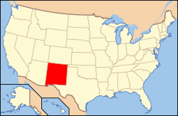
The location of the state of New Mexico in the United States of America Map of USA NM.svg
The location of the state of New Mexico in the United States of America

The following is an alphabetical list of articles related to the U.S. state of New Mexico .

Contents

0–9

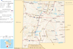
An enlargeable map of the state of New Mexico Map of New Mexico NA.png
An enlargeable map of the state of New Mexico

A

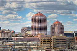
Albuquerque, New Mexico Abqdowntown.jpg
Albuquerque, New Mexico
American black bear Black bear large.jpg
American black bear

B

Bandelier National Monument Bandelier cliff.jpg
Bandelier National Monument

C

The New Mexico State Capitol in Santa Fe NewMexicoCapitolSantaFe.jpg
The New Mexico State Capitol in Santa Fe
An enlargeable map of the 33 counties of the State of New Mexico New Mexico counties map.png
An enlargeable map of the 33 counties of the State of New Mexico
The Cumbres and Toltec Scenic Railroad Cumbres & Toltec Scenic Railroad excursion train headed by locomotive 484 in 2015.jpg
The Cumbres and Toltec Scenic Railroad

D

E

F

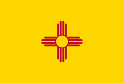
The Flag of the State of New Mexico Flag of New Mexico.svg
The Flag of the State of New Mexico

G

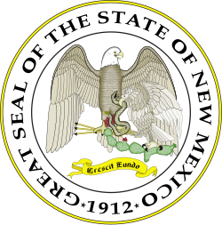
The Great Seal of the State of New Mexico Seal of New Mexico.svg
The Great Seal of the State of New Mexico

H

I

J

K

L

Las Cruces, New Mexico Las Cruces.jpg
Las Cruces, New Mexico

List of dams and reservoirs in New Mexico

M

N

New Mexico spadefoot toad Nmspadefoot.jpg
New Mexico spadefoot toad

O

P

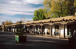
The Palace of the Governors in Santa Fe NewMexicoPalaceSantaFe.jpg
The Palace of the Governors in Santa Fe
The Pecos River near Villanueva, New Mexico Pecosriver.JPG
The Pecos River near Villanueva, New Mexico
Pinto beans Pinto bean.jpg
Pinto beans

R

Rio Grande cutthroat trout Rio Grande Cutthroat Trout Alamosa watershed.jpg
Rio Grande cutthroat trout
The Rio Grande Gorge Bridge NMtrip-05-026.jpg
The Rio Grande Gorge Bridge

S

The Sacramento Mountains of southern New Mexico SacramentoMtnsNM.jpg
The Sacramento Mountains of southern New Mexico
The San Miguel Mission in Santa Fe is the oldest extant church in the United States Santa Fe San miguel chapel.jpg
The San Miguel Mission in Santa Fe is the oldest extant church in the United States

T

Plaza la Fonda in Taos Taos plaza la fonda.jpg
Plaza la Fonda in Taos

U

V

The Very Large Array USA.NM.VeryLargeArray.02.jpg
The Very Large Array

W

Wheeler Peak, the highest point in the State of New Mexico Wheeler Peak 2006.jpg
Wheeler Peak, the highest point in the State of New Mexico

X

Y

Z

Zozobra Zozobra Commencement.jpg
Zozobra

See also

Related Research Articles

<span class="mw-page-title-main">Santa Fe de Nuevo México</span> Provincial kingdom of New Spain (1598–1821); territory of Mexico (1821–48)

Santa Fe de Nuevo México was a province of the Spanish Empire and New Spain, and later a territory of independent Mexico. The first capital was San Juan de los Caballeros from 1598 until 1610, and from 1610 onward the capital was La Villa Real de la Santa Fe de San Francisco de Asís.

<span class="mw-page-title-main">Mexican Cession</span> Land the U.S. acquired from Mexico following the war in 1848

The Mexican Cession is the region in the modern-day western United States that Mexico previously controlled, then ceded to the United States in the Treaty of Guadalupe Hidalgo in 1848 after the Mexican–American War. This region had not been part of the areas east of the Rio Grande that had been claimed by the Republic of Texas, which had been claiming independence since its Texas Revolution of 1836 and subsequent brief war for independence, followed afterwards a decade later by the American annexation and admitted statehood in 1845. It had not specified the southern and western boundary of the new state of Texas with New Mexico consisting of roughly 529,000 square miles (1,370,000 km2), not including any Texas lands, the Mexican Cession was the third-largest acquisition of territory in U.S. history, surpassed only by the 827,000-square-mile (2,140,000 km2) Louisiana Purchase of 1803 and the later 586,000-square-mile (1,520,000 km2) Alaska Purchase from Russia in 1867.

<span class="mw-page-title-main">Kasha-Katuwe Tent Rocks National Monument</span> United States National Monument

Kasha-Katuwe Tent Rocks National Monument is a U.S. National Monument located approximately 40 miles (64 km) southwest of Santa Fe, New Mexico, near Cochiti Pueblo. Managed by the Bureau of Land Management (BLM), it was established as a U.S. National Monument by President Bill Clinton in January 2001. Kasha-Katuwe means "white cliffs" in the Pueblo language Keresan. The monument is a unit of the BLM's National Conservation Lands. The monument closed in 2020 due to Covid and has yet to reopen.

<span class="mw-page-title-main">Pecos National Historical Park</span> National Historical Park of the United States

Pecos National Historical Park is a United States National Historical Park in San Miguel County, New Mexico. The park, operated by the National Park Service, encompasses thousands of acres of landscape infused with historical elements from prehistoric archaeological ruins to 19th-century ranches, to a battlefield of the American Civil War. Its largest single feature is Pecos Pueblo also known as Cicuye Pueblo, a Native American community abandoned in historic times. First a state monument in 1935, it was made Pecos National Monument in 1965, and greatly enlarged and renamed in 1990. Two sites within the park, the pueblo and the Glorieta Pass Battlefield, are National Historic Landmarks.

<span class="mw-page-title-main">Palace of the Governors</span> Historic house in New Mexico, United States

The Palace of the Governors is an adobe structure built in the Territorial Style of Pueblo architecture on Palace Avenue in Santa Fe, New Mexico. Located within the Santa Fe Historic District along the Santa Fe Plaza between Lincoln and Washington avenues, it served as the seat of government for New Mexico for centuries, having been established as the capitol building of Nuevo México in 1610. It was New Mexico's seat of government until 1901.

<span class="mw-page-title-main">Index of Arizona-related articles</span>

The following is an alphabetical list of articles related to the U.S. state of Arizona.

The history of New Mexico is based on archaeological evidence, attesting to the varying cultures of humans occupying the area of New Mexico since approximately 9200 BCE, and written records. The earliest peoples had migrated from northern areas of North America after leaving Siberia via the Bering Land Bridge. Artifacts and architecture demonstrate ancient complex cultures in this region.

<span class="mw-page-title-main">Camino Real de Tierra Adentro</span> Northernmost of Mexico Citys four "royal roads"

El Camino Real de Tierra Adentro, also known as the Silver Route, was a Spanish 2,560-kilometre-long (1,590 mi) road between Mexico City and San Juan Pueblo, New Mexico, that was used from 1598 to 1882. It was the northernmost of the four major "royal roads" that linked Mexico City to its major tributaries during and after the Spanish colonial era.

<span class="mw-page-title-main">Index of Colorado-related articles</span>

This is an alphabetical list of articles related to the U.S. State of Colorado.

<span class="mw-page-title-main">Index of Utah-related articles</span>

The following is an alphabetical list of articles related to the U.S. state of Utah.

<span class="mw-page-title-main">Index of Montana-related articles</span>

The following is an alphabetical list of articles related to the U.S. state of Montana.

<span class="mw-page-title-main">Index of California-related articles</span>

The following is an alphabetical list of articles related to the U.S. state of California.

<span class="mw-page-title-main">San Gabriel de Yungue-Ouinge</span> United States historic place

San Gabriel de Yungue-Ouinge, or San Gabriel de Yunque, was the site of the first Spanish capital of its provincial territory of Santa Fe de Nuevo México. It is located where the Rio Chama meets the Rio Grande, west of present-day Ohkay Owingeh, New Mexico. The pueblo of Yuque Yunque was taken by Juan de Oñate, and he founded his colonial government there. It was moved to Santa Fe in 1610. The site was declared a National Historic Landmark in 1964. The archaeological site was leveled and plowed over in 1984, and a historical marker has been placed on the west side of the Rio Grande, off the old New Mexico State Road 74.

<span class="mw-page-title-main">Santa Fe, New Mexico</span> Capital city of New Mexico, United States

Santa Fe is the capital of the U.S. state of New Mexico, and the county seat of Santa Fe County. With over 89,000 residents, Santa Fe is the fourth-most populous city in the state, and part of the Albuquerque–Santa Fe–Los Alamos combined statistical area, which had a population of 1,162,523 in 2020. Situated at the foothills of the Sangre de Cristo Mountains, the city is at the highest altitude of any U.S. state capital, with an elevation of 7,199 feet.

<span class="mw-page-title-main">Outline of Colorado</span> Overview of and topical guide to Colorado

The following outline is provided as an overview of and topical guide to the U.S. state of Colorado:

<span class="mw-page-title-main">Outline of New Mexico</span> Overview of and topical guide to New Mexico

The following outline is provided as an overview of and topical guide to the U.S. state of New Mexico:

<span class="mw-page-title-main">Northern Rio Grande National Heritage Area</span> United States National Heritage Area in New Mexico

Northern Rio Grande National Heritage Area is a federally designated National Heritage Area in the U.S. state of New Mexico. The national heritage area includes a section of the upper Rio Grande Valley that has been inhabited by the Puebloan peoples since the early Pre-Columbian era.

This timeline is a chronology of significant events in the history of the US State of New Mexico and the historical area that is now occupied by the state.