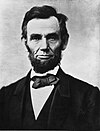
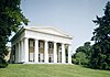
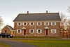
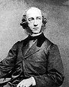
Marker title Image Date dedicated Location Marker type Topics Aaron Siskind (1903-1991) October 29, 2004 28 E. Swamp Rd. (Pa. 313) east of Pa. 611, Doylestown (Cross Keys) 40°19′37″N 75°07′39″W / 40.327°N 75.12755°W / 40.327; -75.12755 (Aaron Siskind ) Roadside Artists, Professions & Vocations Abraham Lincoln 1991 Near intersection of Bristol Pike & Pond St., Bristol City Abraham Lincoln, Government & Politics, Government & Politics 19th Century Andalusia November 1, 2001 1237 State Road, Andalusia (Bensalem Township) 40°03′56″N 74°57′42″W / 40.0656°N 74.9618°W / 40.0656; -74.9618 (Andalusia ) Roadside Agriculture, Buildings, Business & Industry, Government & Politics, Government & Politics 19th Century, Professions & Vocations, Writers Bogart's Tavern June 28, 2003 Route 263 and Route 413, Buckingham 40°19′25″N 75°03′38″W / 40.32357°N 75.06042°W / 40.32357; -75.06042 (Bogart's Tavern ) City American Revolution, Government & Politics, Military, Inns & Taverns Bristol n/a Old U.S. 13 SR 2002 (Missing) Roadside Cities & Towns, Early Settlement, Government & Politics Bristol n/a Old U.S. 13 SR 2002 (Missing) Roadside Cities & Towns, Early Settlement, Government & Politics Bristol January 13, 1949 Old US 13 at Otter Rd., S of Bristol 40°05′50″N 74°52′13″W / 40.09717°N 74.87041°W / 40.09717; -74.87041 (Bristol ) Roadside Cities & Towns, Early Settlement, Government & Politics 17th Century, Transportation Bristol n/a Old U.S. 13 N of Bristol (Missing) Roadside Cities & Towns Buckingham Meeting House March 26, 1947 U.S. 202 NE of Buckingham (Missing) Roadside American Revolution, Buildings, Houses & Homesteads, Military, Religion Bucks County October 29, 1982 Courthouse, E. Court St., Doylestown 40°18′43″N 75°07′47″W / 40.31203°N 75.12965°W / 40.31203; -75.12965 (Bucks County ) City Government & Politics, Government & Politics 17th Century, William Penn Casimir Sienkiewicz (1890-1974) October 20, 2006 202 E. Court St., Doylestown 40°18′52″N 75°07′37″W / 40.31442°N 75.12687°W / 40.31442; -75.12687 (Casimir Sienkiewicz ) Roadside Artists, Business & Industry, Ethnic & Immigration Charles Sheeler May 29, 1999 39 Mercer Ave. at Center St., Doylestown 40°19′32″N 75°07′38″W / 40.32555°N 75.12733°W / 40.32555; -75.12733 (Charles Sheeler ) City Artists Delaware Canal January 18, 1949 Pa. 32 near marker 894 (Missing) Roadside Canals, Navigation, Transportation Delaware Canal January 18, 1949 U.S. 13 at Bristol, South Side (Missing) Roadside Canals, Navigation, Transportation Delaware Canal January 18, 1949 U.S. 13 at Bristol, North Side (Missing) Roadside Canals, Navigation, Transportation Delaware Canal January 24, 1949 Pa. 611 at Durham Furnace Roadside Canals, Navigation, Transportation Delaware Canal January 21, 1949 near covered bridge on Uhlerstown Hill Rd., ~ 1/4 mile west of Pa. 32 at Uhlerstown Roadside Canals, Navigation, Transportation Delaware Canal January 21, 1949 Pa. 32 at Tinicum (Missing) Roadside Canals, Navigation, Transportation Delaware Canal January 20, 1949 Pa. 32, just S of Pa. 232 at New Hope Roadside Canals, Navigation, Transportation Delaware Canal January 20, 1949 Pa. 32 at Lumberville Roadside Canals, Navigation, Transportation Delaware Canal January 18, 1949 Pa. 32, 2.3 miles N of Washington Crossing at Jericho Creek (Missing) Roadside Canals, Navigation, Transportation Delaware Canal January 10, 1949 Pa. 32, 50 ft. N of Pa. 232 at New Hope 40°21′30″N 74°56′57″W / 40.3584°N 74.9492°W / 40.3584; -74.9492 (Delaware Canal ) Roadside Canals, Navigation, Transportation Doan Gang (The) November 5, 2005 4914A Point Pleasant Pike, Gardenville, @ Friends Mtg. House 40°22′03″N 75°06′53″W / 40.36743°N 75.11468°W / 40.36743; -75.11468 (Doan Gang (The) ) Roadside American Revolution, Government & Politics 18th Century Doylestown Agricultural Works October 23, 2003 Ashland St. near Main, Doylestown 40°18′27″N 75°07′48″W / 40.3074°N 75.1301°W / 40.3074; -75.1301 (Doylestown Agricultural Works ) Roadside Agriculture, Business & Industry, Iron Durham Furnace November 21, 1947 Pa. 212 at Durham 40°34′26″N 75°13′29″W / 40.57397°N 75.2247°W / 40.57397; -75.2247 (Durham Furnace ) Roadside American Revolution, Business & Industry, Furnaces, Military Durham Road Milestone October 28, 1988 Pa. 413, 1 mile S of Newtown 40°12′51″N 74°55′53″W / 40.21408°N 74.93125°W / 40.21408; -74.93125 (Durham Road Milestone ) Roadside Roads, Transportation Edward Hicks September 6, 1997 122 Penn St., Newtown 40°13′35″N 74°56′05″W / 40.22642°N 74.9348°W / 40.22642; -74.9348 (Edward Hicks ) City Artists Famous Indian Walk (The) - PLAQUE October 23, 1925 PA 412, ~ a mile SW of Springtown (plaque missing) Plaque Government & Politics 18th Century, Native American, William Penn First Weather Satellite, The September 20, 2001 State & Sterling Streets, Newtown 40°13′27″N 74°56′10″W / 40.22403°N 74.93602°W / 40.22403; -74.93602 (First Weather Satellite, The ) City Business & Industry, Environment, Invention Fries Rebellion of 1799, The May 16, 2003 Main & Broad Sts., Quakertown 40°24′09″N 75°21′09″W / 40.40237°N 75.35245°W / 40.40237; -75.35245 (Fries Rebellion of 1799, The ) City Agriculture, Ethnic & Immigration, Government & Politics, Government & Politics 18th Century, Military Gallows Hill - PLAQUE November 1, 1925 Intersection PA 412 & SR 4075 (Gallows Hill Rd.), Stony Point 40°31′52″N 75°13′22″W / 40.53117°N 75.22283°W / 40.53117; -75.22283 (Gallows Hill - PLAQUE ) Plaque Native American, Paths & Trails Henry Chapman Mercer October 17, 1998 Pa. 313 in front of Tile Works, Doylestown 40°19′26″N 75°07′19″W / 40.32378°N 75.12208°W / 40.32378; -75.12208 (Henry Chapman Mercer ) Roadside Artists, Buildings, Business & Industry, Invention, Professions & Vocations Historic Fallsington June 3, 1961 SR 2020 (Tyburn Rd.) at SR 2026 (New Falls Road), Fallingston (Missing) Roadside Buildings, Cities & Towns, Early Settlement, Government & Politics, Government & Politics 17th Century, Religion, William Penn Historic Fallsington June 3, 1961 U.S. 1 at intersection LR 09136, south side of highway (Missing) Roadside Early Settlement, Government & Politics, Government & Politics 17th Century, Religion, William Penn Historic Fallsington June 3, 1961 Business US 1 at SR 2020 (Tyburn Rd.) Roadside Early Settlement, Government & Politics, Government & Politics 17th Century, Religion, William Penn Honey Hollow Watershed September 20, 1997 Rte. 232, Solebury Twp. Roadside Agriculture, Environment James A. Michener October 29, 1999 East Court St. near Broad St., Doylestown 40°18′45″N 75°07′44″W / 40.31242°N 75.12893°W / 40.31242; -75.12893 (James A. Michener ) Roadside Writers John Fitch 's Steamboat October 23, 1947 Jct. Pa. 132 & 263, Warminster 40°12′24″N 75°05′58″W / 40.2068°N 75.0995°W / 40.2068; -75.0995 (John Fitch's Steamboat ) Roadside Business & Industry, Invention, Professions & Vocations, Transportation Johnsville Naval Air Development Center November 11, 1998 E Street Rd., 200 yds. N of Newton Rd., Warminster 40°11′35″N 75°04′31″W / 40.19295°N 75.07532°W / 40.19295; -75.07532 (Johnsville Naval Air Development Center ) Roadside Business & Industry, Military, Military Post-Civil War Joseph Ridgway Grundy (1863-1961) October 18, 2008 610-680 Radcliffe St., Bristol 40°05′52″N 74°51′01″W / 40.0977°N 74.8504°W / 40.0977; -74.8504 (Joseph Ridgway Grundy ) Roadside Business & Industry, Government & Politics 20th Century, Publishing Katharine Drexel (1858-1955) October 2, 2004 1663 Bristol Pike, Bensalem 40°04′23″N 74°57′28″W / 40.0731°N 74.9577°W / 40.0731; -74.9577 (Katharine Drexel ) Roadside African American, Education, Native American, Religion, Women Langhorne Speedway October 14, 2006 1939 E Lincoln Hwy., Langhorne 40°10′33″N 74°53′09″W / 40.17597°N 74.8858°W / 40.17597; -74.8858 (Langhorne Speedway ) Roadside Sports Levittown November 28, 1992 Levittown Parkway at U.S. 13, Levittown 40°08′29″N 74°49′06″W / 40.1414°N 74.8183°W / 40.1414; -74.8183 (Levittown ) Roadside Buildings, Business & Industry, Cities & Towns Log College October 26, 2008 Between 800 and 886 N York Rd. (PA 263), near Tennyson Dr., across from Log College Manor, Warminster 40°12′53″N 75°05′58″W / 40.21481°N 75.09941°W / 40.21481; -75.09941 (Log College ) Roadside Early Settlement, Education, Religion Loyalist Raid of 1778 September 20, 2001 State & Mercer Streets, Newtown 40°13′39″N 74°56′13″W / 40.22737°N 74.93688°W / 40.22737; -74.93688 (Loyalist Raid of 1778 ) City American Revolution, Military, Inns & Taverns Margaret Mead June 22, 1996 225 W. Court St., Doylestown 40°18′25″N 75°08′06″W / 40.30682°N 75.13513°W / 40.30682; -75.13513 (Margaret Mead ) City Medicine & Science, Women, Writers Martin Johnson Heade (1819-1904) October 14, 2000 Rte. 32, Lumberville, in front of Lumberville General store 40°24′24″N 75°02′14″W / 40.40653°N 75.03715°W / 40.40653; -75.03715 (Martin Johnson Heade ) City Artists Moland House October 21, 1947 1641 Old York Rd., Hartsville 40°14′55″N 75°05′34″W / 40.2486°N 75.0927°W / 40.2486; -75.0927 (Moland House ) Roadside American Revolution, George Washington, Military Mollie Woods Hare (1881-1956) April 13, 2010 At entrance to Woods Services, between 321 and 335 S Bellevue Ave., Langhorne 40°10′23″N 74°55′08″W / 40.1731°N 74.9188°W / 40.1731; -74.9188 (Mollie Woods Hare ) Roadside Education, Medicine & Science, Women Oscar Hammerstein II July 18, 1994 E State St. (Bus. 202) at East Rd., Doylestown 40°18′46″N 75°06′51″W / 40.31273°N 75.11408°W / 40.31273; -75.11408 (Oscar Hammerstein II ) Roadside Music & Theater Pearl S. Buck June 25, 1995 Green Hills Farm, 520 Dublin Road, Perkasie Roadside Women, Writers Pennsbury 1948 At site, E of Tullytown Roadside Government & Politics, Government & Politics 17th Century, William Penn Pennsbury Manor October 8, 1951 SR 2020 (Tyburn Rd.) S of Fallsington; SR 2059 (New Ford Rd.) at SR 2020 Roadside Government & Politics, Government & Politics 17th Century, William Penn Pennsbury Manor November 11, 1949 SR 2055 (old U.S. 13) Tullytown, near junction SR 2059 40°08′34″N 74°48′40″W / 40.1427°N 74.8112°W / 40.1427; -74.8112 (Pennsbury Manor ) Roadside Government & Politics, Government & Politics 17th Century, William Penn Pennsylvania November 11, 1949 PA 413, .4 miles west of bridge at state line, Bristol 40°05′06″N 74°52′16″W / 40.08501°N 74.87121°W / 40.08501; -74.87121 (Pennsylvania ) Roadside Government & Politics, Government & Politics 17th Century, William Penn Pennsylvania November 11, 1949 U.S. 1, approx. 300 yards west of Delaware River Bridge (MISSING) Roadside Government & Politics, Government & Politics 17th Century, William Penn Pennsylvania November 11, 1949 Bridge St. (Old US 1 / Rt. 32), at Central Ave., 1 block from Delaware River, Morrisville 40°12′36″N 74°46′18″W / 40.2101°N 74.77171°W / 40.2101; -74.77171 (Pennsylvania ) Roadside Government & Politics, Government & Politics 17th Century, William Penn Pennsylvania Canal January 10, 1949 Pa. 32, 3.5 miles N of New Hope Roadside Canals, Navigation, Transportation Pennsylvania Canal January 7, 1949 Pa. 611 at Durham Furnace (MISSING) Roadside Canals, Navigation, Transportation Pennsylvania Canal January 10, 1949 River Rd. (PA 32) at Old Carversville Rd., Lumberville 40°24′26″N 75°02′19″W / 40.4073°N 75.03867°W / 40.4073; -75.03867 (Pennsylvania Canal ) Roadside Canals, Navigation, Transportation Pennsylvania Canal December 14, 1948 Pa. 532 W of Washington Crossing (MISSING) Roadside Canals, Navigation, Transportation Playwicky Indian Town , 1682 - PLAQUE October 1925 PA 213 (Bridgetown Pike), .5 mile from Neshaminy Creek & 2.5 miles W of Langhorne Plaque Early Settlement, Government & Politics 17th Century, Native American, William Penn Revolutionary War Burial Site November 11, 1999 Intersection of Bellevue & Flowers Ave., Langhorne Borough 40°10′26″N 74°55′09″W / 40.1739°N 74.91922°W / 40.1739; -74.91922 (Revolutionary War Burial Site ) Roadside American Revolution, George Washington, Military Richard Moore September 14, 2019 401 South Main Street, Quakertown [2] City African American, Houses & Homesteads, Religion, Underground Railroad Richboro Nike Missile Battery PH-07 October 5, 2007 Northampton Twp. Rec. Ctr., Rt. 332, Richboro Roadside Government & Politics 20th Century, Military, Military Post-Civil War Rochambeau Route October 18, 1954 Bristol Pike (Rt. 13) & Mill Rd., Bensalem 40°03′54″N 74°58′50″W / 40.0651°N 74.9805°W / 40.0651; -74.9805 (Rochambeau Route ) Roadside American Revolution, George Washington, Military, Transportation Samuel D. Ingham October 21, 1947 U.S. 202, 1.5 miles W of New Hope Roadside Business & Industry, Canals, Coal, Government & Politics, Government & Politics 18th Century, Professions & Vocations Summerseat January 27, 1949 At site, Legion Ave., near Hillcrest Ave., Morrisville Roadside American Revolution, George Washington, Military Treasure Island Reservation June 25, 1989 Pa. 32, 3.5 miles N of Point Pleasant 40°28′16″N 75°04′11″W / 40.47102°N 75.06973°W / 40.47102; -75.06973 (Treasure Island Reservation ) Roadside Education, Native American, Sports Trevose October 29, 1946 U.S. 1, 3.5 miles W of S. Langhorne (Missing) City Government & Politics, Government & Politics 17th Century, William Penn W. Atlee Burpee October 4, 2000 Burpee Park, Church St. near E Oakland Ave. (Rt. 202), Doylestown 40°18′39″N 75°07′30″W / 40.31088°N 75.12505°W / 40.31088; -75.12505 (W. Atlee Burpee ) City Agriculture, Business & Industry, Entrepreneurs, Invention W.W.H. Davis October 19, 2001 60 E. Court Street, Doylestown 40°18′43″N 75°07′45″W / 40.31207°N 75.12928°W / 40.31207; -75.12928 (W.W.H. Davis ) City Civil War, Government & Politics, Government & Politics 19th Century, Military, Professions & Vocations, Writers Walking Purchase January 7, 1949 PA 412 off PA 212, near Moyer Rd., ~1.5 mi. SW of Springtown 40°32′45″N 75°18′13″W / 40.54597°N 75.30358°W / 40.54597; -75.30358 (Walking Purchase ) Roadside Early Settlement, Government & Politics 18th Century, Native American, William Penn Walking Purchase January 4, 1949 Pa. 611 at Ottsville Roadside Early Settlement, Government & Politics 18th Century, Native American, William Penn Walking Purchase January 10, 1949 Pa. 413 at Penn Park Rd., near Wrightstown (in yard of Friends Mtg. House beside 10' tall brown stone) Roadside Government & Politics, Government & Politics 17th Century, Native American Walking Purchase January 7, 1949 PA 413 at Wrightstown (Missing) Roadside Government & Politics, Government & Politics 18th Century, Native American Walking Purchase January 4, 1949 Pa. 611, .5 mile N of Ottsville (Missing) Roadside Government & Politics, Government & Politics 18th Century, Native American Walking Purchase January 7, 1949 PA 412, SW of Springtown Roadside Government & Politics 18th Century, Native American, William Penn Washington Crossing November 17, 1947 Pa. 532 at Washington Crossing Roadside American Revolution, George Washington, Military William Penn 's First Walking Purchase October 13, 2001 Jericho Creek @ intersection of River & Taylorsville Rds., Washington Crossing Roadside Early Settlement, Government & Politics, Native American, Paths & Trails, Transportation, William Penn