A sounding rocket or rocketsonde, sometimes called a research rocket or a suborbital rocket, is an instrument-carrying rocket designed to take measurements and perform scientific experiments during its sub-orbital flight. The rockets are used to launch instruments from 48 to 145 km above the surface of the Earth, the altitude generally between weather balloons and satellites; the maximum altitude for balloons is about 40 km and the minimum for satellites is approximately 121 km. Certain sounding rockets have an apogee between 1,000 and 1,500 km, such as the Black Brant X and XII, which is the maximum apogee of their class. Sounding rockets often use military surplus rocket motors. NASA routinely flies the Terrier Mk 70 boosted Improved Orion, lifting 270–450-kg (600–1,000-pound) payloads into the exoatmospheric region between 97 and 201 km.

The Institute of Space Technology is a public university located in Islamabad, Pakistan. It is focused on the study of astronomy, aerospace engineering, avionics engineering and astronautics.

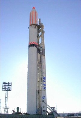
Badr-1 was the first artificial and the first digital communications satellite launched by Pakistan's national space authority — the SUPARCO — in 1990. The Badr-1 was Pakistan's first indigenously developed and manufactured digital communications and an experimental artificial satellite which was launched into low Earth orbit by Pakistan on 16 July 1990, through a Chinese carrier rocket. The launch ushered new military, technological, and scientific developments in Pakistan and also provided data on radio-signal distribution in the ionosphere. Originally planned to be launched from the United States in 1986, the Challenger disaster further delayed the launch of the satellite which changed the plan. After the People's Republic of China offered Pakistan to use its facility, the Badr-1 was finally launched from Xichang Satellite Launch Center in 1990 on Long March 2E. Badr-1 travelled at 17,500 miles per hour (28,200 km/h), taking 96.3 minutes to complete an orbit, and emitted radio signals at the 145 to 435 MHz bands which were operated by Pakistan Amateur Radio Society (PARS). The Badr-1 successfully completed its designed life, and a new satellite was proposed to be developed.

The Space & Upper Atmosphere Research Commission, commonly referred to as SUPARCO, is the national space agency of Pakistan.
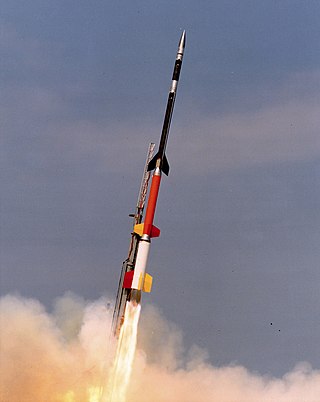
Rehbar is a series of sounding rockets launched into the upper atmosphere by Pakistan's Space and Upper Atmosphere Research Commission (SUPARCO). Rehbar-I was the first rocket launched by SUPARCO, on 7 June 1962. Rehbar-I was a two-staged solid fuel rocket.
Paksat-1,, was a geosynchronous and communications satellite built and owned by the Boeing Company, leased to the Space & Upper Atmosphere Research Commission (SUPARCO) and renamed Paksat-1. It was successfully put on orbit on 1 February 1996 as Palapa-C1 for Indonesia as its original customer. But, after the technical problems, the satellite was leased to SUPARCO at an orbital location of 38° East longitude in December 2002. Paksat-1 offers the C-band and Ku-band coverage in over 75 countries across Europe, Africa, Middle East, South and Central Asia. Its customers included government organizations, television broadcasters, telecommunications companies, data and broadband internet service providers.
The Chronology of Pakistan's rocket tests entails the series of sounding rocket launches conducted by the Space & Upper Atmosphere Research Commission (SUPARCO) aimed at advancing Pakistan's space program. These launches were instrumental in developing high-altitude rockets, fostering scientific exploration, and providing invaluable data for research in physics and atmospheric sciences.
The Pakistan Meteorological Department (PMD) (Urdu: محکمہ موسمیات پاکستان, also known as Pakistan Met Office), is an autonomous and independent institution tasked with providing weather forecasts and public warnings concerning weather for protection, safety and general information.
The Badr-B was the second spacecraft and the first Earth observation satellite launched into Sun-synchronous orbit on 10 December 2001 at 09:15 by SUPARCO — Pakistan's national space agency. Badr-B was a microsatellite, weighing approximately 70 kg, and contained a computerized system to conduct studies on gravity gradients. Badr-B was a research satellite to explore the upper atmosphere and the near space, carrying a large array of instruments for geophysical research.
Science and technology is a growing field in Pakistan and has played an important role in the country's development since its founding. Pakistan has a large pool of scientists, engineers, doctors, and technicians assuming an active role in science and technology. The real growth in science in Pakistan occurred after the establishment of the Higher education Commission in 2002 which supported science in a big way and also became the major sponsor of the Pakistan Academy of Sciences under the leadership of Prof. Atta-ur-Rahman. The emphasis was placed on quality rather than numbers during this period. The quality measures introduced by Prof. Atta-ur-Rahman as Founding Chairman HEC included:1) All Ph.D. thesis were evaluated by eminent foreign scientists,2) All PhD theses and research papers were checked for plagiarism 3) Some 11,000 students were sent abroad to leading universities for PhD level training and absorbed on their return, 4) Appointments at faculty positions were linked to international stature of the applicants as judged from their international publications, patents and citations, and (5) Quality Enhancement Cells were established in all universities for the first time in the history of the country. (6) The minimum criteria for establishment of a new university were approved by the Cabinet and universities that did not meet these criteria were closed down. (7) The Model University Ordinance was approved setting the governance parameters for new universities. (8) A list of fake higher education institutions was prepared and made public. (9) Quality Assurance Agency (QAA) was set up within the Higher Education Commission that established Quality Enhancement Cells (QECs) as its operational units in public and private-sector universities across the country. (10) The funding of universities was linked to excellence in teaching and research under a formula based funding mechanism that considered enrolment, subjects and quality of teaching and research. The first IT policy and implementation strategy was approved under the leadership of Prof. Atta-ur-Rahman, then Federal Minister of Science & technology, in August 2000 which laid the foundations of the development of this sector On the request of Prof. Atta-ur-Rahman, Intel initiated a nationwide programme to train school teachers in Information and Communication technologies in March 2002 which has led to the training of 220,000 school teachers in 70 districts and cities across Pakistan. A 15-year tax holiday was approved on the recommendation of Prof. Atta-ur-Rahman which has resulted in growth of IT business from $30 million in 2001 to over $3 billion. The Pakistan Austria University of Applied Engineering (Fachhochschule) has been established in Haripur Hazara under a Steering Committee Chaired by Prof. Atta-ur-Rahman in which students will get degrees from several Austrian universities. Pakistan's growth in scientific output can be seen from the fact that in 1990 Pakistan published 926 scholarly documents while in 2018 the number rose to 20548, a twenty times increase.In contrast India published 21443 scholarly documents in 1990 and the number rose to 171356 in 2018, an eight times increase. In 2018, 336 people per million were researchers in the R&D in Pakistan compared to 256 people per million being researchers in India. The reforms begun by Prof. Atta-ur-Rahman FRS in 2003-2008 have continued over the subsequent decade and according to the Web of Science report, there was a 300% growth in research publications in 2019 over the decade, with 2019 marking the first year in which Pakistan was ranked above the world average in research. In 2019, Pakistan produced 300% more publications indexed in the Web of Science Core Collection than in 2010. In the decade of 2010-2019, more than half of Pakistan’s research was published in journals with Impact Factor. The global influence of Pakistan’s research is increasing as scientists in the country are publishing more in top quartile journals. The Category Normalized Citation Impact of Pakistan’s publications has risen from 0.67 to 1.03. output. As of 2020, Pakistan has 85% teledensity with 183 million cellular, 98 million 3G/4G and 101 million broadband subscribers, due to the foundations laid by Prof. Atta-ur-Rahman of the IT and telecom industry during 2000-2008. In an analysis of scientific research productivity of Pakistan, in comparison to Brazil, Russia, India and China, Thomson Reuters has applauded the developments that have taken place as a result of the reforms introduced by Prof. Atta-ur-Rahman FRS, since Pakistan has emerged as the country with the highest increase in the percentage of highly cited papers in comparison to the "BRIC" countries
Paksat-1R is a geosynchronous, communications satellite that was manufactured by China Great Wall Industry Corporation (CGWIC) and operated by the Space and Upper Atmosphere Research Commission (SUPARCO), an executive space authority of the Government of Pakistan.
Badr was a series of satellites operated by Pakistan. The first satellite, Badr-1, was launched in July 1990. It was the first SUPARCO-engineered object to orbit the Earth. That launch took place on July 16, 1990, as part of the International Frequency Registration Bureau. The Urdu word "Badr" literally means "Full Moon," and its launch vehicle was the Chinese Long March 2E space rocket.
For other people with the same or similar name, see Abdul Majid
The Pakistan Remote Sensing Satellite (PRSS), is an earth observation optical satellite launched from China's Jiuquan Satellite Centre on 9 July 2018.
Dr. Salim Mehmud, also known as Salim Mehmood, is a Pakistani rocket scientist and a nuclear engineer. Mehmud worked in the Apollo Program for NASA. He is the former chairman of Space and Upper Atmosphere Research Commission (SUPARCO). He has served as chief scientist at the Defence Science and Technology Organization. Currently, he is the chief Scientific and Technological Advisor at the Ministry of Communications of Pakistan.
The SUPARCO Satellite Ground Station is an earth observation and remote sensing satellite control center. The SUPARCO's SGS center is a major space research centre of the Space and Upper Atmosphere Research Commission (SUPARCO), focusing on the earth observational and remote sensing technology.
The Executive Committee of the Space Research Council, was an executive and joint bureaucratic directorate that was established in 1981. The committee was tasked with formulating and developing guidelines for the Pakistani space program as well as coordinating financial management of the program. The committee was placed under the joint control of the Ministry of Finance led by Ghulam Ishaq Khan and Ministry of Science led by Lieutenant-General Zahid Ali Akbar and officials of PAEC led by Munir Ahmad Khan. It was established under the executive decree, "Ordinance No. XX" of 1981, which was issued in the Gazette of Pakistan on 21 May 1989, by the President of Pakistan. Since its establishment, approximately 13 meetings of ECSRC were held and headed by the Finance minister. The ECSRC took financial decision of setting the Flight Test Center on Sonmiani Beach as well as managing the financial and scientific development of integrated space programme on the other hand. The last meeting of ECSRC was held on 9 September 1999, and was officially devolved into Space and Upper Atmosphere Research Commission (Suparco) and the Nuclear Command Authority, the following year.
The Pakistan Mission Control Center is a separate command and control and separate mission control center at the Suparco Headquarters in Karachi, Pakistan. The PMCC manages and controls the satellite programme of Pakistan, and controls the nation's unmanned space programme.
Pakistan Technology Evaluation Satellite (PakTES-1A) is an indigenously developed remote sensing satellite of Space and Upper Atmosphere Research Commission. It was developed by SUPARCO while payload manufacturing was subcontracted to South Africa's Space Advisory Company. It has 300 Kilogram Mass. It was launched on board a Chinese Long March 2C rocket on 9 July 2018. It will operate at an altitude of 610 kilometres (380 mi) from the Earth.
The Paksat-MM1 is Pakistan's second communication satellite, which was launched on 30 May 2024. This mission was a joint effort of the Space and Upper Atmosphere Research Commission (Suparco) and the China Aerospace Science and Technology Corporation. The satellite was launched from China's Xichang Satellite Launch Centre.