Winston County, Alabama

Last updated

Winston County
Winston County Alabama Courthouse.jpg
Winston County courthouse in Double Springs
Map of Alabama highlighting Winston County.svg
Location within the U.S. state of Alabama
Alabama in United States.svg
Alabama's location within the U.S.
Coordinates: 34°08′57″N87°22′29″W / 34.149166666667°N 87.374722222222°W / 34.149166666667; -87.374722222222
CountryFlag of the United States.svg United States
StateFlag of Alabama.svg  Alabama
FoundedFebruary 12, 1850 [1]
Named for John A. Winston
Seat Double Springs
Largest city Haleyville
Area
  Total632 sq mi (1,640 km2)
  Land613 sq mi (1,590 km2)
  Water19 sq mi (50 km2)  3.0%
Population
 (2020)
  Total23,540
  Estimate 
(2023)
23,611 Increase2.svg
  Density37/sq mi (14/km2)
Time zone UTC−6 (Central)
  Summer (DST) UTC−5 (CDT)
Congressional district 4th
Website www.winstoncountyalabama.org
  • County number 67 on Alabama license plates
  • Highest county number in Alabama
  • Widely known as "The Free State of Winston."

Winston County is a county of the U.S. state of Alabama. As of the 2020 census, the population was 23,540. [2] Its county seat is Double Springs. [3] Known as Hancock County before 1858, [1] the county is named in honor of John A. Winston, the fifteenth Governor of Alabama.

Contents

History

Winston County was established under the name Hancock County on February 12, 1850, from territory that was formerly part of Walker County (a county directly to the south of Winston County). [1] It was originally named for John Hancock, Governor of Massachusetts and famous signer of the American Declaration of Independence, with its county seat at Houston. On January 22, 1858, the county was renamed Winston County to honor Alabama Gov. John A. Winston.

During the American Civil War, Winston County gained attention for its opposition to secession, a sentiment so strong that the county is sometimes referred to as the Free State of Winston. [4] This area had few slaves and saw little benefit to secession. [5] The county today plays on its reputation as the "Free State of Winston" to attract tourists. The county's opposition to the Confederacy is briefly mentioned in the novels To Kill a Mockingbird and Addie Pray.

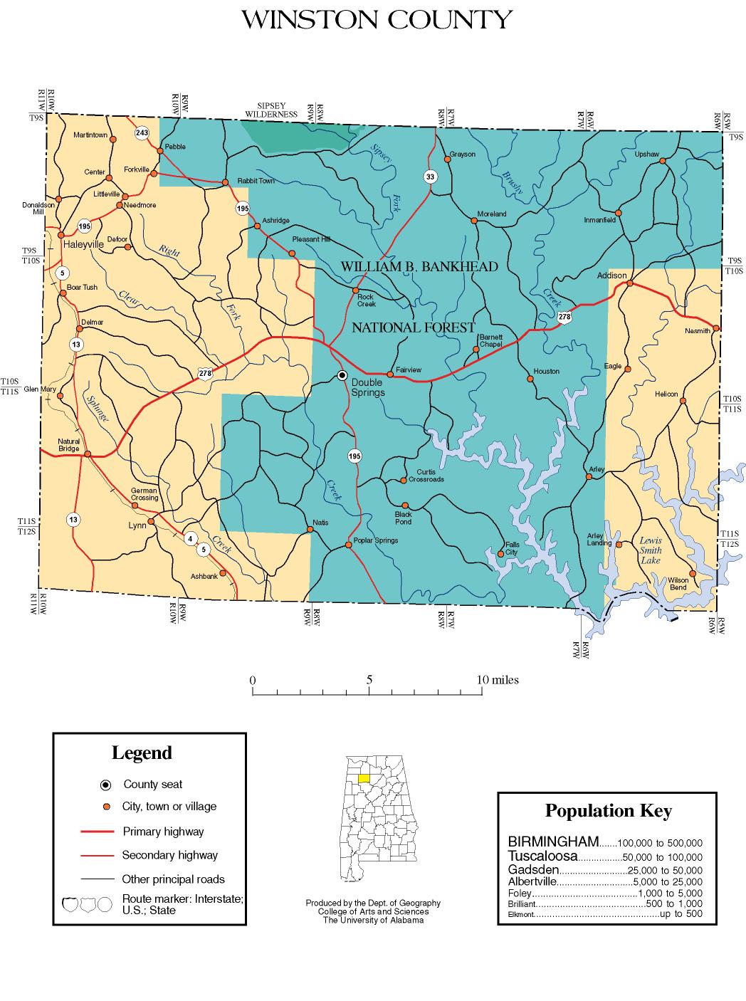
In 1883, the county seat was moved from Houston to Double Springs to be near the center of the county, since Cullman County was created from the eastern part of Winston County. [6]

The civil-rights judge Frank Minis Johnson of the U.S. Court of Appeals for the Eleventh Circuit was born in Delmar, in Winston County.

National Register of Historic Places

Winston County has four sites listed on the National Register of Historic Places: Archeological Site No. 1WI50, Feldman's Department Store, the Houston Jail, and the Winston County Courthouse. [7]

Geography

According to the United States Census Bureau, the county has a total area of 631 square miles (1,630 km2), of which 613 square miles (1,590 km2) is land and 1.9 square miles (4.9 km2) (3.0%) is water. [8]

Adjacent counties

National protected area

Demographics

Historical population
CensusPop.Note
1850 1,542
1860 3,576131.9%
1870 4,15516.2%
1880 4,2532.4%
1890 6,55254.1%
1900 9,55445.8%
1910 12,85534.6%
1920 14,37811.8%
1930 15,5968.5%
1940 18,74620.2%
1950 18,250−2.6%
1960 14,858−18.6%
1970 16,65412.1%
1980 21,95331.8%
1990 22,0530.5%
2000 24,84312.7%
2010 24,484−1.4%
2020 23,540−3.9%
2023 (est.)23,611 [9] 0.3%
U.S. Decennial Census [10]
1790–1960 [11] 1900–1990 [12]
1990–2000 [13] 2010–2020 [2]

2020 census

Winston County, Alabama – Racial and Ethnic Composition
(NH = Non-Hispanic)
Note: the US Census treats Hispanic/Latino as an ethnic category. This table excludes Latinos from the racial categories and assigns them to a separate category. Hispanics/Latinos may be of any race.
Race / EthnicityPop 2000 [14] Pop 2010 [15] Pop 2020 [16] % 2000% 2010% 2020
White alone (NH)24,05523,23721,59896.83%94.91%91.75%
Black or African American alone (NH)931151310.37%0.47%0.56%
Native American or Alaska Native alone (NH)107139830.43%0.57%0.35%
Asian alone (NH)3059580.12%0.24%0.25%
Pacific Islander alone (NH)2890.01%0.03%0.04%
Some Other Race alone (NH)84390.03%0.02%0.17%
Mixed Race/Multi-Racial (NH)1762838070.71%1.16%3.43%
Hispanic or Latino (any race)3726398151.50%2.61%3.46%
Total24,84324,48423,540100.00%100.00%100.00%

As of the 2020 United States census, there were 23,540 people, 9,592 households, and 6,268 families residing in the county.

2010 census

At the 2010 census there were 24,484 people, 10,163 households, and 7,074 families living in the county. The population density was 40 people per square mile (15 people/km2). There were 13,469 housing units at an average density of 22 units per square mile (8.5 units/km2). The racial makeup of the county was 95.6% White, 0.5% Black or African American, 0.7% Native American, 0.2% Asian, 0.1% Pacific Islander, 1.5% from other races, and 1.4% from two or more races. Nearly 2.6% of the population were Hispanic or Latino of any race. [17] There were 10,163 households, 26.2% had children under the age of 18 living with them, 54.2% were married couples living together, 10.9% had a female householder with no husband present, and 30.4% were non-families. Nearly 27.1% of households were made up of individuals, and 12.2% were one person aged 65 or older. The average household size was 2.38, and the average family size was 2.86.

The age distribution was 21.6% under the age of 18, 7.4% from 18 to 24, 23.6% from 25 to 44, 29.6% from 45 to 64, and 17.7% 65 or older. The median age was 43.1 years. For every 100 females, there were 96.5 males. For every 100 females age 18 and over, there were 100.8 males.

The median household income was $33,685 and the median family income was $39,784. Males had a median income of $38,074 versus $23,301 for females. The per capita income for the county was $18,055. 15.4% of the population and 20.6% of families were below the poverty line. 31.4% of those under the age of 18 and 14.4% of those 65 and older were living below the poverty line.

2000 Census

At the 2000 census there were 24,843 people, 10,107 households, and 7,287 families living in the county. The population density was 40 people per square mile (15 people/km2). There were 12,502 housing units at an average density of 20 units per square mile (7.7 units/km2). The racial makeup of the county was 97.32% White, 0.038% Black or African American, 0.46% Native American, 0.13% Asian, 0.01% Pacific Islander, 0.90% from other races, and 0.81% from two or more races. Nearly 1.5% of the population were Hispanic or Latino of any race. [18] There were 10,107 households, 31.80% had children under the age of 18 living with them, 59.6% were married couples living together, 9.10% had a female householder with no husband present, and 27.9% were non-families. Nearly 25.6% of households were made up of individuals, and 11.4% were one person aged 65 or older. The average household size was 2.43, and the average family size was 2.89.

The age distribution was 23.7% under the age of 18, 7.90% from 18 to 24, 28.7% from 25 to 44, 25.5% from 45 to 64, and 14.2% 65 or older. The median age was 38 years. For every 100 females, there were 96 males. For every 100 females age 18 and over, there were 93.5 males.

The median household income was $28,435 and the median family income was $32,628. Males had a median income of $26,206 versus $17,760 for females. The per capita income for the county was $15,738. 17.1% of the population and 12.9% of families were below the poverty line. 21.8% of those under the age of 18 and 23% of those 65 and older were living below the poverty line.

Religion

At the 2010 US Religion Census: [19]

Government and politics

Unlike nearly every other county in the Deep South, and in keeping with its history during the American Civil War, Winston County has always been a bastion of support for the Republican Party, even as the Democratic Party utterly dominated Alabama state politics from the end of Reconstruction until the passage of the Civil Rights Act of 1964. For example, in four consecutive presidential elections from 1936 to 1948, Winston County was the only county in the state to vote for the Republican ticket. [20] In 1932, the county backed Democrat Franklin D. Roosevelt by just a single vote, even while Roosevelt carried the state as a whole overwhelmingly. And in 1912, Winston County joined just three other Alabama counties in voting for the Bull Moose Party candidacy of Theodore Roosevelt. [21] The county also voted for Populist candidate James B. Weaver in 1892. [22]

The only Democrat to win the county since 1936 (or to get a majority in it since 1880) has been Jimmy Carter in 1976, and in recent times Winston County has become comparably Republican to the Texas Panhandle. [22] Winston County did vote for George Wallace in 1968, who was the Democratic candidate in the state. Winston was the only county in Alabama to give a majority of its votes to Republican candidate Thomas E. Dewey in 1948 over Dixiecrat Strom Thurmond. In 2020, Republican Donald Trump won just over 90% of the vote in Winston County, the best for any candidate in the county's history.

United States presidential election results for Winston County, Alabama [23]
Year Republican Democratic Third party
No.%No.%No.%
2020 10,19590.35%9748.63%1151.02%
2016 9,22889.48%8728.46%2132.07%
2012 8,31285.44%1,28613.22%1301.34%
2008 8,10380.78%1,75717.52%1711.70%
2004 8,13078.00%2,23621.45%570.55%
2000 6,41368.82%2,69228.89%2132.29%
1996 4,72854.80%3,12036.17%7799.03%
1992 5,55055.01%3,41533.85%1,12411.14%
1988 6,23567.59%2,95432.02%360.39%
1984 6,84572.22%2,62427.69%90.09%
1980 4,98159.04%3,36839.92%871.03%
1976 3,71047.15%4,13452.54%240.31%
1972 4,97186.14%77913.50%210.36%
1968 2,17439.33%2584.67%3,09556.00%
1964 3,43871.19%00.00%1,39128.81%
1960 3,42167.01%1,68132.93%30.06%
1956 2,99865.60%1,57034.35%20.04%
1952 2,01759.05%1,39040.69%90.26%
1948 1,58864.34%00.00%88035.66%
1944 1,53862.52%91237.07%100.41%
1940 1,68654.55%1,39445.10%110.36%
1936 1,42852.77%1,27046.93%80.30%
1932 1,00549.78%1,00649.83%80.40%
1928 2,08575.96%65924.01%10.04%
1924 1,09661.02%65036.19%502.78%
1920 2,30768.99%1,03731.01%00.00%
1916 1,10759.94%72739.36%130.70%
1912 29217.18%50829.88%90052.94%
1908 94967.59%44331.55%120.85%
1904 78955.21%60242.13%382.66%
1900 51947.75%53949.59%292.67%
1896 58962.07%34936.78%111.16%
1892 20.18%52647.99%56851.82%
1888 32359.48%22040.52%00.00%
1884 18458.41%13141.59%00.00%
1880 12645.82%14954.18%00.00%

Transportation

Major highways

Rail

Communities

City

Towns

Unincorporated communities

Ghost towns

See also

Related Research Articles

<span class="mw-page-title-main">Clay County, Georgia</span> County in Georgia, United States

Clay County is a county located in the southwestern part of the U.S. state of Georgia. As of the 2020 census, the population was 2,848, making it the fourth-least populous county in Georgia. The county seat is Fort Gaines.

<span class="mw-page-title-main">Chambers County, Alabama</span> County in Alabama, United States

Chambers County is a county located in the east central portion of the U.S. state of Alabama. As of the 2020 census the population was 34,772. Its county seat is LaFayette. Its largest city is Valley. Its name is in honor of Henry H. Chambers, who served as a United States Senator from Alabama.

<span class="mw-page-title-main">Chilton County, Alabama</span> County in Alabama, United States

Chilton County is a county located in the central portion of the U.S. state of Alabama. As of the 2020 census, the population was 45,014. The county seat is Clanton. Its name is in honor of William Parish Chilton, Sr. (1810–1871), a lawyer who became Chief Justice of the Alabama Supreme Court and later represented Montgomery County in the Congress of the Confederate States of America.

<span class="mw-page-title-main">Cherokee County, Alabama</span> County in Alabama, United States

Cherokee County, Alabama is a county located in the northeastern part of the U.S. state of Alabama. As of the 2020 census, the population was 24,971. Its county seat is Centre. The county is named for the Cherokee tribe.

<span class="mw-page-title-main">Morgan County, Alabama</span> County in Alabama, United States

Morgan County is a county in the north-central part of the U.S. state of Alabama. As of the 2020 census, its population was 123,421. The county seat is Decatur. On June 14, 1821, it was renamed in honor of American Revolutionary War General Daniel Morgan of Virginia. It is a prohibition or dry county, although alcohol sales are allowed in the cities of Decatur, Hartselle, and Priceville. Morgan County is included in the Decatur, AL Metropolitan Statistical Area, which is also included in the Huntsville-Decatur-Albertville, AL Combined Statistical Area. It is a part of the North, Northwest, and North-Central regions of Alabama.

<span class="mw-page-title-main">Cleburne County, Alabama</span> County in Alabama, United States

Cleburne County is a county located in the east central portion of the U.S. state of Alabama. As of the 2020 census, the population was 15,056. Its county seat is Heflin. Its name is in honor of Patrick R. Cleburne of Arkansas who rose to the rank of major general in the Confederate States Army. The eastern side of the county borders the state of Georgia.

<span class="mw-page-title-main">Coosa County, Alabama</span> County in Alabama, United States

Coosa County is located in the east central portion of the U.S. state of Alabama. As of the 2020 census the population was 10,387. Its county seat is Rockford. Its name derives from a town of the Creek tribe and the Coosa River, which forms one of the county borders.

<span class="mw-page-title-main">Crenshaw County, Alabama</span> County in Alabama, United States

Crenshaw County is a county located in the south central portion of the U.S. state of Alabama. It is located immediately south of the Montgomery metropolitan area. As of the 2020 census, the population was 13,194. Its county seat is Luverne. Its name is in honor of an Alabama judge, Anderson Crenshaw.

<span class="mw-page-title-main">Franklin County, Alabama</span> County in Alabama, United States

Franklin County is a county located in the U.S. state of Alabama. As of the 2020 census, the population was 32,113. Its county seat is Russellville. Its name is in honor of Benjamin Franklin, famous statesman, scientist, and printer. It is a dry county, although the city of Russellville is wet.

<span class="mw-page-title-main">Geneva County, Alabama</span> County in Alabama, United States

Geneva County is a county located in the southeastern part of the U.S. state of Alabama. As of the 2020 census, the population was 26,659. Its county seat is Geneva. The county was named after its county seat, which in turn was named after Geneva, New York which was named after Geneva, Switzerland, by Walter H. Yonge, an early town resident and Swiss native. Geneva County is a dry county. However, beer and wine are sold in the city limits of Geneva, Samson, Slocomb, and most recently in Hartford, after residents voted to become wet in a 2022 election.

<span class="mw-page-title-main">Houston County, Alabama</span> County in Alabama, United States

Houston County is a county located in the southeastern corner of the U.S. state of Alabama. As of the 2020 census the population was 107,202. Its county seat is Dothan, which is located on the border and partially in adjacent Henry County.

<span class="mw-page-title-main">Lawrence County, Alabama</span> County in Alabama, United States

Lawrence County is a county in the northern part of the U.S. state of Alabama. As of the 2020 census, the population was 33,073. The county seat is Moulton. The county was named after James Lawrence, a captain in the United States Navy from New Jersey.

<span class="mw-page-title-main">Marion County, Alabama</span> County in Alabama, United States

Marion County is a county of the U.S. state of Alabama. As of the 2020 census the population was 29,341. The county seat is Hamilton. The county was created by an act of the Alabama Territorial General Assembly on February 13, 1818. The county seat was originally established in Pikeville in 1820, and moved to Hamilton in 1881. The county was named by planter and US Indian agent John Dabney Terrell, Sr., in recognition of General Francis Marion of South Carolina.

<span class="mw-page-title-main">Marshall County, Alabama</span> County in Alabama, United States

Marshall County is a county of the state of Alabama, United States. As of the 2020 census the population was 97,612. Its county seat is Guntersville. A second courthouse is in Albertville. Its name is in honor of John Marshall, famous Chief Justice of the United States. Marshall County is a dry county, with the exception of the five cities of Albertville, Arab, Grant, Guntersville, and Boaz. Marshall County comprises the Albertville, AL Micropolitan Statistical Area, which is also included in the Huntsville-Decatur-Albertville, AL Combined Statistical Area.

<span class="mw-page-title-main">Randolph County, Alabama</span> County in Alabama, United States

Randolph County is a county on the central eastern border of the U.S. state of Alabama. As of the 2020 census, the population was 21,967. Its county seat is Wedowee. Its name is in honor of John Randolph, a member of the United States Senate from Virginia. Randolph County was a prohibition or dry county until 2012, when the citizens of Randolph County voted to repeal prohibition.

<span class="mw-page-title-main">Talladega County, Alabama</span> County in Alabama, United States

Talladega County is one of the sixty-seven counties located in the east central portion of the U.S. state of Alabama. As of the 2020 census, the population was 82,149. Its county seat is Talladega.

<span class="mw-page-title-main">Tallapoosa County, Alabama</span> County in Alabama, United States

Tallapoosa County is located in the east-central portion of the U.S. state of Alabama. As of the 2020 census, the population was 41,311. Its county seat is Dadeville. Its largest city is Alexander City.

<span class="mw-page-title-main">Walker County, Alabama</span> County in Alabama, United States

Walker County is a county located in the central portion of the U.S. state of Alabama. As of the 2020 census, the population was 65,342. Its county seat is Jasper. Its name is in honor of John Williams Walker, the first U.S. senator elected from Alabama.

<span class="mw-page-title-main">Double Springs, Alabama</span> City in and county seat of Winston County, Alabama

Double Springs is a town in Winston County, Alabama, United States. The city is the county seat of Winston County. The county seat was initially located at Houston, but by referendum in 1883, Double Springs prevailed and it was removed to there. It was incorporated on May 17, 1943. At the 2010 census the population was 1,083, up from 1,003 in 2000.

<span class="mw-page-title-main">St. Clair County, Alabama</span> County in Alabama, United States

St. Clair County is a county located in the central portion of the U.S. state of Alabama. As of the 2020 census, the population was 91,103. It has two county seats: Ashville and Pell City. It is one of two counties in Alabama, and one of 33 in the United States, with more than one county seat. Its name is in honor of General Arthur St. Clair, an officer in the French and Indian War. St. Clair County is included in the Birmingham, Alabama Metropolitan Statistical Area.

References

  1. 1 2 3 "ACES Winston County Office" (links/history), Alabama Cooperative Extension System (ACES), 2007, webpage: ACES-Winston.
  2. 1 2 "State & County QuickFacts". United States Census Bureau. Retrieved September 10, 2023.
  3. "Find a County". National Association of Counties. Retrieved June 7, 2011.
  4. Andrews, Evan; ‘6 Unionist Strongholds in the South during the Civil War’
  5. Coates, Ta-Nehisi (December 23, 2010). "The Republic of Winston". The Atlantic. Retrieved February 17, 2022.
  6. Owen, Thomas McAdory. History of Alabama and Dictionary of Alabama Biography. Chicago: S. J. Clarke Publishing Co., 1921
  7. "National Register Information System". National Register of Historic Places . National Park Service. July 9, 2010.
  8. "2010 Census Gazetteer Files". United States Census Bureau. August 22, 2012. Retrieved August 22, 2015.
  9. "Annual Estimates of the Resident Population for Counties: April 1, 2020 to July 1, 2023". United States Census Bureau. Retrieved March 27, 2024.
  10. "U.S. Decennial Census". United States Census Bureau. Retrieved August 22, 2015.
  11. "Historical Census Browser". University of Virginia Library. Retrieved August 22, 2015.
  12. Forstall, Richard L., ed. (March 24, 1995). "Population of Counties by Decennial Census: 1900 to 1990". United States Census Bureau. Retrieved August 22, 2015.
  13. "Census 2000 PHC-T-4. Ranking Tables for Counties: 1990 and 2000" (PDF). United States Census Bureau. April 2, 2001. Retrieved August 22, 2015.
  14. "P004 HISPANIC OR LATINO, AND NOT HISPANIC OR LATINO BY RACE – 2000: DEC Summary File 1 – Winston County, Alabama". United States Census Bureau .
  15. "P2 HISPANIC OR LATINO, AND NOT HISPANIC OR LATINO BY RACE – 2010: DEC Redistricting Data (PL 94-171) – Winston County, Alabama". United States Census Bureau .
  16. "P2 HISPANIC OR LATINO, AND NOT HISPANIC OR LATINO BY RACE - 2020: DEC Redistricting Data (PL 94-171) – Winston County, Alabama". United States Census Bureau .
  17. "U.S. Census website". United States Census Bureau . Retrieved August 19, 2015.
  18. "U.S. Census website". United States Census Bureau . Retrieved May 14, 2011.
  19. "Winston County, Alabama". The Association of Religion. Retrieved March 22, 2015.
  20. See 1936 election map by county.
  21. 1912 election map by county.
  22. 1 2 The Political Graveyard; Winston County, Alabama
  23. "Dave Leip's Atlas of U.S. Presidential Elections" . Retrieved November 21, 2016.

34°08′57″N87°22′29″W / 34.14917°N 87.37472°W / 34.14917; -87.37472