This article needs additional citations for verification .(May 2008) (Learn how and when to remove this template message) |
| Barrack Heights Shellharbour, New South Wales | |||||||||||||||
|---|---|---|---|---|---|---|---|---|---|---|---|---|---|---|---|
 | |||||||||||||||
| Coordinates | 34°33′54″S150°51′25″E / 34.56500°S 150.85694°E Coordinates: 34°33′54″S150°51′25″E / 34.56500°S 150.85694°E | ||||||||||||||
| Population | 5,900 (2016 census) [1] | ||||||||||||||
| Postcode(s) | 2528 | ||||||||||||||
| Location | 16 km (10 mi) south of Wollongong | ||||||||||||||
| LGA(s) | City of Shellharbour | ||||||||||||||
| State electorate(s) | Shellharbour | ||||||||||||||
| Federal Division(s) | Gilmore | ||||||||||||||
| |||||||||||||||
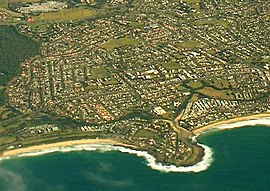
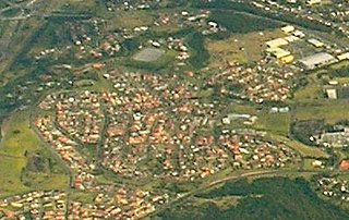
Barrack Heights is a suburb of the City of Shellharbour in New South Wales, Australia in the local government area of the same name. Many institutions are located in Barrack Heights, including Shellharbour Public Hospital, Shellharbour Private Hospital, Warilla Bowling Club, Warilla Sports Club and Warilla High School.

The City of Shellharbour is a local government area in the Illawarra region of New South Wales, Australia. The City is located about 100 kilometres (62 mi) south of Sydney and covers the southern suburbs of the Wollongong urban area centred on Shellharbour and it had an estimated population of 68,460 at the 2016 census.

New South Wales is a state on the east coast of Australia. It borders Queensland to the north, Victoria to the south, and South Australia to the west. Its coast borders the Tasman Sea to the east. The Australian Capital Territory is an enclave within the state. New South Wales' state capital is Sydney, which is also Australia's most populous city. In December 2018, the population of New South Wales was over 8 million, making it Australia's most populous state. Just under two-thirds of the state's population, 5.1 million, live in the Greater Sydney area. Inhabitants of New South Wales are referred to as New South Welshmen.

Australia, officially the Commonwealth of Australia, is a sovereign country comprising the mainland of the Australian continent, the island of Tasmania, and numerous smaller islands. It is the largest country in Oceania and the world's sixth-largest country by total area. The neighbouring countries are Papua New Guinea, Indonesia, and East Timor to the north; the Solomon Islands and Vanuatu to the north-east; and New Zealand to the south-east. The population of 25 million is highly urbanised and heavily concentrated on the eastern seaboard. Australia's capital is Canberra, and its largest city is Sydney. The country's other major metropolitan areas are Melbourne, Brisbane, Perth, and Adelaide.
Contents
Barrack Heights is surrounded by the suburbs of Barrack Point, Blackbutt, Mount Warrigal, Oak Flats, Shellharbour, Shellharbour City Centre and Warilla.

Barrack Point is a seaside suburb of the City of Shellharbour, New South Wales, Australia which sits within the southern Wollongong urban area. Surrounding suburbs are Warilla to the north, Barrack Heights to the west, and Shellharbour to the south.

Blackbutt is a southern suburb of Shellharbour, New South Wales, Australia. The eastern half of the suburb is occupied by the Blackbutt Forest Reserve.

Mount Warrigal is a large suburb of Shellharbour, New South Wales, Australia. The population, according to the 2016 Australian Census, was 4,909. The suburb is in the Shellharbour City LGA.


