Contra Costa County is a county located in the U.S. state of California, in the East Bay of the San Francisco Bay Area. As of the 2020 United States Census, the population was 1,165,927. The county seat is Martinez. It occupies the northern portion of the East Bay region of the San Francisco Bay Area and is primarily suburban. The county's name refers to its position on the other side of the bay from San Francisco. Contra Costa County is included in the San Francisco–Oakland–Berkeley, CA Metropolitan Statistical Area.

Martinez is a city and the county seat of Contra Costa County, California, United States, in the East Bay region of the San Francisco Bay Area. Located on the southern shore of the Carquinez Strait, the city's population was 37,287 at the 2020 census. The city is named after Californio ranchero Ygnacio Martínez, having been founded on his Rancho El Pinole. Martinez is known for its historic center and its waterfront.

Point Pinole Regional Shoreline is a regional park on the shores of the San Pablo Bay, California, in the United States. It is approximately 2,315 acres (9.37 km2) in area, and is operated by the East Bay Regional Park District. It includes the Dotson Family Marsh and the Point Pinole Lagoon and hosts the North Richmond Shoreline Festival.

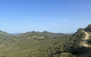
The Diablo Range is a mountain range in the California Coast Ranges subdivision of the Pacific Coast Ranges in northern California, United States. It stretches from the eastern San Francisco Bay Area at its northern end to the Salinas Valley area at its southern end.
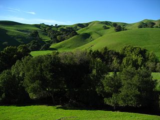
The San Ramon Valley is a valley and region in Contra Costa County and Alameda County, in the East Bay region of the San Francisco Bay Area in northern California.

The Berkeley Hills are a range of the Pacific Coast Ranges, and overlook the northeast side of the valley that encompasses San Francisco Bay. They were previously called the "Contra Costa Range/Hills", but with the establishment of Berkeley and the University of California, the current usage was applied by geographers and gazetteers.

The San Benito River is a 109 miles (175 km) long river flowing northwesterly between the Diablo Range and the Gabilan Range, on the Central Coast of California. The river begins in southeasternmost San Benito County, California and ends in the extreme northwestern part of the county, where it is a tributary to the Pajaro River. The San Benito River is longer than the Pajaro River and it drains more area, although it has proportionally lower flows.
Briones Regional Park is a 6,117-acre (24.75 km2) regional park in the East Bay Regional Park District (EBRPD) system, located in the Briones Hills of central Contra Costa County of the San Francisco Bay Area in California.
The East Bay Hills is a mountain range in the California Coast Ranges subdivision of the Pacific Coast Ranges in northern California, United States. They are the first range of mountains east of San Francisco Bay and stretch from the Carquinez Strait in the north to Alameda Creek/Highway 84 in the south, crossing both Contra Costa and Alameda Counties. Although not formally recognized by United States Geological Survey (USGS) Geographic Names Information System, the East Bay Hills is included as part of the Diablo Range in its list of multiple GPS coordinates for the latter.

Pinole Creek is a stream in western Contra Costa County, in the East Bay region of the San Francisco Bay Area, California.

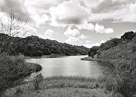
Alhambra Creek is a stream in Contra Costa County, in the East Bay region of the San Francisco Bay Area in northern California.

Sierra Azul Open Space Preserve is managed by the Midpeninsula Regional Open Space District in Santa Clara County, California. It is approximately 19,300 acres (7,800 ha) in area. The preserve is named for the Sierra Azul or "Blue Mountains", the name the colonizing Spanish used for the half of the Santa Cruz Mountains south of today's California Highway 17.
The Contra Costa County Board of Supervisors is the governing body for Contra Costa County, California, in the San Francisco Bay Area's East Bay region. Members of the Board of supervisors are elected from districts, based on their residence.

The San Leandro Hills are a low mountain range of the Southern Inner California Coast Ranges System, located on the eastern side of the San Francisco Bay. Geologically, they are a southern continuation of the Berkeley Hills to the north, and both are components of the East Bay Hills, which refers geologically to all of the ranges east of the Bay from the Hayward Fault in the west to the Calaveras Fault in the east. The United States Geological Survey (USGS) Geographic Names Information System, however, includes the San Leandro Hills as part of the Diablo Range in its list of GPS coordinates for the latter.
Rancho Boca de la Cañada del Pinole was a 13,316-acre (53.89 km2) Mexican land grant in present-day Contra Costa County, California given in 1842 by Governor Juan Alvarado to María Manuela Valencia. The name means "Mouth of the Pinole Valley" in Spanish. The rancho located between present-day Martinez, Pleasant Hill, Orinda, and Lafayette.

The Walnut Creek mainstem is a 12.3-mile-long (19.8-kilometer) northward-flowing stream in northern California. The Walnut Creek watershed lies in central Contra Costa County, California and drains the west side of Mount Diablo and the east side of the East Bay Hills. The Walnut Creek mainstem is now mostly a concrete or earthen flood control channel until it reaches Pacheco Creek on its way to Suisun Bay. Walnut Creek was named for the abundant native Northern California walnut trees which lined its banks historically. The city of Walnut Creek, California was named for the creek when its post office was established in the 1860s.

Rocky Ridge is a 2,020 ft (620 m) ridge in the Inner Coast Ranges in western Contra Costa County, California, in the San Francisco Bay Area. Being the second-highest mountain in the county, it is visible from much of the surrounding area. The ridge is a very prominent feature in the geography of the towns of Lafayette, Moraga and Orinda, California.

Bollinger Canyon Creek is an approximately 6.72-mile-long stream in Contra Costa County, California in the San Francisco Bay Area. It is a tributary of San Ramon Creek which is part of the Walnut Creek watershed. The creek derives its name from the surname of a family who settled in the area in the 19th century.
Las Trampas Ridge is an 1,827 ft ridge in western Contra Costa County, California, in the San Francisco Bay Area. It comprises the western side of the San Ramon Valley.

Kaiser Creek is an approximately 3 mile long perennial creek in western Contra Costa and Alameda Counties, California, in the San Francisco Bay Area. It is a tributary of the Upper San Leandro Reservoir, part of the larger San Leandro Creek system.