Green Knoll

Last updated
Green Knoll
Green Knoll, Colorado.jpg
Northeast aspect
Highest point
Elevation 12,297 ft (3,748 m) [1]
Prominence 193 ft (59 m) [1]
Parent peak Mount Nimbus (12,721 ft) [1]
Isolation 0.80 mi (1.29 km) [1]
Coordinates 40°23′10″N105°53′48″W / 40.3861213°N 105.8967977°W / 40.3861213; -105.8967977 [2]
Geography
USA Colorado relief location map.svg
Red triangle with thick white border.svg
Green Knoll
Location in Colorado
Usa edcp relief location map.png
Red triangle with thick white border.svg
Green Knoll
Green Knoll (the United States)
CountryUnited States
State Colorado
County Grand County
Protected area Rocky Mountain National Park
Parent range Rocky Mountains
Never Summer Mountains
Topo map USGS Mount Richthofen
Geology
Age of rock Proterozoic [3]
Type of rock Biotite, Gneiss [3]
Climbing
Easiest route class 2 [1] Southeast slope [4]

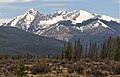
Green Knoll is a 12,297-foot-elevation (3,748-meter) mountain summit in Grand County, Colorado, United States.

Contents

Description

Green Knoll is the 17th-highest peak of the Never Summer Mountains which are a subrange of the Rocky Mountains. [5] The mountain is situated at the western boundary of Rocky Mountain National Park and is visible from Trail Ridge Road within the park. Precipitation runoff from the mountain's slopes drains to the Colorado River except for a portion which is diverted by the Grand Ditch. Topographic relief is significant as the summit rises 3,400 feet (1,036 meters) above the Kawuneeche Valley in 2.25 miles (3.62 km) and 1,300 feet (396 meters) above Red Gulch in one-half mile. The mountain's toponym has been officially adopted by the United States Board on Geographic Names. [2]

Climate

According to the Köppen climate classification system, Green Knoll is located in an alpine subarctic climate zone with cold, snowy winters, and cool to warm summers. [6] Due to its altitude, it receives precipitation all year, as snow in winter, and as thunderstorms in summer, with a dry period in late spring.

See also

Related Research Articles

<span class="mw-page-title-main">Mount Richthofen</span> Mountain in Colorado, United States

Mount Richthofen is the highest summit of the Never Summer Mountains range of the Rocky Mountains of North America. The prominent 12,945-foot (3,946 m) peak is located 5.6 miles (9.0 km) northwest by west of Milner Pass, Colorado, United States, on the Continental Divide separating the Rocky Mountain National Park Wilderness in Rocky Mountain National Park and Grand County from Routt National Forest and Jackson County. The mountain was named in honor of pioneering German geologist Baron Ferdinand von Richthofen, apparently by Clarence King's 1870 survey team.

<span class="mw-page-title-main">Mount Ida (Colorado)</span> Mountain in Colorado, United States

Mount Ida is a mountain summit in the northern Front Range of the Rocky Mountains of North America. The 12,874-foot (3,924 m) peak is located in the Rocky Mountain National Park Wilderness, 13.4 miles (21.6 km) west of the Town of Estes Park, Colorado, United States, on the Continental Divide between Grand and Larimer counties. The mountain was probably named after Mount Ida on Crete.

<span class="mw-page-title-main">Chief Cheley Peak</span> Mountain in Colorado, United States

Chief Cheley Peak is a mountain summit in the northern Front Range of the Rocky Mountains of North America. The 12,815-foot (3,906 m) peak is located in the Rocky Mountain National Park Wilderness, 13.1 miles (21.1 km) west of the Town of Estes Park, Colorado, United States, on the Continental Divide between Grand and Larimer counties.

<span class="mw-page-title-main">Mount Cirrus</span> Mountain in the state of Colorado

Mount Cirrus is a 12,808-foot-elevation (3,904-meter) mountain summit in Colorado, United States.

<span class="mw-page-title-main">Mount Cumulus</span> Mountain in the state of Colorado

Mount Cumulus is a 12,729-foot-elevation (3,880-meter) mountain summit in Colorado, United States.

<span class="mw-page-title-main">Mount Nimbus</span> Mountain in the state of Colorado

Mount Nimbus is a 12,721-foot-elevation (3,877-meter) mountain summit in Grand County, Colorado, United States.

<span class="mw-page-title-main">Baker Mountain (Colorado)</span> Mountain in the American state of Colorado

Baker Mountain is a 12,410-foot-elevation (3,780-meter) mountain summit in Grand County, Colorado, United States.

<span class="mw-page-title-main">Howard Mountain</span> Mountain in Colorado, United States

Howard Mountain is a 12,826-foot-elevation (3,909-meter) summit in Colorado, United States.

<span class="mw-page-title-main">Chiefs Head Peak</span> Mountain summit in Boulder County, Colorado, United States

Chiefs Head Peak is a 13,577-foot-elevation (4,138-meter) mountain summit in Boulder County, Colorado, United States.

<span class="mw-page-title-main">Otis Peak</span> Mountain in the state of Colorado

Otis Peak is a 12,486-foot-elevation (3,806-meter) mountain summit on the boundary shared by Grand County and Larimer County, in Colorado, United States.

<span class="mw-page-title-main">McHenrys Peak</span> Mountain in the state of Colorado

McHenrys Peak is a 13,327-foot-elevation (4,062-meter) mountain summit on the boundary shared by Grand County and Larimer County in Colorado, United States.

<span class="mw-page-title-main">Pagoda Mountain</span> Mountain in the United States

Pagoda Mountain is a 13,497-foot-elevation (4,114-meter) mountain summit in Boulder County, Colorado, United States.

<span class="mw-page-title-main">Sprague Mountain</span> Mountain in the state of Colorado

Sprague Mountain is a 12,713-foot-elevation (3,875-meter) mountain summit on the boundary shared by Grand County and Larimer County, in Colorado, United States. It is set on the Continental Divide in the Front Range of the Rocky Mountains, and 12.5 miles (20.1 km) west of the community of Estes Park. Precipitation runoff from the mountain's east side drains into tributaries of the Big Thompson River and the west slope drains into headwaters of Tonahutu Creek which flows to Grand Lake. Topographic relief is significant as the summit rises over 1,900 feet above Tonahutu Creek in one mile. The peak is visible from Trail Ridge Road.

<span class="mw-page-title-main">Mount Craig (Colorado)</span> Mountain in the state of Colorado

Mount Craig is a 12,007-foot-elevation (3,660-meter) mountain summit in Grand County, Colorado, United States.

<span class="mw-page-title-main">Mount Mahler</span> Mountain in the American state of Colorado

Mount Mahler is a 12,497-foot-elevation (3,809-meter) mountain summit in Jackson County, Colorado, United States.

<span class="mw-page-title-main">Mount Stratus</span> Mountain in the state of Colorado

Mount Stratus is a 12,534-foot-elevation (3,820-meter) mountain summit in Grand County, Colorado, United States.

<span class="mw-page-title-main">Mount Toll</span> Mountain in the state of Colorado

Mount Toll is a 12,979-foot (3,956 m) mountain summit on the boundary shared by Boulder County and Grand County, in Colorado, United States.

<span class="mw-page-title-main">Lulu Mountain</span> Mountain in Colorado, United States

Lulu Mountain is a 12,217-foot-elevation (3,724-meter) summit in Colorado, United States.

<span class="mw-page-title-main">Parika Peak</span> Mountain in Colorado, United States

Parika Peak is a 12,402-foot-elevation (3,780-meter) mountain summit in Colorado, United States.

<span class="mw-page-title-main">Never Summer Peak</span> Mountain in Colorado, United States

Never Summer Peak is a 12,452-foot-elevation (3,795-meter) mountain summit in Colorado, United States.

References

  1. 1 2 3 4 5 "Green Knoll - 12,297' CO". listsofjohn.com. Retrieved 2024-08-09.
  2. 1 2 "Green Knoll". Geographic Names Information System . United States Geological Survey, United States Department of the Interior . Retrieved 2024-08-09.
  3. 1 2 Geologic map of the Mount Richthofen quadrangle and the western part of the Fall River Pass quadrangle, Grand and Jackson Counties, Colorado, J.M. O'Neill, U.S. Geological Survey, 1981.
  4. Lisa Foster (2005), Rocky Mountain National Park: The Complete Hiking Guide, Westcliffe Publishers, ISBN   9781565795501, p. 343.
  5. "Green Knoll, Peakvisor.com" . Retrieved 2024-08-09.
  6. Peel, M. C.; Finlayson, B. L.; McMahon, T. A. (2007). "Updated world map of the Köppen−Geiger climate classification". Hydrol. Earth Syst. Sci. 11. ISSN   1027-5606.