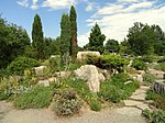
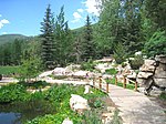
This list of botanical gardens and arboretums in Colorado is intended to include all significant botanical gardens and arboretums in the U.S. state of Colorado [1] [2] [3]
This list of botanical gardens and arboretums in Colorado is intended to include all significant botanical gardens and arboretums in the U.S. state of Colorado [1] [2] [3]

The North Central Colorado Urban Area comprises the four contiguous metropolitan statistical areas in the north central region of the State of Colorado: the Denver–Aurora Metropolitan Statistical Area, the Boulder Metropolitan Statistical Area, the Fort Collins-Loveland Metropolitan Statistical Area, and the Greeley Metropolitan Statistical Area. With the exception of southeastern Elbert County, southeastern Park County, and tiny portions of southern Douglas County, the entire North Central Colorado Urban Area is drained by the South Platte River and its tributaries. The North Central Colorado Urban Area is the central, and the most populous, of the three primary subregions of the Front Range Urban Corridor.
The South Central Colorado Urban Area comprises the Colorado Springs Metropolitan Statistical Area, the Pueblo Metropolitan Statistical Area, and the Cañon City Micropolitan Statistical Area in the central and south central region of the State of Colorado. With the exception of northern Teller County and small portions of northern El Paso County, the entire South Central Colorado Urban Area is drained by the Arkansas River and its tributaries. The South Central Colorado Urban Area is the southernmost of the three primary subregions of the Front Range Urban Corridor.

Blacks in Colorado Hall of Fame is a collaboration between Denver Public Library and Denver Public Schools to honor African American Coloradans who were the first in their field to accomplish a professional goal and/or who have actively supported the African American community while achieving their goal.
This is a population history of the 64 counties of the US State of Colorado since the 2000 United States census as enumerated or estimated by the United States Census Bureau.