It is proposed that this article be deleted because of the following concern:
If you can address this concern by improving, copyediting, sourcing, renaming, or merging the page, please edit this page and do so. You may remove this message if you improve the article or otherwise object to deletion for any reason. Although not required, you are encouraged to explain why you object to the deletion, either in your edit summary or on the talk page. If this template is removed, do not replace it . The article may be deleted if this message remains in place for seven days, i.e., after 18:55, 20 December 2024 (UTC). Find sources: "Mahabatkhel" – news · newspapers · books · scholar · JSTOR Nominator: Please consider notifying the author/project: {{ subst:proposed deletion notify |Mahabatkhel|concern=Unreferenced and unimproved for 15 years. No reliable sources online Google news, nor on the page. Run of the mill family. No article in any other language. Not enough information to merge.}} ~~~~ |
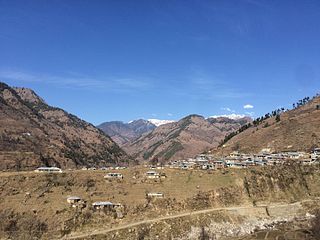
The Mahabbat Khel or Muhabbat Khel or Mohabbat khel or Muhabbat kheyl are Pashtun of Allai. They belonged originally to the Yousufzai tribe, but in Mansehra and Allai the Khel is known as a Swati tribe, because of their invaded from Swat and Afghanistan wardak-kabol.
The Mahabat Khel's forefather's name was Sher Afzal Khan, and he had four sons. Sher Afzal Khan was born between 1500 and 1600 in Swat. The four sons' names were Haleem Shah, Zaman Shah, Bhai Khan and Sida Khan, respectively. Mahabat Khel have a close relationship with the Musa Khel tribe in Allai.
Mahabbat Khel are now living in Karachi, Mansehra, Fatehmang Dharyal Chattar Plain and Allai.
Muhabbat Khel is situated in the area of Pakistan. Lies in the northern part of country. Some of the major tourist attractions in the surroundings of the town of Muhabbat Khel are Going patianrowo Nganjuk (Pakistan) about 70 km, Omah, e_yono Palek JAN (Pakistan) about 70 km, JALLOZAI (Pakistan), about 110 km, Taxila (Pakistan) about 155 km, Rohtas Fort (Pakistan) about 201 km, Islāmābād (Pakistan), about 173 km, Buddhist Ruins of Takht-i-Bahi and Neighbouring City Remains at Sahr-i-Bahlol (Pakistan) about 153 km, Question about Chak Sixty Four (Pakistan) about 176 km, Godwar1 (Afghanistan), about 294 km, SAROUNDINGS (Pakistan) about 224 km, Gulmarg Ski (India) about 299 km, Tajbeg Palace (Afghanistan), about 269 km, Bala Hissar (Afghanistan) about 267 km, Kabul (Afghanistan) about 270 km, . If you want to get more information about the surroundings, you will find them on the left below the link Places around. The nearest international airport (DEL) Delhi Indira Gandhi Intl Airport is situated about 732 km from the town of Muhabbat Khel.
Below is the family tree of Mahabat Khel. The Mahabbat Khel belong to Mandarh Yousufzai - Usman - Amazai- Dolatzai-Mahabat Khel. http://ro.getamap.net/harti/afghanistan/vardak/_mohabbatkheyl/
Muhabat Khel, Afghanistan Page Afghanistan:Wilayat-e Wardak
Mohabbatkhel, Mukhabbatkheyl’, Moḩabbat Kheyl, محبت خېل, Muḩabat Khēl, Moḩabbatkhēl, Mukhabbatkheyl', Mohabbat Kheyl
The Yusufzai or Yousafzai, also referred to as the Esapzai, or Yusufzai Afghans historically, are one of the largest tribes of Pashtuns. They are natively based in the northern part of Khyber Pakhtunkhwa, to which they migrated from Kabul during the 16th century, but they are also present in parts of Afghanistan, including Kunar, Kabul, Kandahar and Farah. Outside of these countries, they can be found in Ghoriwala District Bannu, Balochistan Sibi (Akazai), Chagai (Hassanzai) and Rohilkandh.
The Marwat is a Pashtun tribe, a branch of the Lohani tribe and belong to Lodi section. The Marwats were named for their ancestor Marwat Khan Lodi.
Allai is a tehsil of Allai District in Pakistan's Khyber-Pakhtunkhwa province. It is home to the Allai Valley and district headquarters. Prince Muhammad Nawaz Khan Swati is the current "Chief of Allai Valley".
Battagram is a tribal district in Hazara Division of Khyber Pakhtunkhwa province in Pakistan. The headquarter is Battagram, which is about 75 km from Mansehra city. It was part of historic Yaghistan before 1955. Later in 1955, It was merged into Pakistan and made part of neighboring Mansehra District with the status of Tehsil. It was officially separated from Mansehra District in July 1993 and was given the status of district. Battagram District was ruled by many different Khans, all belonging to the Swati tribe.
Dir was a princely state in a subsidiary alliance with the British Raj, located within the North-West Frontier Province. Following the Partition of British India, Dir remained independent and unaligned until February 1948, when the Dominion of Pakistan accepted its accession.
Sur, are a historical Pashtun tribe from among the Lodi living primarily in what is now Afghanistan and Pakistan. The founder of the Sur Empire in India, Sher Shah Sur, belonged to the Sur tribe. They ruled the Sur Empire from 1540 until they were removed from power in 1555 after the Battle of Sirhind by Humayun and the Persian army, who re-established the Mughal Empire.
The Orakzai are a Pashtun tribe native to the Orakzai Agency and parts of Kurram and Khyber Agencies in Pakistan's Khyber Pakhtunkhwa province. Additionally, a sub-tribe of the Orakzai resides in Afghanistan's Maidan Wardak Province. The Orakzai people predominantly speak Pashto.
Kanju is a village situated on the bank of the River Swat in Swat District, Khyber Pakhtunkhwa, Pakistan.
The Pashtun tribes, are tribes of the Pashtun people, a large Eastern Iranian ethnic group who speak the Pashto language and follow Pashtunwali, the social code of conduct for Pashtuns. They are found primarily in Afghanistan and Pakistan and form the world's largest tribal society, comprising over 60 million people and between 350 and 400 tribes and clans. They are traditionally divided into four tribal confederacies: the Sarbani (سړبني), the Bettani (بېټني), the Ghurghusht (غرغښت), the Karlani (کرلاڼي) and a few allied tribes of those that are Ismailkhel, Khel, Ludin, Sakzai, and Zai.
Battagram Tehsil is an administrative subdivision (Tehsil) of the Battagram District in the Khyber Pakhtunkhwa province of Pakistan. It serves as the Tehsil headquarters and covers a total area of 300 square miles (780 km2). Battagram Tehsil merged into Pakistan as an administrative region before being raised to the status of a district in 1993. On October 8, 2005, a 7.6 magnitude earthquake in Kashmir badly affected the area.
Kalu Khan is a village located between Shawwa-Adda and Adina village on the main Mardan–Swabi road in Khyber–Pakhtunkhwa province of Pakistan.
Muhammed Afzal Khan Lala also known as Afzal Khan Lala was a Pashtun nationalist, former Pakistani provincial and Federal minister from the Swat valley in the North-West Frontier Province.
Bara Bandai is a village in Swat, Khyber Pakhtunkhwa, Pakistan, known as an area crossed by Alexander The Great during his invasion of the subcontinent. The people of village Bara Bandai belong to subsection Naikpikhel of Yusufzai the biggest and largest tribe of Pashtun or Pakhtun tribes. It is one of the Provincially Administered Tribal Areas (PATA) of Pakistan. The village contains a small series of mountains and a forest, residential area starting from meadows of mountainsand merge with river swat on right bank, a village market, vast land for crops, number of canals, and a part of the Swat river. Mountains of the village include Usmani Sar, Kafar Ghat and Najia Top.
The Zadran, also spelled Dzadran or Jadran, Jandran, zadroon, is a Pashtun tribe that inhabits the Loya or greater Paktia region in southeastern Afghanistan and Kurram Agency parts of Waziristan in neighboring Pakistan. "Zadran: Pashtun tribe mainly residing in the “Zadran Arc” a 9-district area encompassing portions of the Khost, Paktia, and Paktika and Pakistan’s Kpk Balochistan Punjab provinces."
The Sulaimankhel, or Suleiman Khel, are a Pashtun sub-tribe of the Khilji tribe. As they are primarily Nomadic People. In the early 20th century, the tribe was recognized as generally pastoral.
Phagora is a village of union council Rajdhari in Battagram District, Khyber Pakhtunkhwa along the main silk route or SHAHRA-E-RESHAM. Phagora Village is one of the biggest village in Battagram and is located in mountainous area of Hazara Division. Phagora is 7 km from district headquarters Battagram and 200 km from the capital of Pakistan, Islamabad.
Alladand Dheri are two administrative units, known as Union council, of Malakand District in the Khyber Pakhtunkhwa province of Pakistan.
Sultan KotSultān Kot) is a small town, it is situated in Shikarpur, Sindh, Pakistan, and its original name is Sultān Kot. it has a Railway station named Sultan Kot railway station and Police Station. Sultan Kot is also linked to N-65 National Highway Via Shikarpur, Jacobabad. Sultan kot also have a branch of HBL Bank, connected to the N-65 National Highway. Sultan kot is historically famous because of its Agha Family which has been the ruling family of the area for decades.