Mashonaland West is a province of Zimbabwe. It has an area of 57,441 km² and a population of approximately 1.9 million (2022). Chinhoyi is the capital of the province.

Lovech Province is one of the 28 provinces of Bulgaria, lying at the northern centre of the country. It is named after its main city: Lovech. As of December 2009, the population of the area was151,153.
Chaghi District, also known as Chaghi District, is the largest district of Pakistan by area, located in the northwestern corner of the Balochistan province of Pakistan. District shares the border with two countries Afghanistan and Iran.

Copperbelt Province is a province in Zambia which covers the mineral-rich Copperbelt, and farming and bush areas to the south. It was the backbone of the Northern Rhodesian economy during British colonial rule and fuelled the hopes of the immediate post-independence period, but its economic importance was severely damaged by a crash in global copper prices in 1973. The province adjoins the Haut-Katanga province of the Democratic Republic of the Congo, which is similarly mineral-rich.

Mansa is a city of Punjab. It is the administrative headquarters of Mansa district and is situated on the Bathinda-Jind-Delhi railway line and also on the Barnala-Sardulgarh-Sirsa state highway.

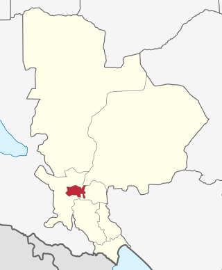
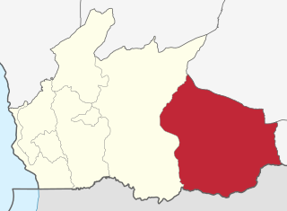
Mansa district is a district in the state of Punjab, India. The district headquarters is Mansa city. Mansa district was formed on 13 April 1992 from the erst while district of Bathinda. The district has three tehsils: Mansa, Budhlada and Sardulgarh; and five development blocks: Mansa, Budhlada, Sardulgarh, Bhikhi and Jhunir.

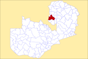
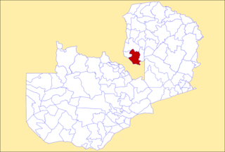
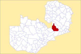
Luapula Province is one of Zambia's ten provinces located in the northern part of the country. Luapula Province is named after the Luapula River and its capital is Mansa. As per the 2022 Zambian census, the Province had a population of 1,519,478, which accounted for 7.72 per cent of the total Zambian population.
Mbeya City is a district of Mbeya Region, Tanzania and comprises the area of Mbeya town. It is bordered to the north by Mbeya Rural District, to the east by Rungwe District, to the south by Ileje District and to the west by Mbozi District.
Tunduru District is one of the five districts in the Ruvuma Region of Tanzania. It is bordered to the north by the Lindi Region, to the east by the Mtwara Region, to the south by Mozambique and to the west by the Namtumbo District. The district is the birthplace of famous artist Edward Tingatinga.
Milenge District with headquarters at Milenge, Zambia is the most southerly district in the Luapula Province and was carved out of Mansa District. As of the 2022 Zambian Census, the district had a population of 56,543 people. It is rural and undeveloped, lacking roads and infrastructure. Its southern boundary is the Luapula River which divides it from DR Congo and the district lies roughly between the Chembe Ferry to Mansa road in the west and the Kapalala Ferry to Samfya road in the east. A single dirt road runs through the central part of the district from Chembe in the west following the north-west bank of the Lwela River, passing through Milenge Boma, Milambo and Lwela Mission, eventually connecting to the provincial capital, Mansa in the north-west. Most of the population of the district lives along the shallow valley of the Lwela River. The district is gently undulating flat plateau with an elevation of about 1200 m, consisting of woodland and wooded grassland interspersed with dambos.

Kalabo District is a district of Zambia, located in Western Province. The capital lies at Kalabo. As of the 2000 Zambian Census, the district had a population of 114,806 people. The district has 3 Secondary Schools namely Kalabo Secondary School, Nalionwa Day School and Lukona Secondary School, of which Kalabo Secondary School is the main school established in 1966. The district has attractive places that attract tourists, places like the Liuwa Plain National Park, and Yuka Seventh-day Adventist Hospital. The main Hospital in the district is Kalabo District Hospital seconded by Yuka Seventh-day Adventist Hospital, Yuka is sometimes referred to as UK.

Mkushi District is a district of Zambia, located in Central Province. The capital lies at Mkushi. As of the 2022 Zambian Census, the district had a population of 208,635 people. The Great North Road and TAZARA railway run through Mkushi district, connecting Kapiri Mposhi with Serenje, Mpika, Kasama & Tanzania. The area is largely undeveloped and home to numerous natural attractions including Lunsemfwa Wonder Gorge, Changwena Falls, and historic Fort Elwes.

Mumbwa District is a district of Zambia, located in Central Province. The capital lies at Mumbwa. As of the 2022 Zambian Census, the district had a population of 332,237 people. It consists of two constituencies, being Mumbwa and Nangoma.
Serenje District is a district of Zambia, located in Central Province. The capital lies at Serenje. As of the 2022 Zambian Census, the district had a population of 158,192 people. It consists of two constituencies, namely Serenje and Muchinga. The district contains Lake Lusiwasi.

Lusaka District is a district of Zambia, located in Lusaka Province. The capital lies at Lusaka. As of the 2022 Zambian Census, the district had a population of 2,204,059 people.

Gwembe District is a district of Zambia, located in Southern Province. The capital now lies at Munyumbwe. As of the 2022 Zambian Census, the district had a population of 79,273 people.

Mwense District is a district of Zambia, located in Luapula Province. The capital lies at Mwense. As of the 2022 Zambian Census, the district had a population of 122,605 people. It consists of two constituencies, namely Mwense and Mambilima.
Jhunir, sometimes spelled Jhuner, is a town in the Sardulgarh tehsil of Mansa district in Punjab, India. It is also a block of the district.
Chotian is a village in the Sardulgarh tehsil of Mansa district in Punjab, India. Jhunir is the surrounding village.

Chembe District is a district of Zambia, located in Luapula Province. The capital lies at Chembe. It was created in 2012 by splitting Mansa District.