Niagara, Toronto

Last updated

Niagara
TorontoQueenStWNiagaraFarrHouse.jpg
Niagara map.PNG
Neighbourhood map
Toronto map.png
Red pog.svg
Location within Toronto
Coordinates: 43°38′35″N79°24′29″W / 43.643°N 79.408°W / 43.643; -79.408
CountryFlag of Canada (Pantone).svg  Canada
Province Flag of Ontario.svg  Ontario
City Toronto
Government
  City Councillor Ausma Malik
  Federal M.P. Kevin Vuong
  Provincial M.P.P. Chris Glover
Area
  Total0.549 km2 (0.212 sq mi)
Population
 (2016) [1]
  Total7,740
  Density14,098/km2 (36,510/sq mi)

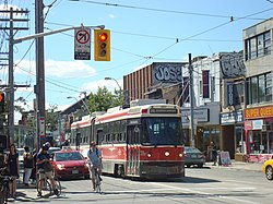
Niagara is a neighbourhood in Toronto, Ontario, Canada, located south of Queen Street West; it is usually bordered by Strachan Avenue to the west, Bathurst Street to the east, and the railway corridor to the south, and so named because Niagara Street runs through the centre of it. The eastern portion of this area (with what is now called the Fashion District) was first planned as the New Town Extension when Toronto was incorporated as a city. The area was developed as a residential area for the workers of industries located along the CN and CP railway corridors. It remains a working-class neighbourhood that has seen the development of new condominium apartment buildings.

Contents

History

Garrison Common

The ten block Town of York (later the St. Lawrence Ward of Toronto) was laid out by Governor Simcoe in 1793 [2] with its southernmost street, Palace Street (now Front Street), following the shoreline to the west where it entered Fort York on the west side of the Garrison Creek [3] This original town extended from Jarvis Street to Parliament Street (now Berkeley) with the rest of the area south of Lot Street (now Queen Street) as the 'Garrison Common' (open government land); north of Queen Street were 'farm lots'. North of about Palace Street (Front Street) and Crookshank Lane (Bathurst Street), a burial ground was established for the fort. Just before 1800 the town was extended with a 'New Town' (now the Financial District) in the west using larger lots than in the 'Old Town' and extending from Jarvis Street to Peter Street. [2] There was a military hospital at Niagara Street and Tecumseh across from Fort York.

New Town extension and development

The 'New Town' grew slowly and it was not until the Town of York was incorporated as the City of Toronto in 1834 that the 'New Town' grid was extended from Peter Street to as far west as the Garrison Creek creating the 'New Town Extension' with its curved Niagara Street, [4] later extended a block closer to the Garrison Creek with Walnut Street.

The 'New Town Extension' was planned with a number of squares: Victoria Square, Clarence Square, McDonell Square and West Market Square. In the West Market Square, St. Andrew's Market was established to rival St. Lawrence Market in the 'Old Town' to the east. [5] Between Victoria Square (including the former Garrison Burial Ground and the garrison chapel) at Bathurst Street and Clarence Square at Brock Street (Spadina Avenue) Wellington Street was planned as a broad 'Wellington Place', [6] likely modelled after similar large boulevards in the planned Capital of the United States, Washington which had been burned during the War of 1812 in return for the American occupation of Toronto. Toronto was divided into 'wards' with much of the 'New Town Extension' in St. Andrew's Ward. [7]

Toronto now extended horizontally from Niagara Street (with the Garrison Creek and Common beyond) to the Don River in the East, the area north of Queen having been planned as large estates. The areas in the extreme west ('New Town Extension') and east ('Corktown') remained largely undeveloped for some time and as poor relief programmes in Britain brought many poor and diseased to Toronto in the following years the empty lots in these areas quickly filled with poorly constructed housing and the land value deteriorated. Several Cholera and Typhoid outbreaks [8] forced the City of Toronto to use these lots to house the sick.

Many of the immigrants to this area were Irish Catholic and Toronto's first Catholic Church to serve the western part of the city was built in McDonell Square: St. Mary's Roman Catholic Church.[ citation needed ] Most of Toronto's institutions and businesses preferred to remain closer to the central city in land subdivided from former 'Park Lots' north of Queen Street.

Residential and industrial development

Historical population
YearPop.±%
20066,524    
20117,113+9.0%
20167,740+8.8%

In the 1850s the railway reached Toronto from Hamilton cutting across the Garrison Common and by 1860, more of the Garrison Common west of the Garrison Creek and south of Queen street was subdivided around a 'Strachan Avenue' leading up to Bishop Strachan's Trinity College. [9] Some of the housing in the older St. Andrew's Ward was rebuilt.

At the end of the 19th century Toronto carried out a large number of annexations and planned new grand institutional building north of Queen Street in St. John's Ward (now the Discovery District), this led to the deterioration and demolition of many of Toronto's old institutional buildings south of Queen Street with many of the large lots being sold to the expanding Railways.

Within the former 'New Town Extension', most of the area east of Bathurst Street and south of King Street, especially along 'Wellington Place' became industrial. [6] In the first half of the 20th century many working families immigrated, especially from southern Europe (especially Italy and Portugal), to this neighbourhood. McDonell Square, the site of St. Mary's Roman Catholic Church, was renamed Portugal Square in recognition of the changing demographics.

Toronto Western Cattle Market (c. 1903) and Toronto Municipal Abattoir (c. 1914) operated in the area of Wellington Street West and Walnut Avenue. The former relocated north to the Ontario Stockyards and the latter is now site of Quality Meat Packers.

In recent years, it has seen an explosion of new condominium loft and row house development. The area is located close to the Fashion and Entertainment districts.

Public transportation

An eastbound 501 Queen streetcar on Bathurst and Queen Street. The 501 Queen runs along the northern boundary of Niagara. TTC 501 ALRV 4207 at Bathurst and Queen August 10, 2013.JPG
An eastbound 501 Queen streetcar on Bathurst and Queen Street. The 501 Queen runs along the northern boundary of Niagara.

Niagara is well served by public transit. King Street West is served by the Toronto Transit Commission's 501 Queen and 504 King streetcar, which with an average of 50,000 passengers per day is the busiest surface route in the city's system.

Main streets

Some of the neighbourhood's major streets include:

Schools

Related Research Articles

<span class="mw-page-title-main">York, Upper Canada</span> Unincorporated municipality in Home District, Upper Canada

York was a town and the second capital of the colony of Upper Canada. It is the predecessor to the old city of Toronto (1834–1998). It was established in 1793 by Lieutenant-Governor John Graves Simcoe as a "temporary" location for the capital of Upper Canada, while he made plans to build a capital near today's London, Ontario. Simcoe renamed the location York after Prince Frederick, Duke of York and Albany, George III's second son. Simcoe gave up his plan to build a capital at London, and York became the permanent capital of Upper Canada on February 1, 1796. That year Simcoe returned to Britain and was temporarily replaced by Peter Russell.

<span class="mw-page-title-main">St. Lawrence, Toronto</span> Neighbourhood in Canada, Ontario, Toronto

St. Lawrence is a neighbourhood located in downtown Toronto, Ontario, Canada. The area, a former industrial area, is bounded by Yonge, Front, and Parliament Streets, and the Canadian National railway embankment. The Esplanade off Yonge St., lined with restaurants, cafés and hotels runs through the middle of the area. In previous times, the area was sometimes referred to as 'St. Lawrence Ward' or more often today as 'St. Lawrence Market', synonymous with the large retail vendor market which is the neighbourhood's focal point. The area is the site of a large city-sponsored housing project of the 1970s, which revitalized an old brownfields area. The boundaries of the St Lawrence Neighbourhood Association and the St Lawrence Market BIA are somewhat larger than those noted above. Both groups have boundaries that extend from Yonge to Parliament Streets and Queen Street East to the rail corridor.

<span class="mw-page-title-main">Queen Street, Toronto</span> Thoroughfare in Toronto, Ontario

Queen Street is a major east–west thoroughfare in Toronto, Ontario, Canada. It extends from Roncesvalles Avenue and King Street in the west to Victoria Park Avenue in the east. Queen Street was the cartographic baseline for the original east–west avenues of Toronto's and York County's grid pattern of major roads. The western section of Queen is a centre for Canadian broadcasting, music, fashion, performance, and the visual arts. Over the past twenty-five years, Queen West has become an international arts centre and a tourist attraction in Toronto.

<span class="mw-page-title-main">King Street (Toronto)</span> Thoroughfare in Canada

King Street is a major east–west commercial thoroughfare in Toronto, Ontario, Canada. It was one of the first streets laid out in the 1793 plan of the town of York, which became Toronto in 1834.

<span class="mw-page-title-main">Trinity Bellwoods Park</span> Public park in Toronto, Ontario, Canada

Trinity Bellwoods Park is a public park located in Toronto, Ontario, Canada, bordered by Queen Street West on the south and Dundas Street on the north. The western boundary of the park is Crawford Street, several hundred feet before Crawford intersects with Dundas St. West, the park juts toward Shaw Street, westside of the Crawford Street Bridge. Most of the park's area lies in the original Garrison Creek ravine and this creek, now a buried city storm sewer, still flows beneath the park from the northwest to the southeast corners.

<span class="mw-page-title-main">Front Street (Toronto)</span> Thoroughfare in Toronto, Ontario

Front Street is an east–west road in downtown Toronto, Ontario, Canada. First laid out in 1796, the street is one of the original streets of the Town of York. The street was laid out along the shoreline of Lake Ontario as it existed during that time. It remains an important street, with many important uses located along it, including the St. Lawrence Market, Meridian Hall, Union Station and the Metro Toronto Convention Centre. The eastern section of Front Street, in the West Don Lands, east of Cherry Street, is being rebuilt as a broad tree-lined boulevard, intended to be the pedestrian-friendly commercial spine of the new neighbourhood.

<span class="mw-page-title-main">Old Toronto</span> Dissolved city in Ontario, Canada

Old Toronto is the part of Toronto, Ontario, Canada, that corresponds to the boundaries of the City of Toronto prior to 1998. It was incorporated as a city in 1834, after being known as the town of York, and being part of York County. Toronto periodically grew in size by annexing adjacent land and municipalities.

<span class="mw-page-title-main">The Queensway–Humber Bay</span> Neighbourhood in Toronto, Ontario, Canada

The Queensway–Humber Bay, known officially as Stonegate–Queensway, is a neighbourhood in the southwest of Toronto, Ontario, Canada. It is located in the southeast area of the former City of Etobicoke.

<span class="mw-page-title-main">Discovery District</span> Neighbourhood in Toronto, Ontario, Canada

The Discovery District is one of the commercial districts in Downtown Toronto, Ontario, Canada. It has a high concentration of hospitals and research institutions, particularly those related to biotechnology. The district is roughly bounded by Bloor Street on the north, Bay Street on the east, Dundas Street on the south, and Spadina Avenue on the west.

<span class="mw-page-title-main">Alexandra Park, Toronto</span> Neighbourhood in Toronto, Ontario, Canada

Alexandra Park is a neighbourhood located in downtown Toronto, Ontario, Canada. Alexandra Park is bounded by Dundas Street West on the north, Spadina Avenue on the east, Queen Street West on the south, and Bathurst Street on the west. Alexandra Park consists of private and public housing, with at grade retail along Queen Street West and Spadina Avenue, some institutional, and several commercial buildings scattered through the neighborhood. The neighborhood takes its name from Alexandra Park, a municipal park at the south-east corner of Dundas Street West and Bathurst Street. The park is named for Queen Alexandra, whose husband, King Edward VII, was the first future monarch to visit Toronto.

<span class="mw-page-title-main">The Ward, Toronto</span>

The Ward was a neighbourhood in central Toronto, Ontario, Canada, in the 19th and early 20th centuries. Many new immigrants first settled in the neighbourhood; it was at the time widely considered a slum.

<span class="mw-page-title-main">Victoria Memorial Square</span> Park and former cemetery in Toronto

Victoria Memorial Square is a park and former cemetery in Toronto, Ontario, Canada. Established in 1793 as the burial place for those affiliated with the nearby Toronto Garrison. It was the first cemetery to be used by European settlers in what would become the city of Toronto. Originally known as St. John's Square, the park today is part of Fort York National Historic Site, and the site of a monument to the War of 1812 sculpted by Walter Seymour Allward and completed in 1902.

<span class="mw-page-title-main">Fort York (neighbourhood)</span> Neighbourhood in Toronto, Ontario, Canada

Fort York, also known as Garrison, is a neighbourhood in Toronto, Ontario, Canada, located west of Downtown Toronto, north of Billy Bishop Toronto City Airport, and east of Exhibition Place along the shores of Lake Ontario. While it is home to Fort York, a National Historic Site, it also contains several mid and high-rise condominium buildings built during the 21st century.

<span class="mw-page-title-main">Ossington Avenue</span> Thoroughfare in Toronto, Ontario

Ossington Avenue is a main or arterial street in Toronto, Ontario, Canada, west of downtown. While the northern 3 kilometres (1.9 mi) of Ossington Avenue is residential, its southern terminus is popularly known as the Ossington Strip, an area popular for its dining, nightlife and shopping establishments.

<span class="mw-page-title-main">St. Mary's Church (Toronto)</span> Church in Ontario, Canada

St. Mary's Church is a Roman Catholic church located at 130 Bathurst Street at Portugal Square in the Niagara neighbourhood of Toronto, Ontario, Canada. The parish was established by Irish immigrants in 1852. The Gothic Revival church was designed by Joseph Connolly and completed in 1889, with the tower finished in 1905. It stands as the picturesque western view terminus for Adelaide Street.

<span class="mw-page-title-main">Trinity-Bellwoods</span> Neighbourhood in Toronto, Ontario, Canada

Trinity-Bellwoods is an inner city neighbourhood in Toronto, Ontario, Canada. It is bounded on the east by Bathurst Street, on the north by College Street, on the south by Queen Street West, and by Dovercourt Road on the west. It has a large Portuguese and Brazilian community, and many local Portuguese-Canadian businesses are located along Dundas Street West, continuing west into Little Portugal; this stretch further west along Dundas is known as Rua Açores.

References

  1. GeoSearch
  2. 1 2 Historical Atlas of Toronto, Derek Hayes, 2008, ISBN   978-1-55365-290-8, Pg 26
  3. Sketch of the Ground in Advance of and Including York, Upper Canada, George Williams, 1813, Archives of Canada, NMC 22819
  4. Historical Atlas of Toronto, Derek Hayes, 2008, ISBN   978-1-55365-290-8, Pg 40
  5. St. Andrew's Market and Playground Historical Plaque
  6. 1 2 Wellington Place Neighbourhood Association | History
  7. Wards of Toronto, 1847-82, 1882-91 and 1891-1908
  8. City of Toronto, Arts Heritage & Culture: A PROVINCIAL CENTRE 1793-1851
  9. Atlas of Toronto, William & Henry Boulton, 1858, Toronto Archives