Rosedale, Toronto

Last updated

Rosedale
Neighbourhood
Rosedale Park playground.JPG
View of Rosedale from Rosedale Park
Rosedale map.PNG
Vicinity
Toronto map.svg
Red pog.svg
Location within Toronto
Coordinates: 43°40′44″N79°22′41″W / 43.679°N 79.378°W / 43.679; -79.378
CountryCanada
Province Ontario
City Toronto
Area
  Total2.741 km2 (1.058 sq mi)
Population
 (2016) [1]
  Total7,816
  Density2,852/km2 (7,390/sq mi)

Rosedale is a neighbourhood in central Toronto, Ontario, Canada. It was formerly the estate of William Botsford Jarvis, and so named by his wife, granddaughter of William Dummer Powell, for the wild roses that grew there in abundance. [2] It is located north of Downtown Toronto and is one of its oldest suburbs. In 2013, Rosedale was ranked the best neighbourhood in Toronto to live in by Toronto Life . [3] According to Today’s Senior Magazine, it is known as the area where the city's 'old money' lives, [4] and is home to some of Canada's richest and most famous citizens including Gerry Schwartz, founder of Onex Corporation, Adrienne Clarkson, the 26th Governor General of Canada, and her husband, the author John Ralston Saul, as well as David Thomson, 3rd Baron Thomson of Fleet of the Thomson Corporation, the latter of whom is the richest man in Canada. [5]

Contents

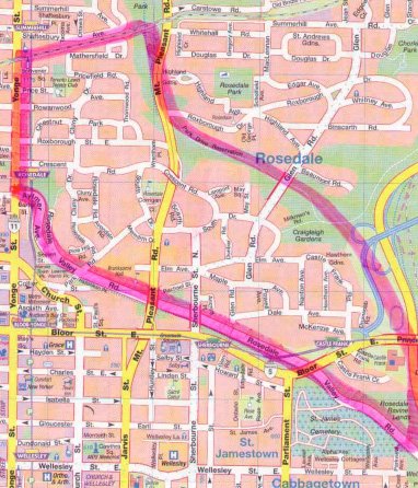
Rosedale's boundaries consist of the Canadian Pacific Railway tracks to the north, Yonge Street to the west, Aylmer Avenue and Rosedale Valley Road to the south, [6] [7] [8] and Bayview Avenue to the east. The neighbourhood is within the City of Toronto's Rosedale-Moore Park neighbourhood. The neighbourhood is divided into a north and south portion by the Park Drive Ravine.

History

The fourth Government House for Ontario's Lieutenant Governor was located in Rosedale. Built in 1915, it was demolished in 1960, with the area redeveloped to Chorley Park Chorley Park.jpg
The fourth Government House for Ontario's Lieutenant Governor was located in Rosedale. Built in 1915, it was demolished in 1960, with the area redeveloped to Chorley Park

South Rosedale was first settled by Sheriff William Jarvis and his wife, Mary, in 1826 after Jarvis inherited his father's home there two years earlier. [9] Mary Jarvis, the granddaughter of chief justice and loyalist William Drummer Powell frequently walked and rode on horseback around the trails for that formed Rosedale's meandering streets (which are one of the area's trademarks). She named the estate "Rosedale" as a tribute to the abundance of wild roses that graced the hillsides of their estate. [10] The Jarvis estate was subdivided in 1854 and became Toronto's first "garden suburb". [11] The Jarvis Family sold the Rosedale homestead in 1864, which led to the residential development of the area soon after, including the extension of Cluny Drive. [12]

A noteworthy piece of Rosedale's History, is that it was home to Ontario's fourth Government House. The house was called Chorley Park, and it was built for the Lieutenant Governor in 1915. [13] It was demolished in 1960 by the city of Toronto to save money. [14] It is now a public park of the same name. [15]

Notable residents

One of Canada's foremost fiction writers both pre- and post-World War II, Morley Callaghan lived in the southern part of Rosedale at 20 Dale Avenue from 1951 until his death in 1990; [16] a historic plaque at the nearby Glen Road footbridge summarizes Callaghan's noteworthy writing career and his best-known literary contemporaries, including Ernest Hemingway and F. Scott Fitzgerald. [17] Hockey Hall of Fame inductees W. A. Hewitt and Foster Hewitt, lived on Roxborough Street at Yonge Street. [18] [19]

Character

Glen Road bridge at Dale Avenue over the Rosedale valley (circa late 1800s) South Glen Road Bridge.jpg
Glen Road bridge at Dale Avenue over the Rosedale valley (circa late 1800s)
Ravines surround the neighbourhood of Rosedale. Rosedale Valley Road (1).jpg
Ravines surround the neighbourhood of Rosedale.

Rosedale is built among three ravines, preserved as parkland. Rosedale is full of cul de sacs and convoluted routes through the neighbourhood, which coupled with other physical boundaries (such as the ravines and bridges) lead to low levels of vehicular traffic. Even though Rosedale is located in the middle of Toronto, virtually no vehicular traffic can be heard with the abundance of trees and foliage that surround the community. [20] The homes are mostly single family detached dwellings, many of which are at least 100 years old including some former farmhouses that are closer to 200. [21] Houses range from Edwardian and Tudor in style to the more common Victorian and Georgian.

Rosedale Park is home to the annual spring park party, Mayfair. The event typically consists of rides, games, flea market and other such carnival-like activities. The event is traditionally on the first Saturday in May and is run and funded by Mooredale House.

According to Census tracts 0086.00 and 0087.00 of the 2006 Canadian census, Rosedale has 7,672 residents, up 4.8% from the 2001 census. The median income in this Census Tract in the 2006 Canadian Census was $55,906, while the average total income in this Census was $165,827, one of the highest incomes of all Toronto neighbourhoods. The median income level was also double that of Canada and Ontario, while the average total income levels were 4.5 to 5 times larger than that of Ontario and Canada. Similarly, the total income levels reflected in the 2011 National Household Survey (NHS) were exceedingly high with the total income median at $61,284, more than double that of Ontario and Canada, and the total income average at $210,484, more than 5 times that of Ontario and Canada. [22] In 2015 the average Rosedale house sold for over $1,800,000. [23] Additionally, Rosedale possesses a large population of people of English, Scottish, and Irish ethnic origin. [24]

Important buildings

North Toronto station is a former Canadian Pacific Railway station located in northwest Rosedale. View of south facade of Summerhill North Toronto CPR station.jpg
North Toronto station is a former Canadian Pacific Railway station located in northwest Rosedale.

Education

Branksome Hall is an all-girls school located in Rosedale. Branksome Hall.JPG
Branksome Hall is an all-girls school located in Rosedale.

Public

Private

Electoral districts

Rosedale is represented in the House of Commons by Chrystia Freeland [27] and is a part of the Toronto's central district, renamed to University-Rosedale in 2015 and formerly known as Toronto Centre. In Provincial Parliament, Rosedale is also a part of the University-Rosedale electoral district, and is represented by Jessica Bell.

Music

Japanese composer Toru Takemitsu wrote a three movement piece for solo guitar called "Into the Woods" in 1995 whose second movement "Rosedale" was inspired in this area of Toronto. [28]

Rosedale, Toronto - Panorama - April 2014.jpg
Whitney Park in Rosedale

Related Research Articles

<span class="mw-page-title-main">Church and Wellesley</span> LGBT-oriented settlement in Canada

Church and Wellesley is an LGBT-oriented enclave in Toronto, Ontario, Canada. It is roughly bounded by Gerrard Street to the south, Yonge Street to the west, Charles Street to the north, and Jarvis Street to the east, with the core commercial strip located along Church Street from Wellesley south to Alexander. Though some LGBT-oriented establishments can be found outside this area, the general boundaries of this village have been defined by the Gay Toronto Tourism Guild.

<span class="mw-page-title-main">Kensington Market</span> Neighbourhood in Toronto, Canada

Kensington Market is a distinctive multicultural neighbourhood in Downtown Toronto, Ontario, Canada. The Market is an older neighbourhood and one of the city's most well-known. In November 2006, it was designated a National Historic Site of Canada. Robert Fulford wrote in 1999 that "Kensington today is as much a legend as a district. The (partly) outdoor market has probably been photographed more often than any other site in Toronto."

<span class="mw-page-title-main">Deer Park, Toronto</span> Neighbourhood in Toronto, Ontario, Canada

Deer Park is a neighbourhood in Toronto, Ontario, Canada. It is centered on the intersection of Yonge Street and St. Clair Avenue and its boundaries are the Vale of Avoca section of Rosedale ravine in the east, Farnham Avenue and Jackes Avenue in the south, Avenue Road and Oriole Parkway in the west, the Beltline Trail in the north on the west side of Yonge Street, and Glen Elm Avenue in the north on the east side of Yonge Street. For the purposes of social policy analysis and research, the Toronto government’s Social Development & Administration division includes Deer Park within the City of Toronto's official "Rosedale-Moore Park" and "Yonge-St.Clair" neighbourhood profiles. The neighbourhood is in Ward 22, represented by Councillor Josh Matlow at Toronto City Council.

<span class="mw-page-title-main">Lawrence Park, Toronto</span> Neighbourhood in Toronto, Ontario, Canada

Lawrence Park is a neighbourhood in Toronto, Ontario, Canada. It is bordered by Yonge Street to the west and Bayview Avenue to the east, and from Blythwood Ravine on the south to Lawrence Avenue on the north. Lawrence Park was one of Toronto's first planned garden suburbs. Begun in the early part of the 20th century, it did not fully develop until after the Second World War. It was ranked the wealthiest neighbourhood in all of Canada in 2011.

<span class="mw-page-title-main">Yorkville, Toronto</span> Neighbourhood in Toronto, Ontario, Canada

Yorkville is a neighbourhood and former village in Toronto, Ontario, Canada. It is roughly bounded by Bloor Street to the south, Davenport Road to the north, Yonge Street to the east and Avenue Road to the west, and it is part of The Annex neighbourhood. Established as a separate community in 1830, it was annexed into Toronto in 1883. Yorkville comprises residential areas, office space, and retail shopping.

<span class="mw-page-title-main">Toronto—St. Paul's</span> Federal electoral district in Ontario, Canada

Toronto—St. Paul's is a federal electoral district in Toronto, Ontario, Canada, that has been represented in the House of Commons of Canada since 1935. Its current MP is Carolyn Bennett. Prior to the 2015 election, the riding was known as St. Paul's.

<span class="mw-page-title-main">York Mills</span> Neighbourhood in Toronto, Ontario, Canada

York Mills is a neighbourhood in Toronto, Ontario, Canada. It is centred around Yonge Street and York Mills Road located in the district of North York. In 2010, it encompassed the fourth and seventh most affluent postal codes in Canada. It is recognized as a millionaires' mile, alongside the other Toronto neighbourhoods of The Bridlepath, Forest Hill, and Rosedale.

<span class="mw-page-title-main">Moore Park, Toronto</span> Neighbourhood in Toronto, Ontario, Canada

Moore Park is a neighbourhood in Toronto, Ontario, Canada. It is one of Toronto's most affluent neighbourhoods. Toronto Life ranked the Rosedale-Moore Park neighbourhood as the best neighbourhood to live in Toronto. It lies along both sides of St. Clair Avenue East between the Vale of Avoca ravine and Moore Park ravine. The northern boundary is Mount Pleasant Cemetery and the southern the Canadian Pacific Railway tracks.

<span class="mw-page-title-main">Bloor Street</span> Major thoroughfare in Toronto

Bloor Street is a major east–west residential and commercial thoroughfare in Toronto, Ontario, Canada. Bloor Street runs from the Prince Edward Viaduct, which spans the Don River Valley, westward into Mississauga where it ends at Central Parkway. East of the viaduct, Danforth Avenue continues along the same right-of-way. The street, approximately 25 kilometres (16 mi) long, contains a significant cross-sample of Toronto's ethnic communities. It is also home to Toronto's famous shopping street, the Mink Mile.

<span class="mw-page-title-main">Government House (Ontario)</span>

Government House was the official residence of the lieutenant governor of Upper Canada and Ontario, Canada. Four buildings were used for this purpose, none of which exist today, making Ontario one of four provinces not to have an official vice-regal residence.

<span class="mw-page-title-main">Garden District, Toronto</span> Neighbourhood in Toronto, Ontario, Canada

The Garden District is a neighbourhood in downtown Toronto, Ontario, Canada. The name was selected by the Toronto East Downtown Residents Association (TEDRA) in recognition of Allan Gardens, an indoor botanical garden located nearby at the intersection of Carlton and Jarvis Streets. The Garden District was officially designated by the Mayor and Toronto City Council in 2001, while TEDRA has since been renamed the Garden District Residents Association. Part of the neighbourhood is within official City of Toronto neighbourhood of Moss Park.

<span class="mw-page-title-main">Bedford Park, Toronto</span> Neighbourhood in Toronto, Ontario, Canada

Bedford Park is a neighbourhood just outside the downtown core of Toronto. It borders Lawrence Park which was ranked Canada's wealthiest neighbourhood in 2011. The City of Toronto's neighbourhood definitions places most of Bedford Park, including Bedford Park Avenue in the Lawrence Park North Planning Neighbourood and the remaining western and northern portions of Bedford Park within a larger neighbourhood, called Bedford Park-Nortown. The border of this larger area extend to Bathurst Street on the west, Highway 401 to the north, Hillhurst Boulevard to the south, and zigzags from northeast to southwest along Yonge Street and Avenue Road.

<span class="mw-page-title-main">William Botsford Jarvis</span> Sheriff of York, Upper Canada and politician

William Botsford Jarvis was an important member of the Family Compact and Sheriff of the Home District. His estate in what was then York, Upper Canada, gave its name to Rosedale, Toronto. Jarvis Street was named for his cousin, Samuel.

<span class="mw-page-title-main">Lansing, Toronto</span> Neighbourhood in Toronto, Ontario, Canada

Lansing is a neighbourhood in Toronto, Ontario, Canada. It originated as a minor settlement of a store, other services and a post office at the corner of Yonge Street and Sheppard Avenue and later got consolidated with Toronto as sprawling development took place. A larger area was designated as the postal village of Lansing. The City of Toronto labels it as Lansing-Westgate for neighbourhood planning purposes with the boundaries Yonge Street to the east, Highway 401 to the south, Bathurst Street to the west and Burnett Avenue to the north.

<span class="mw-page-title-main">Moss Park</span> Neighbourhood in Toronto, Ontario, Canada

Moss Park is a residential neighbourhood located in downtown Toronto, Ontario, Canada. The area known as Moss Park is typically considered to be between Jarvis Street and Parliament Street, south of Dundas Street, an area dominated by public housing projects. According to one set of boundaries of the City of Toronto, it is roughly L-shaped, bounded on the north by Carlton Street to Parliament Street, on the east by Parliament Street to Queen Street East and the Don River, on the south by Eastern Avenue and Front Street, and on the west by Jarvis Street. This larger concept of the area includes the neighbourhoods known as Corktown and the Garden District, as well as a portion of Cabbagetown.

<span class="mw-page-title-main">Midtown, Toronto</span> Human settlement in Toronto, Ontario, Canada

Midtown is one of four central business districts outside the city's downtown core of Toronto, Ontario, Canada. Located in the north of Old Toronto, its borders are roughly defined by St. Clair Avenue to the south and Eglinton Avenue or Lawrence Avenue to the north, Bayview Avenue to the east and Dufferin Street to the west. The central neighbourhood of the area is Yonge–Eglinton.

<span class="mw-page-title-main">Governor's Bridge, Toronto</span> Neighbourhood in Toronto, Ontario, Canada

Governor's Bridge is a bridge and small neighbourhood in Toronto, Ontario, Canada, located to the east of Rosedale and Moore Park neighbourhoods. Unlike them, it was part of the former city of East York. The neighbourhood is named for the Governor's Bridge that crosses the Moore Park Ravine from Douglas Crescent to Astley Avenue and connects the area to Rosedale. The bridge was built in 1923 and restored in 2000.

<span class="mw-page-title-main">Beltline Trail</span> Rail trail in Toronto, Ontario

The Beltline Trail is a 9-kilometre (5.6 mi)-long cycling and walking rail trail in Toronto, Ontario, Canada. It consists of three sections, the York Beltline Trail west of Allen Road, the Kay Gardner Beltline Park from the Allen to Mount Pleasant Road, and the Ravine Beltline Trail south of Mount Pleasant Cemetery through the Moore Park Ravine. Built on the former right-of-way of the Toronto Belt Line Railway, the linear park passes through the neighbourhoods of Rosedale, Moore Park, Forest Hill, Chaplin Estates, and Fairbank.

Teddington Park is a neighbourhood in Toronto, Ontario, Canada. It is bordered by Yonge Street to the west and Bayview Avenue to the east, and from Snowden Road in the south to north of Glen Echo Road and Rosedale Golf Club. Development occurred in and around the 1930s, and was farmland before that time.

References

  1. GeoSearch
  2. "Rosedale".
  3. "The Best Places to Live in the City: A (Mostly) Scientific Ranking of All 140 Neighbourhoods in Toronto | Toronto Life". torontolife.com. 14 August 2013. Retrieved 2017-10-22.
  4. "Rosedale - old money and new luxury".
  5. "#9 Kenneth Thomson & Family".
  6. "About Us | South Rosedale Residents' Assoc | The SRRA is one of Canada's oldest ratepayer groups. Formally incorporated in 1931, the Association is committed to providing South Rosedale's residents with a strong voice relative to the area's unique position as one of Toronto's most desirable residential communities". southrosedale.org. Retrieved 2015-09-02.
  7. "Image: SouthRosedale_MAP2.jpg, (382 × 446 px)". southrosedale.org. Retrieved 2015-09-02.
  8. Marsha Kelmans (15 May 2003). "South Rosedale Heritage Conservation District Study, November 2002" (PDF). Retrieved 2015-09-02.
  9. "Rosedale - Toronto Historical Association".
  10. "History of Rosedale". Toronto Neighbourhood Guide.
  11. "Rosedale Villa".
  12. "Willaim Botsford Jarvis".
  13. "Historicist: The Saga of Chorley Park".
  14. "Biography – HEPBURN, MITCHELL FREDERICK – Volume XVIII".
  15. "Chorely Park". Archived from the original on 2016-12-06. Retrieved 2016-08-09.
  16. "Following the Footsteps of Toronto's Past Greats". National Post. 30 June 2018. Retrieved 23 November 2019. Amelia Earhart, Morley Callaghan and Lester B. Pearson are among those whose past homes have been honoured with blue plaques
  17. "Toronto's Historical Plaques". Tronto Plaques. 11 July 2016. Archived from the original on 8 February 2019. Retrieved 23 November 2019. Morley Callaghan wrote 18 novels and over 100 short stories, all about Canadians. Critically acclaimed around the world
  18. Hewitt, Foster (May 23, 1981). "Beginnings: Foster Hewitt". Ottawa Citizen . Ottawa, Ontario. p. 163. Lock-green.svg
  19. Hewitt, W. A. (1958). Down the Stretch: Recollections of a Pioneer Sportsman and Journalist. Toronto, Ontario: Ryerson Press. p. 41. OCLC   8623829.
  20. "Welcome to Rosedale".
  21. "Drumsnab".
  22. Statistics Canada, 2006, 2011
  23. "How Much Are Homes in Toronto Neighborhoods".
  24. Statistics Canada, 2006, 2011
  25. "Our IB Advantage".
  26. "When nature is the classroom". The Globe and Mail. 2017-09-28. Retrieved 2019-06-08.
  27. "Federal Election 2015: University-Rosedale riding results".
  28. "about this recording".