
Humber River—Black Creek is a federal electoral district in Toronto, Ontario, Canada, that has been represented in the House of Commons of Canada from 1867 to 1904 and since 1917. Prior to the 2015 election, the riding was known as York West. The former name reflects the riding is in the former Township of York which is within the City of Toronto.

Jane and Finch is a neighbourhood located in the northwest end of Toronto, Ontario, Canada, in the district of North York. Centred at the intersection of Jane Street and Finch Avenue West, the area is roughly bounded by Highway 400 to the west, Black Creek to the east, Sheppard Avenue to the south, and Steeles Avenue to the north.
The Demographics of Montreal concern population growth and structure for Montreal, Quebec, Canada. The information is analyzed by Statistics Canada and compiled every five years, with the most recent census having taken place in 2021.
York South—Weston is a federal electoral district in Ontario, Canada, that has been represented in the House of Commons of Canada since 1979.

Etobicoke North is a federal electoral district in Toronto, Ontario, Canada, that has been represented by one Member of Parliament in the House of Commons of Canada since 1979. It covers the neighbourhood of Rexdale, in the northern part of the Etobicoke district of Toronto.

Chicago's demographics show that it is a large, and ethnically and culturally diverse metropolis. It is the third largest city and metropolitan area in the United States by population. Chicago was home to over 2.7 million people in 2020, accounting for over 25% of the population in the Chicago metropolitan area, home to approximately 9.6 million.

Atlanta is the capital and largest city in the state of Georgia. Atlanta ranks as the 38th-largest in the United States, and the sixth-largest city in the southeastern region. 2010 census results varied dramatically with previous Census Bureau estimates, counting 420,003 residents. Atlanta is the core city of the ninth most populous United States metropolitan area at 5,268,860, with a combined statistical area of 5,626,400. A 2015 article, written by Nate Silver of fivethirtyeight.com, found that Atlanta was the second most segregated city in the U.S.
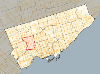
The demographics of Toronto, Ontario, Canada make Toronto one of the most multicultural and multiracial cities in the world. In 2021, 57.0 percent of the residents of the metropolitan area belonged to a visible minority group, compared with 51.4 percent in 2016, and 13.6 percent in 1981. Toronto also has established ethnic neighbourhoods such as the multiple Chinatowns, Corso Italia, Little Italy, Little India, Greektown, Koreatown, Little Tokyo, Little Jamaica, Little Portugal, Little Malta, Roncesvalles (Polish), Bloor West Village (Ukrainian), which celebrate the city's multiculturalism. Data from the suburban municipalities are also included for some metrics as most of these municipalities are part of the Toronto CMA.

Humber Summit is a neighbourhood in Toronto, Ontario, Canada. It is one of the northernmost neighbourhoods in Toronto, located in the North York district of the city. It is bounded by Steeles Avenue to the north, Highway 400 to the east, Finch Avenue to the south, and follows the Humber River to the west.

Humbermede, often called Emery, is a neighbourhood of Toronto, Ontario, Canada. Humbermede, like many of the "Humber" neighbourhoods in the city, gets its name from the Humber River. It is bounded on the west by the Humber River, on the north by Finch Avenue West, on the east by the Highway 400 and on the south by Sheppard Avenue West.

Pelmo Park-Humberlea is a neighbourhood in Toronto, Ontario, Canada. It is located north-west of the central core, in the former suburb of North York. Many of the neighbourhoods in this quadrant of the city can aptly be described as family neighbourhoods with access to parks, green space and a slower pace than found closer to downtown.

York University Heights, also known as Northwood Park, is a neighbourhood in Toronto, Ontario, Canada. It is one of Toronto's northernmost neighbourhoods, located along the northern boundary of Steeles Avenue in the former city of North York. The neighbourhood is so named because it contains the main campus of York University. This area is most popular with immigrants of Italian and Chinese descent who have established communities in the area. It is located between Sheppard Avenue and Steeles Avenue east of Black Creek.

Yorkdale–Glen Park is a neighbourhood in the city of Toronto, Ontario, Canada, located in the former suburb of North York. It is bounded by Highway 401 to the north, Allen Road to the east, a line south of Stayner Avenue to the south, and the CNR tracks to the west.

The demographics of Queens, the second-most populous borough in New York City, are highly diverse. No racial or ethnic group holds a majority in the borough.

According to the U.S. Census Bureau, as of 2023, New York was the fourth largest state in population after California, Texas, and Florida, with a population of 19,571,216, a decrease of over 600,000 people, or −3.1%, since the 2020 census. The population change between 2000–2006 includes a natural increase of 601,779 people and a decrease due to net migration of 422,481 people out of the state. Immigration from outside the United States resulted in a net increase of 820,388 people, and migration within the country produced a net loss of about 800,213.

Palmerston-Little Italy is a neighbourhood in central Toronto, Ontario, Canada. Its boundaries, according to the City of Toronto, are by Bathurst Street to the east, Bloor Street to the north, Dovercourt Road to the west and College Street to the south. It is a mature downtown neighbourhood. Within this official neighbourhood of the City of Toronto are two neighbourhoods, Palmerston and Little Italy and the commercial enclave of Mirvish Village.

Maple Leaf is a neighbourhood in the city of Toronto, Ontario, Canada. It is located in the southwest of the North York district. Its approximate borders are Lawrence Avenue to the south, Culford Road to the west, Highway 401 to the north, and the CNR rail lines east of Keele Street to the east.

Corso Italia-Davenport is a neighbourhood in central Toronto, Ontario, Canada. Its boundaries, according to the City of Toronto, are the CNR tracks to the west, Morrison Avenue to the north, Westmount Avenue to the east on the northern portion and Oakwood Avenue to the east on the southern portion, and on the south by Davenport Road. Within this official neighbourhood of the City of Toronto are several neighbourhoods, Corso Italia, Davenport, Earlscourt, and Regal Heights.

The 2020 United States Census reported that San Francisco had a population of 815,201—an increase from the 2010 Census count of 805,235. With a population density of 18,633 per square mile (7,194/km2), San Francisco is the second-most densely populated major American city, behind only New York.
As according to the New York City Department of City Planning, there were a total of 8,804,190 residents. There were almost equivalent populations of 2,719,856 White residents at 30.9% and 2,490,350 Hispanic residents at 28.3%, meanwhile there were 1,776,891 Black residents at 20.2% and 1,373,502 Asian residents at 15.6%. There were even much smaller numbers of 143,632 other race residents at 1.6% and 299,959 Two or More races residents at 3.4%. The White population declined mainly in these NYC Boroughs through these following rankings, Queens, The Bronx, and then Staten Island, though the White population increased marginally in Brooklyn and then Manhattan. The Black population experienced declines by these following rankings in these NYC Boroughs, Brooklyn, Queens, and then Manhattan, though the Black population increased marginally in The Bronx and then Staten Island. The Hispanic population increased in these NYC Boroughs by these following rankings, The Bronx, Queens, Brooklyn, and then Staten Island, but experienced decline in Manhattan. The Asian population increased in these NYC Boroughs by these following rankings, Queens, Brooklyn, Manhattan, The Bronx, and then Staten Island.
