York University Heights/Northwood Park | |
|---|---|
Neighbourhood | |
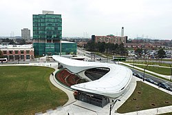 View of York University Heights from York University station | |
 | |
| Country | |
| Province | |
| City | Toronto |
| Municipality established | 1850 York Township |
| Changed municipality | 1922 North York from York Township |
| Changed municipality | 1998 Toronto from North York |
| Population (2016) [1] | |
• Total | 27,593 |
| • Density | 2,086/km2 (5,400/sq mi) |
York University Heights, also known as Northwood Park, is a neighbourhood in Toronto, Ontario, Canada. It is one of Toronto's northernmost neighbourhoods, located along the northern boundary of Steeles Avenue in the former city of North York. The neighbourhood is so named because it contains the main campus of York University. This area is most popular with immigrants of Italian and Chinese descent who have established communities in the area. It is located between Sheppard Avenue and Steeles Avenue east of Black Creek (Derrydowns Park).
Contents
- History
- The Village at York University
- Education
- Demographics
- Transportation
- Public transit
- References
- External links
The neighborhood contains many private residences, many of which are detached and semi-detached bungalows, townhouses as well as a recent new urbanism development, The Village at York University, there is also a handful of condominiums, several lowrise apartments, and a few high rise apartments.

