West Rouge

Last updated

West Rouge
Neighbourhood
Trainspotting DSC 0136 (8123569553).jpg
View of a residences in West Rouge
West Rouge map.PNG
Coordinates: 43°47′07″N79°07′33″W / 43.78528°N 79.12583°W / 43.78528; -79.12583
CountryFlag of Canada (Pantone).svg  Canada
ProvinceFlag of Ontario.svg  Ontario
City Toronto
Established1811 Pickering Township
Changed Municipality1974 Scarborough from Pickering
Changed Municipality1998 Toronto from Scarborough
Government
   MP Gary Anandasangaree (Scarborough—Rouge Park)
   MPP Vijay Thanigasalam (Scarborough—Rouge Park)
   Councillor Jennifer McKelvie (Ward 25 Scarborough—Rouge Park)

West Rouge is a neighbourhood in Toronto, Ontario, Canada. It is located in the south-east corner of Toronto, within the former city of Scarborough. The community is roughly bounded by Lake Ontario to the south, the Rouge River and the Rouge National Urban Park to the east, Port Union Road to the west and Kingston Road to the north.

Contents

History

The area was recorded as being settled as early as 1798, when a crown patent for lots 29, 30, 32 & 33, "Con. 1 with the Broken Front, Township of Pickering, County of York and Home District, Province of Upper Canada", was granted to William Holmes, Esquire. From the 1802 survey of Pickering Deputy Provincial Surveyor General Sir David Smith [1] held 4800 acres land on the east side of the Broken Front from the shoreline of Lake Ontario to 2nd Concession. [2] In 1843 Henry Cowan, an immigrant from Ayr, Scotland, bought lots 32 & 33 from Holmes and settled the land with his family. In 1848 Cowan sold a small portion of his land on the shores of Lake Ontario to the Grand Trunk Railway Company. In 1852 it became part of Ontario County.

Rouge Hill GO Station opened in southwestern West Rouge in 1967. Trainspotting GO train -440 headed by MPI MP40PH-3C - 651 (8123537685).jpg
Rouge Hill GO Station opened in southwestern West Rouge in 1967.

In the years following, much of the land was sold. In 1948, the land that is now a housing development between Rouge Hills Dr. and Ridgewood was sold to Rouge Hills Golf and Country Club Limited. The country club and golf course were closed in 1973. In May 1967, Rouge Hill GO Station was opened at the southwestern boundary of West Rouge, providing residents of the neighbourhood access to GO Transit's commuter rail network.

Until 1974 West Rouge was not part of current City of Toronto or the former City/Borough of Scarborough, but it was considered part of the township of Pickering. When Ontario County was reorganized as Durham Region that year, it was transferred to the then-borough of Scarborough under Metropolitan Toronto.

Education

The neighbourhood is home to several elementary schools operated by two public school boards, the Toronto District School Board (TDSB), and the Toronto Catholic District School Board (TCDSB).

Prior to the area's annexation by Toronto, the schools in the area were either administered by the Ontario County Board of Education (now Durham District School Board), and the Ontario County Catholic Board (now Durham Catholic District School Board). Following the neighbourhood's annexation in 1976, secular public schools were managed by the Scarborough Board of Education (later merged with the TDSB), and the Metro Toronto Separate School Board (later reorganized into the TCDSB).

The following elementary schools operate in West Rouge (with the managing school board in parentheses):

Sir Oliver Mowat Collegiate Institute (TDSB) is a public secondary school located in Port Union, adjacent to West Rouge.

The area is also a short distance from two public post-secondary campuses in nearby Highland Creek. Centennial College's Morningside Campus is located along Highland Creek's western boundary on Morningside Avenue. The University of Toronto also operates a satellite campus in the neighbourhood, the University of Toronto Scarborough. Both institutions are an approximately 8 minute drive, or 15 minute bus ride away from West Rouge.

Recreation

Rouge Pond at Rouge National Urban Park. A portion of the national urban park is located in West Rouge. Pond at south end of Rouge 1.jpg
Rouge Pond at Rouge National Urban Park. A portion of the national urban park is located in West Rouge.

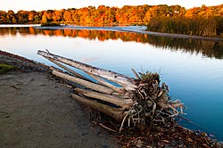
The neighbourhood of West Rouge is home to several municipal parks managed by the Toronto Parks, Forestry and Recreation Division, such as West Rouge Park. In addition to municipal parks, the neighbourhood is also home to a portion of the Rouge National Urban Park, the only national urban park in Canada. Rouge National Urban Park is situated along the western boundary of the city, with the mouth of the Rouge River located within the neighbourhood.

The West Rouge community is also the home of a large soccer club, known as the West Rouge Storm. It has house leagues and rep soccer teams for boys and girls.

Related Research Articles

<span class="mw-page-title-main">Scarborough, Ontario</span> District of Toronto, Ontario, Canada

Scarborough is a district of Toronto, Ontario, Canada. It is situated atop the Scarborough Bluffs in the eastern part of the city. Its borders are Victoria Park Avenue to the west, Steeles Avenue and the city of Markham to the north, Rouge River and the city of Pickering to the east, and Lake Ontario to the south. Scarborough was named after the English town of Scarborough, North Yorkshire, inspired by its cliffs.

<span class="mw-page-title-main">Bendale</span> Neighbourhood in Toronto, Ontario, Canada

Bendale, also called Cedarbrae and Midland Park, is a residential neighbourhood in the eastern part of Toronto, Ontario, Canada. It is located in the former suburb of Scarborough. It is centred on the intersection of Lawrence Avenue East and Brimley Road. Its boundaries, as defined by the City, are Midland Avenue from Lawrence, north to Highway 401, east to McCowan, south to Lawrence, east to West Highland Creek, south-west along West Highland Creek, then follow several side streets parallel to the Creek, north to Midland Avenue. The area north of Ellesmere is typically considered the Scarborough City Centre district, and is not considered in this neighbourhood article.

<span class="mw-page-title-main">Agincourt, Toronto</span> Neighbourhood in Toronto, Ontario, Canada

Agincourt is a neighbourhood and former village in Toronto, Ontario, Canada. Agincourt is located in northeast Toronto, along Sheppard Avenue between Kennedy and Markham Roads. Before the creation of the "megacity" of Toronto in 1998, the area was part of Scarborough. It is officially recognized by the City of Toronto as occupying the neighbourhoods of Agincourt South–Malvern West and Agincourt North.

<span class="mw-page-title-main">Port Union, Toronto</span> Neighbourhood in Toronto, Ontario, Canada

Port Union, also known as Centennial Scarborough is a neighbourhood in Toronto, Ontario, Canada. It is located in the south-east corner of Toronto, within the former suburb of Scarborough. The neighbourhood is bounded by Kingston Road to the north, Port Union Road to the east, the Lake Ontario shoreline to the south, and Highland Creek to the west.

<span class="mw-page-title-main">Malvern, Toronto</span> Neighbourhood in Toronto, Ontario, Canada

Malvern is a neighbourhood in the city of Toronto, Ontario, Canada, with a population of 44,315. It is located in the northeast corner of the city.

<span class="mw-page-title-main">West Hill, Toronto</span> Neighbourhood in Toronto, Ontario, Canada

West Hill is a neighbourhood in Toronto, Ontario, Canada. It is located in the eastern end of the city, in the former suburb of Scarborough. It is roughly bounded by Scarborough Golf Club Road and a branch of Highland Creek on the west, the CNR railway tracks and Lake Ontario on the south, and Highland Creek on the north-east. The name comes from its elevated position on the west side of Highland Creek, a deep glacial ravine.

<span class="mw-page-title-main">Scarborough Village</span> Neighbourhood in Toronto, Ontario, Canada

Scarborough Village is a neighbourhood in Toronto, Ontario, Canada, located in the Scarborough district. It was one of the earliest settlements in the former township of Scarborough with the distinction of being the site of the township's first post office. Today, the neighbourhood is composed of private and public housing, apartment complexes, schools, a few condominiums, and strip mall plazas. The neighbourhood lies along the Scarborough Bluffs escarpment.

<span class="mw-page-title-main">Milliken, Ontario</span> Neighbourhood in Ontario, Canada

Milliken and Milliken Mills are neighbourhoods in the cities of Toronto and Markham. Milliken is situated in the north west section of Scarborough, whereas Milliken Mills is situated in the south-central portions of Markham. The neighbourhoods are centered on Kennedy Road and Steeles Avenue, the latter street serving as the boundary between the cities of Markham and Toronto.

<span class="mw-page-title-main">York University Heights</span> Neighbourhood in Toronto, Ontario, Canada

York University Heights, also known as Northwood Park, is a neighbourhood in Toronto, Ontario, Canada. It is one of Toronto's northernmost neighbourhoods, located along the northern boundary of Steeles Avenue in the former city of North York. The neighbourhood is so named because it contains the main campus of York University. This area is most popular with immigrants of Italian and Chinese descent who have established communities in the area. It is located between Sheppard Avenue and Steeles Avenue east of Black Creek.

<span class="mw-page-title-main">Steeles, Toronto</span> Neighbourhood in Toronto, Ontario, Canada

Steeles is a suburban neighbourhood in Toronto, Ontario, Canada. Steeles is located in the north-eastern part of Toronto in the former suburb of Scarborough. To the north is bordered by Steeles Avenue East, to the east by Kennedy Road, to the south by a hydro-electric transmission line and to the west by Victoria Park Avenue.

<span class="mw-page-title-main">Tam O'Shanter-Sullivan</span> Neighbourhood in Toronto, Ontario, Canada

Tam O'Shanter-Sullivan is a neighbourhood in the east end of the city of Toronto, Ontario, Canada, in the district of Scarborough. The neighbourhood is bordered by Huntingwood Drive to the North, Kennedy Road to the East, Highway 401 to the South and Victoria Park to the West. The neighbourhood, which includes the Tam O'Shanter and Sullivan communities, takes its name from Tam O’Shanter Golf Course and O'Sullivan's Corners.

<span class="mw-page-title-main">Clairlea</span> Neighbourhood in Toronto, Ontario, Canada

Clairlea is a safe, quiet, middle to upper-middle income neighbourhood in Toronto, Ontario, Canada that features well treed streets and detached homes with large backyards. The neighbourhood is located in east Toronto just east of Victoria Park Avenue.

<span class="mw-page-title-main">Cliffcrest</span> Neighbourhood in Toronto, Ontario, Canada

Cliffcrest is a residential neighborhood in Toronto, Ontario, Canada. It is located along the shores of Lake Ontario in the district of Scarborough, bordered by Midland Avenue to the west, the Canadian National Railway to the north, and Bellamy Road to the east.

<span class="mw-page-title-main">Rouge, Toronto</span> Neighbourhood in Toronto, Ontario, Canada

Rouge is a neighbourhood in the northeastern area of Toronto, Ontario, within the former city of Scarborough. It is Toronto's largest neighbourhood by surface area; however, unlike other neighbourhoods, most of its area remains undeveloped, as the neighbourhood is adjacent to Rouge National Urban Park.

<span class="mw-page-title-main">Morningside, Toronto</span> Neighbourhood in Toronto, Ontario, Canada

Morningside, also known as Seven Oaks, is a suburban neighbourhood in the city of Toronto, Ontario, Canada. It is located to the north-east of downtown Toronto, in the suburb of Scarborough. Morningside is bordered by Highway 401 to the north, Morningside Avenue to the east, West Highland Creek and Lawrence Avenue to the south and Scarborough Golf Club Road to the west.

<span class="mw-page-title-main">Woburn, Toronto</span> Neighbourhood in Toronto, Ontario, Canada

Woburn is a neighbourhood located in eastern Toronto, Ontario, Canada, in the former suburb of Scarborough. Woburn is bordered by Highway 401 to the north, Orton Park Road to the east, Lawrence Avenue to the south, and McCowan Road to the west.

<span class="mw-page-title-main">Eglinton East</span> Neighbourhood in Toronto, Ontario, Canada

Eglinton East, historically known as Knob Hill, is a residential and commercial neighbourhood in Toronto, Ontario, Canada. It is bounded by Stansbury Crescent, Citadel Drive, and West Highland Creek to the north, Midland Avenue to the west, the CNR rail line, Brimley Road, and Eglinton Avenue to the south, and Bellamy Road North to the east.

<span class="mw-page-title-main">Armadale, Ontario</span> Neighbourhood in Markham and Toronto, Ontario, Canada

Armadale is a neighbourhood which overlaps the city of Markham, Ontario and the city of Toronto, Ontario, in Canada. The historical community is situated in the south-east of Markham and north-east of the former suburb of Scarborough, now part of Toronto.

<span class="mw-page-title-main">Morningside Heights, Toronto</span> Neighbourhood in Toronto, Ontario, Canada

Morningside Heights is a residential neighbourhood in Toronto, Ontario, Canada. It is located in the northeast corner of the city, in the district of Scarborough, just north of the neighbourhood of Malvern and west of Rouge Park and the Rouge. The subdivision, comprising approximately 750 acres (3.0 km2), was one of the last large tracts of undeveloped land within the City of Toronto, located between Finch Avenue East and Steeles Avenue East, from Tapscott Road to the Rouge River.

<span class="mw-page-title-main">Highland Creek, Toronto</span> Neighbourhood in Toronto, Ontario, Canada

Highland Creek is a neighbourhood in eastern Toronto, Ontario, Canada. It is located along the southern portion of the river of the same name in the former suburb of Scarborough. To the east are the neighbourhoods of Port Union and West Rouge, to the west West Hill and Woburn, and to the south Centennial Scarborough.

References