Humber Heights-Westmount

Last updated

Humber Heights-Westmount
Neighbourhood
Looking west to Raymore Park -2.JPG
View of Raymore Park in Humber Heights – Westmount
Coordinates: 43°41′50″N79°31′33″W / 43.69722°N 79.52583°W / 43.69722; -79.52583
CountryFlag of Canada (Pantone).svg  Canada
ProvinceFlag of Ontario.svg  Ontario
City Toronto
Established1850 Etobicoke Township
Changed municipality1998 Toronto from City of Etobicoke
Government
   MP Yvan Baker (Etobicoke Centre)
   MPP Kinga Surma (Etobicoke Centre)
   Councillor John Campbell (Ward 2 Etobicoke Centre)
Population
 (2016) [1]
  Total10,948
  Density3,981/km2 (10,310/sq mi)

Humber Heights-Westmount, also known as Humbervale, is a neighbourhood in Toronto, Ontario, Canada. The neighbourhood is bounded by the west bank of the Humber River, west to Royal York Road and south to Eglinton Avenue West. The Humber Creek divides the area into the northern 'Humber Heights' (originally the Etobicoke side of York Township's Weston) and the southern 'Westmount' (originally part of the 'Richview' farming district) centred along Scarlett Road and La Rose Avenue.

Contents

'Richview' district (and Richview Sideroad) originated in Westmount at Scarlett Road (at the now Eglinton Avenue intersection) and its elevation in the scenic neighbourhood gave birth to the name 'rich'-'view'. Richview Sideroad was changed to Eglinton Avenue in 1970 when a 4-lane bridge was built from the east side of the Humber River to Scarlett Road in Etobicoke. This caused the morphing of Richview Sideroad with Eglinton Avenue, and the name-change. Toronto City planners had hoped to turn Richview Sideroad into The Richview Expressway to connect mid-town Toronto to the western townships down to Hamilton. Local opposition from Westmount/James Gardens/Richmond Gardens districts put up strong and influential fight to eventually kill the plan.

Character

The housing type varies from the 'mansions' of Yorkleigh Avenue and Westmount Park to the more modest; most are low-density single homes. A commercial stretch exists on La Rose Avenue including La Rose plaza which has many stores such as La Rose Bakery, La Rose Dollar Store, and Mel Rose Variety. La Rose Bakery is known among residents to serve excellent European food. Most of the children of the neighbourhood go to either Westmount Public School or All Saints Catholic School.

The major arterial roads of the neighbourhood are Royal York Road to the west, Scarlett Road, which travels north-west to south-east through the neighbourhood and Eglinton Avenue West running east–west to the south.

Toronto Life described Humber Heights the safest neighborhood in Toronto in 2011, with the lowest crime rate of any neighborhood in the Greater Toronto Area. [2]

History

View of the aftermath of Hurricane Hazel, several kilometres from Raymore Drive, where the street of houses were washed away. Hurricane Hazel -- house2.jpg
View of the aftermath of Hurricane Hazel, several kilometres from Raymore Drive, where the street of houses were washed away.

Originally the Etobicoke side of York Township's community (later independent town) of Weston which began on the western (Etobicoke) side, the early community (now called Humber Heights) was centred on St Philip's Anglican Church at the top of Royal York Road, one of Etobicoke's first churches. [3] Early settlers traveling north to Albion Township (now in Brampton) would pass through the area.

A very large amount of land comprising the majority of farms lots on both banks of the Humber River between Lambton and Weston were first purchased by the Scarlett family in the 19th century. [4] The first Scarlett estate, 'Runnymede' near York Township's community of Lambton, was connected by an, originally private, road (now called Scarlett Road) to the three estates owned by his sons on the Etobicoke side; the street crossing the Humber River into Etobicoke near Eglinton Avenue (then called Richview Road, a small section with this name remains). As new families, many related to the Scarletts', purchased land in the area, the Etobicoke community of 'Humbervale' appeared in the late 19th century along Scarlett Road, parallel to the Humber River, from the Humber Creek in the north to where Scarlett Road crosses over the Humber River to the south (near Eglinton and La Rose Avenues).

Development

Humbervale is best known as the site of Raymore Drive, a street washed out during Hurricane Hazel with the loss of many lives. Much low-density residential was built on former farmland as many immigrants from Italy and some eastern-European countries, settled in the rapidly urbanising Etobicoke during the 1960s. All Saints Catholic Church and St Demetrius Byzantine Catholic church and school (1975) as well as a small commercial area were established on La Rose Avenue (parallel to and just north of the long undeveloped Eglinton Avenue) to serve the growing population. The original 1858 La Rose family farm house still stands on La Rose Avenue near Islington as well as a number of other historic buildings throughout the neighbourhood. A large collection of early photographs of Humbervale became one of the largest components of Etobicoke's 'History Room' when it was established in 1985 at Richview Library. Recent high-density development is now taking place along Eglinton Avenue such as the 'Royal York Grand' condominium. [5]

Demographics

Major ethnic populations (2016):

Schools

Scarlett Heights Entrepreneurial Academy is a secondary school situated in the neighbourhood. Scarlett Heights Entrepreneurial Academy.JPG
Scarlett Heights Entrepreneurial Academy is a secondary school situated in the neighbourhood.

Institutions

St. Philips Anglican Church is one of several churches located in the neighbourhood. St. Philip Anglican Church, Etobicoke.JPG
St. Philips Anglican Church is one of several churches located in the neighbourhood.

Recreation

  • Douglas B. Ford Park - formerly Weston Woods Park
  • LaRose Park
  • Scarlett Heights Park
  • Top of Richview
  • Westmount Park
  • Weston Golf & Country Club

Churches

  • St Philips Anglican Church [7] (est. 1830)
  • St Andrews Presbyterian Church, Humber Heights [8] (est. 1951)
  • St Demetrius Byzantine Catholic Church [9] (est. 1959)
  • All Saints Roman Catholic Church
  • Westmount Gospel Hall

Related Research Articles

<span class="mw-page-title-main">Etobicoke</span> District of Toronto, Ontario, Canada

Etobicoke is an administrative district and former city within Toronto, Ontario, Canada. Comprising the city's west-end, Etobicoke is bordered on the south by Lake Ontario, on the east by the Humber River, on the west by Etobicoke Creek, the cities of Brampton, and Mississauga, the Toronto Pearson International Airport, and on the north by the city of Vaughan at Steeles Avenue West.

<span class="mw-page-title-main">The Kingsway, Toronto</span> Neighbourhood in Toronto, Ontario, Canada

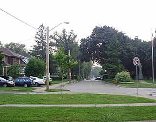
The Kingsway is a residential neighbourhood in Toronto, Ontario, Canada. It is bounded by Bloor Street to the south, Dundas Street to the north, the Mimico Creek to the west and the Humber River to the east. The neighbourhood was officially known as Kingsway Park, which later became replaced by its nickname, The Kingsway. For planning purposes, the neighbourhood is known by the City of Toronto as "Kingsway South" to differentiate it from a more recent extension of The Kingsway north of Dundas Street. "Kingsway South" is not used by residents, due to confusion with the South Kingsway, a street located east of the Humber River and extending south from Bloor Street.

<span class="mw-page-title-main">Humber River—Black Creek (federal electoral district)</span> Federal electoral district in Ontario, Canada

Humber River—Black Creek is a federal electoral district in Toronto, Ontario, Canada, that has been represented in the House of Commons of Canada from 1867 to 1904 and since 1917. Prior to the 2015 election, the riding was known as York West. The former name reflects the riding is in the former Township of York which is within the City of Toronto.

<span class="mw-page-title-main">Mimico</span> Neighbourhood in Toronto, Ontario, Canada

Mimico is a neighbourhood in Toronto, Ontario, Canada, being located in the south-west area of Toronto on Lake Ontario. It is in the south-east corner of the former Township of Etobicoke, and was an independent municipality from 1911 to 1967.

<span class="mw-page-title-main">Weston, Toronto</span> Neighbourhood in Toronto, Ontario, Canada

Weston is a neighbourhood and former town in Toronto, Ontario, Canada. The neighbourhood is situated in the northwest of the city, south of Highway 401, east of the Humber River, north of Eglinton Avenue, and west of Jane Street. The eponymous Weston Road, just north of Lawrence Avenue is the historic core of Weston, with many small businesses and services. Weston was incorporated as a village in the 19th century and was absorbed into the Borough of York in the late 1960s. York itself was amalgamated into Toronto in 1998. Weston is one of the few former towns and villages in Toronto located in a generally suburban setting, although it is contiguous with the inner city to the southeast along Weston Road. It is also one of the few not developed as a planned satellite town, as is the case with Leaside or New Toronto.

<span class="mw-page-title-main">Thistletown</span> Neighbourhood in Toronto, Ontario, Canada

Thistletown is a culturally diverse neighbourhood in Toronto, Ontario, Canada. It consists of the area surrounding the intersection of Albion Road and Islington Avenue. The borders of Thistletown are generally delineated by the Humber River: the West Branch to the south, slightly beyond the river to the east, and to the William Osler Health Centre - Etobicoke General Hospital just above the river in the north. The western border is Kipling Avenue, though the part of the neighbourhood west of Islington is sometimes considered a separate area named Beaumonde Heights.

<span class="mw-page-title-main">Lawrence Avenue</span> Thoroughfare in Toronto, Ontario

Lawrence Avenue is a major east–west thoroughfare in Toronto, Ontario, Canada. It is divided into east and west portions by Yonge Street, the dividing line of east–west streets in Toronto.

<span class="mw-page-title-main">Eglinton Avenue</span> Road in Toronto and Mississauga, Canada

Eglinton Avenue is a major east–west arterial thoroughfare in Toronto and Mississauga in the Canadian province of Ontario. The street begins at Highway 407 at the western limits of Mississauga, as a continuation of Lower Baseline in Milton. It traverses the midsection of both cities and ends at Kingston Road. Eglinton Avenue is the only street to cross all six former cities and boroughs of Metropolitan Toronto.

<span class="mw-page-title-main">Kipling Avenue</span> Road in Toronto, Canada

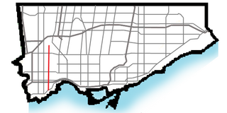
Kipling Avenue is a street in the cities of Toronto and Vaughan in Ontario, Canada. It is a concession road, 6 concessions (12 km) west from Yonge Street, and is a major north–south arterial road. It consists of three separate sections, with total combined length of 26.4 km. (16.4 mi.).

<span class="mw-page-title-main">Richview, Toronto</span> Neighbourhood in Toronto, Ontario, Canada

Richview, formally known as Willowridge-Martingrove-Richview, is a neighbourhood in the city of Toronto, Ontario, Canada. It is bounded on the west by Highway 401 and on the north by the highway and by Dixon Road, Royal York Road on the east, and Eglinton Avenue West along the south. Richview was originally established as a postal village within the then-agricultural Etobicoke Township, which later became the suburb of Etobicoke.

<span class="mw-page-title-main">Humber Valley Village</span> Neighbourhood in Toronto, Ontario, Canada

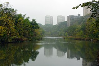
Humber Valley Village is a neighbourhood located in Toronto, Ontario, Canada. It is within the former suburb of Etobicoke and includes some of the most expensive real estate in the metropolitan west end. The boundaries are from Dundas Street on the south to Islington Avenue to the west, Eglinton Avenue to the north, and the Humber River in the east. The neighbourhood is in the political riding of Etobicoke Centre.

<span class="mw-page-title-main">Rockcliffe–Smythe</span> Neighbourhood in Toronto, Ontario, Canada

Rockcliffe–Smythe is a neighbourhood in Toronto, Ontario, Canada. It was developed after World War II as part of the urbanization of the former suburb of York Township. It is in Ward 5 in the City of Toronto.

<span class="mw-page-title-main">Mount Dennis</span> Neighbourhood in Toronto, Ontario, Canada

Mount Dennis is a neighbourhood in Toronto, Ontario, Canada. It was initially an urban area within the former township of York. Primarily located along Eglinton Avenue between the Humber River and the Kitchener commuter rail line, the neighbourhood was best known for Kodak Heights, once a major film manufacturing facility owned and operated by the Eastman Kodak Company. According to the 2016 Toronto Ward 11 Census, 62,620 residents are in the area, with a median age of 39.3 as of 2016, and a population growth of over 0.4% as of 2016. 24, 895 households are in Ward 11, and 230 net new households were built in 2016. A total of 31,125 of 62,620 are immigrant populations as of 2016. Unemployment rate is 9.5% in Ward 11 as of 2016, with an average household income of $66,447 and is much lower than Toronto's average of $102,721 as of 2016. Average rent price is $940/month as of 2016's census as well.

<span class="mw-page-title-main">The Queensway–Humber Bay</span> Neighbourhood in Toronto, Ontario, Canada

The Queensway–Humber Bay, known officially as Stonegate–Queensway, is a neighbourhood in the southwest of Toronto, Ontario, Canada. It is located in the southeast area of the former City of Etobicoke.

<span class="mw-page-title-main">Lambton, Toronto</span> Neighbourhood in Canada

Lambton is a neighbourhood in the city of Toronto, Ontario, Canada. It is situated on the east bank of the Humber River north and south of Dundas Street West. It is bounded on the north by Black Creek, on the east by Jane Street and on the south by St. Mark's Road. The area west of Gooch Avenue and south of Dundas Street West is also known as "Warren Park", the name of the housing sub-division built in the 1950s. The portion south of Dundas Street West is within the 'Lambton Baby Point' neighbourhood as defined by the City of Toronto.

<span class="mw-page-title-main">Princess Gardens</span> Neighbourhood in Toronto, Ontario, Canada

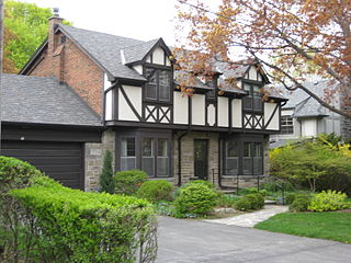
Princess Gardens is a neighbourhood in Toronto, Ontario, Canada. It is located in the western area of Toronto that was formerly the City of Etobicoke. Its boundaries are Eglinton Avenue to the north, Martin Grove to the west, Islington to the east, and Rathburn Road to the south. The southeastern part of this area is the separate neighbourhood of Thorncrest Village. The neighbourhood is divided into two areas: The portion east of Kipling Road is known as Princess Anne Manor, while the portion west of Kipling is Princess Margaret Gardens. They are named after Princess Anne, Princess Royal, and Princess Margaret, Countess of Snowdon, the daughter and sister of the late Queen Elizabeth II respectively. Both Princesses visited the Gardens and opened up Princess Margaret Public School during its opening ceremony. The southwestern part of the neighbourhood is also sometimes known as Glen Agar. Princess Gardens has some of the highest income Canadians in the Greater Toronto Area according to a 2016 census, at an average of $222,218 per year.

<span class="mw-page-title-main">Royal York Road</span> Thoroughfare in Toronto, Ontario

Royal York Road, historically known as Church Street or New Church Street, is a north-south arterial road in Toronto, Ontario, Canada. It is a concession road, 5 concessions (10 km) west of Yonge Street, and runs through many residential neighbourhoods, most notably Mimico and the Kingsway. It is classified as a "minor arterial" road by the city of Toronto.

<span class="mw-page-title-main">Italian Canadians in the Greater Toronto Area</span>

Toronto has a large Italian Canadian community, with 30.3 per cent of the ethnic Italians in Canada living in the Greater Toronto Area (GTA) as of 2021. Toronto is home to the fourth largest population of people of Italian descent after Buenos Aires, São Paulo and New York City, respectively. As of the Canada 2021 Census, there were 468,970 Italian Canadians located in the Greater Toronto Area, with 444,755 located within the Toronto CMA.

References

  1. "2016 Neighborhood Profile Humber Heights-Westmount" (PDF). City of Toronto. Retrieved 9 January 2019.
  2. Landau, Emily (25 June 2008). "Crime". Toronto Life. St. Joseph Media. Archived from the original on 27 April 2016. Retrieved 18 April 2016.
  3. 'Villages of Etobicoke', 1983 'Weston' by Marjorie Mossman, Pgs 105-109
  4. Atlas of the County of York, Etobicoke Township. Miles & Co., 1878
  5. "Royal York Grand". Archived from the original on 2009-02-12. Retrieved 2009-07-29.
  6. "All Saints Catholic School". Archived from the original on 2009-09-16. Retrieved 2009-07-29.
  7. "St. Philip's Anglican Church History".
  8. "St. Andrew's Humber Heights : About Us". Archived from the original on 2009-03-28. Retrieved 2010-03-11.
  9. "St. Demetrius Byzantine Ukrainian Catholic Church, Toronto WWW.stdemetriuschurch.ca".