Oakridge, Toronto

Last updated

Oakridge
Neighbourhood
Oakridge 2022.jpg
Oakridge aerial view in 2022
Oakridge map.PNG
Vicinity
Toronto map.png
Red pog.svg
Location within Toronto
Coordinates: 43°41′44″N79°16′33″W / 43.69556°N 79.27583°W / 43.69556; -79.27583
CountryFlag of Canada (Pantone).svg  Canada
ProvinceFlag of Ontario.svg  Ontario
City Toronto
Established1850 Scarborough Township
Changed municipality1998 Toronto from City of Scarborough
Government
   MP Bill Blair (Scarborough Southwest)
   MPP Doly Begum (Scarborough Southwest)
   Councillor Vacant (Ward 20 Scarborough Southwest)

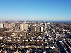
Oakridge is a neighbourhood in the city of Toronto, Canada, in the Scarborough district. The community neighbours Birch Cliff to the south, Danforth Village to the east and Cliffside to the west edging onto the Scarborough Bluffs. The neighbourhood is bordered by Victoria Park Avenue to the west, Massey Creek to the north, Warden Avenue to the east travelling south until Mack Avenue which then extends east again to the CNR rail line which forms the southern border.

Contents

Description

Victoria Park, one of two subway stations located in Oakridge Victoria Park station exterior 2022.jpg
Victoria Park, one of two subway stations located in Oakridge
Houses in Oakridge Oakridge, Toronto.JPG
Houses in Oakridge

Though traditionally a working-class neighbourhood, Oakridge is mixed with working-middle and upper-class residents. The racial make up of Oakridge is diverse with many ethnicities and religions. More than 50% of residents were born outside of Canada, and consists of Black, South Asian, and East Asian people. Over 51% of residents are of Christian faith and 20% of Muslim faith. The share of population by language spoken at home is 53% English where Bengali, Urdu and Tamil are over 20% and the remaining identify as English-Non Official or other. [1]

The section of the Danforth running through Oakridge offers shopping, dining, automotive retail, community centres and other entertainment. Being only a 15 minute commute into Downtown Toronto, the neighbourhood has two subway stations on Warden and Victoria Park, providing easy access to the City Centre or Central Scarborough. Oakridge's Business Improvement Area is represented by Crossroads of the Danforth. The BIA and merchants organize and operate year-round, admission-free festivals, charity dinners, and dances, including Wheels on the Danforth. The merchants of Crossroads of the Danforth are composed of volunteers from the business community, who work to promote growth and a strong neighbourhood identity.

The residential landscape within Oakridge dates from the Edwardian era, but the majority of homes were built during the interwar period and after World War II. Toronto council classified Oakridge as a neighbourhood improvement area in 2014, after it was assessed as having the lowest "neighbourhood equity score" in Scarborough and the fifth-lowest in the city. The score is based on 15 criteria. [2] Traditionally an immigrant, working class neighbourhood, Oakridge is experiencing the beginning phase of rapid gentrification and was featured in Toronto's Neighbourhood to Watch 2018. The neighbourhood will soon host a Long & McQuade and several new condo developments along Danforth Avenue.

See also

Related Research Articles

<span class="mw-page-title-main">Scarborough, Ontario</span> District of Toronto, Ontario, Canada

Scarborough is a district of Toronto, Ontario, Canada. It is situated atop the Scarborough Bluffs in the eastern part of the city. Its borders are Victoria Park Avenue to the west, Steeles Avenue and the city of Markham to the north, Rouge River and the city of Pickering to the east, and Lake Ontario to the south. Scarborough was named after the English town of Scarborough, North Yorkshire, inspired by its cliffs.

<span class="mw-page-title-main">Chinatowns in Toronto</span>

Toronto Chinatowns are ethnic enclaves in Toronto, Ontario, Canada, with a high concentration of ethnic Chinese residents and businesses. These neighbourhoods are major cultural, social and economic hubs for the Chinese-Canadian communities of the region. In addition to Toronto, several areas in the Greater Toronto Area also hold a high concentration of Chinese residents and businesses.

<span class="mw-page-title-main">Riverdale, Toronto</span> Neighbourhood in Toronto, Ontario, Canada

Riverdale is a large neighbourhood in Toronto, Ontario, Canada. It is bounded by the Don River Valley to the west, Danforth Avenue and Greektown to the north, Jones Avenue, the CN/GO tracks, Leslieville to the east, and Lake Shore Boulevard to the south.

<span class="mw-page-title-main">East York</span> District of Toronto, Ontario, Canada

East York is a district and former municipality within Toronto, Ontario, Canada. From 1967 to 1998, it was officially the Borough of East York, a semi-autonomous borough within the upper-tier municipality of Metropolitan Toronto. The borough was dissolved in 1998 when it was amalgamated with the other lower-tier municipalities of Metropolitan Toronto to form the new "megacity" of Toronto. Prior to its amalgamation, East York was Ontario's last remaining borough.

<span class="mw-page-title-main">Malvern, Toronto</span> Neighbourhood in Toronto, Ontario, Canada

Malvern is a neighbourhood in the city of Toronto, Ontario, Canada, with a population of 44,315. It is located in the northeast corner of the city.

<span class="mw-page-title-main">West Hill, Toronto</span> Neighbourhood in Toronto, Ontario, Canada

West Hill is a neighbourhood in Toronto, Ontario, Canada. It is located in the eastern end of the city, in the former suburb of Scarborough. It is roughly bounded by Scarborough Golf Club Road and a branch of Highland Creek on the west, the CNR railway tracks and Lake Ontario on the south, and Highland Creek on the north-east. The name comes from its elevated position on the west side of Highland Creek, a deep glacial ravine.

<span class="mw-page-title-main">Scarborough Village</span> Neighbourhood in Toronto, Ontario, Canada

Scarborough Village is a neighbourhood in Toronto, Ontario, Canada, located in the Scarborough district. It was one of the earliest settlements in the former township of Scarborough with the distinction of being the site of the township's first post office. Today, the neighbourhood is composed of private and public housing, apartment complexes, schools, a few condominiums, and strip mall plazas. The neighbourhood lies along the Scarborough Bluffs escarpment.

<span class="mw-page-title-main">Scarborough Southwest (federal electoral district)</span> Federal electoral district in Ontario, Canada

Scarborough Southwest is a federal electoral district in Toronto, Ontario, Canada, that has been represented in the House of Commons of Canada since 1968.

<span class="mw-page-title-main">Danforth Avenue</span> Arterial street in Toronto

Danforth Avenue and Danforth Road are two historically-related arterial streets in Toronto, Ontario, Canada. Danforth Avenue is an east-west street that begins in Old Toronto at the Prince Edward Viaduct as a physical continuation of Bloor Street and continues for about 6 kilometres (3.7 mi) east through old Toronto, about 350 metres (1,150 ft) of old East York, and a further 5 kilometres (3.1 mi) in Scarborough until it intersects with Kingston Road via a ramped interchange. Danforth Road splits off the Avenue west of Warden Avenue and runs diagonally northeast until south of Lawrence Avenue, where it continues as McCowan Road.

<span class="mw-page-title-main">Crescent Town</span> Neighbourhood in Toronto, Ontario, Canada

Crescent Town is a neighbourhood in Toronto, Ontario, Canada, in the former borough of East York. It is located near Victoria Park Avenue and Danforth Avenue. It mainly consists of high-rise apartment complexes, built originally to take advantage of the opening of the adjacent Victoria Park subway station, which connects to the central quadrangle via a partially covered walkway.

<span class="mw-page-title-main">Steeles, Toronto</span> Neighbourhood in Toronto, Ontario, Canada

Steeles is a suburban neighbourhood in Toronto, Ontario, Canada. Steeles is located in the north-eastern part of Toronto in the former suburb of Scarborough. To the north is bordered by Steeles Avenue East, to the east by Kennedy Road, to the south by a hydro-electric transmission line and to the west by Victoria Park Avenue.

<span class="mw-page-title-main">Tam O'Shanter-Sullivan</span> Neighbourhood in Toronto, Ontario, Canada

Tam O'Shanter-Sullivan is a neighbourhood in the east end of the city of Toronto, Ontario, Canada, in the district of Scarborough. The neighbourhood is bordered by Huntingwood Drive to the North, Kennedy Road to the East, Highway 401 to the South and Victoria Park to the West. The neighbourhood, which includes the Tam O'Shanter and Sullivan communities, takes its name from Tam O’Shanter Golf Course and O'Sullivan's Corners.

<span class="mw-page-title-main">Clairlea</span> Neighbourhood in Toronto, Ontario, Canada

Clairlea is a safe, quiet, middle to upper-middle income neighbourhood in Toronto, Ontario, Canada that features well treed streets and detached homes with large backyards. The neighbourhood is located in east Toronto just east of Victoria Park Avenue.

<span class="mw-page-title-main">Scarborough Junction</span> Neighbourhood in Toronto, Ontario, Canada

Scarborough Junction is a small neighbourhood in the Scarborough district of Toronto, Ontario, Canada. It is bordered by Birchmount Road, Brimley Road, Eglinton Avenue, and St. Clair Avenue. Scarbrough Junction has an approximated population of 20,000. The population consists of 1/4 Caucasian, 2/4 Asian and 1/4 other

<span class="mw-page-title-main">Ionview</span> Neighbourhood in Toronto, Ontario, Canada

Ionview is a neighbourhood in Toronto, Ontario, Canada, in the district of Scarborough. It is bounded by Birchmount Road to the west, the hydro transmission corridor north of Ranstone Gardens to the north, the CNR railway to the east, and Eglinton Avenue East, Kennedy Road and the CNR railway to the south.

<span class="mw-page-title-main">Woburn, Toronto</span> Neighbourhood in Toronto, Ontario, Canada

Woburn is a neighbourhood located in eastern Toronto, Ontario, Canada, in the former suburb of Scarborough. Woburn is bordered by Highway 401 to the north, Orton Park Road to the east, Lawrence Avenue to the south, and McCowan Road to the west.

<span class="mw-page-title-main">East Danforth</span> Neighbourhood in Toronto, Ontario, Canada

East Danforth, also known as Danforth Village, is a neighbourhood in the east end of Toronto, Ontario, Canada. It is located on the eastern part of Danforth Avenue in the old city of Toronto. It stretches from the eastern edge of Greektown by Greenwood Avenue to the boundary of Scarborough at Victoria Park Avenue. The area is covered by two business improvement associations, Danforth Village and Danforth Mosaic. To the north of the neighbourhood is Old East York, once a separate municipality, but today closely integrated into the area. The southern border is the railway tracks, beyond which is Leslieville and the Upper Beaches. According to the 2006 census the area has a population of 14,629.

<span class="mw-page-title-main">Birch Cliff</span> Neighbourhood in Toronto, Ontario, Canada

Birch Cliff is a neighbourhood in Toronto, Ontario, Canada. It is located in the eastern part of the city, part of the district of Scarborough running along the shore of Lake Ontario atop the western part of the Scarborough Bluffs. Birch Cliff has a large Irish population. About one-third of Birch Cliff residents are of Irish origin.

References

  1. "2016 Neighbourhood Profile - Oakridge" (PDF). City of Toronto. Retrieved 14 April 2019.
  2. "Oakridge residents discuss improvements to area | Toronto.com".