
Koreatown is an ethnic enclave within Seaton Village, a neighbourhood of Toronto, Ontario, Canada. Located along Bloor Street between Christie and Bathurst Streets, the area is known for its Korean business and restaurants. The ethnic enclave developed during the 1970s, as the city experienced an influx of Korean immigrants settling in Toronto. Toronto has the largest single concentration of Koreans in Canada with 53,940 living in the city, according to the Canada 2016 Census.

Parkdale is a neighbourhood and former village in Toronto, Ontario, Canada, west of downtown. The neighbourhood is bounded on the west by Roncesvalles Avenue, on the north by the CP Rail line where it crosses Queen Street and Dundas Street. It is bounded on the east by Dufferin Street from Queen Street south, and on the south by Lake Ontario. The original village incorporated an area north of Queen Street, east of Roncesvalles from Fermanagh east to the main rail lines, today known as part of the Roncesvalles neighbourhood. The village area was roughly one square kilometre in area. The City of Toronto government extends the neighbourhood boundaries to the east, south of the CP Rail lines, east to Atlantic Avenue, as far south as the CN Rail lines north of Exhibition Place, the part south of King Street commonly known as the western half of Liberty Village neighbourhood.

Liberty Village is a neighbourhood in Toronto, Ontario, Canada. It is bordered to the north by King Street West, to the west by Dufferin Street, to the south by the Gardiner Expressway, to the east by Strachan Avenue, and to the northeast by the CP railway tracks.

Roncesvalles is a neighbourhood in the city of Toronto, Ontario, Canada, centred on Roncesvalles Avenue, a north–south street leading from the intersection of King and Queen Streets to the south, north to Dundas Street West, a distance of roughly 1.5 kilometres. It is located east of High Park, north of Lake Ontario, in the Parkdale–High Park provincial and federal ridings and the municipal Ward 14. Its informal boundaries are High Park to the west, Bloor Street West to the north, Lake Ontario/Queen Street West to the south and Lansdowne Avenue/rail corridor to the east. Originally known as "Howard Park", most of this area was formerly within the boundaries of Parkdale and Brockton villages and was annexed into Toronto in the 1880s.

Dovercourt Park or Dovercourt Village is a neighbourhood in Toronto, Ontario, Canada situated north of Bloor Street between Christie Street to the east, the CPR railway lines to the north, and Dufferin Street to the west.

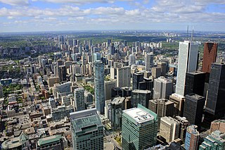
Bloor Street is a major east–west residential and commercial thoroughfare in Toronto, Ontario, Canada. Bloor Street runs from the Prince Edward Viaduct, which spans the Don River Valley, westward into Mississauga where it ends at Central Parkway. East of the viaduct, Danforth Avenue continues along the same right-of-way. The street, approximately 25 kilometres (16 mi) long, contains a significant cross-sample of Toronto's ethnic communities. It is also home to Toronto's famous shopping street, the Mink Mile.

Dufferin Street is a major north–south street in Toronto, Vaughan and King, Ontario, Canada. It is a concession road, two concessions (4 km) west of Yonge Street. The street starts at Exhibition Place, continues north to Toronto's northern boundary at Steeles Avenue with some discontinuities and continues into Vaughan, where it becomes York Regional Road 53. The street is named for Frederick Hamilton-Temple-Blackwood, 1st Marquess of Dufferin and Ava, who served as Governor General of Canada from 1872 to 1878. Prior to 1878 the street was labelled as Western City Limits or Sideline Road south off Bloor. In 2003 and 2007, it was voted as one of "Ontario's Worst 20 Roads" in the Ontario's Worst Roads poll organized by the Canadian Automobile Association.

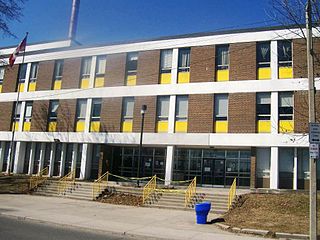
Bloor Collegiate Institute is a public secondary school located at the intersection of Bloor Street and Dufferin Street in Toronto, Ontario, Canada. The school is located in the Dufferin Grove neighbourhood and part of the Toronto Board of Education that was merged into the Toronto District School Board. Attached to the school is Alpha II Alternative School.

Brockton Village is a former town, and now the name of a neighbourhood, in Toronto, Ontario, Canada. It comprises a section of the old Town of Brockton which was annexed by the City of Toronto in 1884.

Islington-City Centre West is a commercial and residential neighbourhood in Etobicoke, Toronto, Ontario, Canada. One of four central business districts outside Downtown Toronto, it is bounded by Rathburn Road to the north, Islington Avenue to the east, Bloor Street to the south, Mimico Creek to the west.

Dufferin Grove is a neighbourhood located in Toronto, Ontario, Canada, west of downtown. The neighbourhood is bordered by Bloor Street West to the north, Ossington Ave to the east, College Street to the south, and Dufferin Street to the west.
Midtown is one of four central business districts outside the city's downtown core of Toronto, Ontario, Canada. Located in the north of Old Toronto, its borders are roughly defined by St. Clair Avenue to the south and Eglinton Avenue or Lawrence Avenue to the north, Bayview Avenue to the east and Dufferin Street to the west. The central neighbourhood of the area is Yonge–Eglinton.
Little Jamaica, also known as Eglinton West, is an ethnic enclave in the York district of Toronto, Ontario, Canada. It is situated along Eglinton Avenue West, from Allen Road to Keele Street, and is part of four neighbourhoods: Silverthorn, Briar Hill–Belgravia, Caledonia–Fairbank, and Oakwood–Vaughan. The commercial main street has been recognized to be of great cultural heritage significance to the City of Toronto, as a distinct ethnic and cultural hub for Afro-Caribbean immigrants for many decades.

Bloor West Village is a shopping district in Toronto, Ontario, Canada. Located along Bloor Street, it encompasses all businesses along Bloor Street between South Kingsway and Ellis Park Road, consisting of more than 400 shops, restaurants and services. The mix of stores include specialty clothing stores, book stores, restaurants and cafes. The businesses organized in 1970 into the first mandatory business improvement district, an idea that has spread to numerous other commercial streets in Toronto and to cities around the world.

Little Portugal is a neighbourhood and ethnic enclave in Toronto, Ontario, Canada. It is located west of downtown in the "Old" City of Toronto. It is bound on the west by Lansdowne Avenue, on the north by College Street, on the east by Bathurst Street and on the south by the Go Transit and Union Pearson Express railway tracks. The area is mainly residential, with Portuguese businesses along Dundas Street West and College Street. The area west of Dufferin Street was a part of the former Town of Brockton. The area to the east of Dufferin and south of Dundas Street is also known as "Beaconsfield Village" dating back to the days of the sub-division of lots in the area around Beaconsfield Avenue.
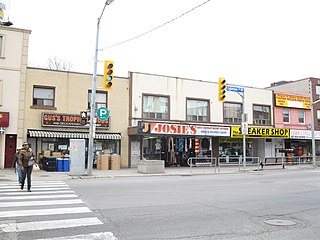
Bloorcourt Village is a Business Improvement Area in Toronto, Ontario, Canada along Bloor Street east of Dufferin Street. It is located on the southern edge of the Dovercourt Park neighbourhood. This is west of downtown, and located within the former City of Toronto.

East Danforth, also known as Danforth Village, is a neighbourhood in the east end of Toronto, Ontario, Canada. It is located on the eastern part of Danforth Avenue in the old city of Toronto. It stretches from the eastern edge of Greektown by Greenwood Avenue to the boundary of Scarborough at Victoria Park Avenue. The area is covered by two business improvement associations, Danforth Village and Danforth Mosaic. To the north of the neighbourhood is Old East York, once a separate municipality, but today closely integrated into the area. The southern border is the railway tracks, beyond which is Leslieville and the Upper Beaches. According to the 2006 census the area has a population of 14,629.

Wallace Emerson is a neighbourhood in Toronto, Ontario, Canada situated north of Bloor Street between Dufferin Street to the east, the CPR railway lines to the north and the CPR railway lines to the west.
Brockton High School is a Toronto District School Board learning complex based in the Brockton Village neighbourhood of Toronto, Ontario, Canada that once operated as Brockton Learning Centre consisting of the Aboriginal Education Centre and the Caring and Safe Schools Brockton program. It was formerly a public and vocational high school operated from 1967 to 1995 by the Toronto Board of Education. The Brockton property, located near Dufferin Mall, is currently owned by the Toronto Lands Corporation, a realtor arm of the school board.
Bloordale Beach was a guerrilla art installation and an informal community hub in the west end of Toronto, and was ironically described as "Toronto's only waterless beach".
