Demographic
The following data relates only to census tract 5350118.00. Income distribution is interesting to take into consideration due to the large majority of affluent residents in this neighbourhood. The income distribution data collected by Statistics Canada through the census in 2006 indicates that there are 900 people making under $19,999. The population was 3,900 in 2006, therefore, the 900 people in the income bracket aforementioned makes up 23% of the population within this area.
To acknowledge the changes over time, it is also important to take into consideration the data collected by Statistics Canada in the 2011 census. In 2011, the population decreased from 2006 by 303 people to 3,597. The number of people in the neighbourhood making under $19,999 in 2011 was 945. Therefore, between 2006 and 2011, there was an increase of 45 people in the low income bracket for census tract 5350118.00. Because the population decreased between 2006 and 2011, and the number of people in the low income bracket increased, in 2011, the percentage of the people in the low income bracket (making under $19,999) made up 26% of the population living in census tract 5350118.00.

Forest Hill is a neighbourhood and former village in Midtown Toronto, Ontario, Canada, located north of Downtown Toronto. The village was amalgamated into Toronto in 1967 and the area has retained its name as a neighbourhood. Along with other neighbourhoods such as Rosedale, and The Bridle Path, it is one of Toronto's wealthiest and most affluent neighbourhoods. It is home to many prominent entrepreneurs, celebrities, engineers, doctors, and lawyers. Census data from Statistics Canada states an average income for all private households in Forest Hill to be $101,631, compared to the $40,704 average income in Toronto's Census Metropolitan Area.
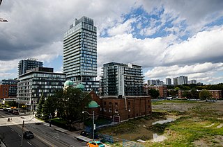
Regent Park is a neighbourhood located in downtown Toronto, Ontario built in the late 1930s as a public housing project managed by Toronto Community Housing. It sits on what used to be a significant part of the Cabbagetown neighbourhood and is bounded by Gerrard Street East to the north, River Street to the east, Shuter Street to the south and Parliament Street to the west. Regent Park's residential dwellings, prior to the ongoing redevelopment, were entirely social housing and covered all of the 69 acres (280,000 m²) which comprise the community. The original neighbourhood was razed in the process of creating Regent Park. The nickname Cabbagetown is now applied to the remaining historical, area north and west of the housing project, which has experienced considerable gentrification since the 1960s and 70s.

Rosedale is an affluent neighbourhood in central Toronto, Ontario, Canada. It was formerly the estate of William Botsford Jarvis, and so named by his wife, granddaughter of William Dummer Powell, for the wild roses that grew there in abundance. It is located north of Downtown Toronto and is one of its oldest suburbs. It is also one of the wealthiest and most highly priced neighbourhoods in Canada. Rosedale has been ranked the best neighbourhood in Toronto to live in by Toronto Life. It is known as the area where the city's 'old money' lives, and is home to some of Canada's richest and most famous citizens including Gerry Schwartz, founder of Onex Corporation, Adrienne Clarkson, the 26th Governor General of Canada, and her husband, the author John Ralston Saul, as well as David Thomson, 3rd Baron Thomson of Fleet of the Thomson Corporation, the latter of whom is the richest man in Canada.

The Junction is a neighbourhood in Toronto, Ontario, Canada, that is near the West Toronto Diamond, a junction of four railway lines in the area. The neighbourhood was previously an independent city called West Toronto, that was also its own federal electoral district until amalgamating with the city of Toronto in 1909. The main intersection of the area is Dundas Street West and Keele Street. The Stockyards is the northeastern quadrant of the neighbourhood.

Kensington Market is a distinctive multicultural neighbourhood in Downtown Toronto, Ontario, Canada. The Market is an older neighbourhood and one of the city's most well-known. In November 2006, it was designated a National Historic Site of Canada. Robert Fulford wrote in 1999 that "Kensington today is as much a legend as a district. The (partly) outdoor market has probably been photographed more often than any other site in Toronto."
Port Union, also known as Centennial Scarborough is a neighbourhood in Toronto, Ontario, Canada. It is located in the south-east corner of Toronto, within the former suburb of Scarborough. The neighbourhood is bounded by Kingston Road to the north, Port Union Road to the east, the Lake Ontario shoreline to the south, and Highland Creek to the west.

Scarborough Village is a neighbourhood in the suburb of Scarborough in Toronto, Ontario, Canada. It was one of the earliest settlements in the former township of Scarborough with the distinction of being the site of the township's first post office. Today, the neighbourhood is composed of private and public housing, apartment complexes, schools, a few condominiums, and strip mall plazas. The neighbourhood lies along the Scarborough Bluffs escarpment.

Moore Park is a neighbourhood in Toronto, Ontario, Canada. It is one of Toronto's most affluent neighbourhoods. Toronto Life ranked the Rosedale-Moore Park neighbourhood as the best neighbourhood to live in Toronto. It lies along both sides of St. Clair Avenue East between the Vale of Avoca ravine and Moore Park ravine. The northern boundary is Mount Pleasant Cemetery and the southern the Canadian Pacific Railway tracks.

St. James Town is a neighbourhood of Toronto, Ontario, Canada. It lies in the northeast corner of the downtown area. The neighbourhood covers the area bounded by Jarvis Street to the west, Bloor Street East to the north, Parliament Street to the east, and Wellesley Street East to the south.

Dovercourt Park or Dovercourt Village is a neighbourhood in Toronto, Ontario, Canada situated north of Bloor Street between Christie Street to the east, the CPR railway lines to the north, and Dufferin Street to the west.
Amesbury or Brookhaven-Amesbury is a neighbourhood in Toronto, Ontario, Canada, formerly in North York before it was amalgamated into Toronto in 1998. It is part of federal and provincial electoral district York South—Weston, and Toronto electoral wards 11: York South—Weston (West) and 12: York South—Weston (East).

Hillcrest Village is a neighbourhood located in the district of North York at the northernmost tip of the city of Toronto, Ontario, Canada. Hillcrest Village is considered by some to be part of the Don Valley Village, the neighbourhood directly to the south; however, it is quite distinct. It is bordered by Finch to the South, Leslie Street to the West, Steeles to the North and Victoria Park to the East. Both neighbourhoods share the Don Valley as a point of reference in the Eastern border of the neighbourhoods.

Mount Dennis is a neighbourhood in the York district of Toronto, Ontario, Canada, and Ward 11 in Toronto. Primarily located along Eglinton Avenue between the Humber River and the Kitchener commuter rail line, the neighbourhood was best known for Kodak Heights, once a major film manufacturing facility owned and operated by the Eastman Kodak Company. According to the 2016 Toronto Ward 11 Census, 62,620 residents are in the area, with a median age of 39.3 as of 2016, and a population growth of over 0.4% as of 2016. 24, 895 households are in Ward 11, and 230 net new households were built in 2016. A total of 31,125 of 62,620 are immigrant populations as of 2016. Unemployment rate is 9.5% in Ward 11 as of 2016, with an average household income of $66,447 and is much lower than Toronto's average of $102,721 as of 2016. Average rent price is $940/month as of 2016's census as well.

Clairlea is a neighbourhood of Scarborough, in the city of Toronto, Ontario, Canada. The neighbourhood is located in the western part of Scarborough just east of Victoria Park Avenue. To the north it is bounded by Eglinton Avenue and to the south by Taylor-Massey Creek and the railway tracks. The neighborhood is served by Warden station and the Don Valley Parkway. A large portion of Clairlea-Birchmount is taken up by shopping centres, the Eglinton Square Shopping Centre and other large retail developments along what was once Scarborough’s old Golden Mile of Industry on Eglinton Avenue.

Laflèche is a neighbourhood in the Saint-Hubert borough of the city of Longueuil.
Poverty in Canada refers to people that do not have "enough income to purchase a specific basket of goods and services in their community."

Carleton Village is a neighbourhood in the city of Toronto, Ontario, Canada. It is centered along Davenport Road, south of St. Clair Avenue West and surrounded on the other three sides by railway lines. The CNR/CPR mainline to the west, the CNR railway lines to the east, and the CPR east–west railway lines to the south.

Harbord Village is a neighbourhood in Toronto, Ontario, Canada. It lies just to the west of the University of Toronto, with its most commonly accepted borders being Bloor Street on the north, Spadina Avenue on the east, College Street to the south, and Bathurst Street to the west. Areas west of Bathurst, as far as Ossington are also sometimes included, though they are not covered by the residents' association. The area was previously known as Sussex-Ulster, after two of the major east west streets in the area. In 2000 the residents' association decided to rename itself and the area Harbord Village, after the main street running through the middle of the community. The street's name origin is unclear but could be named for abolitionist Edward Harbord, 3rd Baron Suffield.

Grange Park is a neighbourhood in downtown Toronto, Ontario, Canada. It is bounded on the west by Spadina Avenue, on the north by College Street, on the east by University Avenue and on the south by Queen Street West. It is within the 'Kensington-Chinatown' planning neighbourhood of the City of Toronto. Its name is derived from the Grange Park public park. The commercial businesses of Chinatown extend within this neighbourhood.
The demographics of Winnipeg reveal the city to be a typically Canadian one: multicultural and multilingual. Winnipeg is also prominent in the size and ratio of its First Nations population, which plays an important part in the city's makeup. About 11% of Winnipeggers are of First Nations descent, which vastly exceeds the national average of 4.3%.


