
St. Clair Avenue is a major east-west street in Toronto, Ontario, Canada. It was laid out in the late 18th century by the British as a concession road, 2 kilometres (1.2 mi) north of Bloor Street and 4 kilometres (2.5 mi) north of Queen Street.

Toronto—St. Paul's is a federal electoral district in Toronto, Ontario, Canada, that has been represented in the House of Commons of Canada since 1935. Its current MP is Carolyn Bennett. Prior to the 2015 election, the riding was known as St. Paul's.
William R. Allen Road, also known as Allen Road, the Allen Expressway and colloquially as the Allen, is a short expressway and arterial road in Toronto. It starts as a controlled-access expressway at Eglinton Avenue West, heading north to just south of Transit Road, then continues as an arterial road north to Kennard Avenue, where it continues as Dufferin Street. Allen Road is named after Metro Toronto chairman William R. Allen and is maintained by the City of Toronto. Landmarks along the road include the Lawrence Heights housing project, Yorkdale Shopping Centre and Downsview Park, and Downsview Airport. A section of the Line 1 Yonge–University subway is located within the median of the expressway from Eglinton Avenue to north of Wilson Avenue.
The Toronto Suburban Railway was a Canadian electric railway operator with local routes in west Toronto, and a radial (interurban) route to Guelph.

Bathurst Street is a main north–south thoroughfare in Toronto, Ontario, Canada. It begins at an intersection of the Queens Quay roadway, just north of the Lake Ontario shoreline. It continues north through Toronto to the Toronto boundary at Steeles Avenue. It is a four-lane thoroughfare throughout Toronto. The roadway continues north into York Region where it is known as York Regional Road 38.

Dufferin Street is a major north–south street in Toronto, Vaughan and King, Ontario, Canada. It is a concession road, two concessions (4 km) west of Yonge Street. The street starts at Exhibition Place, continues north to Toronto's northern boundary at Steeles Avenue with some discontinuities and continues into Vaughan, where it becomes York Regional Road 53. The street is named for Frederick Hamilton-Temple-Blackwood, 1st Marquess of Dufferin and Ava, who served as Governor General of Canada from 1872 to 1878. Prior to 1878 the street was labelled as Western City Limits or Sideline Road south off Bloor. In 2003 and 2007, it was voted as one of "Ontario's Worst 20 Roads" in the Ontario's Worst Roads poll organized by the Canadian Automobile Association.

Humewood–Cedarvale is an area of Toronto, Ontario, Canada, consisting of Humewood in the south, divided by Vaughan Road and Cedarvale Ravine. The neighbourhood is bordered by Bathurst Street on the east, Eglinton Avenue to the north, Arlington Avenue to the west, and St. Clair Avenue to the south. Humewood has also been known as "the Woods" because of its many streets that have names ending with "-wood", including Wychwood, Humewood, Cherrywood, Valewood, Maplewood, Wellwood, Kenwood, and Pinewood. The neighbourhood's main commercial areas are along St. Clair Ave. W., referred to as Hillcrest Village and along Eglinton Ave. W..
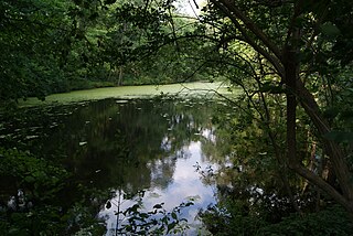
Wychwood Park is a neighbourhood enclave and private community in Toronto, Ontario, Canada. It is located west of Bathurst Street on the north side of Davenport Road, within the larger area of Bracondale Hill. It is considered part of the overall Wychwood official neighbourhood as designated by the City of Toronto.
Toronto—St. Paul's is a provincial electoral district in Ontario, Canada, that has been represented in the Legislative Assembly of Ontario since 1999. Before the 2018 election, it was known simply as St. Paul's.

Palmerston-Little Italy is a neighbourhood in central Toronto, Ontario, Canada. Its boundaries, according to the City of Toronto, are by Bathurst Street to the east, Bloor Street to the north, Dovercourt Road to the west and College Street to the south. It is a mature downtown neighbourhood. Within this official neighbourhood of the City of Toronto are two neighbourhoods, Palmerston and Little Italy and the commercial enclave of Mirvish Village.

Little Portugal is a neighbourhood and ethnic enclave in Toronto, Ontario, Canada. It is located west of downtown in the "Old" City of Toronto. It is bound on the west by Lansdowne Avenue, on the north by College Street, on the east by Ossington Avenue and on the south by the Go Transit and Union Pearson Express railway tracks. The area is mainly residential, with Portuguese businesses along Dundas Street West and College Street. The area west of Dufferin Street was a part of the former Town of Brockton. The area to the east of Dufferin and south of Dundas Street is also known as "Beaconsfield Village" dating back to the days of the sub-division of lots in the area around Beaconsfield Avenue.

Lansdowne Avenue is an arterial road in Toronto, Ontario. It runs north–south and starts at Queen Street West and proceeds north to St. Clair Avenue West. Lansdowne Avenue is primarily a four-lane arterial road, with two lanes regularly used for motor vehicle parking.

Oakwood Village, formerly known as Oakwood–Vaughan, is a neighbourhood in Toronto, Ontario, Canada. Located in the former suburb of York, the neighbourhood is a Business Improvement Area (BIA); it has an annual arts festival and a public library built in 1997.

Bracondale was a provincial electoral district in Toronto, Ontario, Canada. It was represented in the Legislative Assembly of Ontario from 1926 to 1967. The constituency got its name from an old Toronto suburb called Bracondale, that was annexed by Toronto in 1909. Its most notable event was electing one of the first two women Members of the Provincial Parliament (MPP) to share the title "first-woman MPP" in 1943 when Rae Luckock was elected. In 1965, Bracondale's MPP, Joseph Gould, died in office sparking the final election held in the constituency. George Ben won the by-election, and became the constituency's last MPP. It was abolished for the 1967 Ontario provincial election, and redistributed into the Dovercourt and Bellwoods constituencies. As of 2022, the current electoral districts of Davenport, St. Paul's, University–Rosedale, and Spadina–Fort York encompass this historic riding.

Davenport Road is an east–west arterial road in Toronto, Ontario, Canada. It is believed to follow an old native trail along the foot of the scarp of the old shoreline of glacial Lake Iroquois. It currently runs from Yonge Street in the east to Old Weston Road in the west.

Regal Heights is a neighbourhood located in Toronto, Ontario, Canada. It is classified as a part of the Corso Italia-Davenport neighbourhood by the City of Toronto. and is situated on the western crest of the Davenport escarpment. This neighbourhood has many distinguishing characteristics including very large turn of the century houses, winding tree- lined streets, and an elevation atop the Davenport escarpment. Its main commercial shopping area is along St. Clair Avenue West between Dufferin Street and Oakwood Avenue.

The St. Clair Carhouse was a streetcar facility in Toronto, Ontario, Canada. It was located south of St. Clair Avenue on a parcel of land bounded by Wychwood Avenue on the east, Benson Avenue on its north side and Christie Street on the west side. It was opened by the Toronto Civic Railways in 1913, taken over by the Toronto Transportation Commission in 1921 and closed by its successor, the Toronto Transit Commission, in 1998. The carhouse was subsequently transformed into a community centre called the Wychwood Barns.
Ward 12 Toronto—St. Paul's is a municipal electoral division in Toronto, Ontario that has been represented in the Toronto City Council since the 2018 municipal election. It was last contested in 2018, with Josh Matlow elected councillor for the 2018–2022 term.


