Woburn, Toronto

Last updated

Woburn
Neighbourhood
Centennial College Progress Campus (2023 001).jpg
View of Woburn from Centennial College's Progress Campus
Woburn map.PNG
Coordinates: 43°46′00″N79°13′40″W / 43.76667°N 79.22778°W / 43.76667; -79.22778
CountryFlag of Canada (Pantone).svg  Canada
ProvinceFlag of Ontario.svg  Ontario
City Toronto
Established1850 Scarborough Township
Changed municipality1998 Toronto from City of Scarborough
Government
   MP John McKay (Scarborough-Guildwood)
   MPP Brad Duguid (Scarborough Centre)
   Councillor Glenn De Baeremaeker (Ward 38 Scarborough Centre)
Elevation
157 m (515 ft)
Time zone UTC-5 (EST)
  Summer (DST) UTC-4 (EDT)
Area code(s) (416) and (647)

Woburn is a neighbourhood located in eastern Toronto, Ontario, Canada, in the former suburb of Scarborough. Woburn is bordered by Highway 401 to the north, Orton Park Road to the east, Lawrence Avenue to the south, and McCowan Road to the west.

Contents

Residences are split between high rises and single detached homes, which account for almost ninety per cent of all residences.

History

Taber Hill is a Wyandot burial mound in Woburn, dating back to 1250. Taber Hill.JPG
Taber Hill is a Wyandot burial mound in Woburn, dating back to 1250.

A Wyandot burial mound, Taber Hill is situated in Woburn. Dating to 1250, the burial mound contains over 500 graves, with skeletons buried in a manner consistent with the Huron Feast of the Dead.

A post-office south of Painted Post Drive (formerly Danforth's Road) and Markham Road, and a schoolhouse on Ellesmere Road west of The Markham Road, today the site of Woburn Collegiate Institute, were important sites in the early community.

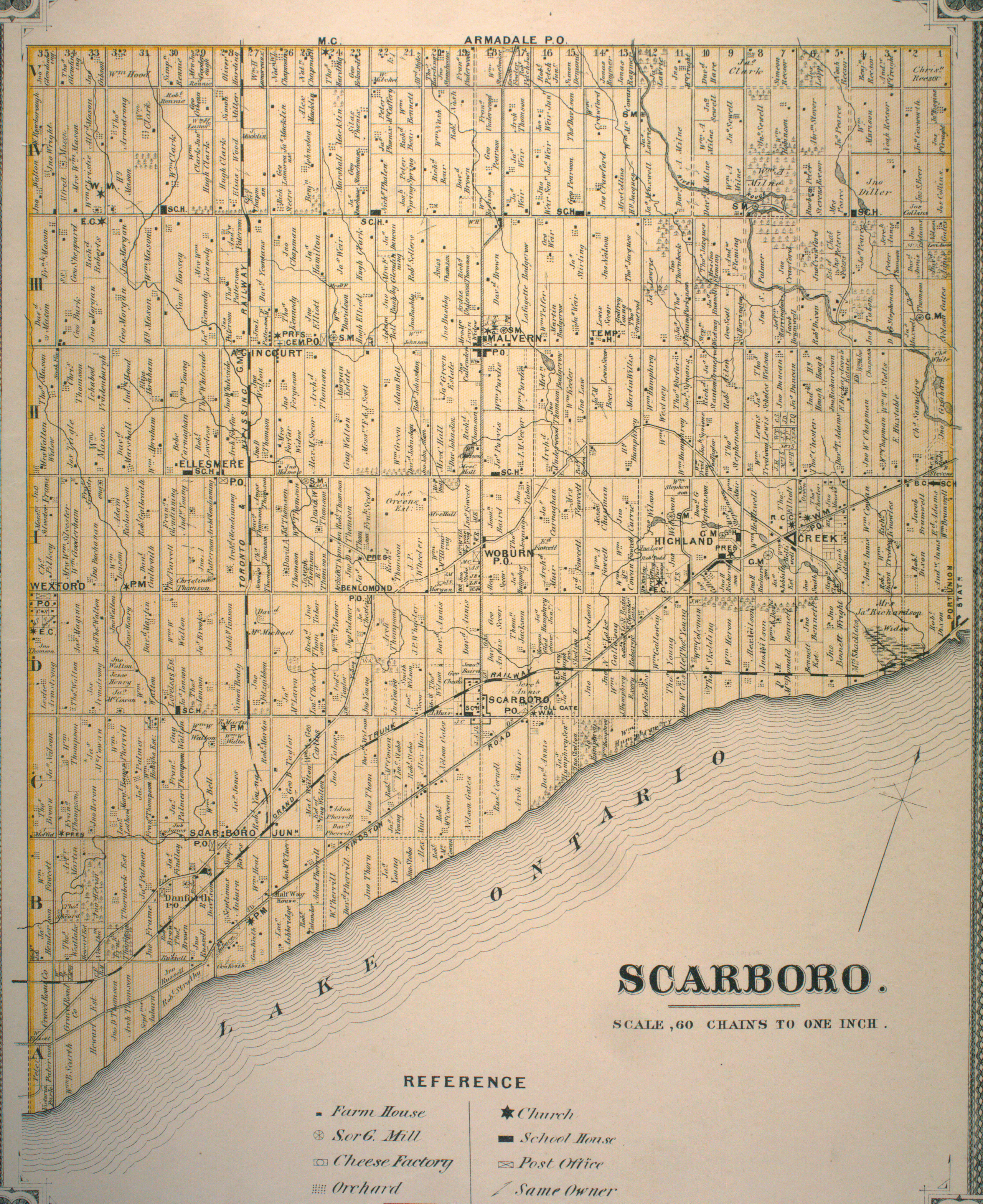
The intersection of Painted Post and Markham Road was also the site of the Woburn Hotel, and across the road was the Woburn Hall. The Woburn Hotel housed the meetings of the first Scarborough Council from 1850 until 1922.

Painted Post Drive connected Woburn to the southwest via Danforth Road and Danforth Avenue to Toronto, and to the east via Military Trail and Colonel Danforth Trails to Kingston Road and points east (for more details, see Danforth Avenue ).

Education

Two public school boards operate elementary schools in Woburn, the secular Toronto District School Board (TDSB), and the separate Toronto Catholic District School Board (TCDSB). TDSB and TCDSB elementary schools include:

Cedarbrae Collegiate Institute is a public secondary schools in Woburn. Cedarbrae Collegiate Institute.JPG
Cedarbrae Collegiate Institute is a public secondary schools in Woburn.

In addition to elementary schools TDSB also operates two secondary school in Woburn, Cedarbrae Collegiate Institute, and Woburn Collegiate Institute. TDSB is the only school board to operate a public secondary school. The French-based public secular school board, Conseil scolaire Viamonde, and it separate counterpart, Conseil scolaire catholique MonAvenir also offer schooling to applicable residents of Woburn, although they do not operate a school in the neighbourhood.

Along with primary and secondary education institutions, Woburn is also home to the Progress Campus of Centennial College, a post-secondary college.

Recreation

Morningside Park is a municipal park located in Woburn. Morningside Park (37344822530).jpg
Morningside Park is a municipal park located in Woburn.

The south and south east sections of Woburn, along West Highland Creek, have a great amount of green space, echoed by the tree lined and winding roads typical of the neighbourhood. Woburn holds a number of undeveloped green space, making up portions of the Toronto ravine system. In addition, Woburn is home to several municipal parks, including Cedar Ridge Park, Curran Hall Ravine Park, Highland Creek Park, and Morningside Park. Municipal parks in Toronto are maintained by the Toronto Parks, Forestry and Recreation Division.

In addition to municipal parks, the division also manages local community centres situated in the neighbourhood, including Cedarbrae Community Centre, and Curran Hall Community Centre. The neighbourhood is also home to several shopping plazas and a mall, Cedarbrae Mall.

Transportation

The neighbourhood is served by Toronto Transit Commission (TTC) bus system. These include the 54 Lawrence East and 954 Lawrence East Express (which predominantly serves the area), 102 Markham Road, 902 Markham Road Express, 9 Bellamy, and the 16 McCowan, (the latter four connect to Warden station). The area is also served by three bus routes on Ellesmere Road, which are 95 York Mills, 38 Highland Creek, and the 133 Neilson (the latter two serve the Scarborough Centre station). The area is also served by Highway 401 which runs through the Greater Toronto Area from east-to-west.

Related Research Articles

<span class="mw-page-title-main">Bendale</span> Neighbourhood in Toronto, Ontario, Canada

Bendale, also called Cedarbrae and Midland Park, is a residential neighbourhood in the eastern part of Toronto, Ontario, Canada. It is located in the former suburb of Scarborough. It is centred on the intersection of Lawrence Avenue East and Brimley Road. Its boundaries, as defined by the City, are Midland Avenue from Lawrence, north to Highway 401, east to McCowan, south to Lawrence, east to West Highland Creek, south-west along West Highland Creek, then follow several side streets parallel to the Creek, north to Midland Avenue. The area north of Ellesmere is typically considered the Scarborough City Centre district, and is not considered in this neighbourhood article.

<span class="mw-page-title-main">Agincourt, Toronto</span> Neighbourhood in Toronto, Ontario, Canada

Agincourt is a neighbourhood and former village in Toronto, Ontario, Canada. Agincourt is located in northeast Toronto, along Sheppard Avenue between Kennedy and Markham Roads. Before the creation of the "megacity" of Toronto in 1998, the area was part of Scarborough. It is officially recognized by the City of Toronto as occupying the neighbourhoods of Agincourt South–Malvern West and Agincourt North.

<span class="mw-page-title-main">Port Union, Toronto</span> Neighbourhood in Toronto, Ontario, Canada

Port Union, also known as Centennial Scarborough is a neighbourhood in Toronto, Ontario, Canada. It is located in the south-east corner of Toronto, within the former suburb of Scarborough. The neighbourhood is bounded by Kingston Road to the north, Port Union Road to the east, the Lake Ontario shoreline to the south, and Highland Creek to the west.

<span class="mw-page-title-main">Cliffside, Toronto</span> Neighbourhood in Toronto, Ontario, Canada

Cliffside is a neighbourhood in Toronto, Ontario, Canada, located along the Scarborough Bluffs in the district of Scarborough. Its boundaries are Kennedy Road to the west, St. Clair Avenue East to the north, Brimley Road to the east, and the Bluffs on the lakeshore to the south.

<span class="mw-page-title-main">Malvern, Toronto</span> Neighbourhood in Toronto, Ontario, Canada

Malvern is a neighbourhood in the city of Toronto, Ontario, Canada, with a population of 44,315. It is located in the northeast corner of the city.

<span class="mw-page-title-main">West Hill, Toronto</span> Neighbourhood in Toronto, Ontario, Canada

West Hill is a neighbourhood in Toronto, Ontario, Canada. It is located in the eastern end of the city, in the former suburb of Scarborough. It is roughly bounded by Scarborough Golf Club Road and a branch of Highland Creek on the west, the CNR railway tracks and Lake Ontario on the south, and Highland Creek on the north-east. The name comes from its elevated position on the west side of Highland Creek, a deep glacial ravine.

<span class="mw-page-title-main">Wexford, Toronto</span> Neighbourhood in Toronto, Ontario, Canada

Wexford is a neighbourhood in Toronto, Ontario, Canada. It is located in the eastern part of the city, on the western end of the district of Scarborough, spanning Lawrence Avenue East between Victoria Park Avenue and Birchmount Road. There are many persons of Greek heritage in this neighbourhood. The Wexford Heights Business Improvement Area boasts 245 members and hosts an annual street festival on Lawrence.

<span class="mw-page-title-main">Scarborough Village</span> Neighbourhood in Toronto, Ontario, Canada

Scarborough Village is a neighbourhood in Toronto, Ontario, Canada, located in the Scarborough district. It was one of the earliest settlements in the former township of Scarborough with the distinction of being the site of the township's first post office. Today, the neighbourhood is composed of private and public housing, apartment complexes, schools, a few condominiums, and strip mall plazas. The neighbourhood lies along the Scarborough Bluffs escarpment.

<span class="mw-page-title-main">Richview, Toronto</span> Neighbourhood in Toronto, Ontario, Canada

Richview, formally known as Willowridge-Martingrove-Richview, is a neighbourhood in the city of Toronto, Ontario, Canada. It is bounded on the west by Highway 401 and on the north by the highway and by Dixon Road, Royal York Road on the east, and Eglinton Avenue West along the south. Richview was originally established as a postal village within the then-agricultural Etobicoke Township, which later became the suburb of Etobicoke.

<span class="mw-page-title-main">Cedarbrae Collegiate Institute</span> Public high school in Toronto, Ontario, Canada

Cedarbrae Collegiate Institute, formerly Cedarbrae Secondary School is a semestered public secondary school in Toronto, Ontario, Canada. It is located in the Woburn neighbourhood in former suburb of Scarborough. It was established in 1961 by the former Scarborough Board of Education and is now operated by the Toronto District School Board.

<span class="mw-page-title-main">L'Amoreaux</span> Neighbourhood in Toronto, Ontario, Canada

L'Amoreaux is a neighbourhood in Toronto, Ontario, Canada, situated east of Victoria Park Avenue, south of McNicoll Avenue, west of Kennedy Road and north of Huntingwood Drive. L'Amoreaux is named after Josue L'Amoreaux (1738–1834), a French Huguenot loyalist who settled in the area. Prior to the amalgamation of Toronto in 1998, L'Amoreaux was a neighbourhood of the former city of Scarborough, and prior to the amalgamation of municipalities, it formed part of the town of Agincourt.

<span class="mw-page-title-main">Tam O'Shanter-Sullivan</span> Neighbourhood in Toronto, Ontario, Canada

Tam O'Shanter-Sullivan is a neighbourhood in the east end of the city of Toronto, Ontario, Canada, in the district of Scarborough. The neighbourhood is bordered by Huntingwood Drive to the North, Kennedy Road to the East, Highway 401 to the South and Victoria Park to the West. The neighbourhood, which includes the Tam O'Shanter and Sullivan communities, takes its name from Tam O’Shanter Golf Course and O'Sullivan's Corners.

<span class="mw-page-title-main">Clairlea</span> Neighbourhood in Toronto, Ontario, Canada

Clairlea is a safe, quiet, middle to upper-middle income neighbourhood in Toronto, Ontario, Canada that features well treed streets and detached homes with large backyards. The neighbourhood is located in east Toronto just east of Victoria Park Avenue.

<span class="mw-page-title-main">Scarborough Junction</span> Neighbourhood in Toronto, Ontario, Canada

Scarborough Junction is a small neighbourhood in the Scarborough district of Toronto, Ontario, Canada. It is bordered by Birchmount Road, Brimley Road, Eglinton Avenue, and St. Clair Avenue. Scarbrough Junction has an approximated population of 20,000. The population consists of 1/4 Caucasian, 2/4 Asian and 1/4 other

<span class="mw-page-title-main">Dorset Park</span> Neighbourhood in Toronto, Ontario, Canada

Dorset Park is a neighbourhood in Toronto, Ontario, Canada. It is located in the western part of the district of Scarborough. The neighbourhood is bordered by Highway 401 to the north, Midland Avenue to the east, Lawrence Avenue to the south, and Birchmount Road to the west. Kennedy Road runs along the neighbourhood's centre north and south and Ellesmere Road runs along the centre east and west. The area south of Lawrence Avenue, north of the hydro corridor, is known as McGregor Park and is often included as part of Dorset Park.

<span class="mw-page-title-main">Morningside Heights, Toronto</span> Neighbourhood in Toronto, Ontario, Canada

Morningside Heights is a residential neighbourhood in Toronto, Ontario, Canada. It is located in the northeast corner of the city, in the district of Scarborough, just north of the neighbourhood of Malvern and west of Rouge Park and the Rouge. The subdivision, comprising approximately 750 acres (3.0 km2), was one of the last large tracts of undeveloped land within the City of Toronto, located between Finch Avenue East and Steeles Avenue East, from Tapscott Road to the Rouge River.

<span class="mw-page-title-main">Highland Creek, Toronto</span> Neighbourhood in Toronto, Ontario, Canada

Highland Creek is a neighbourhood in eastern Toronto, Ontario, Canada. It is located along the southern portion of the river of the same name in the former suburb of Scarborough. To the east are the neighbourhoods of Port Union and West Rouge, to the west West Hill and Woburn, and to the south Centennial Scarborough.

<span class="mw-page-title-main">Scarborough Board of Education</span> Board of Education for the City of Scarborough

The Scarborough Board of Education, formally the Board of Education for the City of Scarborough is the former public-secular school district serving Scarborough, Ontario, Canada. The board was founded in 1954 through a merger of the Scarborough Collegiate and Township School Boards.

<span class="mw-page-title-main">Bendale Business and Technical Institute</span> High school in Scarborough, Toronto, Ontario, Canada

Bendale Business and Technical Institute, formerly Bendale Secondary School and Bendale Vocational School is a defunct specialized technical public high school that was located in Bendale, a neighbourhood in Scarborough, Ontario, Canada owned by the Scarborough Board of Education, that succeeded its operations into the present Toronto District School Board prior to merger. Existed from 1963 until its closure in 2019, it was the first vocational school that served in the former borough of Scarborough in which the school tailored for students with life skills or pursue career in the industry. The school's motto was Flourish Through Industry.

References

  1. "Bellmere Junior Public School > About Us > General Information".
  2. "PEG Achievements".
  3. "Ontario Band Association Awards 08'".