
Yonge–Eglinton is a neighbourhood in Toronto, Ontario, Canada, at the intersection of Yonge Street and Eglinton Avenue. It is central to the area of Midtown Toronto, one of four central business districts outside Downtown Toronto. The City of Toronto defines its boundaries as Briar Hill Avenue to the north, Yonge Street to the east, Frobisher Avenue and a line in that direction west to Elmsthorpe Avenue, then north to Eglinton Avenue, east to Avenue Road and north to Briar Hill.
Guildwood, also known as Guildwood Village, is a residential neighbourhood in Toronto, Ontario, Canada. It is located in the eastern area of the city, in the district of Scarborough. It is bounded by the Scarborough Bluffs, south of Kingston Road, from Grey Abbey Trail in the east.

Bloordale Village is a Business Improvement Area (BIA) located along Bloor Street from Dufferin Street to Lansdowne Avenue, west of downtown in Toronto, Ontario, Canada. It sits on the southern border of the Wallace Emerson neighbourhood and the northern border of the Brockton Village neighbourhood. The district is home to various and unique shops including restaurants, bars, vintage and thrift stores.

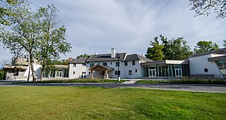
Riverdale Farm is a 3-hectare (7.4-acre) municipally operated farm in the heart of Cabbagetown, an urban neighbourhood in Toronto, Ontario, Canada. It is maintained by Toronto Parks, Forestry and Recreation Division.
Wanless Park is a neighbourhood and park in North Toronto, Ontario, Canada. It is located just north of Lawrence Avenue, between Bayview Avenue and Ronan Avenue.
Erindale is an historical neighbourhood located within the central part of the city of Mississauga, west of Toronto, Ontario, Canada. Erindale is named in honour of the birthplace of the first rector of the village, Reverend James Magrath from Erin (Ireland).

Lansing is a neighbourhood in Toronto, Ontario, Canada. It originated as a minor settlement of a store, other services and a post office at the corner of Yonge Street and Sheppard Avenue and later got consolidated with Toronto as sprawling development took place. A larger area was designated as the postal village of Lansing. The City of Toronto labels it as Lansing-Westgate for neighbourhood planning purposes with the boundaries Yonge Street to the east, Highway 401 to the south, Bathurst Street to the west and Burnett Avenue to the north.

For the settlement established by former slaves in Guyana known as Victoria Village see Victoria, Guyana

Pleasant View is a neighbourhood in the city of Toronto, Ontario, Canada that is located in the district of North York at the northern end of the city. It is bordered by Victoria Park to the East, Sheppard Avenue to the South, Highway 404 to the west and the Finch hydro corridor to the north. The neighbourhood is home to several high-rise apartment and condominium buildings, such as The Clippers.

Don Valley Village is a neighbourhood in the city of Toronto, Ontario, Canada. It is located in the former suburb of North York. Located north of Highway 401 and bisected by Don Mills Road, it is bounded by Sheppard Avenue to the south, Leslie Street to the west, Finch Avenue to the north and Highway 404 to the east. Like the nearby Don River Valley, the neighbourhood has hill and dale topography.

Hillcrest Village is a neighbourhood located in Toronto, Ontario, Canada. It is located in the northern district of North York. It is bordered by Finch to the South, Leslie Street to the West, Steeles to the North and Victoria Park to the East. Both neighbourhoods share the Don Valley as a point of reference in the Eastern border of the neighbourhoods.

Old Mill is a neighbourhood of Toronto, Ontario, Canada on the banks of the Humber River. It is located north and west of the intersection of Bloor Street and Jane Street. The area takes its name from the old grist mill ruins on the west bank of the river, now converted into a hotel. The City of Toronto includes this neighbourhood in the official "Lambton Baby Point" neighbourhood which includes the Baby Point enclave and former Lambton village areas to the north.

Ionview is a neighbourhood in Toronto, Ontario, Canada, in the district of Scarborough. It is bounded by Birchmount Road to the west, the hydro transmission corridor north of Ranstone Gardens to the north, the CNR railway to the east, and Eglinton Avenue East, Kennedy Road and the CNR railway to the south.
Midtown is one of four central business districts outside the city's downtown core of Toronto, Ontario, Canada. Located in the north of Old Toronto, its borders are roughly defined by St. Clair Avenue to the south and Eglinton Avenue or Lawrence Avenue to the north, Bayview Avenue to the east and Dufferin Street to the west. The central neighbourhood of the area is Yonge–Eglinton.

Toronto District Christian High School (TDChristian) is an independent Christian secondary school located in the city of Vaughan, Ontario, Canada, in the city's Woodbridge neighbourhood. It was founded in 1960 and began classes in 1963. TDCH currently has an enrollment of about 450 students. TDCH is a member of the Ontario Alliance of Christian Schools.

East Toronto was an incorporated community, currently part of Toronto, Ontario, Canada. It covered much of the present day neighbourhood of the Upper Beaches, stretching up to Danforth Avenue in the north, part of it stretching to Lake Ontario in the south a portion of the present-day neighbourhood, The Beaches. The central street in East Toronto was Main Street, running between Danforth Avenue to Kingston Road. The commercial centre of the town was located at the intersection of Main Street and Lake View Avenue. Following the annexation of East Toronto into Toronto, Main Street retained its name despite Toronto's conceptual Main Street being historically designated to be Yonge Street.

Bloor West Village is a residential neighbourhood and shopping district in Toronto, Ontario, Canada. Bordered on the south by Bloor Street, it encompasses all businesses along Bloor Street between South Kingsway and Ellis Park Road, consisting of more than 400 shops, restaurants and services, plus the residential neighbourhood to the north. The official City of Toronto name of the neighbourhood is Runneymede-Bloor West Village.

Baitul Islam is a mosque in Vaughan, Ontario run by the Ahmadiyya Muslim Community (AMJ) in Canada. It was inaugurated on October, 17th 1992 in the presence of the fourth Caliph of the community and many Members of Parliament.
Toronto and Region Islamic Congregation, commonly referred to by its acronym as TARIC Islamic Center is one of the largest Islamic Centers in the city of Toronto, Ontario, Canada, formerly in the city of North York. With its distinct box-shaped oriental motif, TARIC makes a rather unusual and highly visible landmark in the city of Toronto, primarily due to its location on a vacant space near the very busy multi-level Hwy 401/Hwy 400 interchange.
Corktown Common is a park in the south eastern portion of the West Don Lands neighbourhood in Toronto, Ontario, Canada which opened in 2013. It borders the Don River to the east. It was built on remediated industrial lands to be the centrepiece of a new emerging neighbourhood in downtown Toronto. It also provides a barrier to flooding from the Don River.

