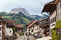
Statistics
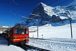
Official statistics of tourism were planned in 1852, but were only realized in 1934, and continued until 2003. Since 2004, the Federal Statistical Office had discontinued its statistics, but collaborates with Switzerland Tourism in the publication of yearly "Swiss Tourism Figures". In the year 2011, a total number of 4,967 registered hotels or hostels, offered a total of 240,000 beds in 128,000 rooms. This capacity was saturated to 41.7% (compared to 39.7% in 2005), amounting to a total of 38.8 million lodging nights. 14% of hotels were in Grisons, 12% each in the Valais and Eastern Switzerland, 11% in Central Switzerland and 9% in the Bernese Oberland. The ratio of lodging nights in relation to resident population ("tourism intensity", a measure for the relative importance of tourism to local economy) was largest in Grisons (8.3) and Bernese Oberland (5.3), compared to a Swiss average of 1.3. 56.4% of lodging nights were by visitors from abroad (broken down by nationality: 16.5% Germany, 6.3% United Kingdom, 4.8% United States, 3.6% France, 3.0% Italy). [10]
The total financial volume associated with tourism, including transportation, is estimated to CHF 35.5 billion (as of 2010) although some of this comes from fuel tax and sales of motorway vignettes. The total gross value added from tourism is 14.9 billion. Tourism provides a total of 144,838 full-time equivalent jobs in the entire country. The total financial volume of tourist lodging is 5.19 billion CHF and eating at the lodging provides an additional 5.19 billion. The total gross value added of 14.9 billion is about 2.9% of Switzerland's 2010 nominal GDP of 550.57 billion CHF. [11] [12]
The most visited Swiss tourist attractions are first, the Rhine Falls, second, the Berne Bear exhibit (both without entrance fee), and third, with over 1.8 million paid entries: Zoo Basel.
Overnight stays by country
Most overnight stays in 2019 in Switzerland were from the following countries of residence: [15]
| Rank | Country | Number of overnight stays |
|---|
| 1 |  Germany Germany | 3,925,653 |
| 2 |  United States United States | 2,474,360 |
| 3 |  United Kingdom United Kingdom | 1,641,429 |
| 4 |  China China | 1,583,799 |
| 5 |  France France | 1,227,105 |
| 6 |  Italy Italy | 887,679 |
| 7 |  Gulf states Gulf states | 863,767 |
| 8 |  India India | 792,607 |
| 9 |  Netherlands Netherlands | 648,054 |
| 10 |  Belgium Belgium | 636,425 |
| Total foreign | 21,639,611 |
|---|
This page is based on this
Wikipedia article Text is available under the
CC BY-SA 4.0 license; additional terms may apply.
Images, videos and audio are available under their respective licenses.

 Bern Old City with the Zytglogge
 Geneva Jet d'Eau with Mont Blanc
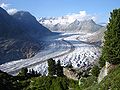 Aletsch Glacier with Aletsch Forest
 Lake Geneva with the Lavaux vineyards
 Chillon Castle with the Dents du Midi
 Tremola road of the Gotthard Pass
 Lake Lugano from Parco Ciani

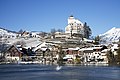 Werdenberg with Castle