Grant County | |
---|---|
Coordinates: 38°38′N84°37′W / 38.64°N 84.61°W | |
Country | United States |
State | Kentucky |
Founded | 1820 |
Seat | Williamstown |
Largest city | Williamstown |
Area | |
• Total | 261 sq mi (680 km2) |
• Land | 258 sq mi (670 km2) |
• Water | 2.8 sq mi (7 km2) 1.1% |
Population (2020) | |
• Total | 24,941 |
• Estimate (2023) | 25,619 |
• Density | 96/sq mi (37/km2) |
Time zone | UTC−5 (Eastern) |
• Summer (DST) | UTC−4 (EDT) |
Congressional district | 4th |
Website | grantcounty |
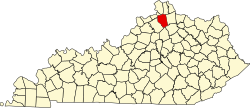
Grant County is a county located in the northern part of the U.S. state of Kentucky. As of the 2020 census, the population was 24,941. [1] Its county seat is Williamstown. [2] The county was formed in 1820 and named for Colonel John Grant, [3] who led a party of settlers in 1779 to establish Grant's Station, in today's Bourbon County, Kentucky. Grant County is included in the Cincinnati-Middletown, OH-KY-IN Metropolitan Statistical Area. Grant County residents voted to allow full alcohol sales in the county by a margin of 56% to 44% in a special election on December 22, 2015. [4] In the 19th century, Grant County had multiple saloons. [5]
The Grant County News, established in 1906 and published in Williamstown, is preserved on microfilm by the University of Kentucky Libraries. The microfilm holdings are listed in a master negative database on the UK Libraries Preservation and Digital Programs website. [6]
Grant County was established in 1820 from land taken from Pendleton County. The historic courthouse, built in 1939, replaced two earlier structures. A new judicial center was completed in April 2010. [7] In 1975, many residents reported seeing a UFO at Williamstown Lake. [8]
According to the United States Census Bureau, the county has a total area of 261 square miles (680 km2), of which 258 square miles (670 km2) is land and 2.8 square miles (7.3 km2) (1.1%) is water. [9]
Census | Pop. | Note | %± |
---|---|---|---|
1830 | 2,986 | — | |
1840 | 4,192 | 40.4% | |
1850 | 6,531 | 55.8% | |
1860 | 8,356 | 27.9% | |
1870 | 9,529 | 14.0% | |
1880 | 13,083 | 37.3% | |
1890 | 12,671 | −3.1% | |
1900 | 13,239 | 4.5% | |
1910 | 10,581 | −20.1% | |
1920 | 10,435 | −1.4% | |
1930 | 9,876 | −5.4% | |
1940 | 9,876 | 0.0% | |
1950 | 9,809 | −0.7% | |
1960 | 9,489 | −3.3% | |
1970 | 9,999 | 5.4% | |
1980 | 13,308 | 33.1% | |
1990 | 15,737 | 18.3% | |
2000 | 22,384 | 42.2% | |
2010 | 24,682 | 10.3% | |
2020 | 24,941 | 1.0% | |
2023 (est.) | 25,619 | [10] | 2.7% |
U.S. Decennial Census [11] 1790-1960 [12] 1900-1990 [13] 1990-2000 [14] 2010-2020 [1] |
As of the census of 2000, there were 22,384 people, 8,175 households, and 6,221 families residing in the county. The population density was 86 per square mile (33/km2). There were 9,306 housing units at an average density of 36 per square mile (14/km2). The racial makeup of the county was 98.31% White, 0.25% Black or African American, 0.23% Native American, 0.29% Asian, 0.05% Pacific Islander, 0.32% from other races, and 0.54% from two or more races. 1.04% of the population were Hispanic or Latino of any race.
There were 8,175 households, out of which 39.60% had children under the age of 18 living with them, 60.10% were married couples living together, 11.10% had a female householder with no husband present, and 23.90% were non-families. 19.80% of all households were made up of individuals, and 8.20% had someone living alone who was 65 years of age or older. The average household size was 2.72 and the average family size was 3.10.
In the county, the population was spread out, with 28.70% under the age of 18, 9.40% from 18 to 24, 31.50% from 25 to 44, 20.90% from 45 to 64, and 9.50% who were 65 years of age or older. The median age was 33 years. For every 100 females there were 97.10 males. For every 100 females age 18 and over, there were 94.80 males.
The median income for a household in the county was $38,438, and the median income for a family was $42,605. Males had a median income of $31,987 versus $23,669 for females. The per capita income for the county was $16,776. About 9.00% of families and 11.10% of the population were below the poverty line, including 15.10% of those under age 18 and 13.40% of those age 65 or over.
Grant County has six schools: Crittenden Mt Zion (CMZ), Dry Ridge Elementary (DRE), Sherman Elementary (SES), Mason Corinth Elementary (MCE), Grant County Middle School (GCMS), Grant County High School (GCHS) and Williamstown Independent Schools (WES)- (WMS) – (WHS).
Grant County's only library is located in Williamstown.
Year | Republican | Democratic | Third party | |||
---|---|---|---|---|---|---|
No. | % | No. | % | No. | % | |
2020 | 8,725 | 78.55% | 2,205 | 19.85% | 178 | 1.60% |
2016 | 7,268 | 76.03% | 1,910 | 19.98% | 381 | 3.99% |
2012 | 5,664 | 65.80% | 2,810 | 32.64% | 134 | 1.56% |
2008 | 5,510 | 62.94% | 3,112 | 35.55% | 132 | 1.51% |
2004 | 5,951 | 67.44% | 2,818 | 31.94% | 55 | 0.62% |
2000 | 4,405 | 62.02% | 2,568 | 36.15% | 130 | 1.83% |
1996 | 2,697 | 45.43% | 2,541 | 42.80% | 699 | 11.77% |
1992 | 2,128 | 39.44% | 2,097 | 38.87% | 1,170 | 21.69% |
1988 | 2,835 | 59.05% | 1,896 | 39.49% | 70 | 1.46% |
1984 | 2,840 | 61.70% | 1,685 | 36.61% | 78 | 1.69% |
1980 | 1,779 | 42.53% | 2,272 | 54.32% | 132 | 3.16% |
1976 | 1,212 | 33.35% | 2,336 | 64.28% | 86 | 2.37% |
1972 | 2,086 | 64.03% | 1,054 | 32.35% | 118 | 3.62% |
1968 | 1,386 | 39.35% | 1,169 | 33.19% | 967 | 27.46% |
1964 | 1,068 | 30.13% | 2,461 | 69.42% | 16 | 0.45% |
1960 | 2,163 | 53.25% | 1,899 | 46.75% | 0 | 0.00% |
1956 | 1,680 | 42.04% | 2,300 | 57.56% | 16 | 0.40% |
1952 | 1,609 | 38.67% | 2,545 | 61.16% | 7 | 0.17% |
1948 | 1,154 | 30.22% | 2,633 | 68.94% | 32 | 0.84% |
1944 | 1,621 | 40.05% | 2,413 | 59.62% | 13 | 0.32% |
1940 | 1,535 | 35.96% | 2,729 | 63.93% | 5 | 0.12% |
1936 | 1,353 | 34.35% | 2,560 | 64.99% | 26 | 0.66% |
1932 | 1,407 | 30.64% | 3,148 | 68.55% | 37 | 0.81% |
1928 | 2,448 | 59.48% | 1,662 | 40.38% | 6 | 0.15% |
1924 | 1,404 | 39.45% | 1,923 | 54.03% | 232 | 6.52% |
1920 | 1,613 | 37.19% | 2,686 | 61.93% | 38 | 0.88% |
1916 | 1,078 | 36.44% | 1,841 | 62.24% | 39 | 1.32% |
1912 | 837 | 32.43% | 1,562 | 60.52% | 182 | 7.05% |
Public transportation is provided by Senior Services of Northern Kentucky with demand-response service. [16]
Grant County, specifically in Williamstown, is the location of the Ark Encounter, operated by the Christian apologetics organization Answers in Genesis and opened in 2016. [17] [18] [19]
Wood County is a county in the U.S. state of West Virginia. As of the 2020 census, the population was 84,296, making it West Virginia's fifth-most populous county. Its county seat is Parkersburg. The county was formed in 1798 from the western part of Harrison County and named for James Wood, governor of Virginia from 1796 to 1799.
Shelby County is a county located in the northeastern portion of the U.S. state of Missouri. As of the 2020 census, the population was 6,103. Its county seat is Shelbyville. The county was established on January 2, 1835, and named for Governor Isaac Shelby of Kentucky.
Schuyler County is a county located in the northeastern portion of the U.S. state of Missouri. As of the 2020 census, its population was 4,032, making it the fourth-least populous county in Missouri. Its county seat is Lancaster. The county was organized February 14, 1845, from Adair County, and named for General Philip Schuyler, delegate to the Continental Congress and U.S. Senator from New York.
Owen County is a county located in the northern part of the U.S. state of Kentucky. Its county seat is Owenton. The county is named for Colonel Abraham Owen. It is a prohibition or dry county, with the exception of a winery that is authorized to sell its product to the public, and limited sales within the incorporated city limits of Owenton.
Marion County is a county in the U.S. state of Kentucky. As of the 2020 census, the total population was 19,581. Its county seat is Lebanon. The county was founded in 1834 and named for Francis Marion, the American Revolutionary War hero known as the "Swamp Fox".
Kenton County is a county located in the northern part of the Commonwealth of Kentucky. As of the 2020 census, the population was 169,064, making it the third most populous county in Kentucky. Its county seats are Covington and Independence. It was, until November 24, 2010, the only county in Kentucky to have two legally recognized county seats. The county was formed in 1840 and is named for Simon Kenton, a frontiersman notable in the early history of the state.
Hickman County is a county located in the U.S. state of Kentucky. As of the 2020 census, the population was 4,521, making it the third-least populous county in Kentucky. Its county seat is Clinton. The county was formed in 1821. It is the least densely populated county in the state and is a prohibition or dry county.
Harrison County is a county located in the U.S. state of Kentucky. As of the 2020 census, the population was 18,692. Its county seat is Cynthiana. The county was founded in 1793 and named for Colonel Benjamin Harrison, an advocate for Kentucky statehood, framer of the Kentucky Constitution, and Kentucky legislator.
Fleming County is a county located in the U.S. state of Kentucky. As of the 2020 census, the population was 15,082. Its county seat is Flemingsburg. The county was formed in 1798 and named for Colonel John Fleming, an Indian fighter and early settler. It is a moist county. In 1998, the Kentucky General Assembly designated Fleming County as the Covered Bridge Capital of Kentucky.
Crittenden County is a county in the U.S. state of Kentucky. At the 2020 census, the population was 8,990. Its county seat and only municipality is Marion. The county was formed in 1842 and named for John J. Crittenden, senator and future Governor of Kentucky.
Carlisle County is a county located in the U.S. state of Kentucky. As of the 2020 census, the population was 4,826, making it the fourth-least populous county in Kentucky. Its county seat is Bardwell. The county was founded in 1886 and named for John Griffin Carlisle, a Speaker of the United States House of Representatives from Kentucky. It remains a prohibition or dry county. Carlisle County is included in the Paducah, KY-IL, Metropolitan Statistical Area.
Prestonsburg is a small home rule-class city in and the county seat of Floyd County, Kentucky, United States. It is in the eastern part of the state in the valley of the Big Sandy River. The population was 3,255 at the time of the 2010 census, down from 3,612 at the 2000 census.
Millersburg is a home rule-class city in Bourbon County, Kentucky, United States. The population was 792 at the 2010 census. It is part of the Lexington–Fayette Metropolitan Statistical Area.
Liberty is a home rule-class city in Casey County, Kentucky, in the United States. It is the seat of its county. Its population was 2,168 at the 2010 U.S. census.
Crittenden is a home rule-class city in Grant and Kenton counties, Kentucky, in the United States. The population was 4,023 as of the 2020 Census, up from 3,815 as of the 2010 census, which was further up from 2,401 at the 2000 census.
Dry Ridge is a home rule-class city in Grant County, Kentucky, in the United States. The population was 2,191 at the 2010 census, up from 1,995 at the 2000 census. From around 1910 to 1960, the city's economy was dominated by business related to its mineral water wells, purported to have healing properties.
Berry is a home rule-class city in Harrison County, Kentucky, in the United States. The city was formally incorporated by the state assembly in 1867 as "Berryville". It was renamed "Berry Station" two years later. The population was 264 at the 2010 census, down from 310 at the 2000 census.
North Eagle Butte is a census-designated place (CDP) in Dewey County, South Dakota, United States, along the 45th parallel. The population was 1,879 at the 2020 census.
Corinth is a home rule-class city mostly in Grant County with a small portion of land in Scott County in the U.S. state of Kentucky. The population was 232 as of the 2010 census, up from 181 at the 2000 census.
Williamstown is a home-rule-class city in Grant and Pendleton counties in the U.S. state of Kentucky. The population was 3,925 at the 2010 census, up from 3,227 as of the 2000 census. It is the county seat of Grant County.