Honda Group, Colombia

Last updated
Honda Group
Stratigraphic range: Late Oligocene-Late Miocene
typically Middle Miocene
(Laventan)
~13.8–11.8  Ma
O
S
D
C
P
T
J
K
Pg
N
Villa vieja2.jpg
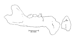
Statue of a prehistoric ground sloth from the Honda Group in Villavieja, Huila
Type Geological group
Sub-units Villavieja Fm.
  Cerro Colorado Mb.
  Baraya Mb.
La Victoria Fm.
  Cerbatana Mb.
Underlies Gigante Group
  Neiva Fm.
Overlies Payandé Group
  Barzalosa Fm., Saldaña Fm., Santa Teresa Fm.
Thicknessup to 5,000 m (16,000 ft)
Lithology
Primary Conglomerate, sandstone
Other Claystone, siltstone, volcanoclastic sediments
Location
Coordinates 5°11′31″N74°43′21″W / 5.19194°N 74.72250°W / 5.19194; -74.72250
Region Huila, Tolima, Cundinamarca
Middle Magdalena Valley, Upper Magdalena Valley
Central & Eastern Ranges
Andes
CountryFlag of Colombia.svg  Colombia
Extent~250 km (160 mi)
Type section
Named for Honda
Named by Hettner
Location Honda (original)
Tatacoa Desert (redefined)
Year defined1892
Coordinates 3°14′04″N75°12′15″W / 3.23444°N 75.20417°W / 3.23444; -75.20417
Approximate paleocoordinates 3°06′N72°24′W / 3.1°N 72.4°W / 3.1; -72.4
Region Tolima (original)
Huila (redefined)
CountryFlag of Colombia.svg  Colombia
Thickness at type section3,255 m (10,679 ft)
Blakey 020Ma - COL.jpg
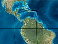
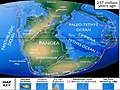
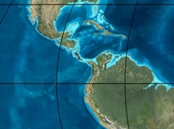
Paleogeography of Northern South America
20 Ma, by Ron Blakey
Tolima Topographic 2.png
Blue pog.svg
Orange pog.svg
Topographical map of Tolima Department
Blue pog.svg original type locality of the Honda Group
Orange pog.svg redefined type section in Huila

The Honda Group (Spanish : Grupo Honda, Tsh, Ngh) is a geological group of the Upper and Middle Magdalena Basins and the adjacent Central and Eastern Ranges of the Colombian Andes. The group, in older literature also defined as formation, is in its present-day type section in the Tatacoa Desert in the department of Huila subdivided into two main formations; La Victoria and Villavieja.

Contents

The group was originally defined in and named after Honda, Tolima, but has been redefined based on the many fossil finds in the Tatacoa Desert, 250 kilometres (160 mi) to the south. In the original type section of its occurrence, the 3,255 metres (10,679 ft) thick group is subdivided into three formations, from old to young; Cambrás, San Antonio and Los Limones.

The group dates to the Neogene period; in its broadest definition from the Late Oligocene to Late Miocene, and in the redefined type section restricted to the Laventan age of the South American Land Mammal Ages (SALMA), equivalent to the Middle Miocene Serravallian epoch.

The Honda Group is a Konzentrat-Lagerstätte at the fossiliferous La Venta site in the department of Huila and eastern Tolima and hosts one of the richest formations containing Miocene fauna worldwide.

Etymology and definitions

View of Honda, Tolima, namesake of the Honda Group Honda (Colombia).jpg
View of Honda, Tolima, namesake of the Honda Group

The group was first defined by Hettner in 1892 in the area of the town after which it is named; Honda, Tolima. [1] In 1942 and 1946, the group was defined as a formation by Royo and Gómez. The first author who used the name Honda for a group, was American zoologist who studied the La Venta fauna in detail, Ruben Arthur Stirton. Subdivisions of the group have been proposed by many different authors with high detail in the different beds. [2] Names as "Monkey Beds", "Fish Beds" and "Unit above Fish Beds" have been colloquially used to designate certain stratigraphic units based on their fossil content. [3] [4] The most accepted definition of the group, formations and members was proposed by Villarroel et al. in 1996 to simplify the stratigraphy in a regional sense solving the excessive subdivision into 19 units by Guerrero et al. (1994). [5]

Regional setting

Today, the sediments of the Honda Group are exposed in the Middle (Valle Medio del Magdalena, VMM) and Upper Magdalena Valley (Valle Superior del Magdalena, VSM) in an intermontane valley between the Central Ranges in the west and the Eastern Ranges in the east. The valley in between the two major orogenic chains is filled by the Magdalena River, the longest river of Colombia. The Upper Magdalena Valley geologically is subdivided into the Neiva Sub-basin with the Girardot Sub-basin of the southernmost Middle Magdalena Valley to the north, divided by the Natagaima Arch. [6] The Neiva Sub-basin is bound by the Chusma Fault in the west and to the east by the west-verging Garzón Fault. [7] The Mulato-Getudo Fault possibly underlies the Honda Group south of the La Miel River. [8] The Tatacoa Desert, where the type section of the Honda Group has been redefined is an unusually dry region in Colombia, caused by a mountain induced rain-shadow effect. In Middle Miocene times, the geography was more comparable to the present eastern foothills of the Andes. [9]

The tectonic history of the three mountain chains of Colombia, from west to east, the Western, Central and Eastern Ranges has been studied in detail. The Western and Central Ranges were the first to be exhumed in the Paleogene, with minor uplifts in the Eastern Ranges at this age. The onset of the regional uplift of the Eastern Ranges is dated around the Middle Miocene, with an increased rate of exhumation between 12 and 3 Ma. [10] This caused a segmentation of the current Magdalena Basins and the Llanos Basin to the east, previously part of a larger foreland basin to the east of the Central Ranges. [11] The León Formation in the Llanos Basin provides the first indication of the tectonic uplift of the Eastern Ranges, isolating the Llanos Basin from the Magdalena Valley. [12]

Description

Stratigraphy

The Honda Group unconformably overlies in parts the volcanic deposits of the Prado Member, [4] Barzalosa Formation of the Payandé Group, and in other parts the Saldaña, [13] and Santa Teresa Formations. [14] The unit is overlain by the Neiva Formation of the Gigante Group. [3] [15] The presence of a hiatus between the Honda Group and the Barzalosa Formation has been suggested. [16] The group is characterised by two main formations; the lower La Victoria Formation and upper Villavieja Formation. Previously, the La Dorada Formation has been named as a subdivision of the Honda Group, while other authors define that unit as a member. Other names for members and formations are Cerbatana Member, also published as Cervetana Member, named after Quebrada La Cerbatana, Las Mesitas Formation, El Líbano Formation, Baraya Volcanic Member, named after Baraya, and Cerro Colorado Red Bed Member. [17] The Perico Member of the La Dorada Formation has been made equivalent to the La Victoria Formation, as well as the El Líbano Formation. [4]

La Victoria Formation

This formation was first defined by Guerrero in his Master's thesis (1991) and further refined in his doctoral thesis in 1993. The type locality of the La Victoria Formation has been set in the La Venta area and the formation is named after the town of La Victoria, at 15 kilometres (9.3 mi) north-northeast of the urban centre of Villavieja. The formation, restricted to the Neiva Sub-basin, [18] consists mainly of sandstones, conglomeratic sandstones and conglomerates (75%) with intercalated claystones and siltstones (25%). [5]

The upper part of the La Victoria Formation, underlying the Villavieja Formation, is characterised by a 45 metres (148 ft) section of conglomerates, designated the Cerbatana Member or Cerbatana Conglomerates. The conglomerate shows trough-cross lamination and imbrication of clasts in a predominantly matrix-supported sequence, with minor clast-supported sections. The base of the conglomerate marks an erosional surface into the underlying silt and clay beds. The clasts of the conglomerate are mostly milky quartz, chert and volcanic in origin, with diameters averaging around 7 centimetres (2.8 in) with a maximum of 15 centimetres (5.9 in). Conglomeratic and medium to coarse-grained sandstone banks, with a similar grain composition as the conglomerates, up to 2 metres (79 in) thick are intercalated between the conglomeratic sections. The sandstones are cemented by calcium carbonate in hardgrounds that sometimes form rounded concretions. The claystones and siltstones that are less commonly found in the La Victoria Formations range in thickness from 1 to 11 metres (3.3 to 36.1 ft) and show reddish-brown, greenish-grey and greyish colourations. [19]

Villavieja Formation

Wind erosion of the Villavieja Formation in the Tatacoa Desert Las catedrales - The Tatacoa Desert (4925039787).jpg
Wind erosion of the Villavieja Formation in the Tatacoa Desert

The name Villavieja Formation was first proposed by Wellman in 1968 as a member of the Honda Formation. Two years later, the author elevated the rank to a formation, as part of the Honda Group. The formation takes its name from the municipality Villavieja, Huila, 35 kilometres (22 mi) to the north-northeast of the departmental capital Neiva. The type locality is situated on the right bank of the Magdalena River in the Eastern Ranges of the Colombian Andes. [20]

The contact between the Villavieja Formation and the underlying La Victoria Formation is concordant. [18] The basal part of the Villavieja Formation comprises siltstones and claystones that also form the bulk of the formation with 75 percent. The remaining quarter is composed of conglomeratic sandstones. The thickness of the siltstones and claystones can exceed 8 metres (26 ft) and have interspersed fine- to medium-grained 10 centimetres (3.9 in) thin sandstone beds. The fine sediments of the Villavieja Formation are coloured greenish, reddish-brown or bluish-grey and display weathering patterns in so-called "cauliflower erosion" structures. The light grey coarser beds, up to conglomeratic sandstone size, do not exceed 2.5 metres (8.2 ft) in thickness and commonly show a lateral transition with the silt- and claystones. The Baraya Member of the Villavieja Formation shows thin yellowish and reddish brown sandstone and siltstone levels with volcaniclastic grains. [20]

Honda area

The Honda Group extends for approximately 250 kilometres (160 mi) from the Upper to the Middle Magdalena Basin and is exposed in various locations along the right and left banks of the Magdalena River. Outcrops along the road between Girardot and Agua de Dios, Cundinamarca show a lower sequence of thick beds of greenish-yellow feldspar- and mica-rich conglomeratic sandstones, intercalated with reddish claystones and an upper level of alternating medium-to-coarse grained quartz arenites with low-angle cross stratification. These sandstones are intercalated with thick layers of fissile claystones with common calcareous sandstone concretions. [21] Sediments of the Honda Group restrict the course of the Sumapaz River to a narrow valley, close to its confluence with the Magdalena River. [22]

The majority of the municipality Prado, Tolima rests upon sediments of the Honda Group. [23] In the Middle Magdalena Basin and the eastern flank of the Central and the western flank of the Eastern Ranges, the group is subdivided into the Los Limones, San Antonio and Cambrás Formations. The total thickness of these formations in the northern original type section of the Honda Group reaches 3,255 metres (10,679 ft), [1] while a total thickness of 5,000 metres (16,000 ft) has been registered. [15]

Age

Thanks to the fossil abundance of the Honda Group at La Venta, the geological period of the sediments has received a separate name in the South American Mammal Ages (SALMA); Laventan, ranging from 13.8 to 11.8 Ma, as the only SALMA age defined north of the equator and in Colombia. [24] The age of the Villavieja Formation has been estimated to be between 17.0 and 12.1 Ma, [20] while the stratigraphically lower La Victoria Formation is dated at 13.82 to 12.38 Ma (Serravallian), based on fission track and volcanic analysis and paleomagnetic research. [18]

The Honda Group is laterally time equivalent with the lower part of the Real Formation in the central and northern Middle Magdalena Basin, [25] the lower part of the León Formation of the Llanos Basin, [26] the upper range of the Ciénaga de Oro Formation of the Lower Magdalena Basin, [27] and the Caja and Diablo Formations of the Llanos foothills. [28]

Depositional environment

The paleogeography of the meandering and braided river sediments of the Honda Group was characterised by a more African or Asian ecosystem than that of the Neotropics Vero River estuary (extensive tropical forest wilderness), Tutuala village, with Paitchau Range background, Lautem, Timor-Leste.jpg
The paleogeography of the meandering and braided river sediments of the Honda Group was characterised by a more African or Asian ecosystem than that of the Neotropics

The Honda Group has been deposited in a fluvial environment, with the lower part of the La Victoria Formation in a meandering setting, while the upper part was formed in a braided river system. The paleocurrent was from the west to the east and east-southeast. [19] The overlying predominantly finer grained Villavieja Formation was deposited in a meandering setting of a smaller size than those of the older La Victoria Formation. Paleocurrent analysis of the sediments in the Baraya and Cerro Colorado Members has revealed a similar flow direction as the La Victoria paleorivers, while the upper part of the Cerro Colorado Member shows an opposite trend to the west. [20] The volcanic clasts of the formations have as provenance the Central Range volcanism, of which the volcaniclastics in the Honda Group mark its onset. [29] [30]

The depositional boundary for the Honda Group in the east is formed by the reverse Prado-Suárez and Cambrás-Salinas-Cambao Faults. [31]

Paleoclimate and vegetation

Analysis of the "Monkey Beds" of the Honda Group, provided estimates of annual precipitation levels between 1,500 and 2,000 millimetres (59 and 79 in). Today, these levels of rainfall are associated with the transition between savanna and forest environments in lowland South America. The vegetation of the La Venta fossil assemblage was diverse due to the different biomes of the depositional environment; meandering and braided river systems in a setting at lower altitudes than the present-day elevation of more than 400 metres (1,300 ft) above mean sea level. It has been suggested that the vegetational cover of the Honda Group sedimentary sequence was not a continuous canopy forest, yet a complex pattern of different flora ecosystems. The evergreen Amazonian foothill forests of today would therefore postdate the uplift of the Eastern Ranges of the Andes. [32] Based on vegetational and grazer diversity analysis of the La Venta fauna, it has been suggested the ecosystem resembled more that of Africa and Asia than of the modern Neotropics. [33] Research of the paleosols found in various levels within the Honda Group suggests the presence of arid areas in close proximity to pluvial parts. [34]

Petroleum geology

In the oil-producing Upper Magdalena Basin, the Honda Group is one of the reservoir formations, next to the more important Caballos and Monserrate Formations. [35] [36] Shales of the Honda Group function as seal rock for certain oilfields in the Upper Magdalena Basin. [37] In the Tello Field in the basin, the Honda Group forms the overburden rock for the producing Monserrate reservoirs. [38]

Fossil content

A fossil species in the genus Arapaima has been described among the many fishes from the Honda Group Arapaima close-up.jpg
A fossil species in the genus Arapaima has been described among the many fishes from the Honda Group

The Honda Group is the richest fossiliferous stratigraphic unit of Colombia, and one of the most important for the Miocene worldwide. At the La Venta site, numerous fossils of various orders have been recovered and are found still. The site marks a unique ecosystem showing a broad range of biodiversity. La Venta is also an important site as it represents the youngest uniquely South American faunal assemblage before the Great American Biotic Interchange; the result of the uplift of the Isthmus of Panama, of which the initial phase has been dated at around 12 Ma. [39] This led to a drastic alteration of the South American former island continental fauna. The Sparassodonta formed the dominant carnivorous mammal group in South America during most of the Cenozoic.

In South America, the carnivorous adaptive zone in terrestrial ecosystems was shared with other mammals; terror birds (Phorusrhacoidea), large crocodiles (Sebecidae), large snakes (Madtsoiidae and Boidae), and even occasionally frogs. [40] The diversity of fossil freshwater fishes and crocodilians at La Venta is the richest assemblage of South America. [33] [41] Fossilised trunks of Goupioxylon sp. have been identified in the Honda Group. [42]

The genus names Hondadelphys and Hondathentes , and the species epithets of Anadasypus hondanus and Scirrotherium hondaensis refer to the Honda Group. The giant sloth Brievabradys laventensis , the primate Stirtonia tatacoensis (originally described as Kondous laventicus), and the marsupial Micoureus laventicus were named after La Venta, while the primates Miocallicebus villaviejai and Stirtonia victoriae received their species epithets from the formations comprising the Honda Group.

Mammals

Chiroptera

TaxaSpeciesPresenceAbundanceDescriptionImagesNotes
Diclidurus D. sp.
Eumops E. sp.
Kiotomops K. lopezi
Lophostoma L. sp.
Mormopterus M. colombiensis
Noctilio N. albiventris A lesser bulldog bat
Notonycteris N. magdalenensis
N. sucharadeus
Palynephyllum P. antimaster
Potamops P. mascahehenes
Tonatia T. sp.
Thyroptera T. lavali A LaVal's disk-winged bat
T. robusta
T. tricolor A Spix's disk-winged bat

Marsupials

Didelphimorphia
TaxaSpeciesPresenceAbundanceDescriptionImagesNotes
Thylamys T. colombianus
T. minutus
Microbiotheria
TaxaSpeciesPresenceAbundanceDescriptionImagesNotes
Micoureus M. laventicus
Pachybiotherium P. minor
Sparassodonta
TaxaSpeciesPresenceAbundanceDescriptionImagesNotes
Anachlysictis A. gracilisVillavieja Formation, La Venta.A Skull and lower jaw.A Thylacosmilidae sparassodont.
Anachlysictis.svg
Dukecynus D. magnusKonzentrat-Lagerstätte, La Venta.A fragment skull and parts of the humerus and femur.A sparassodont.
Dukecynus magnus fossil.svg
Hondadelphys H. fieldsiLa Venta.A basicranium.A sparassodont.
Hondadelphys fieldsi.jpg
Lycopsis L. longirostrusDuke locality, La Venta.A postcranial skeleton.A sparassondont.
Lycopsis longirostris.JPG
Paucituberculata
TaxaSpeciesPresenceAbundanceDescriptionImagesNotes
Hondathentes H. cazador
Pithiculites P. chenche

Primates

TaxaSpeciesPresenceAbundanceDescriptionImagesNotes
Aotus A. dindensis
Cebupithecia C. sarmientoi
Cebupithecia skull.jpg
Lagonimico L. conclucatus
Micodon M. kiotensis
Miocallicebus M. villaviejai
Mohanamico M. hershkovitzi
Neosaimiri N. annectens (syn. Laventiana annectens)
N. fieldsi
Nuciruptor N. rubricae
Patasola P. magdalenae
Stirtonia S. tatacoensis(syn. Kondous laventicus)
S. victoriae

Astrapotheria

TaxaSpeciesPresenceAbundanceDescriptionImagesNotes
Hilarcotherium H. castanedaii
Hilarcotherium skull.jpg
Granastrapotherium G. snorki
Granastrapotherium reconstruction.jpg
Xenastrapotherium X. kraglievichi
Xenastrapotherium kraglievichi.jpg

Panperissodactyla

Litopterna
TaxaSpeciesPresenceAbundanceDescriptionImagesNotes
Megadolodus M. molariformis La Venta, Villavieja Formation.A left preserved mandibles, limb bones, teeth, vertebrae, pelvis, and ribsA proterotheriid litoptern.
Mesolicaphrium M. sanalfonense La Victoria and Villavieja FormationsThe jaw symphysis, two right mandibular rami, and teeth.A litoptern.
Neodolodus N. colombianus La Victoria and Villavieja Formations.Right mandibular ramus, teeth, and part of the fore- and hindlimbsA litoptern.
Proterotheriidae P. indet.A litoptern.
Theosodon T. sp.A litoptern.
Theosodon.jpg
Villarroelia V. totoyoi La Victoria Formation.A partial skull.A litoptern.
Notoungulata
TaxaSpeciesPresenceAbundanceDescriptionImagesNotes
Cochilius C. sp.
Huilatherium H. pluriplicatumKonzentrat-Lagerstätte of La Venta.A leontiniid.
Huilatherium pluriplicatum.jpg
Leontiniidae L. sp.
Miocochilius M. anomopodusAn interatheriid.
Miocochilius anomopodus - skeleton - Honda Group - Colombia.jpg
Pericotoxodon P. platignathusA toxodontid.
Toxodontidae T. sp.

Rodent

TaxaSpeciesPresenceAbundanceDescriptionImagesNotes
Acarechimys A. minutissimus
Dolichotinae D. sp.
Echimyidae ?E. sp.
Eodolichotis E. elachys
E. maddeni
Microscleromys M. cribiphilus
M. paradoxalis
M. jacobsi
Neoreomys N. huilensis
Olenopsis O. sp.
Prodolichotis P. guerreroi
P. pridiana
Rhodanodolichotis Rhodanodolichotis antepridiana
R. vucetichae
Ricardomys R. longidens
Scleromys Scleromys colombianus
S. schurmanni
Steiromys ?S. sp.

Sirenia

TaxaSpeciesPresenceAbundanceDescriptionImagesNotes
Potamosiren P. magdalenensis

Xenarthra

Pilosa
TaxaSpeciesPresenceAbundanceDescriptionImagesNotes
Hapalops H. sp.
Hapalops skeleton.jpg
Brievabradys B. laventensis
Glossotheriopsis G. pascuali
Huilabradys H. magdaleniensis
Magdalenabradys M. confusum
Megalonychidae M. sp.
Megatheriinae M. sp.
Neonematherium N. flabellatum
Neotamandua N. borealis
Nothrotheriinae N. sp.
Cingulata
TaxaSpeciesPresenceAbundanceDescriptionImagesNotes
Anadasypus A. hondanus
Boreostemma B. acostae
Boreostemma reconstruction - Colombia.jpg
B. gigantea
Dasypodidae D. sp.
Nanoastegotherium N. prostatum
Neoglyptatelus N. originalis
Pedrolypeutes P. praecursor
Scirrotherium S. hondaensis
Scirrotherium-bpk.jpg

Birds

TaxaSpeciesPresenceAbundanceDescriptionImagesNotes
Aramus A. paludigrus Konzentrat-Lagerstätte of La Venta.A nearly complete tibiotarsus bone.An extinct aramidae bird.
Galbula G. hylochoreutes Konzentrat-Lagerstätte of La VentaOne end of the right humerus.An extinct Jacamar bird.
Galbula hylochoreutes 2023-06-02.png
Hoazinoides H. magdalenae Konzentrat-Lagerstätte of La VentaFragmentary remains, including the back portion of the skull.An extinct opisthocomidae bird.

Reptiles and amphibians

Crocodilians
TaxaSpeciesPresenceAbundanceDescriptionImagesNotes
Alligatoridae Indetermidate.
Balanerodus B. logimus
Charactosuchus C. fieldsi
Eocaiman E. maddeni
Gavialis G. sp.
Gryposuchus G. colombianus
Gryposuchus colombianus skull.jpg
Langstonia L. huilensis
Langstonia life reconstruction.jpg
Purussaurus P. neivensis
Purussaurus BW.jpg
Mourasuchus M. atopus
Sebecus S. sp.
Turtles
TaxaSpeciesPresenceAbundanceDescriptionImagesNotes
Chelus C. colombiana
Geochelone G. hesterna
Mesoclemmys M. vanegasorum Tortue a tete de crapaud.jpg
Podocnemis P. medemi
Snakes
TaxaSpeciesPresenceAbundanceDescriptionImagesNotes
Colombophis C. portai
Eunectes ?E. stirtoni
Lizards
TaxaSpeciesPresenceAbundanceDescriptionImagesNotes
Dracaena D. colombiana (syn. Paradracaena colombiana)
Frogs
TaxaSpeciesPresenceAbundanceDescriptionImagesNotes
Rhinella R. marina a Cane toad

Fish and crustaceans

GroupFossilsNotes
Fish Colossoma macropomum , Lepidosiren paradoxa , cf. Acanthicus , Arapaima sp. , Brachyplatystoma cf. B. vaillanti , Brachyplatystoma promagdalena , cf. Corydoras sp. , Hoplias sp. , cf. Hoplosternum , Hydrolycus sp. , Phractocephalus hemiliopterus , Serrasalmus sp. , Pygocentrus sp. , or Pristobrycon sp. ( cf. Myletes sp. ), Ariidae gen. et. sp. Incertae sedis, Characidae cf. Tetragonopterinae gen. et. sp., Cichlidae gen. et. sp. Incertae sedis, Doradidae gen. et. sp. Incertae sedis 1-3, Loricariidae gen. et. sp. Incertae sedis 1 & 2, Potamotrygonidae
Crabs Sylviocarcinus piriformis

Panorama

El Desierto de Tatacoah, Colombia - Panorama.jpg
Panorama of the Tatacoa Desert, reassigned type section of the Honda Group

Regional correlations

Stratigraphy of the Llanos Basin and surrounding provinces
Ma AgePaleomapRegional events Catatumbo Cordillera proximal Llanos distal Llanos Putumayo VSM Environments Maximum thicknessPetroleum geologyNotes
0.01 Holocene
Blakey 000Ma - COL.jpg
Holocene volcanism
Seismic activity
alluvium Overburden
1 Pleistocene
Blakey Pleist - COL.jpg
Pleistocene volcanism
Andean orogeny 3
Glaciations
Guayabo Soatá
Sabana
Necesidad Guayabo Gigante
Alluvial to fluvial (Guayabo)550 m (1,800 ft)
(Guayabo)
[128] [129] [130] [131]
2.6 Pliocene
Blakey 020Ma - COL.jpg
Pliocene volcanism
Andean orogeny 3
GABI
Subachoque
5.3 Messinian Andean orogeny 3
Foreland
Marichuela Caimán Honda [130] [132]
13.5 Langhian Regional flooding León hiatus Caja León Lacustrine (León)400 m (1,300 ft)
(León)
Seal [131] [133]
16.2 Burdigalian Miocene inundations
Andean orogeny 2
C1 Carbonera C1 Ospina Proximal fluvio-deltaic (C1)850 m (2,790 ft)
(Carbonera)
Reservoir [132] [131]
17.3 C2 Carbonera C2 Distal lacustrine-deltaic (C2) Seal
19 C3 Carbonera C3 Proximal fluvio-deltaic (C3) Reservoir
21 Early Miocene Pebas wetlands C4 Carbonera C4 Barzalosa Distal fluvio-deltaic (C4) Seal
23 Late Oligocene
Blakey 035Ma - COL.jpg
Andean orogeny 1
Foredeep
C5 Carbonera C5 Orito Proximal fluvio-deltaic (C5) Reservoir [129] [132]
25 C6 Carbonera C6 Distal fluvio-lacustrine (C6) Seal
28 Early Oligocene C7 C7 Pepino Gualanday Proximal deltaic-marine (C7) Reservoir [129] [132] [134]
32Oligo-Eocene C8 Usme C8 onlapMarine-deltaic (C8) Seal
Source
[134]
35 Late Eocene
Blakey 050Ma - COL.jpg
Mirador Mirador Coastal (Mirador)240 m (790 ft)
(Mirador)
Reservoir [131] [135]
40 Middle Eocene Regadera hiatus
45
50 Early Eocene
Blakey 065Ma - COL.jpg
Socha Los Cuervos Deltaic (Los Cuervos)260 m (850 ft)
(Los Cuervos)
Seal
Source
[131] [135]
55 Late Paleocene PETM
2000 ppm CO2
Los Cuervos Bogotá Gualanday
60 Early Paleocene SALMA Barco Guaduas Barco Rumiyaco Fluvial (Barco)225 m (738 ft)
(Barco)
Reservoir [128] [129] [132] [131] [136]
65 Maastrichtian
Blakey 090Ma - COL.jpg
KT extinction Catatumbo Guadalupe Monserrate Deltaic-fluvial (Guadalupe)750 m (2,460 ft)
(Guadalupe)
Reservoir [128] [131]
72 Campanian End of rifting Colón-Mito Juan [131] [137]
83 Santonian Villeta/Güagüaquí
86 Coniacian
89 Turonian Cenomanian-Turonian anoxic event La Luna Chipaque Gachetá hiatusRestricted marine (all)500 m (1,600 ft)
(Gachetá)
Source [128] [131] [138]
93 Cenomanian
Blakey 105Ma - COL.jpg
Rift 2
100 Albian Une Une Caballos Deltaic (Une)500 m (1,600 ft)
(Une)
Reservoir [132] [138]
113 Aptian
Blakey 120Ma - COL.jpg
Capacho Fómeque Motema Yaví Open marine (Fómeque)800 m (2,600 ft)
(Fómeque)
Source (Fóm) [129] [131] [139]
125 Barremian High biodiversity Aguardiente Paja Shallow to open marine (Paja)940 m (3,080 ft)
(Paja)
Reservoir [128]
129 Hauterivian
Blakey 150Ma - COL.jpg
Rift 1 Tibú-
Mercedes
Las Juntas hiatus Deltaic (Las Juntas)910 m (2,990 ft)
(Las Juntas)
Reservoir (LJun) [128]
133 Valanginian Río Negro Cáqueza
Macanal
Rosablanca
Restricted marine (Macanal)2,935 m (9,629 ft)
(Macanal)
Source (Mac) [129] [140]
140 Berriasian Girón
145 Tithonian Break-up of Pangea Jordán Arcabuco Buenavista
Saldaña Alluvial, fluvial (Buenavista)110 m (360 ft)
(Buenavista)
"Jurassic" [132] [141]
150 Early-Mid Jurassic
Blakey 170Ma - COL.jpg
Passive margin 2 La Quinta
Noreán
hiatusCoastal tuff (La Quinta)100 m (330 ft)
(La Quinta)
[142]
201 Late Triassic
Blakey 200Ma - COL.jpg
Mucuchachi Payandé [132]
235 Early Triassic
237 Ma orogenies reconstruction.jpg
Pangea hiatus"Paleozoic"
250 Permian
280 Ma plate tectonic reconstruction.png
300 Late Carboniferous
Laurasia 330Ma.jpg
Famatinian orogeny Cerro Neiva
()
[143]
340 Early Carboniferous Fossil fish
Romer's gap
Cuche
(355-385)
Farallones
()
Deltaic, estuarine (Cuche)900 m (3,000 ft)
(Cuche)
360 Late Devonian
380 Ma plate tectonic reconstruction.png
Passive margin 1 Río Cachirí
(360-419)
Ambicá
()
Alluvial-fluvial-reef (Farallones)2,400 m (7,900 ft)
(Farallones)
[140] [144] [145] [146] [147]
390 Early Devonian
Gondwana 420 Ma.png
High biodiversity Floresta
(387-400)
Shallow marine (Floresta)600 m (2,000 ft)
(Floresta)
410 Late Silurian Silurian mystery
425 Early Silurian hiatus
440 Late Ordovician
Middle Ordovician South Polar paleogeography - 460 Ma.png
Rich fauna in Bolivia San Pedro
(450-490)
Duda
()
470 Early Ordovician First fossils Busbanzá
(>470±22)
Guape
()
Río Nevado
()
Agua Blanca
Venado
(470-475)
[148] [149] [150]
488 Late Cambrian
kyaambriy'aan50.png
Regional intrusions Chicamocha
(490-515)
Quetame
()
Ariarí
()
SJ del Guaviare
(490-590)
San Isidro
()
[151] [152]
515 Early Cambrian Cambrian explosion [150] [153]
542 Ediacaran
Positions of ancient continents, 550 million years ago.jpg
Break-up of Rodinia pre-Quetamepost-Parguaza El Barro
()
Yellow: allochthonous basement
(Chibcha Terrane)
Green: autochthonous basement
(Río Negro-Juruena Province)
Basement [154] [155]
600 Neoproterozoic Cariri Velhos orogeny Bucaramanga
(600-1400)
pre-Guaviare [151]
800
Pannotia - 2.png
Snowball Earth [156]
1000 Mesoproterozoic
Paleoglobe NO 1260 mya.gif
Sunsás orogeny Ariarí
(1000)
La Urraca
(1030-1100)
[157] [158] [159] [160]
1300 Rondônia-Juruá orogeny pre-Ariarí Parguaza
(1300-1400)
Garzón
(1180-1550)
[161]
1400
Paleoglobe NO 1590 mya-vector-colors.svg
pre-Bucaramanga [162]
1600 Paleoproterozoic Maimachi
(1500-1700)
pre-Garzón [163]
1800
2050ma.png
Tapajós orogeny Mitú
(1800)
[161] [163]
1950 Transamazonic orogeny pre-Mitú [161]
2200 Columbia
2530 Archean
Kenorland.jpg
Carajas-Imataca orogeny [161]
3100 Kenorland
Sources
Legend

Laventan correlations

Laventan correlations in South America
FormationHonda Honda Aisol Cura-Mallín Pisco Ipururo Pebas Capadare Urumaco Inés Paraná Map
Basin VSM Honda San Rafael Caldera Pisco Ucayali Amazon Falcón Venezuela Paraná
South America laea relief location map.jpg
Pink ff0080 pog.svg
Yellow pog.svg
Pink ff0080 pog.svg
Yellow pog.svg
Yellow pog.svg
Pink ff0080 pog.svg
Yellow pog.svg
Dark Green 004040 pog.svg
Yellow pog.svg
Yellow pog.svg
Yellow pog.svg
Honda Group, Colombia (South America)
CountryFlag of Colombia.svg  Colombia Bandera de Bolivia (Estado).svg  Bolivia Flag of Argentina.svg  Argentina Flag of Chile.svg  Chile Flag of Peru.svg  Peru Flag of Venezuela.svg  Venezuela Flag of Argentina.svg  Argentina
Boreostemma Yellow pog.svg Yellow pog.svg Yellow pog.svg
Hapalops Yellow pog.svg Yellow pog.svg Yellow pog.svg
Miocochilius Yellow pog.svg Yellow pog.svg Yellow pog.svg
Theosodon Yellow pog.svg Yellow pog.svg Yellow pog.svg
Xenastrapotherium Yellow pog.svg Yellow pog.svg Yellow pog.svg
Mylodontidae Yellow pog.svg Yellow pog.svg Yellow pog.svg Yellow pog.svg
Sparassodonta Yellow pog.svg Yellow pog.svg
Primates Brown pog.svg
Rodents Steel pog.svg Steel pog.svg Steel pog.svg Steel pog.svg Steel pog.svg Steel pog.svg Steel pog.svg
Birds White pog.svg White pog.svg White pog.svg
Terror birds Red pog.svg
Reptiles SpringGreen pog.svg SpringGreen pog.svg SpringGreen pog.svg SpringGreen pog.svg SpringGreen pog.svg SpringGreen pog.svg SpringGreen pog.svg
megalodon Cyan pog.svg Cyan pog.svg Cyan pog.svg
Flora Green pog.svg
Insects Blue pog.svg
Environments FluvialFluvio-deltaicFluvio-lacustrineFluvio-deltaicFluvial
Pink ff0080 pog.svg Laventan volcanoclastics

Yellow pog.svg Laventan fauna

Dark Green 004040 pog.svg Laventan flora
VolcanicYes

See also

Sources

Notes

  1. based on Duarte et al. (2019), [164] García González et al. (2009), [165] and geological report of Villavicencio [166]
  2. based on Duarte et al. (2019) [164] and the hydrocarbon potential evaluation performed by the UIS and ANH in 2009 [167]

Related Research Articles

<span class="mw-page-title-main">North Andes Plate</span> Small tectonic plate in the northern Andes

The North Andes Plate or North Andes Block is a small tectonic plate (microplate) located in the northern Andes. It is squeezed between the faster moving South American Plate and the Nazca Plate to the southwest. Due to the subduction of the Coiba and Malpelo plates, this area is very prone to volcanic and seismic activity, with many historical earthquakes.

<span class="mw-page-title-main">Paja Formation</span> Early Cretaceous geologic formation of central Colombia

The Paja Formation is an Early Cretaceous geologic formation of central Colombia. The formation extends across the northern part of the Altiplano Cundiboyacense, the Western Colombian emerald belt and surrounding areas of the Eastern Ranges of the Colombian Andes. In the subsurface, the formation is found in the Middle Magdalena Valley to the west. The Paja Formation stretches across four departments, from north to south the southernmost Bolívar Department, in Santander, Boyacá and the northern part of Cundinamarca. Well known fossiliferous outcrops of the formation occur near Villa de Leyva, also written as Villa de Leiva, and neighboring Sáchica.

<span class="mw-page-title-main">Chicamocha Canyon</span>

The Chicamocha Canyon is a steep sided canyon carved by the Chicamocha River in Colombia. With a maximum depth of 2,000 metres (6,600 ft), an area of 108,000 hectares and a length of 227 kilometres (141 mi), the canyon is the second-largest worldwide. The canyon is situated in the departments of Boyacá and Santander, stretching from Soatá in the southeast to Girón and Betulia in the northwest.

<span class="mw-page-title-main">Chipaque Formation</span>

The Chipaque Formation (Spanish: Formación Chipaque, K2cp, Kc) is a geological formation of the Altiplano Cundiboyacense, Eastern Ranges of the Colombian Andes. The formation is also described as Gachetá Formation, named after Gachetá, in the area of the Llanos foothills of the Eastern Ranges. The predominantly organic shale formation dates to the Late Cretaceous period; Cenomanian-Turonian epochs and has a maximum thickness of 1,700 metres (5,600 ft). The formation, rich in TOC, is an important oil and gas generating unit for the giant oilfields Cupiagua and Cusiana of the Eastern Ranges as well as in the Llanos Orientales.

<span class="mw-page-title-main">Guadalupe Group</span>

The Guadalupe Group (Spanish: Grupo Guadalupe, K2G, Ksg) is a geological group of the Altiplano Cundiboyacense, Eastern Ranges of the Colombian Andes. The group, a sequence of shales and sandstones, is subdivided into three formations; Arenisca Dura, Plaeners and Arenisca Labor-Tierna, and dates to the Late Cretaceous period; Campanian-Maastrichtian epochs and at its type section has a thickness of 750 metres (2,460 ft).

<span class="mw-page-title-main">Guaduas Formation</span> Geological formation in the Colombian Andes

The Guaduas Formation (Spanish: Formación Guaduas, K2P1G, K2E1G, KPgg, KTg, TKg, Ktg) is a geological formation of the Middle Magdalena Basin and the Altiplano Cundiboyacense, Eastern Ranges of the Colombian Andes. The predominantly shale with coalbed formation dates to the Late Cretaceous and Paleogene periods; Maastrichtian-Paleocene epochs, and has a maximum thickness of 1,090 metres (3,580 ft). Fossils of Coussapoa camargoi, Ficus andrewsi, Berhamniphyllum sp. and Archaeopaliurus boyacensis have been found in coalbeds in Zipaquirá and Tasco, Boyacá.

<span class="mw-page-title-main">Bogotá Formation</span> Geological formation in Bogotá, Colombia

The Bogotá Formation (Spanish: Formación Bogotá, E1-2b, Tpb, Pgb) is a geological formation of the Eastern Hills and Bogotá savanna on the Altiplano Cundiboyacense, Eastern Ranges of the Colombian Andes. The predominantly shale and siltstone formation, with sandstone beds intercalated, dates to the Paleogene period; Upper Paleocene to Lower Eocene epochs, with an age range of 61.66 to 52.5 Ma, spanning the Paleocene–Eocene Thermal Maximum. The thickness of the Bogotá Formation ranges from 169 metres (554 ft) near Tunja to 1,415 metres (4,642 ft) near Bogotá. Fossils of the ungulate Etayoa bacatensis have been found in the Bogotá Formation, as well as numerous reptiles, unnamed as of 2017.

<span class="mw-page-title-main">La Frontera Formation</span> Geological formation

The La Frontera Formation (Spanish: Formación La Frontera, K2F, Ksf) is a geological formation, part of the Villeta Group, of the Altiplano Cundiboyacense and neighbouring areas of the Eastern Ranges of the Colombian Andes. The sequence of limestones and lydites dates to the Late Cretaceous period; Turonian epoch and has a maximum thickness of 206 metres (676 ft).

<span class="mw-page-title-main">Conejo Formation</span> Fossiliferous geological formation in the Eastern Ranges of the Colombian Andes

The Conejo Formation (Spanish: Formación Conejo, K2C, Kscn) is a fossiliferous geological formation of the Altiplano Cundiboyacense, Eastern Ranges of the Colombian Andes. The uppermost unit of the Villeta Group, a sequence of shales and sandstones dates to the Late Cretaceous period; Turonian, Coniacian and Santonian epochs, and has a maximum thickness of 1,022 metres (3,353 ft).

Fernando Etayo Serna is a Colombian paleontologist and geologist. His contributions on the paleontology in Colombia has been mainly on the descriptions of ammonites and Etayo has helped describing many fossiliferous geologic formations of Colombia. Etayo obtained his MSc. degree in geology and geophysics from the Universidad Nacional de Colombia in 1963, and his PhD in paleontology from the University of California, Berkeley in 1975.

<span class="mw-page-title-main">Macanal Formation</span>

The Macanal Formation or Macanal Shale is a fossiliferous geological formation of the Altiplano Cundiboyacense and Tenza Valley in the Eastern Ranges of the Colombian Andes. The predominantly organic shale formation dates to the Early Cretaceous period; Berriasian to Valanginian epochs and has a maximum thickness of 2,935 metres (9,629 ft). The Macanal Formation contains numerous levels of fossiliferous abundances. Bivalves, ammonites and fossil flora have been found in the formation.

The Mulato-Getudo or Mulato-Jetudo Fault is a sinistral oblique thrust fault in the departments of Tolima, Caldas and Antioquia in central Colombia. The fault has a total length of 187.3 kilometres (116.4 mi) and runs along an average north-northeast to south-southwest strike of 016.7 ± 9 in the Middle Magdalena Valley and along the western foothills of the Central Ranges of the Colombian Andes.

<span class="mw-page-title-main">Loma Gorda Formation</span> Geological formation in the Colombian Andes

The Loma Gorda Formation is a fossiliferous geological formation of the Upper Magdalena Valley (VSM) and surrounding Central and Eastern Ranges of the Colombian Andes, extending from Cundinamarca in the north to Huila and easternmost Tolima in the south. The uppermost unit of the Güagüaquí Group, a sequence of laminated siltstones and shales, dates to the Late Cretaceous period; Turonian to Coniacian epochs, and has a maximum thickness of 167 metres (548 ft).

<span class="mw-page-title-main">Hondita Formation</span> Fossiliferous geological formation of the Colombian Andes

The Hondita Formation is a fossiliferous geological formation of the Upper Magdalena Valley (VSM) and surrounding Central and Eastern Ranges of the Colombian Andes, extending from Cundinamarca in the north to Huila and easternmost Tolima in the south. The lowermost unit of the Güagüaquí Group, a sequence of sandy limestones and shales, dates to the Late Cretaceous period; Turonian epoch, and has a maximum thickness of 90 metres (300 ft).

<span class="mw-page-title-main">Oliní Group</span> Fossiliferous geological group

The Oliní Group (Spanish: Grupo Oliní, K3k5o, K2ol, Kso) is a fossiliferous geological group of the VMM, VSM and the eastern flanks of the Central and western flanks of the Eastern Ranges of the Colombian Andes. The regional group stretches from north to south across approximately 700 kilometres (430 mi) and dates to the Late Cretaceous period; Coniacian, Santonian and Campanian epochs, and has a maximum thickness of 287 metres (942 ft). Fossils of Eonatator coellensis have been found in the unit, near Coello, Tolima.

<span class="mw-page-title-main">La Guajira Terrane</span> Geological province in Colombia

La Guajira Terrane is one of the geological provinces (terranes) of Colombia. The terrane, dating to the Late Cretaceous, is situated on the North Andes Plate and borders the Caribbean, Tahamí and Chibcha Terranes along the Bucaramanga-Santa Marta Fault. The southern boundary is formed by the Oca Fault with the Chibcha Terrane.

<span class="mw-page-title-main">Caribbean Terrane</span> Geological province of Colombia

The Caribbean Terrane is one of the geological provinces (terranes) of Colombia. The terrane, dating to the Late Cretaceous, is situated on the North Andes Plate and borders the La Guajira, Chibcha and underlying Tahamí Terrane along the regional Bucaramanga-Santa Marta Fault. The terrane overlies the Tahamí, Arquía and Quebradagrande Terranes along the Romeral Fault System.

<span class="mw-page-title-main">Chibcha Terrane</span>

The Chibcha Terrane, named after Chibcha, is the largest of the geological provinces (terranes) of Colombia. The terrane, the oldest explored domains of which date to the Meso- to Neoproterozoic, is situated on the North Andes Plate. The megaregional Romeral Fault System forms the contact of the terrane with the Tahamí Terrane. The contact with the Caribbean and La Guajira Terranes is formed by the regional Bucaramanga-Santa Marta Fault. The northeastern boundary is formed by the regional Oca Fault, bounding the La Guajira Terrane. The terrane is emplaced over the Río Negro-Juruena Province of the Amazonian Craton along the megaregional Eastern Frontal Fault System.

<span class="mw-page-title-main">Tahamí Terrane</span>

The Tahamí or Tahamí-Panzenú Terrane is one of the geological provinces (terranes) of Colombia. The terrane, dating to the Permo-Triassic, is situated on the North Andes Plate. The contact with the Chibcha, Arquía and Quebradagrande Terranes is formed by the megaregional Romeral Fault System. A tiny terrane is located at the contact with the Quebradagrande Terrane; Anacona Terrane.

<span class="mw-page-title-main">Llanos Basin</span>

The Llanos Basin or Eastern Llanos Basin is a major sedimentary basin of 96,000 square kilometres (37,000 sq mi) in northeastern Colombia. The onshore foreland on Mesozoic rift basin covers the departments of Arauca, Casanare and Meta and parts of eastern Boyacá and Cundinamarca, western Guainía, northern Guaviare and southeasternmost Norte de Santander. The northern boundary is formed by the border with Venezuela, where the basin grades into the Barinas-Apure Basin.

References

  1. 1 2 Acosta & Ulloa, 2002, p.34
  2. Villarroel et al., 1996, p.47
  3. 1 2 Villarroel et al., 1996, p.48
  4. 1 2 3 Villarroel et al., 1996, p.50
  5. 1 2 Villarroel et al., 1996, p.51
  6. López Quintero, 2007, p.1
  7. Jiménez et al., 2012, p.186
  8. Plancha 188, 2009
  9. Kay & Madden, 1997, p.163
  10. Sánchez et al., 2012, p.1
  11. Parra, 2008, p.41
  12. Villegas et al., 1994, p.1849
  13. Carrera Ortíz, 2015, p.24
  14. Álvarez et al., 2017, p.142
  15. 1 2 García et al., 2009. p.85
  16. López Quintero, 2007, p.16
  17. Villarroel et al., 1996, p.49
  18. 1 2 3 Villarroel, 1996, p.53
  19. 1 2 Villarroel et al., 1996, p.52
  20. 1 2 3 4 Villarroel et al., 1996, p.54
  21. ANi & Infracon, 2015, p.33
  22. ANi & Infracon, 2015, p.45
  23. N.N., s.a., p.182
  24. Laventan at Fossilworks.org
  25. Sánchez et al., 2012, p.3
  26. García et al., 2009. p.60
  27. Torres et al., 2012, p.2
  28. Acosta & Ulloa, 2002, p.22
  29. Gónzalez, 2001, p.81
  30. Kroonenberg et al., 1982, p.21
  31. Triviño, 1993, p.29
  32. Kay & Madden, 1997, p.186
  33. 1 2 Kay & Madden, 1997, p.183
  34. Flórez et al., 2013, p.243
  35. Barrero et al., 2007, p.85
  36. Carrera Ortíz, 2015, p.25
  37. Carrera Ortíz, 2015, p.26
  38. Ramón et al., 2001, p.63
  39. De Porta, 2003, p.191
  40. Súarez, 2015, p.03
  41. 1 2 3 (in Spanish) Fauna de La Venta - flora, cangrejos y peces
  42. The Villavieja Formation, Colombia - University of California, Berkeley
  43. 1 2 3 4 Czaplewski et al., 2003, p.278
  44. 1 2 Takai et al., 1991
  45. 1 2 Kiotomops lopezi at Fossilworks.org
  46. 1 2 Potamops mascahehenes at Fossilworks.org
  47. 1 2 Thyroptera robusta at Fossilworks.org
  48. 1 2 3 4 5 6 7 8 9 Croft, 2007, p.299
  49. Thylamys colombianus at Fossilworks.org
  50. Thylamys minutus at Fossilworks.org
  51. Pachybiotherium minor at Fossilworks.org
  52. Marshall, 1976
  53. Hondadelphys fieldsi at Fossilworks.org
  54. Suárez et al., 2015
  55. Hondathentes cazador at Fossilworks.org
  56. Pithiculites chenche at Fossilworks.org
  57. 1 2 Croft, 2007, p.301
  58. Meldrum & Kay, 1997
  59. Organ & Lemelin, 2011
  60. Rosenberger et al., 1991
  61. Setoguchi & Rosenberger, 1988
  62. Setoguchi, 1985
  63. Takai et al., 2001
  64. Tejedor, 2013, p.22
  65. Defler, 2004, p.32
  66. Cebupithecia sarmientoi at Fossilworks.org
  67. Miocallicebus villaviejai at Fossilworks.org
  68. Neosaimiri annectens at Fossilworks.org
  69. Stirtonia tatacoensis at Fossilworks.org
  70. Stirtonia victoriae at Fossilworks.org
  71. Vallejo Pareja et al., 2015
  72. 1 2 3 4 5 Croft, 2007, p.302
  73. Pardo Jaramillo, 2010
  74. 1 2 3 Granastrapotherium snorki, Sebecus sp. at Fossilworks.org
  75. Prolicaphrium sanalfolsensis at Fossilworks.org
  76. Prothoatherium colombianus at Fossilworks.org
  77. Duke Locality 33 at Fossilworks.org
  78. Villarroelia totoyoi at Fossilworks.org
  79. Villarroel, 1997
  80. Villarroel et al., 1996, p.63
  81. Hoffstetter, 1971, p.40
  82. Stirton, 1953, p.265
  83. 1 2 3 4 Croft, 2007, p.300
  84. Neoreomys huilensis at Fossilworks.org
  85. Rhodanodolichotis antepridiana at Fossilworks.org
  86. Scleromys colombianus at Fossilworks.org
  87. Scleromys schurmanni at Fossilworks.org
  88. Prodolichotis guerreroi at Fossilworks.org
  89. UCMP V4936 at Fossilworks.org
  90. Eodolichotis elachys at Fossilworks.org
  91. Eodolichotis maddeni at Fossilworks.org
  92. Rhodanodolichotis vucetichae at Fossilworks.org
  93. Croft, 2007, p.303
  94. Villarroel, 2000, p.118
  95. Kay & Madden, 1997, p.171
  96. Brievabradys laventensis at Fossilworks.org
  97. Huilabradys magdaleniensis at Fossilworks.org
  98. Neonematherium flabellatum at Fossilworks.org
  99. Neotamandua borealis at Fossilworks.org
  100. Pseudoprepotherium confusum at Fossilworks.org
  101. Anadasypus hondanus at Fossilworks.org
  102. Boreostemma acostae at Fossilworks.org
  103. Boreostemma gigantea at Fossilworks.org
  104. Neoglyptatelus originalis at Fossilworks.org
  105. Pedrolypeutes praecursor at Fossilworks.org
  106. Scirrotherium hondaensis at Fossilworks.org
  107. 1 2 3 Rasmussen, 1997
  108. Miller, 1953
  109. 1 2 Charactosuchus fieldsi at Fossilworks.org
  110. 1 2 Mourasuchus atopus at Fossilworks.org
  111. 1 2 UCMP Locality V4524 at Fossilworks.org
  112. 1 2 Balanerodus logimus at Fossilworks.org
  113. 1 2 Eocaiman at Fossilworks.org
  114. Gryposuchus colombianus at Fossilworks.org
  115. Sebecus huiensis at Fossilworks.org
  116. Purussaurus neivensis at Fossilworks.org
  117. Cadena et al., 2008, p.1206
  118. Geochelone hesterna at Fossilworks.org
  119. Cadena et al., 2020
  120. De la Fuente et al., 2013, p.102
  121. Hsiou et al., 2010
  122. (in Spanish) Fauna de La Venta - serpientes
  123. Dracaena colombiana at Fossilworks.org
  124. Estes, Richard; Wassersug, Richard (1963). "A Miocene toad from Colombia, South America" (PDF). Breviora . 193: 1–13. Archived from the original (PDF) on 2015-03-19. Retrieved 2017-05-04.
  125. Kay & Madden, 1997, p.185
  126. Lundberg & Chernoff, 1992, p.5
  127. Brachyplatystoma promagdalena at Fossilworks.org
  128. 1 2 3 4 5 6 García González et al., 2009, p.27
  129. 1 2 3 4 5 6 García González et al., 2009, p.50
  130. 1 2 García González et al., 2009, p.85
  131. 1 2 3 4 5 6 7 8 9 10 Barrero et al., 2007, p.60
  132. 1 2 3 4 5 6 7 8 Barrero et al., 2007, p.58
  133. Plancha 111, 2001, p.29
  134. 1 2 Plancha 177, 2015, p.39
  135. 1 2 Plancha 111, 2001, p.26
  136. Plancha 111, 2001, p.24
  137. Plancha 111, 2001, p.23
  138. 1 2 Pulido & Gómez, 2001, p.32
  139. Pulido & Gómez, 2001, p.30
  140. 1 2 Pulido & Gómez, 2001, pp.21-26
  141. Pulido & Gómez, 2001, p.28
  142. Correa Martínez et al., 2019, p.49
  143. Plancha 303, 2002, p.27
  144. Terraza et al., 2008, p.22
  145. Plancha 229, 2015, pp.46-55
  146. Plancha 303, 2002, p.26
  147. Moreno Sánchez et al., 2009, p.53
  148. Mantilla Figueroa et al., 2015, p.43
  149. Manosalva Sánchez et al., 2017, p.84
  150. 1 2 Plancha 303, 2002, p.24
  151. 1 2 Mantilla Figueroa et al., 2015, p.42
  152. Arango Mejía et al., 2012, p.25
  153. Plancha 350, 2011, p.49
  154. Pulido & Gómez, 2001, pp.17-21
  155. Plancha 111, 2001, p.13
  156. Plancha 303, 2002, p.23
  157. Plancha 348, 2015, p.38
  158. Planchas 367-414, 2003, p.35
  159. Toro Toro et al., 2014, p.22
  160. Plancha 303, 2002, p.21
  161. 1 2 3 4 Bonilla et al., 2016, p.19
  162. Gómez Tapias et al., 2015, p.209
  163. 1 2 Bonilla et al., 2016, p.22
  164. 1 2 Duarte et al., 2019
  165. García González et al., 2009
  166. Pulido & Gómez, 2001
  167. García González et al., 2009, p.60

Bibliography

General

  • Villamil, Tomas (2012). Chronology Relative Sea Level History and a New Sequence Stratigraphic Model for Basinal Cretaceous Facies of Colombia (Report). Society for Sedimentary Geology (SEPM). pp. 161–216.
  • García González, Mario; Mier Umaña, Ricardo; Cruz Guevara, Luis Enrique; Vásquez, Mauricio (2009). Informe Ejecutivo - evaluación del potencial hidrocarburífero de las cuencas colombianas (Report). Universidad Industrial de Santander. pp. 1–219.
  • Barrero, Dario; Pardo, Andrés; Vargas, Carlos A.; Martínez, Juan F. (2007). Colombian Sedimentary Basins: Nomenclature, Boundaries and Petroleum Geology, a New Proposal (Report). ANH. pp. 1–92.
  • Cooper, M.A.; Addison, F.T.; Álvarez, R.; Coral, M.; Graham, R.H.; Hayward, A.B.; Howe, S.; Martínez, J.; Naar, J.; Penas, R; Pulham, A.J.; Taborda, A. (1995). "Basin development and tectonic history of the Llanos Basin, Eastern Cordillera and Middle Magdalena Valley, Colombia". AAPG Bulletin . 79: 1421–1443.

Llanos Basin

  • González Iregui, Humberto; Duque Pineda, Jorge; Rincón, Juan Pablo; Castro Rodríguez, Wilmar; Suárez Gómez, Alejandro; Peláez Mejía, Carolina; Vélez Giraldo, Wilson; Dávila Bolívar, Cristina (2015). Geología de la Plancha 173 - Támara - 1:100,000 (PDF) (Report). Servicio Geológico Colombiano. pp. 1–139. Retrieved 2018-06-01.
  • Unión Temporal, G&H (2015). Geología de la Plancha 177 - Río Agua Clara - 1:100,000 (Report). Servicio Geológico Colombiano. pp. 1–108.
  • Pulido, Orlando; Gómez, Luz Stella (2001). Geología de la Plancha 266 - Villavicencio - 1:100,000 (Report). INGEOMINAS. pp. 1–52.
  • Unión Temporal, G&H (2015). Geología de la Plancha 304 - La Uribe - 1:100,000 (Report). Servicio Geológico Colombiano. pp. 1–102.
  • Unión Temporal, G&H (2015). Geología de la Plancha 348 - Serranía de la Macarena - 1:100,000 (Report). Servicio Geológico Colombiano. pp. 1–101.
  • Unión Temporal, G&H (2011). Geología de la Plancha 350 - San José del Guaviare - 1:100,000 (Report). Servicio Geológico Colombiano. pp. 1–165.

Basement

'Paleozoic'
'Jurassic'

Maps

National
Regional

Llanos Basin

Catatumbo Basin

Eastern Cordillera

Upper Magdalena Valley (VSM)

  • Fuquen M., Jaime Alberto; Osorno M, José Fernando (2002). Geología de la Plancha 303 - Colombia - 1:100,000 (Report). INGEOMINAS. pp. 1–88.
  • Rodríguez, Gabriel; et al. (2002). Geología de las Planchas 367 Gigante, 368 San Vicente del Caguán, 389 Timaná, 390 Puerto Rico, 391 Lusitania (parte noroccidental) y 414 El Doncello (Report). INGEOMINAS. pp. 1–164.

Caguán-Putumayo Basin

  • Núñez Tello, Alberto (2003). Cartografía geológica de las zonas Andina Sur y Garzón-Quetame (Colombia) - Memoria explicativa de las planchas 411 La Cruz, 412 San Juan de Villalobos, 430 Mocoa, 431 Piamonte, 448 Monopamba, 449 Orito y 465 Churuyaco (Report). INGEOMINAS. pp. 1–298.

See also

Notes

    References

      Bibliography

      Regional geology

      Local geology

      Paleontology

      Maps