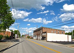
Hustonville, Kentucky

Last updated
Hustonville, Kentucky
Hustonville-Main-Street-ky.jpg
Main Street (KY 78) in Hustonville
City-of-Hustonville-KY-logo.png
Lincoln County Kentucky Incorporated and Unincorporated areas Hustonville Highlighted 2138836.svg
Location of Hustonville in Lincoln County, Kentucky.
Coordinates: 37°28′42″N84°48′54″W / 37.47833°N 84.81500°W / 37.47833; -84.81500
Country United States
State Kentucky
County Lincoln
Established1836
Incorporated1850
Area
[1]
  Total0.74 sq mi (1.91 km2)
  Land0.74 sq mi (1.91 km2)
  Water0.00 sq mi (0.00 km2)
Elevation
[2]
1,034 ft (315 m)
Population
 (2020)
  Total387
  Density524.39/sq mi (202.51/km2)
Time zone UTC-5 (Eastern (EST))
  Summer (DST) UTC-4 (EDT)
ZIP code
40437
Area code 606
FIPS code 21-38836
GNIS feature ID2404750 [2]
Website www.hustonvilleky.com/index.html

Hustonville is a home rule-class city in Lincoln County, Kentucky, in the United States. The population was 405 at the 2010 census. It is part of the Danville Micropolitan Statistical Area.

Contents

History

The community was originally known as The Crossroads from its location on trails connecting the Kentucky and Green rivers and the Falls of the Ohio with Logan's Fort (present-day Stanford). It was then known as Farmington and, after the 1818 erection of a post office, Hanging Fork after a local stream named for two bandits who were hanged by Virginia officers rather than escorted back for trial. For three months in 1826, it was known as New Store, but the name then returned to Hanging Fork. When the town was established on February 29, 1836, it was renamed Hustonville after two local landowners; the post office adopted the name the next year. [3] The city was formally incorporated by the state assembly in 1850. [4]

During the mid 19th and early 20th centuries, Hustonville was home to Christian College. The school was established following a fundraising campaign by William Logan Williams, who had been instrumental in securing money for church construction in the city. [5] Future U.S. senator and Governor of Kentucky, Augustus O. Stanley, served as chair of belles-lettres at the school in 1890. [6]
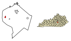
Geography

According to the United States Census Bureau, the city has a total area of 0.6 square miles (1.6 km2), all land. The city is concentrated along Kentucky Route 78 (Main Street), just east of its intersection with U.S. Route 127, in northwestern Lincoln County. The city lies near the headwaters of Hanging Fork Creek, a tributary of the Dix River.

Demographics

Historical population
CensusPop.Note
1860 215
1870 32048.8%
1880 35310.3%
1890 43523.2%
1900 425−2.3%
1910 384−9.6%
1920 372−3.1%
1930 4058.9%
1940 4439.4%
1950 435−1.8%
1960 387−11.0%
1970 4136.7%
1980 339−17.9%
1990 313−7.7%
2000 34710.9%
2010 40516.7%
2020 387−4.4%
U.S. Decennial Census [7]

As of the census [8] of 2000, there were 347 people, 165 households, and 100 families residing in the city. The population density was 628.9 per square mile (242.8/km2). There were 181 housing units at an average density of 328.0 per square mile (126.6/km2). The racial makeup of the city was 96.83% White, 1.15% African American, 0.29% Asian, and 1.73% from two or more races.

There were 165 households, out of which 21.8% had children under the age of 18 living with them, 45.5% were married couples living together, 11.5% had a female householder with no husband present, and 38.8% were non-families. 34.5% of all households were made up of individuals, and 19.4% had someone living alone who was 65 years of age or older. The average household size was 2.10 and the average family size was 2.67.

In the city, the population was spread out, with 17.3% under the age of 18, 6.1% from 18 to 24, 23.3% from 25 to 44, 28.2% from 45 to 64, and 25.1% who were 65 years of age or older. The median age was 46 years. For every 100 females, there were 81.7 males. For every 100 females age 18 and over, there were 85.2 males.

The median income for a household in the city was $33,750, and the median income for a family was $45,000. Males had a median income of $29,167 versus $22,917 for females. The per capita income for the city was $16,379. About 9.6% of families and 19.6% of the population were below the poverty line, including 12.2% of those under age 18 and 30.9% of those age 65 or over.

Related Research Articles

<span class="mw-page-title-main">Martin, Kentucky</span> City in Kentucky, United States

Martin is a home rule-class city in Floyd County, Kentucky, in the United States. The population was 634 as of the 2010 census.

<span class="mw-page-title-main">Wayland, Kentucky</span> City in Floyd County, Kentucky, United States

Wayland is a home rule-class city in Floyd County, Kentucky, United States. The population was 426 at the 2010 census, up from 298 at the 2000 census.

<span class="mw-page-title-main">Evarts, Kentucky</span> City in Kentucky, United States

Evarts is a home rule-class city in Harlan County, Kentucky, in the United States. The post office was opened on February 9, 1855, and named for one of the area's pioneer families. The city was formally incorporated by the state assembly in 1921. The population was 962 at the 2010 census.

<span class="mw-page-title-main">Berry, Kentucky</span> City in Kentucky, United States

Berry is a home rule-class city in Harrison County, Kentucky, in the United States. The city was formally incorporated by the state assembly in 1867 as "Berryville". It was renamed "Berry Station" two years later. The population was 264 at the 2010 census, down from 310 at the 2000 census.

<span class="mw-page-title-main">Bellewood, Kentucky</span> City in Kentucky, United States

Bellewood is a home rule-class city in Jefferson County, Kentucky, United States. The city was formally incorporated by the state assembly in 1950. The population was 321 at the 2010 census.

<span class="mw-page-title-main">Meadowview Estates, Kentucky</span> City in Kentucky, United States

Meadowview Estates is a home rule-class city in Jefferson County, Kentucky, United States. The population was 178 at the 2020 census,.

<span class="mw-page-title-main">Middletown, Kentucky</span> City in Kentucky, United States

Middletown is an independent, home rule-class city in Jefferson County, Kentucky, United States, and a former neighborhood of Louisville. The population was 7,218 at the 2010 census.

<span class="mw-page-title-main">Moorland, Kentucky</span> City in Kentucky, United States

Moorland is a home rule-class city in Jefferson County, Kentucky, United States. The population was 431 as of the 2010 census.

<span class="mw-page-title-main">Norbourne Estates, Kentucky</span> City in Kentucky, United States

Norbourne Estates is a home rule-class city in Jefferson County, Kentucky, United States. The population was 441 at the 2010 census.

<span class="mw-page-title-main">Fort Mitchell, Kentucky</span> City in Kentucky, United States

Fort Mitchell is a home rule-class city in Kenton County, Kentucky, United States. The population was 8,702 at the 2020 census. It is part of the Cincinnati metropolitan area.

<span class="mw-page-title-main">Pippa Passes, Kentucky</span> City in Kentucky, United States

Pippa Passes is a home rule-class city located along Caney Fork in Knott County, eastern Kentucky, United States. Its formal name was chosen to honor benefactors of Alice Lloyd College. Residents commonly call the community "Caney" or "Caney Creek". The population was 533 at the 2010 census, up from 297 at the 2000 census. The small city is located in the mountainous Appalachia region, an area of coal mining.

<span class="mw-page-title-main">Blackey, Kentucky</span> City in Kentucky, United States

Blackey is an unincorporated community in Letcher County, Kentucky, in the United States. As of the 2010 census, the population was 120. It is located near the early settlement of Indian Bottom. Blackey is thought to have been named after Blackey Brown, one of its citizens.

<span class="mw-page-title-main">McRoberts, Kentucky</span> Census-designated place in Kentucky, United States

McRoberts is an unincorporated community and census-designated place (CDP) in Letcher County, Kentucky, United States. The population was 784 at the 2010 United States Census, down from 921 at the 2000 census. McRoberts is in the Eastern Kentucky Coalfield region.

<span class="mw-page-title-main">Adairville, Kentucky</span> City in Kentucky, United States

Adairville is a home rule-class city in Logan County, Kentucky, in the United States. Established on January 31, 1833, it was named for Governor John Adair and incorporated by the state assembly on February 7, 1871. The population was 852 at the 2010 census.

<span class="mw-page-title-main">Bradfordsville, Kentucky</span> City in Kentucky, United States

Bradfordsville is a home rule-class city in Marion County, Kentucky, in the United States. The population was 270 at the time of the 2020 census.

<span class="mw-page-title-main">Edmonton, Kentucky</span> City in Kentucky, United States

Edmonton is a home rule-class city in and the county seat of Metcalfe County, Kentucky, United States. It is part of the Glasgow Micropolitan Statistical Area. The population was 1,671 at the 2020 census.

<span class="mw-page-title-main">Fairfield, Kentucky</span> City in Kentucky, United States

Fairfield is a home rule-class city in Nelson County, Kentucky, in the United States. The population was 113 at the 2010 census.

<span class="mw-page-title-main">Booneville, Kentucky</span> City in Kentucky, United States

Booneville is a home rule-class city in Owsley County, Kentucky, in the United States. The population was 81 at the 2010 census. It is the county seat of Owsley County. It is located at the junction of Kentucky Route 11 and Kentucky Route 30 on the South Fork of the Kentucky River.

<span class="mw-page-title-main">Buckhorn, Kentucky</span> City in Kentucky, United States

Buckhorn is a home rule-class city in Perry County, Kentucky, in the United States. The population was 162 at the 2010 census. It is centered on the Buckhorn Presbyterian Church, a log structure listed on the National Register of Historic Places. The Buckhorn Children's Center and Buckhorn Lake State Resort Park are also located here.

<span class="mw-page-title-main">Mount Gay-Shamrock, West Virginia</span> Census-designated place in West Virginia, United States

Mount Gay-Shamrock is a census-designated place (CDP) in Logan County, West Virginia, United States.

References

  1. "2020 U.S. Gazetteer Files". United States Census Bureau. Retrieved March 18, 2022.
  2. 1 2 U.S. Geological Survey Geographic Names Information System: Hustonville, Kentucky
  3. Rennick, Robert M. (1987). Kentucky Place Names. University Press of Kentucky. p. 147. Retrieved 28 April 2013.
  4. Commonwealth of Kentucky. Office of the Secretary of State. Land Office. "Hustonville, Kentucky". Accessed 29 July 2013.
  5. Brown, John Thomas (1904). Churches of Christ: A Historical, Biographical, and Pictorial History of Churches of Christ in the United States, Australasia, England and Canada. J. P. Morton. p.  432. The church at Hustonville having no suitable house of worship,.
  6. Johnson, E. Polk. A History of Kentucky and Kentuckians: The Leaders and Representative Men in Commerce, Industry and Modern Activities. Chicago, Illinois: Lewis Publishing Company, 1912.
  7. "Census of Population and Housing". Census.gov. Retrieved June 4, 2015.
  8. "U.S. Census website". United States Census Bureau . Retrieved 2008-01-31.