List of Bay Area Rapid Transit stations

Last updated

Bay Area Rapid Transit (BART) is a heavy rail rapid transit system in the San Francisco Bay Area in California, United States. With average weekday ridership around 165,000 passengers in June 2024, BART is the fifth busiest rapid transit system in the United States. [1] [2] BART is administered by the Bay Area Rapid Transit District, a special district government agency formed by Alameda, Contra Costa, and San Francisco counties.

Contents

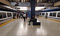
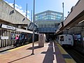
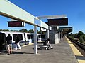
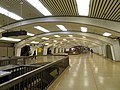
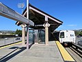
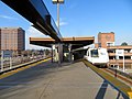
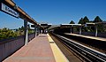
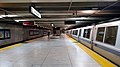
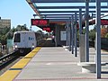
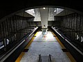
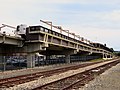
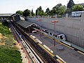
BART has 50 stations: 19 on the surface, 15 elevated, and 16 underground (i.e. subway). [3] 22 stations are in Alameda County, 12 are in Contra Costa, and 8 are in San Francisco. 6 stations are in San Mateo County and 2 are in Santa Clara County; those counties are not part of the BART special district, but contribute to operations funding. As of June 2024, Montgomery Street has the highest ridership and Oakland International Airport has the lowest. [1] Every day before 9 pm, BART trains run on five principal routes; four are transbay routes connecting San Francisco to Oakland and various destinations in the East Bay, while the Orange Line runs exclusively in the East Bay. The Green and Red lines do not run after 9 pm, but all stations remain accessible by transfers via other routes.

BART's first route between Fremont and MacArthur, the Orange Line, opened in September 1972; it was extended to Richmond in January 1973. Service began between Concord and MacArthur on the Yellow Line in May 1973, and between Montgomery Street and Daly City in November 1973. The original system was completed in September 1974 when the underwater Transbay Tube and West Oakland opened. BART's three routes then were the Orange, Yellow, and Green lines. Embarcadero opened as an infill station in 1976, and direct Richmond–Daly City service began operating that year. [4]

The Yellow Line was extended to North Concord/​Martinez in 1995, and to Colma and Pittsburg/​Bay Point in 1996. BART's fifth route, the Blue Line, began service with a new branch to Dublin/​Pleasanton in 1997. The San Mateo County line was extended south from Colma to San Francisco International Airport and Millbrae in 2003. [4] A second infill station, West Dublin/​Pleasanton, opened in 2011. The automated guideway transit (AGT) Oakland Airport Connector opened in 2014 to serve Oakland International Airport. [5] BART service was extended south from Fremont to Warm Springs/​South Fremont in 2017, then to Berryessa/​North San José in 2020. A diesel multiple unit feeder service, eBART, opened from Pittsburg/Bay Point to Antioch in 2018. Several additional stations, including a subway through San Jose to Santa Clara, are planned or proposed.

Services

BART daytime service map BART system map.png
BART daytime service map

BART operates five named and interlined heavy rail services plus one separate automated guideway line. All of the heavy rail services run through Oakland, and all but the Orange Line run through the Transbay Tube to San Francisco. All five services run until 9 pm; only three services operate evenings after 9 pm, as well as some Sundays during maintenance work. All stations are served during all service hours. [6] The eastern segment of the Yellow Line, between Antioch and the transfer platform east of Pittsburg/Bay Point, uses different rolling stock and is separated from the rest of the line.

Unlike most other rapid transit and rail systems around the world, BART lines were not primarily referred to by shorthand designations or their color names (although the colors used on maps have been constant since 1980). The services were mainly identified on maps, schedules, and station signage by the names of their termini. However, the new fleet displays line colors more prominently, and BART has begun to use color names in press releases and GTFS data. [7] [8] In 2022, BART formally announced on Twitter they were using colors on the line map and officially. [9]

Route nameFirst serviceTerminiService times
  O   Orange Line September 11, 1972 Berryessa/​North San José Richmond Operates during all service hours.
  Y   Yellow Line May 21, 1973 San Francisco International Airport or Millbrae (after 9pm) Antioch Operates during all service hours. Daytime service terminates at SFO, while evening (after 9 pm) service terminates at Millbrae.
  G   Green Line November 16, 1974 Daly City Berryessa/​North San José No evening (after 9 pm) service.
  R   Red Line April 19, 1976 Millbrae Richmond No evening (after 9 pm) service.
  B   Blue Line May 10, 1997 Daly City Dublin/​Pleasanton Operates during all service hours.
  OAK   Oakland Airport Connector November 22, 2014 Oakland International Airport Coliseum Operates during all service hours.

Stations

BART has 50 passenger stations, of which 47 are high-platform rapid transit stations. Oakland International Airport is served by the Oakland Airport Connector, which uses cable-hauled automated guideway transit (AGT) rolling stock; Coliseum has separate platforms for rapid transit trains and AGT trains. Antioch and Pittsburg Center have low platforms for use with the diesel multiple unit (DMU) trains used on that section of the line. A transfer platform east of Pittsburg/​Bay Point, which does not have street access and is not designated as a unique station, provides cross-platform transfers between the rapid transit and DMU sections of the line.

Seven stations are designated as transfer points between services; timed cross-platform transfers are available between the Orange and Yellow lines at MacArthur (southbound) and 19th Street Oakland (northbound). Nine stations are the terminal of one or more services; Coliseum is also a transfer station. Ten stations have connections available to other rail services – Amtrak, Caltrain, Muni Metro, and VTA light rail. All stations are served during all operating hours.

^ Transfer stations within the BART system
^Transfer stations that are also line termini
Line termini
Aiga railtransportation 25.svgStations with connections to other rail systems

Future stations

Map of the Silicon Valley extension BART Silicon Valley extension.svg
Map of the Silicon Valley extension

The four-station Phase II of the Silicon Valley BART extension will add underground stations at 28th Street/​Little Portugal, Downtown San José, and Diridon in San José, plus the surface-level Santa Clara station; it is planned to open in 2036. [10] An infill station on the Warm Springs extension at Irvington is planned to open in 2031. Two additional infill stations–the surface-level Calaveras on the Silicon Valley extension and the elevated Doolittle on the Oakland Airport Connector–are proposed but not yet funded or scheduled. Several of these future stations connect with other rail services in the South Bay region, including Altamont Corridor Express, which does not yet have a connection with BART.

StationLine(s)ConnectionsLocationPlanned
opening
Irvington   G   Green Line
  O   Orange Line
Fremont 2031
28th Street/​Little Portugal   G   Green Line
  O   Orange Line
San José 2036 [10]
Downtown San José Aiga railtransportation 25.svg  G   Green Line
  O   Orange Line
BSicon LOGO SCvta.svg VTA light rail: VTA-Blue-icon.svg VTA-Green-icon.svg San José 2036 [10]
Diridon Aiga railtransportation 25.svg  G   Green Line
  O   Orange Line
BSicon LOGO Amtrak2.svg Amtrak:       Coast Starlight ,       Capitol Corridor
Caltrain roundel.svg Caltrain
ACE arrows.svg Altamont Corridor Express
BSicon LOGO SCvta.svg VTA light rail: VTA-Green-icon.svg
San José 2036 [10]
Santa Clara  Aiga railtransportation 25.svg  G   Green Line  
  O   Orange Line  
BSicon LOGO Amtrak2.svg Amtrak:       Capitol Corridor
Caltrain roundel.svg Caltrain
ACE arrows.svg Altamont Corridor Express
Santa Clara 2036 [10]
Doolittle   OAK   Oakland Airport Connector Oakland
Calaveras   G   Green Line
  O   Orange Line
Milpitas

Related Research Articles

<span class="mw-page-title-main">Bay Area Rapid Transit</span> Rapid transit system serving the San Francisco Bay Area

Bay Area Rapid Transit (BART) is a rapid transit system serving the San Francisco Bay Area in California. BART serves 50 stations along six routes and 131 miles of track, including eBART, a 9-mile (14 km) spur line running to Antioch, and Oakland Airport Connector, a 3-mile (4.8 km) automated guideway transit line serving San Francisco Bay Oakland International Airport. With an average of 157,700 weekday passengers as of the first quarter of 2024 and 48,119,400 annual passengers in 2023, BART is the sixth-busiest rapid transit system in the United States.

<span class="mw-page-title-main">AC Transit</span> Public transit operator in Alameda County and Contra Costa County, California

AC Transit is an Oakland-based public transit agency serving the western portions of Alameda and Contra Costa counties in the East Bay of the San Francisco Bay Area. AC Transit also operates "Transbay" routes across San Francisco Bay to San Francisco and selected areas in San Mateo and Santa Clara counties. AC Transit is constituted as a special district under California law. It is governed by seven elected members. It is not a part of or under the control of Alameda or Contra Costa counties or any local jurisdictions.

<span class="mw-page-title-main">Embarcadero station</span> Subway station in San Francisco, California, US

Embarcadero station is a combined BART and Muni Metro rapid transit subway station in the Market Street subway in downtown San Francisco. Located under Market Street between Drumm Street and Beale Street near The Embarcadero, it serves the Financial District neighborhood and surrounding areas. The three-level station has a large fare mezzanine level, with separate platform levels for Muni Metro and BART below. Embarcadero station opened in May 1976 – almost two years after service began through the Transbay Tube – as an infill station.

<span class="mw-page-title-main">Red Line (BART)</span> Rapid Transit line in the San Francisco Bay Area, California

The Red Line is a Bay Area Rapid Transit (BART) line in the San Francisco Bay Area that runs between Richmond station and Millbrae station via San Francisco International Airport station. It has 24 stations in Richmond, El Cerrito, Berkeley, Oakland, San Francisco, Daly City, Colma, South San Francisco, San Bruno, and Millbrae. The line shares tracks with the four other mainline BART services.

<span class="mw-page-title-main">Yellow Line (BART)</span> Rapid transit line in the San Francisco Bay Area

The Yellow Line is a Bay Area Rapid Transit (BART) line in the San Francisco Bay Area that runs between Antioch and San Francisco International Airport (SFO). Some morning trains and all trains after 9 pm are extended from SFO to serve Millbrae station when the Red Line is not running. It serves 28 stations in Antioch, Pittsburg, Bay Point, Concord, Pleasant Hill, Walnut Creek, Lafayette, Orinda, Oakland, San Francisco, Daly City, Colma, South San Francisco, San Bruno, and Millbrae. It is the most-used BART line, and the only line with additional trains on weekdays.

<span class="mw-page-title-main">Blue Line (BART)</span> Rapid transit line in the San Francisco Bay Area

The Blue Line is a Bay Area Rapid Transit (BART) line in the San Francisco Bay Area that runs between Dublin/Pleasanton station and Daly City station. It has 18 stations in Dublin, Pleasanton, Castro Valley, San Leandro, Oakland, San Francisco, and Daly City.

<span class="mw-page-title-main">Millbrae station</span> Train station in Millbrae, California, U.S.

Millbrae station is an intermodal transit station serving Bay Area Rapid Transit (BART) and Caltrain, located in Millbrae, California. The station is the terminal station for BART on the San Francisco Peninsula, served by two lines: The Red Line before 9 pm and the Yellow Line during the early morning and evening. It is served by all Caltrain services. The station is also served by SamTrans bus service, Commute.org and Caltrain shuttle buses, and other shuttles.

<span class="mw-page-title-main">12th Street Oakland City Center station</span> Rapid transit station in Oakland, California, US

12th Street/Oakland City Center station is an underground Bay Area Rapid Transit (BART) station located under Broadway between 12th Street and 14th Street in Downtown Oakland, adjacent to the Oakland City Center. The station has three underground levels, with tracks on the second and third levels. It is served by the Red Line, Orange Line, and Yellow Line, as well as by AC Transit buses on the surface.

<span class="mw-page-title-main">19th Street Oakland station</span> Metro station in Oakland, California, US

19th Street Oakland station is an underground Bay Area Rapid Transit (BART) station located under Broadway between 17th Street and 20th Street in the Uptown District of Oakland, California. It is a timed transfer point between northbound trains to Richmond and to Antioch. The station has three underground levels, with tracks on the second and third levels. It is served by the Red Line, Orange Line, and Yellow Line, as well as by AC Transit buses on the surface at the Uptown Transit Center.

<span class="mw-page-title-main">MacArthur station (BART)</span> Rapid transit station in San Francisco Bay Area

MacArthur station is a Bay Area Rapid Transit (BART) station in the Temescal District of Oakland, California. It is the largest station in the BART system, being the only one with four platform tracks. Service through MacArthur is timed for cross-platform transfers between the southbound lines that pass through the station. MacArthur station is located in the median of SR 24 just north of its interchange with I-580. The station is perpendicular to 40th Street and MacArthur Boulevard. The surrounding neighborhood is mostly low-density residential, making MacArthur station primarily a commuting hub.

<span class="mw-page-title-main">Hayward station (BART)</span> Metro station in Hayward, California, US

Hayward station is a Bay Area Rapid Transit (BART) station in Hayward, California, serving Downtown Hayward and the surrounding areas. It is served by the Orange and Green lines. The elevated station has two side platforms. A two-lane bus terminal is located on the northeast side of the station. A pedestrian tunnel under the Union Pacific Railroad Oakland Subdivision connects the fare lobby to a parking lot and a five-level parking garage.

<span class="mw-page-title-main">All Nighter (bus service)</span> San Francisco Bay Area late night bus service

The All Nighter is a night bus service network in the San Francisco Bay Area, California. Portions of the service shadow the rapid transit and commuter rail services of BART and Caltrain, which are the major rail services between San Francisco, the East Bay, the Peninsula, and San Jose. Neither BART nor Caltrain operate owl service due to overnight track maintenance; the All Nighter network helps fill in this service gap. The slogan is, "Now transit stays up as late as you do!"

<span class="mw-page-title-main">San Francisco International Airport station</span> Rapid transit station in San Francisco Bay Area

San Francisco International Airport station is a Bay Area Rapid Transit (BART) terminal station located adjacent to Garage G inside the San Francisco International Airport. The elevated station is a transfer point to the AirTrain people mover system at Garage G/BART station.

<span class="mw-page-title-main">Oakland Coliseum station</span> Rail station in Oakland, California, US

The station complex of Amtrak's Oakland Coliseum station and Bay Area Rapid Transit (BART)'s Coliseum station is located in the East Oakland area of Oakland, California, United States. The two stations, located about 600 feet (180 m) apart, are connected to each other and to the Oakland Coliseum/Oakland Arena sports complex with an accessible pedestrian bridge. The BART station is served by the Orange, Green, and Blue lines; the Amtrak station is served by the Capitol Corridor service.

Throughout the history of Bay Area Rapid Transit, there have been plans to extend service to other areas.

Bay Area Rapid Transit, widely known by the acronym BART, is the main rail transportation system for the San Francisco Bay Area. It was envisioned as early as 1946 but the construction of the original system began in the 1960s.

eBART Hybrid rail line in Contra Costa County, California

eBART is a hybrid rail branch line of the Bay Area Rapid Transit (BART) system in eastern Contra Costa County, California, United States. The line extends the Yellow Line beyond Pittsburg/Bay Point station to Antioch station.

<span class="mw-page-title-main">Oakland International Airport station</span> Transit station at Oakland International Airport

Oakland International Airport station is a Bay Area Rapid Transit (BART) station on the Oakland Airport Connector in Oakland, California, serving San Francisco Bay Oakland International Airport (OAK). This station is on the system's automated guideway transit (AGT) spur line, which carries passengers between the airport and Coliseum station.

<span class="mw-page-title-main">Oakland Airport Connector</span> Automated guideway transit system in Oakland, California

The Oakland Airport Connector is an automated guideway transit (AGT) system operated by Bay Area Rapid Transit (BART) between BART's Coliseum station and Oakland International Airport station. The line is colored on BART maps as the Beige Line. The system is integrated into BART's fare system. The line opened for revenue service on November 22, 2014, replacing the AirBART shuttle bus service that had operated since July 1, 1977. Currently operating between two terminal stations, the system includes provisions for an intermediate third station that may be built at a later date.

The Oakland Wye is an underground flying wye junction in downtown Oakland, California which serves the Bay Area Rapid Transit (BART) system. Trains can switch between (a) the northbound Richmond or Antioch lines, (b) the westbound San Francisco lines, and (c) the southbound Berryessa or Dublin/Pleasanton lines. The Oakland Wye is the center of the BART system, and is a bottleneck for the whole system because every regularly scheduled BART train passes through it.

References

  1. 1 2 3 "Monthly Ridership Reports". San Francisco Bay Area Rapid Transit District. June 2024.
  2. "Transit Ridership Report: Fourth Quarter 2019" (PDF). American Public Transportation Association. February 27, 2020. Archived (PDF) from the original on May 23, 2020. Retrieved May 24, 2020 via Ridership Report page.{{cite web}}: External link in |via= (help)
  3. "System Facts". Bay Area Rapid Transit (BART). 2021. Archived from the original on 2017-02-23. Retrieved 2008-10-06.
  4. 1 2 3 "BART Chronology January 1947 – March 2009" (PDF). San Francisco Bay Area Rapid Transit District. March 2009. Archived from the original (PDF) on October 13, 2013.
  5. "BART to OAK service opens in time for Thanksgiving travel" (Press release). San Francisco Bay Area Rapid Transit District. November 21, 2014. Archived from the original on February 22, 2021. Retrieved December 20, 2014.
  6. "Schedules". Bay Area Rapid Transit District. Archived from the original on January 20, 2019. Retrieved February 14, 2011.
  7. "New Train Car Project". Bay Area Rapid Transit District. Archived from the original on February 13, 2021. Retrieved January 29, 2018.
  8. "February 11 schedule change impacts weekdays and Sundays" (Press release). San Francisco Bay Area Rapid Transit District. January 15, 2019. Archived from the original on May 9, 2020. Retrieved May 24, 2020.
  9. "BART's New Map Uses Colorful Names for Its Lines". Funcheap. Archived from the original on 2023-04-27. Retrieved 2023-04-27.
  10. 1 2 3 4 5 Greschler, Gabriel (October 4, 2023). "San Jose BART extension will take 10 years longer than expected — at more than double the cost". The Mercury News . Archived from the original on October 5, 2023. Retrieved October 4, 2023.