This article possibly contains original research .(February 2016) (Learn how and when to remove this template message) |
This article possibly contains original research .(February 2016) (Learn how and when to remove this template message) |
The following is a table of the largest incorporated suburbs worldwide, with over 700,000 people.

A suburb is a mixed-use or residential area, existing either as part of a city or urban area or as a separate residential community within commuting distance of a city. In most English-speaking countries, suburban areas are defined in contrast to central or inner-city areas, but in Australian English and South African English, suburb has become largely synonymous with what is called a "neighborhood" in other countries and the term extends to inner-city areas. In some areas, such as Australia, India, China, New Zealand, the United Kingdom, and parts of the United States and Canada, new suburbs are routinely annexed by adjacent cities. In others, such as Saudi Arabia, France, and much of the United States and Canada, many suburbs remain separate municipalities or are governed as part of a larger local government area such as a county. In the United States, beyond the suburbs are exurbs, or "exurban areas", with less density but linked to the metropolitan area economically and by commuters.
A suburb here is defined as subordinate to a central city from a business or infrastructure sense, and it may or may not have more population than the central city due to arbitrary municipal definitions.
Excluded are transborder agglomerations. In the Pop date column, C stands for census, P for provisional result, E for estimate. Although the list is ordered by population for ease of reference, the figures are not comparable with each other due to differing dates and lack of updates by respective countries.
A transborder agglomeration is an agglomeration or conurbation that extends into multiple territories, countries or states.

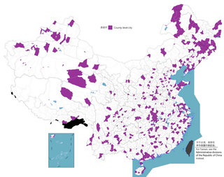
Mainland China, also known as the Chinese mainland, is the geopolitical as well as geographical area under the direct jurisdiction of the People's Republic of China (PRC). It includes Hainan island and strictly speaking, politically, does not include the special administrative regions of Hong Kong and Macau, even though both are partially on the geographic mainland.

A prefectural-level municipality, prefectural-level city or prefectural city; formerly known as province-administrated city from 1949 to 1983, is an administrative division of the People's Republic of China (PRC), ranking below a province and above a county in China's administrative structure. Prefectural level cities form the second level of the administrative structure. Administrative chiefs (mayors) of prefectural level cities generally have the same rank as a division chief of a national ministry. Since the 1980s, most former prefectures have been renamed into prefectural level cities.
A county-level municipality, county-level city, or county city is a county-level administrative division of mainland China. County-level cities are usually governed by prefecture-level divisions, but a few are governed directly by province-level divisions. Formerly known as prefecture-controlled city.
This article is written in the style of a debate rather than an encyclopedic summary.(August 2014) (Learn how and when to remove this template message) |
This article needs attention from an expert on the subject.(August 2014) |
Cities in the People's Republic of China and Republic of China are often defined in way as prefectures/counties. Their prefecture/county limits often are physically more extensive than entire metropolitan areas, encompassing large rural areas and outright separate cities. "Suburbs" may be located both within the municipality and/or adjacent to it, depending on how the area agglomerated. Some urban districts, as in the case of Wanzhou Urban District in Chongqing Municipality (Province Level), are separated by farmlands from the core metropolitan area and functions as a suburban city in spite of naming.
As to what constitutes a "city" in the PRC, there exist other definitions of city limits are in actual usage, such as combination of several districts where urban area of the central city is dominant, or roads, railways, natural boundaries, or a combination thereof. This is commonly designated by the central statistics bureaus as "urban districts", however some counties are also included, as well as some cities opt for towns rather than counties. Some counties/districts (e.g. Handan County, Handan City(Prefecture level)) are indeed suburbs of their respective central cities (e.g. Congtai, Hanshan, Fuxing districts of Handan City(Prefecture level) are a common definition of true urban area of Handan, although this definition now often also involves Handan County as the city expands).

Handan is a prefecture-level city located in the southwest of Hebei province, China. The southernmost prefecture-level city of the province, it borders Xingtai on the north, and the provinces of Shanxi on the west, Henan on the south and Shandong on the east. At the 2010 census, its population was 9,174,683 inhabitants whom 2,845,790 lived in the built-up area made of 3 urban districts, Handan and Yangyan counties, and Shahe City in Xintai municipality, largely being conurbated now.
In the case of Chaoshan Metropolitan Area, Jieyang (Prefecture-level city) urban districts border that of the central city of Shantou (Prefecture-level city), effectively spanning neighboring municipalities. Complicating the matter is the nesting of city structures, as Jieyang municipality itself is a suburb of Shantou, even though Puning city (County level city, and can be a suburb of Shantou) lies within Jieyang's jurisdiction.

Chaoshan or Teoswa is the cultural-linguistic region in the east of Guangdong, China that is developing into a single metropolis. This region is the origin of the Min Nan Chaoshan dialect (潮汕话). The region, also known as Chiushan in Cantonese, consists of the cities Chaozhou, Jieyang and Shantou. It differs linguistically from the rest of Guangdong province which was historically dominated by Yue speakers, followed by Hakka and Leizhou Min speakers. However, Mandarin has recently become the dominant language in the region. It is historically important as the ancestral homeland of many Thais, Singaporeans, Malaysians and Indonesians of Chinese descent.

Jieyang is a prefecture-level city in Guangdong Province, People's Republic of China, part of the Chaoshan region whose people speak Teochew dialect distinct from neighbouring Yue speakers. It is historically important as the hometown of many overseas Chinese in Southeast Asia. It borders Shantou to the east, Chaozhou to the northeast, Meizhou to the north, Shanwei to the west, and looks out to the South China Sea to the south.

Shantou, alternately romanized as Swatow and sometimes known as Santow, is a prefecture-level city on the eastern coast of Guangdong, China, with a total population of 5,391,028 as of 2010 and an administrative area of 2,064 square kilometres (797 sq mi).
This section needs expansion. You can help by adding to it.(May 2014) |
| Rank | City | Population | Pop date | Type | Includes | Metropolitan area | Province/province-level municipality |
|---|---|---|---|---|---|---|---|
| 1 | Puning | 2,054,703 [27] | 2010C | County-level city within Jieyang | entire city (县级市) | Greater Chaoshan | Guangdong |
| 2 | Jieyang | 1,899,394 [27] | 2010C | adjacent Prefecture-level city | urban districts (市辖区) | Greater Chaoshan | Guangdong |
| 3 | Huilai County | 1,097,615 [27] | 2010C | County within Jieyang | entire county (县) | Greater Chaoshan | Guangdong |
| 4 | Wanzhou District | 859,662 [28] | 2010C | non contiguous urban district | single district (市辖区) | Greater Chongqing | Chongqing |
| 5 | Changshu City | 929,124 [29] | 2010C | County-level city within Suzhou | Entire city (县级市) | Greater Suzhou | Jiangsu |
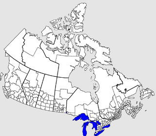
The census geographic units of Canada are the administrative divisions defined and used by Canada's federal government statistics bureau Statistics Canada to conduct the country's quinquennial census. They exist on four levels: the top-level (first-level) divisions are Canada's provinces and territories; these are divided into second-level census divisions, which in turn are divided into third-level census subdivisions and fourth-level dissemination areas.

Bhimavaram is a city in West Godavari district of the Andhra Pradesh state of India. It is the administrative headquarters of Bhimavaram mandal in Narasapuram revenue division. It is a part of Eluru Urban Development Authority. As of 2011 census, it is the second most populous city in the district with a population of 142,184. It is one of the major pilgrimage centers in the state, which is home to Somaramam, one of the five great Pancharama Kshetras.